


What Is LiDAR Drone? A Buyer’s Guide for UAV Mapping, Surveying & Obstacle Avoidance
A LiDAR drone is a UAV equipped with a laser-based distance sensing system that captures accurate 3D information about terrain, structures, vegetation, or obstacles while flying. Here’s the deal: a standard camera drone records what it can see, while a drone with LiDAR measures distance directly. It emits laser pulses or light signals, waits for the return, and calculates range from that travel time. That simple difference is why LiDAR is so useful for UAV mapping, surveying, powerline inspection, forestry, mining, construction, robotics navigation, and obstacle avoidance in places where camera-only systems can get confused.
For buyers, though, the phrase “LiDAR drone” can mean a few very different things. It might mean a high-end airborne mapping payload. It might mean a compact solid-state depth sensor for a small drone. It might mean a perception module used only for obstacle avoidance. Or it might mean a complete UAV surveying system with GNSS/INS, RTK, SLAM, calibration tools, and post-processing software. Look, those are not the same purchase. This guide explains what a LiDAR drone is, how it works, where it beats photogrammetry, what specifications actually matter, and how to choose the right LiDAR module or payload for your UAV project. It also includes a real compact dToF solid-state LiDAR example for small drone integration, using the DTOF Solid State LiDAR HM-LD1 as a practical reference.
Table of Contents
- 👉 What Is a LiDAR Drone?
- 👉 How Does a LiDAR Drone Work?
- 👉 LiDAR Drone vs Photogrammetry Drone
- 👉 Main Applications of LiDAR Drones
- 👉 Types of LiDAR Used on Drones
- 👉 Key LiDAR Drone Specifications Buyers Should Compare
- 👉 LiDAR Drone Mapping and Surveying Workflow
- 👉 LiDAR for UAV Obstacle Avoidance and Navigation
- 👉 LiDAR for Small Drones and Budget UAV Platforms
- 👉 Real Product Example: DTOF Solid State LiDAR HM-LD1
- 👉 Integration Guide for UAV Developers
- 👉 Buyer Checklist: How to Choose a LiDAR Drone System
- 👉 Common Mistakes When Buying a LiDAR Drone
- 👉 LiDAR Drone FAQ
- 👉 Final Thoughts: Choosing the Right LiDAR Drone for Your Mission
What Is a LiDAR Drone?
A LiDAR drone is an unmanned aerial vehicle equipped with a Light Detection and Ranging sensor. The sensor emits laser light or infrared pulses toward the environment and measures the return signal to calculate distance. By combining those distance measurements with drone position, orientation, and flight data, a LiDAR drone can generate 3D point clouds, elevation models, terrain maps, and real-time obstacle information.
We’ve recently been testing the HM-LD1 compact dToF LiDAR in a variety of r…
In practical terms, asking “what is lidar drone” is really asking what job the LiDAR is doing on the aircraft. In a surveying project, the LiDAR payload may be part of a complete geospatial system that includes GNSS, RTK or PPK correction, an IMU or INS, and point cloud processing software. In a robotics or autonomous flight project, the LiDAR may be a compact depth sensor used to detect nearby obstacles, support altitude hold, assist terrain following, or feed data into navigation algorithms.
Basic Components of a LiDAR Drone
A complete LiDAR drone system may include the UAV airframe, LiDAR sensor or payload, GNSS receiver, RTK/PPK module, IMU or INS, flight controller, data storage unit, power supply, post-processing software, and optional RGB camera. For advanced autonomous systems, an onboard computing platform may also be used to process point clouds, depth maps, object detection, SLAM, or flight control decisions in real time.
In the shop, we usually separate LiDAR drone hardware into two buckets: the parts that measure the world, and the parts that tell you exactly where the sensor was when it made those measurements. That second bucket is where a lot of beginner buyers underestimate the system. A LiDAR sensor by itself can measure range. A complete mapping payload can place that range into real-world coordinates with enough confidence to support survey deliverables.
The exact configuration depends on the mission. A survey company usually prioritizes georeferenced point cloud accuracy and repeatable deliverables. A drone OEM may prioritize size, weight, power consumption, interface compatibility, and embedded software support. An inspection team may need a balance between mapping quality, obstacle awareness, safety, and field reliability.
Is Every LiDAR Drone Used for Surveying?
No. Not every LiDAR drone is a surveying system. Some LiDAR drones are designed for mapping and topographic measurement, while others are built for perception, collision avoidance, distance detection, altitude control, terrain following, indoor navigation, or autonomous robotics research. That distinction matters because a survey payload and an obstacle-avoidance module are engineered around different priorities. For buyers comparing complete UAV payloads, see our related guide on how to choose a drone with LiDAR.
How Does a LiDAR Drone Work?
A LiDAR drone works by measuring distance from the sensor to surrounding objects using light. The LiDAR module sends out optical signals and receives reflected signals from surfaces such as ground, trees, buildings, rocks, vehicles, powerlines, shelves, walls, terrain, bridges, or obstacles. The system calculates range and combines it with the UAV’s position and attitude data to build spatial information.
Time-of-Flight Measurement
Many UAV LiDAR systems use time-of-flight measurement. The basic concept is simple: light leaves the sensor, travels to a target, reflects back, and is detected by the receiver. Because the speed of light is known, distance can be calculated from travel time. The simplified formula is:
Distance = speed of light × time of flight / 2
The division by two is required because the measured time includes the outbound and return path. In dToF, or direct time-of-flight LiDAR, the sensor directly measures the travel time of emitted light pulses. This approach is useful for depth sensing, obstacle detection, compact UAV perception systems, and real-time robotic vision.
Point Clouds and Depth Maps
A point cloud is a collection of 3D points. Each point may include X, Y, and Z coordinates, and advanced systems may also store intensity, timestamp, return number, scan angle, or RGB color. For surveying and mapping, point clouds are processed into digital terrain models, digital surface models, contours, cross sections, volume reports, CAD files, or GIS layers.
A depth map represents distance values in a 2D image-like matrix. Instead of showing color as a camera image does, a depth map tells the system how far each pixel or measurement cell is from the sensor. Depth maps are especially useful for small UAVs, robots, embedded perception systems, and obstacle avoidance algorithms because they provide structured distance information that can be processed quickly.
Here’s the practical difference. A survey crew typically wants a georeferenced point cloud that can be brought into CAD, GIS, or specialized survey software. A UAV developer building obstacle avoidance may only need fast local depth data so the aircraft can slow down, hold position, or steer away from a wall. Both are LiDAR use cases, but the data pipeline and engineering requirements are very different.
Drone Positioning and Orientation
For survey-grade drone LiDAR mapping, accurate spatial output requires more than the LiDAR sensor alone. The system must know where the drone is and how it is oriented at the exact time each measurement is captured. This is why GNSS, RTK, PPK, IMU, INS, time synchronization, and boresight calibration are important.
GNSS provides global positioning. RTK and PPK improve positioning accuracy using correction data. The IMU measures motion and attitude, while an INS integrates inertial and positioning information. Calibration aligns the LiDAR coordinate system with the UAV body frame and navigation system. If your project requires centimeter-level positioning, read our guide on RTK GPS for robotics, UAVs, and surveying.
LiDAR Drone vs Photogrammetry Drone
Photogrammetry drones use overlapping images to reconstruct 3D models, while LiDAR drones measure distance directly using laser-based ranging. Photogrammetry can produce high-resolution textured models at a lower equipment cost, but it depends on good lighting, image overlap, surface texture, camera calibration, and processing quality. LiDAR is often stronger when measuring terrain under vegetation, working in low-texture areas, capturing complex structures, or supporting autonomous navigation.
When LiDAR Is Better
LiDAR is often the better choice for vegetation penetration, forest terrain modeling, powerline and utility inspection, low-light or low-texture environments, fast 3D acquisition, obstacle detection, accurate elevation models, and industrial inspection. Because LiDAR actively measures distance, it does not need image texture in the same way photogrammetry does. It can also operate in darkness when the UAV platform and safety procedures support night operation.
✅ Use LiDAR when geometry matters more than pretty pictures. If the job is to understand elevation, clearance, slope, volume, or obstacle distance, LiDAR often gives you the cleaner path.
✅ Use LiDAR when the target surface is hard for cameras. Bare soil, uniform concrete, vegetation, dark industrial corners, and repetitive structures can all cause trouble for image-only reconstruction.
When Photogrammetry Is Better
Photogrammetry is often better for orthomosaic generation, visual texture documentation, lower-cost visual surveying, façade inspection requiring fine visual detail, marketing visuals, construction progress monitoring, and 3D visualization where realistic color is important. If a project mainly needs a high-resolution map image rather than ground elevation under vegetation, a camera-based workflow may be sufficient.
✅ Use photogrammetry when visual detail is the deliverable. If your client wants texture, color, roof condition, crack visibility, or an orthomosaic, the camera still earns its seat on the aircraft.
Can You Use LiDAR and Photogrammetry Together?
Yes. Many professional systems combine LiDAR point clouds with RGB images. This allows teams to create colorized point clouds, improve interpretation, document visible defects, and produce outputs that are easier for non-technical stakeholders to understand. For engineering workflows, LiDAR can provide reliable geometry while imagery provides context and surface appearance.
Look, in real industrial work, the best answer is often not “LiDAR or camera.” It is “what data does the job need, and how do we collect it without wasting flights?” A combined payload may cost more, but it can reduce repeat visits and give engineers, operators, and managers a dataset they can all understand.
Main Applications of LiDAR Drones
Land Surveying and Topographic Mapping
Drone LiDAR mapping is widely used to generate elevation models, contours, surface models, and terrain datasets. Typical use cases include construction sites, earthworks, road corridors, mining areas, railway surveys, dam and reservoir mapping, and large industrial properties. Compared with ground-based survey methods, UAV LiDAR can reduce field time and improve safety when terrain is difficult, steep, remote, or hazardous.
✅ Good fit: Sites with uneven terrain, vegetation, limited access, dangerous slopes, heavy equipment traffic, or large areas that would take too long to measure from the ground.
Forestry and Vegetation Analysis
In forestry, LiDAR drones help measure tree height, estimate biomass, perform forest inventory, evaluate vegetation density, and model terrain under canopy. LiDAR cannot see through solid trees, but some laser pulses can pass through gaps in branches and leaves to capture returns from lower vegetation and the ground. After classification and filtering, the data can be used to separate canopy from ground terrain more effectively than many camera-only methods.
✅ Good fit: Timber inventory, canopy height models, vegetation encroachment studies, habitat surveys, and terrain modeling where camera imagery cannot reliably capture the ground.
Infrastructure Inspection
LiDAR drones are valuable for bridges, transmission lines, solar farms, wind turbines, railways, expressways, dams, and industrial facilities. They can help capture geometry, measure clearances, detect deformation, support asset documentation, and reduce the need for workers to enter dangerous areas. For objects that are difficult for people to approach, such as bridges, expressways, and dams, compact ranging LiDAR can also assist inspection robots and UAVs with local distance sensing.
✅ Good fit: Clearance checks, asset modeling, structural geometry documentation, repeat inspection routes, and drone operation near equipment where distance awareness improves safety.
Mining, Stockpile, and Volume Measurement
Mining teams use LiDAR point cloud data to calculate stockpile volumes, monitor excavation progress, detect slope changes, inspect haul roads, and improve operational safety. Repeat UAV LiDAR flights can provide comparable datasets over time, helping teams understand material movement and site conditions. For reliable volume calculations, field control, processing consistency, and validation are important.
In the field, repeatability is just as important as raw accuracy. If one stockpile flight is processed with different settings from the next, volume reports can drift. Good operators standardize flight altitude, overlap, control points, processing workflow, and QA checks so month-to-month comparisons actually mean something.
Robotics, Navigation, and Obstacle Avoidance
Compact LiDAR modules can help drones detect obstacles, hold altitude, follow terrain, and support autonomous flight. The broader LiDAR ecosystem includes established perception technology companies such as RoboSense and Innoviz Technologies, whose work illustrates the rapid development of solid-state and automotive-grade LiDAR technologies.
✅ Good fit: Indoor drones, warehouse inspection UAVs, autonomous research platforms, smart inspection robots, small quadcopters, and UAVs that need local sensing rather than full survey-grade mapping.
Types of LiDAR Used on Drones
Mechanical Scanning LiDAR
Mechanical scanning LiDAR uses rotating or oscillating components to scan the environment. These sensors can provide wide fields of view and dense point clouds, making them common in professional mapping payloads. The tradeoff is that they are often larger, heavier, more complex, and more expensive than compact perception modules.
Solid-State LiDAR
Solid-state LiDAR generally avoids large rotating mechanisms. This can make the sensor more compact and suitable for UAV integration, particularly where size, weight, and power are critical. Solid-state LiDAR is often used for perception, depth imaging, obstacle avoidance, robotic vision, and embedded navigation. For small drones, solid-state design can be a practical path toward adding LiDAR without carrying a full mapping payload.
dToF LiDAR
dToF LiDAR, or direct time-of-flight LiDAR, measures distance by directly calculating the travel time of emitted light. In UAV applications, dToF modules can provide real-time depth maps and point clouds for local perception. This is useful when a drone needs to know how far it is from walls, terrain, trees, shelves, people, or structures, but does not necessarily need a survey-grade georeferenced point cloud.
Flash LiDAR and Depth Sensors
Flash LiDAR captures an area of the scene rather than scanning one point at a time. This can be valuable for short-to-medium range perception, obstacle avoidance, autonomous navigation, and real-time depth imaging. Flash-style depth sensing can be attractive when low latency and compact form factor matter more than long-range survey mapping density.
Survey-Grade LiDAR Payloads vs Embedded LiDAR Modules
| Category | Survey-Grade UAV LiDAR | Embedded LiDAR Module |
|---|---|---|
| Main use | Mapping and surveying | Obstacle avoidance, ranging, navigation |
| Typical payload | Larger | Compact |
| Positioning | GNSS/INS critical | May use flight controller or onboard computer |
| Output | Georeferenced point cloud | Depth map, range data, local point cloud |
| Buyer | Survey company, mapping team | UAV OEM, robotics developer, integrator |
Here’s the deal with that table: do not buy a perception module and expect it to behave like a turnkey survey payload. Also, do not buy a large survey payload if all you need is short-range obstacle detection on a small UAV. Matching the LiDAR category to the mission is the first serious buying decision.
Key LiDAR Drone Specifications Buyers Should Compare
Range
Range is one of the first specifications buyers compare, but maximum range alone can be misleading. Indoor range, outdoor range, target reflectivity, sunlight intensity, material type, surface angle, and environmental conditions all affect real performance. A sensor that reaches far indoors may have a shorter usable range in bright outdoor sunlight. Buyers should compare usable range under mission conditions, not only laboratory maximum values.
✅ Buying tip: Ask for outdoor range data, target reflectivity assumptions, and real-world test results. If the drone is flying in full sun near concrete, vegetation, metal, or dark surfaces, bench numbers are not enough.
Accuracy and Precision
Accuracy describes how close a measurement is to the true value, while precision or repeatability describes how consistent repeated measurements are. A compact module with ±3 cm ranging accuracy may be very useful for obstacle avoidance, altitude hold, or distance detection. However, survey-grade terrain mapping depends on the complete georeferenced system, including GNSS/INS, synchronization, calibration, flight planning, and processing.
Field of View
Field of view determines the angular coverage of the sensor. A wider horizontal and vertical FOV improves coverage for obstacle detection because the drone can observe more of its surroundings. Mapping payloads may use different scan patterns and flight planning strategies to achieve required point density and coverage. For embedded perception, the mounting position and FOV clearance are as important as the sensor’s published angle.
Resolution and Frame Rate
Resolution affects how many depth measurements are available in each frame, while frame rate affects how frequently data updates. Higher resolution can improve object shape understanding, and faster frame rate can reduce detection latency. For autonomous drones, the correct balance depends on flight speed, obstacle size, processing capacity, and safety requirements.
Look at the whole control loop, not just the sensor. A fast LiDAR feeding a slow processor still creates a slow system. For obstacle avoidance, the UAV must sense, process, decide, and respond before it reaches the hazard.
Weight and Power Consumption
Weight and power consumption are critical for UAV design. Every gram affects flight time, payload margin, stability, and endurance. Power consumption affects battery life and thermal management. Small UAV developers should pay close attention to sensor mass, mounting hardware, cables, voltage regulation, and onboard computer power requirements.
Interfaces and SDKs
Practical integration depends heavily on interfaces and software support. Common interfaces include UART, UDP, UVC, USB, Ethernet, and sometimes CAN. Developers may also need ROS support, Linux support, Windows support, ARM platform support, Raspberry Pi compatibility, or flight controller communication. A sensor with excellent hardware specifications can still slow a project if documentation, SDKs, timestamps, or data formats are difficult to use.
✅ Buying tip: Before purchase, confirm the exact data format, supported operating systems, sample code, timing method, and whether the supplier can help if your embedded platform does not work on the first try.
Environmental Adaptability
Environmental conditions matter in the field. Buyers should evaluate operating temperature, sunlight resistance, dust, rain, vibration, mounting stability, and IP rating if available. UAVs introduce vibration, propeller wash, changing sunlight angle, rapid motion, and power noise. Good engineering practice includes bench testing, environmental validation, and flight testing before production deployment.
LiDAR Drone Mapping and Surveying Workflow
Step 1 — Define the Mapping Objective
⚙️ Start by defining whether the project requires contour mapping, digital terrain modeling, stockpile measurement, vegetation analysis, corridor inspection, as-built documentation, or asset inspection. The deliverable determines point density, accuracy requirements, flight altitude, sensor type, and processing workflow.
Step 2 — Choose the Right UAV and LiDAR Payload
⚙️ The UAV must be able to carry the LiDAR payload safely while maintaining enough flight time and stability. Survey-grade projects often require GNSS/INS quality, scan density, terrain clearance, reliable mounting, and appropriate post-processing software. Smaller drones may be suitable for local inspection or perception tasks, but not for every mapping requirement.
Step 3 — Plan the Flight
⚙️ Flight planning should consider altitude, speed, overlap, ground control, weather, sunlight, terrain clearance, battery reserve, regulatory restrictions, and emergency procedures. For corridor inspection, flight lines may follow roads, railways, pipelines, or powerlines. For area mapping, flight patterns should provide uniform point density and sufficient coverage.
Step 4 — Collect LiDAR Data
⚙️ Field procedures should include pre-flight checks, sensor warm-up if required, calibration steps, GNSS status verification, mission monitoring, and backup strategy. Operators should confirm that data is being recorded correctly before leaving the site. For repeatable projects, consistent settings and documentation help maintain quality.
Step 5 — Process Point Clouds
⚙️ Processing may include trajectory processing, point cloud generation, noise filtering, classification, ground extraction, DEM or DSM generation, volume calculation, and CAD/GIS export. Professional deliverables require careful quality control because errors in trajectory, calibration, or classification can affect engineering decisions.
Step 6 — Validate Deliverables
⚙️ Validation should include checkpoints, field measurements, repeat surveys, or comparison with known control points. Accuracy should be evaluated under real project conditions rather than assumed from a single sensor specification. For commercial surveying, documentation and QA procedures are essential.
In the shop, we say the map is only as good as the weakest link in the workflow. A strong LiDAR sensor cannot rescue sloppy flight planning, bad time sync, poor calibration, or unverified processing. Treat the whole workflow as the system.

LiDAR for UAV Obstacle Avoidance and Navigation
Not all LiDAR drones are designed for survey mapping. Many UAV projects use LiDAR for real-time sensing instead of georeferenced point cloud mapping. For obstacle avoidance, the drone needs fast and reliable distance information to detect walls, poles, trees, wires, shelves, people, terrain changes, or structures near the flight path.
Why LiDAR Helps Drone Obstacle Avoidance
LiDAR helps because it provides direct distance measurement. It can work in low-texture scenes where stereo vision may struggle, and it is useful for indoor and nighttime operation. It can support altitude hold, terrain following, and detection of objects that may be difficult for camera-only systems. For low-altitude drones operating near structures, reliable local depth sensing can improve safety and autonomy.
✅ Practical benefit: The drone gets a direct range reading instead of trying to infer distance from image features. That can make a big difference near blank walls, dark corners, storage racks, tunnels, bridges, and industrial equipment.
LiDAR vs Ultrasonic vs Stereo Vision
| Sensor Type | Strength | Limitation |
|---|---|---|
| LiDAR | Accurate range and depth data | Range affected by sunlight and reflectivity |
| Ultrasonic | Low cost, simple altitude sensing | Short range, wide beam, noise sensitivity |
| Stereo vision | Rich visual context | Needs texture and lighting |
| Radar | Good in dust, fog, and longer range | Lower spatial resolution |
Real-Time Depth Maps for Flight Controllers
Local depth data can be used by onboard computing systems and flight controllers for reactive planning, speed reduction, hovering, terrain following, or obstacle avoidance. In a typical embedded architecture, the LiDAR sends range or depth information to a companion computer, which processes the data and sends commands or constraints to the flight controller. Latency, frame rate, FOV, and fail-safe logic are critical.
Look, obstacle avoidance is not just “install LiDAR and go fly.” The aircraft needs a decision strategy. What does it do if a valid reading disappears? What if the object is outside the field of view? What if the sensor sees rain, glare, dust, or a reflective surface? The safer design includes fallback behavior, speed limits, and careful field testing.
LiDAR for Small Drones and Budget UAV Platforms
Small drones cannot carry heavy mapping payloads, so compact solid-state LiDAR modules are often a better fit for perception, ranging, and obstacle avoidance. A lightweight dToF module can provide enough depth information for development platforms, experimental UAVs, robotics research, and embedded navigation systems.
Why Weight Matters
Every gram affects flight time, endurance, payload capacity, and stability. A compact LiDAR module weighing around 28 g is easier to integrate than a large survey payload, especially on small quadcopters, indoor drones, inspection UAVs, and R&D platforms. Weight also affects center of gravity, mounting options, and vibration behavior.
Why Power Consumption Matters
Low power consumption helps preserve battery life and reduces thermal management problems. For UAVs, even a few watts can affect total flight endurance when combined with onboard computers, cameras, radios, and other sensors. A low-power LiDAR module can make integration easier, especially when the drone already has a tight power budget.
Practical Use Cases for Compact LiDAR Modules
Compact LiDAR modules can support altitude hold, terrain following, forward obstacle detection, indoor drone navigation, warehouse inspection UAVs, security patrol drones, bridge and infrastructure inspection, robotics research, and UAV R&D. For UAV buyers comparing commercial systems, also see our guide to DJI drone LiDAR options for UAV mapping.
✅ Good fit for compact LiDAR: Small UAVs that need local awareness, nearby object detection, indoor ranging, low-altitude sensing, or embedded perception without the cost and payload burden of a full airborne survey system.
Real Product Example: DTOF Solid State LiDAR HM-LD1
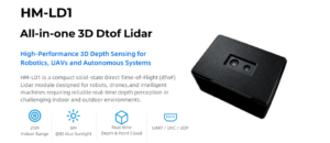
For small UAVs, robotics platforms, and embedded perception systems, a compact solid-state LiDAR module can be more practical than a full survey-grade payload. The DTOF Solid State LiDAR HM-LD1 is a lightweight dToF LiDAR module designed for depth sensing, obstacle avoidance, distance detection, autonomous navigation, smart inspection, and robotic vision development. It provides real-time depth images and 3D point cloud data with multiple interfaces for integration into PCs, Raspberry Pi, flight controllers, and embedded systems.

Download DTOF SSL HM-LD1 Product Brochure
| Specification | DTOF Solid State LiDAR HM-LD1 |
|---|---|
| Technology | SPAD dToF solid-state LiDAR |
| Dimensions | 43.5 mm × 30 mm × 26.5 mm |
| Weight | 28 g |
| Indoor Ranging Capability | 0.5–25 m |
| Outdoor Ranging Capability | 0.2–8 m |
| Ranging Accuracy | ±3 cm |
| Field of View | 60° horizontal × 45° vertical |
| Resolution | 40 × 30 |
| Frame Rate | 10 fps |
| Interfaces | UART / UDP / UVC |
| Operating Temperature | -20 ℃ to 60 ℃ |
| Power Consumption | 1.2 W |
| Development Platform Support | SDKs for x86 Windows, x86 Linux, and ARM Linux |
| Typical UAV Uses | Obstacle avoidance, altitude hold, terrain following, distance detection, smart inspection, autonomous navigation |
View Product Details & Pricing ➔
Why HM-LD1 Fits Small UAV Development
The HM-LD1 fits small UAV development because it combines a compact form factor, 28 g weight, 1.2 W power consumption, real-time depth images, and 3D point cloud data. Its UART, UDP, and UVC interfaces give developers flexibility across embedded controllers, networked data transfer, and camera-like depth streaming. SDK support for x86 Windows, x86 Linux, and ARM Linux helps teams integrate the module into PCs, Raspberry Pi-class platforms, and embedded systems.
Its listed ranging capability is 0.5–25 m indoors and 0.2–8 m outdoors, with ±3 cm ranging accuracy. The outdoor ranging capability is particularly relevant for drones operating in bright daylight, where sunlight and target reflectivity can reduce usable range. Its 60° horizontal by 45° vertical field of view supports local depth sensing for nearby obstacles, terrain, or objects in front of the UAV.
Here’s where it fits best: small drones that need practical distance sensing without carrying a heavy mapping payload. For example, a development team may mount the module forward-facing for obstacle detection, downward-facing for altitude and terrain awareness, or angled toward a work area for smart inspection. The right mounting choice depends on how the flight controller or companion computer will use the depth data.
Important Buyer Note
The HM-LD1 is best positioned as a compact perception and ranging LiDAR module, not as a complete survey-grade airborne mapping payload with integrated GNSS/INS. It is well suited for obstacle avoidance, altitude hold, terrain following, distance detection, autonomous navigation, smart inspection, robotic vision development, autofocus, user presence detection, object recognition, volume measurement, and zone intrusion monitoring. Buyers who need georeferenced mapping deliverables should evaluate complete UAV LiDAR payloads with navigation, calibration, and processing workflows.
Integration Guide for UAV Developers
Mechanical Integration
⚙️ Mechanical integration starts with mounting position. The LiDAR should have a clear field of view and should not be blocked by landing gear, propellers, camera gimbals, cables, or payload brackets. Vibration isolation may be required depending on the UAV platform. The module should be protected from mechanical shock and mounted securely so its orientation does not shift during flight. Weight balance and center of gravity should be checked after installation.
In the shop, one of the first mistakes we see is a sensor mounted where the aircraft itself blocks half the view. Before machining brackets or printing housings, check the field of view with the landing gear installed, the gimbal in operating position, and cables routed the way they will be routed in flight.
Electrical Integration
⚙️ Electrical integration requires stable power, suitable voltage regulation, adequate current capacity, EMI protection, connector reliability, and a good grounding strategy. UAV power systems can be noisy because motors, ESCs, radios, and onboard computers draw dynamic current. Developers should test sensor stability during motor operation, not only on a bench power supply.
✅ Practical check: Run the motors while streaming LiDAR data and watch for dropouts, corrupted frames, resets, or heating. If the sensor only works on the bench, the integration is not finished.
Data Interface Integration
⚙️ UART can be useful for embedded controllers and simpler range data integration. UDP can support networked data transfer to companion computers. UVC can allow camera-like depth image streaming for platforms that process sensor data similarly to video. The best interface depends on bandwidth, latency, software environment, flight controller compatibility, and data processing architecture.
Software and SDK Integration
⚙️ SDK support for x86 Windows, x86 Linux, and ARM Linux helps development teams work across desktop prototyping, embedded Linux systems, and field deployment. Integration may involve Raspberry Pi, Jetson-class embedded platforms, ROS, OpenCV, custom flight stacks, obstacle avoidance algorithms, or robotic middleware. Developers should confirm data format, timestamping, frame rate, coordinate convention, error handling, and processing load early in the project.
Testing and Calibration
⚙️ Recommended testing includes bench validation, indoor range testing, outdoor sunlight testing, target reflectivity testing, vibration testing, latency measurement, and fail-safe logic. For obstacle avoidance, the system should define what happens when data is missing, saturated, noisy, delayed, or outside valid range. For navigation, sensor coordinate alignment and mounting angle should be measured and documented.
Look, calibration does not need to be fancy for every prototype, but it does need to be known. If the sensor is tilted five degrees down and your software assumes it is level, your depth interpretation will be wrong. Measure the mounting angle, record it, and feed that information into your processing stack.
Buyer Checklist: How to Choose a LiDAR Drone System
Step 1 — Define the Application
⚙️ Start by asking whether you need survey mapping or obstacle avoidance. Are you flying indoors or outdoors? Do you need georeferenced point clouds? Do you need real-time onboard perception? What accuracy is required? A forestry mapping payload, a warehouse inspection drone, and an experimental indoor UAV may all use LiDAR, but they need different systems.
Step 2 — Match Range and Accuracy to the Mission
⚙️ A short-range LiDAR may be excellent for obstacle detection but insufficient for corridor mapping at high altitude. A long-range mapping payload may be unnecessary for a small indoor drone. Match indoor and outdoor range, accuracy, resolution, FOV, and frame rate to the actual operating environment.
Step 3 — Check Payload Weight and Power Budget
⚙️ Confirm drone payload capacity, battery life, flight time, thermal behavior, and mounting constraints. Include the weight and power of cables, converters, onboard computers, brackets, and protective housings. A sensor that looks good on paper may reduce flight endurance or exceed the aircraft’s safe payload margin.
Step 4 — Confirm Interface Compatibility
⚙️ Check whether the LiDAR supports the required interface, such as UART, UDP, UVC, USB, Ethernet, or CAN. Confirm SDK availability, operating system support, driver stability, data access, timestamping, and documentation. The best hardware is only useful if the development team can access and use its data reliably.
Step 5 — Evaluate Supplier Support
⚙️ Industrial buyers should ask whether technical support is available, whether SDKs are provided, whether documentation is complete, whether custom integration support is possible, whether the product is made by the source factory, and whether stable supply is available. Supplier responsiveness often determines how quickly a UAV project reaches field deployment.
Step 6 — Ask for Real Field Testing
⚙️ Test in bright sunlight, low-light conditions, dusty environments, reflective surfaces, vegetation, and high-vibration UAV conditions. For mapping, validate against checkpoints. For obstacle avoidance, test different object sizes, materials, approach speeds, and lighting conditions. Real field testing is the best way to expose integration issues before scaling production.
✅ Bottom-line checklist: Define the mission, match the range, confirm accuracy under real conditions, check weight and power, verify the interface, review SDK support, test outdoors, and do not assume a single datasheet number tells the full story.
Common Mistakes When Buying a LiDAR Drone
Mistake 1 — Confusing Mapping LiDAR with Obstacle-Avoidance LiDAR
Survey-grade payloads and compact depth sensors serve different purposes. A mapping payload is designed to produce georeferenced point clouds and survey deliverables. A compact perception module is designed for local distance sensing, depth maps, and navigation support. Buying the wrong category leads to poor performance, unnecessary cost, or integration delays.
Mistake 2 — Only Comparing Maximum Range
Maximum range does not tell the whole story. Outdoor range, target reflectivity, sunlight, rain, dust, and mounting angle affect real performance. Buyers should compare usable range in their actual mission environment and leave a safety margin for detection and control response.
Mistake 3 — Ignoring Weight and Power
A LiDAR sensor that looks attractive in a datasheet may reduce flight time, require a larger battery, create thermal issues, or exceed payload limits. UAV integration should evaluate the complete system weight and power budget, not only the sensor module.
Mistake 4 — Forgetting SDK and Interface Requirements
A LiDAR module is only useful if the buyer can access, process, and integrate its data. Interface mismatch, incomplete drivers, unclear data formats, and weak documentation can slow development more than hardware limitations.
Mistake 5 — Not Planning for Calibration
For accurate mapping or stable navigation, calibration and coordinate alignment are essential. Even an excellent LiDAR can produce poor results if it is mounted at an unknown angle, vibrates during flight, lacks synchronization, or is not aligned with the flight controller or navigation system.
Look, most LiDAR buying mistakes are not caused by bad sensors. They are caused by mismatched expectations. If the project needs survey deliverables, buy a survey workflow. If the project needs obstacle avoidance, buy a perception sensor and design the control behavior around it.
Got tired of bulky LiDAR setups for simple depth tasks
LiDAR Drone FAQ
What is a LiDAR drone and how is it different from photogrammetry?
Is there LiDAR for small drones or budget UAV platforms?
What should beginners consider before buying a LiDAR drone system?
Can a LiDAR drone see through trees?
How accurate is drone LiDAR?
Can LiDAR drones fly at night?
Is LiDAR better than radar for drones?
What is the difference between dToF LiDAR and other LiDAR types?
Can LiDAR be connected to a Raspberry Pi or embedded computer?
Do I need RTK for a LiDAR drone?
Final Thoughts: Choosing the Right LiDAR Drone for Your Mission
A LiDAR drone can mean either a survey-grade mapping platform or a compact UAV perception system. The right choice depends on the mission. If your goal is professional surveying, evaluate the full system, including LiDAR payload, GNSS/INS, RTK or PPK workflow, calibration, point cloud software, and validation methods. If your goal is obstacle avoidance, altitude hold, terrain following, robotics navigation, or embedded perception, focus on usable range, accuracy, field of view, resolution, frame rate, weight, power consumption, interface support, SDKs, and supplier support.
Here’s the deal: do not buy LiDAR by buzzword. Buy it by mission requirement. A highway corridor survey, a forest inventory project, a bridge inspection drone, and a small indoor UAV all have different needs. The right system is the one that delivers the data you can actually use, within the aircraft’s payload limits, power budget, software stack, and field conditions.
For small UAV obstacle avoidance and depth sensing, compact solid-state dToF modules such as the DTOF Solid State LiDAR HM-LD1 can provide practical capability with low weight and low power consumption. If you are developing a drone, robot, or embedded perception system and need compact LiDAR sensing, explore the DTOF Solid State LiDAR HM-LD1 or contact our team for integration support.
📚 References & Further Reading
- Industry Standard: RoboSense | Innoviz Technologies
- Related Guide: How to Choose a Drone with LiDAR | RTK GPS for Robotics, UAVs, and Surveying | DJI Drone LiDAR Options for UAV Mapping






