


Drone with LiDAR: How to Choose a Lightweight, Budget-Friendly LiDAR Sensor for UAV Mapping and Obstacle Avoidance
A drone with LiDAR can measure distance, read terrain shape, support autonomous navigation, and spot obstacles in ways a normal camera simply cannot. Here’s the deal: cameras are great for color, texture, and visual context, but when a UAV needs to know exactly how far it is from a wall, bridge beam, warehouse rack, tree branch, roof edge, or sloped ground surface, LiDAR gives you direct range data. That is why engineering teams, robotics labs, student developers, UAV startups, and inspection crews keep looking for lighter, cheaper, easier-to-integrate LiDAR options.
Look, full survey-grade aerial LiDAR payloads are impressive. They can produce dense point clouds and professional mapping deliverables when paired with RTK GNSS, high-end IMUs, tight time synchronization, vibration-isolated mounts, calibration workflows, and specialized software. But that setup is not always what a small drone project needs. It can get expensive fast, and the payload may require a bigger aircraft, more battery, more structure, and more engineering hours than the mission can justify.
For compact drones and budget-conscious R&D work, a lightweight dToF solid-state LiDAR sensor can be the smarter first move. Instead of hauling a heavy rotating scanner, a compact module such as the DTOF Solid State LiDAR HM-LD1 provides real-time depth images and 3D point cloud data in a 28 g package, with 1.2 W power consumption and UART, UDP, and UVC interfaces. In the shop, those numbers matter. Weight affects flight time. Power affects battery life. Interfaces affect whether your team spends a weekend integrating the sensor or burns a month fighting drivers and data formats.
This guide walks through how LiDAR works on UAVs, what specifications matter most, where budget modules make sense, where they do not, and how to choose a practical LiDAR module for obstacle avoidance, altitude sensing, terrain following, inspection, and mapping development. The goal is not to oversell one sensor as magic. The goal is to help you make a clean engineering decision before you bolt hardware onto an airframe.
a short-flex design and a long-flex design for different robotics and UAV d…
Table of Contents
- 👉 What Is a Drone with LiDAR?
- 👉 Why Use LiDAR on a Drone?
- 👉 How LiDAR Works for UAV Mapping and Obstacle Avoidance
- 👉 Types of LiDAR Sensors Used on Drones
- 👉 Key LiDAR Specifications to Compare Before Buying
- 👉 LiDAR for Mapping vs Obstacle Avoidance
- 👉 How to Choose a Budget-Friendly LiDAR Sensor
- 👉 Integration with Flight Controllers, Raspberry Pi, Jetson, and PCs
- 👉 Recommended Lightweight LiDAR Module: HM-LD1
- 👉 Drone LiDAR Use Cases by Application
- 👉 Drone LiDAR Installation and Testing Checklist
- 👉 Common Mistakes When Choosing UAV LiDAR
- 👉 FAQ: Drone with LiDAR
- 👉 Conclusion: Choosing the Right LiDAR for Your Drone
What Is a Drone with LiDAR?
A drone with LiDAR is an unmanned aircraft equipped with a laser-based sensing system that measures distance to surfaces around it. LiDAR stands for Light Detection and Ranging. In plain English, the sensor sends out light, receives the return signal after it reflects off a target, and calculates distance from that measurement. On a UAV, that distance information can support mapping, inspection, obstacle avoidance, altitude hold, terrain following, SLAM, and autonomous navigation.
Not all LiDAR drones are built for the same job. A professional aerial survey drone may carry a high-end scanner, RTK GNSS receiver, inertial measurement unit, time synchronization hardware, calibrated mounting, and point cloud processing software. That setup is built for engineering deliverables, forestry inventory, mining, construction documentation, powerline inspection, and infrastructure digital twins. It is powerful, but it is also heavier, more expensive, and less forgiving if the calibration is wrong.
A compact UAV for robotics research may need something much simpler: a small LiDAR depth module that outputs local depth data in real time. A forward-facing sensor can warn the drone about nearby obstacles. A downward-facing sensor can help with distance-to-ground measurement. A side-facing sensor can help inspection drones maintain standoff distance from walls, tanks, bridge members, or machinery. That distinction matters because many teams search for “drone with LiDAR” and assume they need a full survey payload, when what they really need is local 3D perception.
For a focused introduction to lightweight dToF sensing for UAVs, see our guide on the best dToF for drone applications using HM-LD1 solid-state LiDAR.
Why Use LiDAR on a Drone?
LiDAR is valuable because it gives the aircraft a direct way to measure distance. Cameras, barometers, GPS receivers, ultrasonic sensors, and radar can all help, but each has limits. A camera sees texture and color, but it does not directly know distance unless paired with stereo vision, visual odometry, structure-from-motion, or AI depth estimation. A barometer estimates altitude from air pressure, but it cannot tell the drone how close it is to a shelf, pipe, wall, beam, or sloped roof. LiDAR fills that gap.
Accurate Distance Measurement
✅ When a drone approaches a structure, lands on uneven ground, hovers beside a bridge, or moves through a warehouse aisle, distance is the variable that matters. LiDAR provides active ranging rather than depending only on ambient light, image contrast, or surface texture. A module with centimeter-class ranging accuracy can support close-range detection, short-range obstacle awareness, and low-speed navigation logic.
Better 3D Environmental Awareness
✅ Modern compact LiDAR modules can generate depth maps or point cloud data. A depth map stores distance values across a 2D sensing area. A point cloud represents measured points in 3D space. On a drone, that information helps software estimate free space, identify nearby objects, maintain a safe standoff distance, or build local maps. Even modest resolution can be useful if the aircraft speed, field of view, and mission are matched correctly.
Useful in Low-Texture or Poor-Feature Environments
✅ Vision-only systems often struggle with blank walls, repeated patterns, glare, low contrast, or poor lighting. Industrial plants, tunnels, warehouses, dams, and concrete structures are full of surfaces that give cameras trouble. LiDAR can still measure distance if the target returns enough light to the receiver. That makes it a practical partner for cameras, IMUs, and visual-inertial navigation systems.
Obstacle Avoidance and Safer Navigation
✅ LiDAR can detect walls, trees, poles, racks, machinery, bridge elements, terrain changes, and other hazards. For small drones, the point is usually not high-speed racing through clutter. The point is adding a dependable layer of perception during controlled inspection, indoor testing, or low-speed autonomous movement. A forward-facing module can watch the flight path; a downward-facing module can help with altitude sensing; multiple modules can cover more directions if the payload and power budget allow it.
Support for Mapping, Inspection, and Robotics Research
✅ Lightweight LiDAR modules let teams experiment with obstacle avoidance, SLAM, terrain following, landing support, and local mapping without buying a full survey-grade system first. For broader background on photonics and optical sensing, the IEEE Photonics Society provides useful technical resources.
How LiDAR Works for UAV Mapping and Obstacle Avoidance
LiDAR uses light to measure distance, but the hardware details matter. Different sensors use different timing methods, detectors, optics, scanning approaches, and output formats. For UAV work, you care about more than maximum range. You care about usable outdoor range, frame rate, latency, field of view, power draw, interface support, mounting tolerance, and how cleanly the data fits into your flight software.
Time-of-Flight Distance Measurement
Time-of-Flight LiDAR measures how long emitted light takes to return after reflecting off a target. Since light speed is known, the sensor calculates distance from the timing information. In real flight conditions, the sensor must also deal with target reflectivity, sunlight, receiver noise, optical filtering, vibration, and calibration. That is why two sensors with similar advertised range can behave very differently outdoors.
dToF vs iToF
dToF, or direct Time-of-Flight, measures the travel time of light pulses directly. iToF, or indirect Time-of-Flight, estimates distance by measuring phase shift between emitted and received modulated light. Both can work, but they have different tradeoffs. For compact UAV systems, dToF can be attractive when the sensor needs short-range depth data, practical outdoor performance, and a small form factor. The better choice depends on mission range, frame rate, field of view, processing load, and integration constraints.
SPAD-Based Solid-State LiDAR
SPAD means Single-Photon Avalanche Diode. SPAD detectors can detect very weak returned signals, which makes them useful in compact dToF LiDAR designs. Solid-state LiDAR generally avoids large rotating scanner assemblies. For drones, that can mean less weight, simpler mounting, fewer mechanical concerns, and easier packaging into compact airframes. Solid-state does not automatically mean suitable for every mission, but it is often a strong architecture for lightweight perception.
Depth Map and Point Cloud Output
A depth map is a 2D image where each measurement point contains distance information. A point cloud converts those measurements into 3D coordinates. UAV software can use this data to detect obstacles, measure standoff distance, estimate local geometry, and support navigation research. The HM-LD1 outputs real-time depth images and 3D point cloud data with a 40 × 30 resolution and 10 fps frame rate, making it useful for short-range perception and embedded vision development.
Types of LiDAR Sensors Used on Drones
Before buying a LiDAR sensor, be clear about the category. A survey payload, spinning scanner, solid-state depth module, and single-point rangefinder may all be called LiDAR, but they are not interchangeable.
Survey-Grade Mapping LiDAR Payloads
Survey-grade payloads are built to create accurate, georeferenced point clouds. They usually rely on RTK GNSS, IMU data, time synchronization, calibration, and post-processing software. They are the right tool for topographic models, forestry, mining, construction sites, powerline corridors, and formal engineering documentation. They are also heavier and more expensive than compact perception modules.
Mechanical Spinning LiDAR
Mechanical spinning LiDAR sensors use rotating components to scan a wide area. They are common in robotics and autonomous vehicle work because they can provide broad coverage and continuous point cloud output. On smaller drones, though, they can be heavy, power-hungry, costly, and mechanically more complex than a compact solid-state module.
Solid-State LiDAR Modules
Solid-state LiDAR modules are compact sensors designed without large rotating mechanisms. Their advantages are practical: low weight, low power, simple mounting, and development-friendly interfaces. They are usually best for obstacle avoidance, local navigation, altitude sensing, terrain awareness, robotics research, and short-range 3D perception.
Single-Point Laser Rangefinders
Single-point rangefinders measure distance in one direction. They work well for altitude hold or simple distance-to-target measurement, but they do not provide a depth image. If the drone needs to understand the shape, width, or position of an obstacle across an area, a depth-sensing LiDAR module is usually more useful.
Depth Camera and LiDAR Hybrid Modules
Some compact sensors behave more like depth cameras than traditional survey scanners. They output depth frames, point clouds, or video-like streams that can be processed on PCs and embedded Linux boards. These modules are practical for UAV prototyping and robotics development. As an example of industry movement toward compact LiDAR-based depth sensing, see Sony’s LiDAR depth sensing product information.
Key LiDAR Specifications to Compare Before Buying
Choosing a drone LiDAR sensor is a tradeoff. Longer range can mean more cost, weight, or power. A wider field of view may reduce angular resolution. A higher frame rate may demand more bandwidth and compute. The right sensor is the one that fits the mission, not the one with the biggest marketing number.
Weight
✅ Weight affects flight time, motor load, battery selection, stability, and safety margin. On small drones, even 50 g can matter. The HM-LD1 weighs only 28 g, making it attractive for compact UAV projects where payload margin is tight.
Power Consumption
✅ Low power reduces battery drain, heat, and regulator complexity. The HM-LD1 consumes 1.2 W, which helps simplify onboard integration for lightweight drones and embedded platforms.
Ranging Capability
✅ Indoor and outdoor range should be evaluated separately. Sunlight, surface angle, target reflectivity, rain, fog, dust, and vibration can all reduce usable range. The HM-LD1 specifies Indoor: 0.5–25 m and Outdoor: 0.2–8 m, which fits controlled short-range perception, inspection, and obstacle awareness.
Ranging Accuracy
✅ The HM-LD1 has a ranging accuracy of ±3 cm. That is useful for distance detection and close-range perception, but it should not be confused with centimeter-level georeferenced surveying. Survey accuracy requires positioning, orientation, calibration, synchronization, and processing.
Field of View
✅ The HM-LD1 provides a 60° horizontal × 45° vertical field of view. That is practical for forward obstacle detection, downward terrain sensing, or short-range spatial awareness depending on mounting direction.
Resolution
✅ The 40 × 30 resolution equals 1,200 depth points per frame. That is much richer than a single-point rangefinder and useful for local perception, though it is not meant to replace high-density survey LiDAR.
Frame Rate
✅ The HM-LD1 outputs at 10 fps. That works for hover inspection, low-speed navigation, indoor experiments, and controlled obstacle awareness. For high-speed UAVs, teams must evaluate stopping distance, latency, and safety margin carefully.
Interface Compatibility
✅ Interface support can make or break integration. UART works well for embedded systems. UDP can move richer data over a network-style connection. UVC can simplify PC and Linux workflows. The HM-LD1 supports UART / UDP / UVC, giving developers flexibility.
SDK and Operating System Support
✅ SDK support saves engineering time. MRP offers SDKs for x86 Windows, x86 Linux, and ARM Linux. That means teams can prototype on a desktop, visualize data, then move toward Raspberry Pi-class or embedded Linux deployment. For measured performance details, read the MRP HM-LD1 dToF LiDAR distance test report.
LiDAR for Mapping vs Obstacle Avoidance: What Is the Difference?
Here’s where buyers get crossed up. Mapping LiDAR and obstacle avoidance LiDAR both measure distance, but the system requirements are different.
Mapping LiDAR Requirements
Professional mapping needs high point density, time synchronization, RTK GNSS, IMU orientation, calibration, validation, and post-processing. The end goal is a georeferenced point cloud that can be measured and delivered. The LiDAR sensor is only one piece of that system.
Obstacle Avoidance Requirements
Obstacle avoidance needs low latency, adequate field of view, reliable short-range detection, onboard processing, and flight control logic. The data does not need to be globally georeferenced. It needs to answer a local question: is something in the drone’s path, and where is it relative to the aircraft?
Altitude Hold and Terrain Following
A downward-facing LiDAR can measure distance to the ground, floor, roof, or surface below the drone. That helps indoors, near structures, or at low altitude where GPS and barometers may not be precise enough. Terrain following also requires control software that interprets the data smoothly instead of chasing noise.
When a Budget LiDAR Module Is Enough
A lightweight module is often enough for detecting obstacles within several meters, experimenting with indoor navigation, supporting terrain awareness, building prototype mapping logic, or developing UAV perception algorithms. In those jobs, low weight, low power, SDK support, and integration flexibility may matter more than survey-grade point density.
When You Need Survey-Grade LiDAR
You need a full survey payload when the deliverable requires certified accuracy, large-area mapping, forestry inventory, construction surveying, infrastructure digital twins, or topographic models. A compact dToF module is excellent for perception and R&D, but it is not a complete aerial mapping system by itself.
How to Choose a Budget-Friendly LiDAR Sensor for a Drone
A budget LiDAR decision should start with the mission, not the price tag. The cheapest sensor is a bad deal if the data is unusable, and the most expensive sensor is wasteful if all you need is short-range obstacle detection.
Step 1 — Define the Mission
⚙️ Decide whether the drone is doing mapping, inspection, obstacle avoidance, SLAM, altitude sensing, landing assistance, or terrain following. Then define indoor versus outdoor, daytime versus nighttime, hover versus moving flight, and short-range versus long-range operation.
Step 2 — Calculate Payload and Power Budget
⚙️ Include the sensor, bracket, cables, housing, companion computer, regulator, and any extra cameras or IMUs. A 28 g, 1.2 W module is far easier to integrate than a heavy payload that forces battery, motor, and structure changes.
Step 3 — Match Range to Flight Speed
⚙️ A fast drone needs more detection distance because it must sense, process, decide, and maneuver before impact. Short-range LiDAR is best for low-speed navigation, close inspection, indoor testing, and controlled flight.
Step 4 — Choose the Right Output Format
⚙️ Depth images work well for perception algorithms. Point clouds help with 3D reasoning. UART may be enough for simple range data. UDP or UVC may be better for richer streams on a companion computer.
Step 5 — Check Development Support
⚙️ Documentation, SDKs, sample tools, and supplier support matter. A sensor with weak software support can cost more in engineering time than it saves in purchase price.
Step 6 — Validate Outdoor Performance
⚙️ Test in real conditions. Sunlight, dark materials, shiny surfaces, prop wash, vibration, rain, fog, and dust can all affect readings. Never assume bench behavior equals flight behavior.
Integration with Flight Controllers, Raspberry Pi, Jetson, and PCs
Adding LiDAR to a drone is not just a mounting job. You need a full data path: sensor, power supply, interface, companion computer or flight controller, perception code, logging, visualization, and control behavior. In the shop, most failures come from integration details, not the basic idea of LiDAR.
UART Integration
UART is useful for embedded communication and simple distance handling. Check voltage levels, baud rate, grounding, cable routing, and parsing. It is straightforward, but may not be ideal for dense depth streams.
UDP Integration
UDP is useful for sending richer depth or point cloud data to an onboard computer. Consider bandwidth, packet loss, timing, network setup, and how the receiving software handles dropped or delayed data.
UVC Integration
UVC can be convenient because supported systems may treat the module like a video or depth device. That can help with visualization, data capture, and computer vision workflows on PCs and embedded Linux platforms.
Raspberry Pi, Jetson, and ARM Linux
Many compact drones use a companion computer. Raspberry Pi-class boards are lightweight and affordable. Jetson-class platforms make sense when AI, camera processing, or heavier perception algorithms are involved. HM-LD1 support for ARM Linux helps teams move from desktop testing to embedded deployment.
x86 Windows and Linux Development
PC development is still valuable. Engineers often start by visualizing depth maps, logging point clouds, checking range, and validating SDK functions on x86 Windows or Linux before installing the sensor on the drone. If your project combines LiDAR with visual odometry or SLAM, see our guide on how to build VIO and VSLAM systems.
Recommended Lightweight LiDAR Module for Drone Integration: DTOF Solid State LiDAR HM-LD1
The DTOF Solid State LiDAR HM-LD1 is a compact SPAD dToF LiDAR module designed for real-time depth sensing and 3D perception. For drone developers, its strongest advantage is the combination of low weight, low power consumption, practical short-range outdoor performance, and multiple interfaces. It fits UAV obstacle avoidance, altitude sensing, terrain following, robotic vision, smart inspection, navigation development, and embedded perception experiments.
Product page: DTOF Solid State LiDAR HM-LD1
View Product Details & Pricing ➔
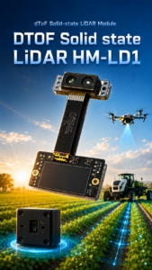
Download technical brochure: DTOF SSL HM-LD1 Product Brochure
| Specification | HM-LD1 Real Specification | Why It Matters for a Drone with LiDAR |
|---|---|---|
| Product Name | DTOF Solid State LiDAR HM-LD1 | Compact dToF LiDAR module for depth sensing, obstacle detection, and UAV perception development. |
| Technology | SPAD dToF solid-state LiDAR | Provides real-time depth images and 3D point cloud data without a large rotating scanner assembly. |
| Dimension | 43.5 mm × 30 mm × 26.5 mm | Small physical size helps integration into compact UAV frames and embedded sensor housings. |
| Weight | 28 g | Low weight helps preserve flight time and payload margin on small drones. |
| Ranging Capability | Indoor: 0.5–25 m; Outdoor: 0.2–8 m | Suitable for indoor navigation, short-range outdoor obstacle detection, inspection, and terrain awareness. |
| Ranging Accuracy | ±3 cm | Useful for distance detection, close-range obstacle awareness, and embedded perception tasks. |
| Field of View | 60° horizontal × 45° vertical | Provides a practical forward or downward sensing area for obstacle avoidance and depth imaging. |
| Resolution | 40 × 30 | Outputs a depth image with 1,200 measurement points per frame for real-time perception development. |
| Frame Rate | 10 fps | Appropriate for controlled UAV movement, hovering inspection, robotics development, and short-range perception. |
| Interface | UART / UDP / UVC | Supports integration with PCs, Raspberry Pi, embedded systems, and other development platforms. |
| Operating Temperature | -20 ℃ to 60 ℃ | Supports deployment in varied indoor, outdoor, and industrial environments. |
| Power Consumption | 1.2 W | Low power demand reduces battery impact and simplifies onboard power design. |
| SDK Support | x86 Windows, x86 Linux, ARM Linux | Helps developers prototype on PCs and deploy on embedded Linux platforms. |
| Typical Applications | Obstacle avoidance, altitude sensing, terrain following, autonomous navigation, smart inspection, robotic vision | Covers common drone and robotics use cases where lightweight 3D perception is required. |
Best-Fit Applications for HM-LD1
✅ HM-LD1 is a strong fit for compact drone obstacle avoidance, indoor UAV navigation, downward altitude sensing, terrain awareness, bridge or dam inspection support, expressway infrastructure inspection, robotics research, SLAM development, and embedded depth perception experiments. It can also be used in robots, smart cameras, security systems, object recognition projects, user presence detection, volume measurement, and zone intrusion monitoring.
Where HM-LD1 Is Not a Replacement for Survey Payloads
Look, HM-LD1 should not be described as a complete georeferenced aerial survey payload by itself. It does not replace RTK GNSS, a high-end IMU, survey calibration, high-density scanning, or professional post-processing software. Its best role is lightweight perception and R&D: real-time depth images, point cloud output, and practical short-range 3D sensing without the cost and complexity of a full mapping payload.
Drone LiDAR Use Cases by Application
Obstacle Avoidance for Compact UAVs
A forward-facing LiDAR module can help detect walls, shelves, machinery, structural beams, trees, and terrain features. The companion computer can use that data to create warning zones, slow the aircraft, stop movement, or trigger avoidance behavior. Reliable operation depends on matching flight speed to sensor range and processing latency.
Altitude Hold and Landing Assistance
A downward-facing LiDAR provides direct distance-to-ground measurement. That helps with low-altitude hover, indoor flight, landing assistance, and operation over surfaces where barometer readings are not precise enough. Ground material, surface angle, frame rate, and controller tuning all affect the result.
Terrain Following
Terrain following means the drone maintains a relative distance from the surface below it. LiDAR can provide the distance input, but the control logic must be tuned carefully. Test over different slopes, materials, and lighting conditions before trusting autonomous terrain following.
Indoor Navigation and SLAM Research
Indoor environments are often GPS-denied, so onboard perception becomes essential. LiDAR can support local mapping, obstacle detection, and SLAM research by providing depth information that does not depend on GPS. Combined with cameras and IMUs, it can improve robustness in low-texture areas.
Infrastructure Inspection
Bridges, expressways, dams, tanks, industrial buildings, and confined structures can be hard or risky to inspect manually. A drone with LiDAR can help maintain distance from structural elements and support controlled navigation near surfaces. HM-LD1 product details specifically highlight useful distance measurement for difficult-to-approach objects such as bridges, expressways, and dams.
Smart Security and Zone Intrusion Monitoring
LiDAR depth sensing is useful beyond airborne drones. Fixed systems and mobile robots can use depth data to detect objects or people entering defined zones, supporting smart security, safety monitoring, and automated presence detection.
Object Detection, Presence Detection, and Volume Measurement
Depth data can support object recognition, user presence detection, volume measurement, and zone intrusion monitoring. The sensor provides the depth input; final performance depends on software, calibration, mounting, and environmental testing.
Drone LiDAR Installation and Testing Checklist
Mechanical Mounting Checklist
⚙️ Mount the LiDAR securely, protect the sensing window, and keep the field of view clear of propellers, landing gear, cables, and frame parts. Use vibration control where needed, but avoid flexible mounts that let the sensor angle shift during flight.
Electrical Checklist
⚙️ Confirm power requirements, use stable voltage regulation, check grounding, secure connectors, add strain relief, and route signal wires away from high-current motor wiring when possible. Low power helps, but bad wiring can still cause unstable data.
Data Interface Checklist
⚙️ Select UART, UDP, or UVC based on the application. Confirm communication settings, SDK behavior, frame stability, logging capability, and latency before flight. Record raw data on the bench before trusting the system in the air.
Calibration Checklist
⚙️ Align the LiDAR coordinate frame with the drone frame. Measure mounting angle and position. Validate range against known targets. Test different surfaces indoors and outdoors. Calibration matters even more when fusing LiDAR with cameras, IMUs, or SLAM software.
Flight Test Checklist
⚙️ Start with bench testing, then handheld tests, tethered tests, or low-altitude hover. Test slow movement before faster flight. Validate thresholds, fail-safe behavior, and obstacle detection in the expected lighting and vibration conditions.
Common Mistakes When Choosing UAV LiDAR
Choosing Maximum Range Instead of Usable Range
Maximum range may only apply under favorable conditions. Bright sunlight, dark surfaces, angled targets, reflective materials, rain, fog, and dust can reduce usable range. Compare indoor and outdoor specifications, then test.
Ignoring Weight and Power
Many buyers focus on range and forget payload impact. A heavy or power-hungry sensor can shorten flight time, overload motors, force battery changes, or create thermal problems.
Confusing Mapping LiDAR with Obstacle Avoidance LiDAR
A sensor that works for local obstacle awareness may not create survey-grade maps. Mapping requires positioning and post-processing. Obstacle avoidance requires real-time depth and control integration.
Forgetting About SDKs and Integration Support
A strong datasheet is not enough. Developers need documentation, tools, examples, stable interfaces, and supplier support. SDK availability across Windows, Linux, and ARM Linux reduces risk.
Expecting a Sensor Alone to Create a Survey-Grade Drone
LiDAR is only part of a survey system. Without GNSS, IMU, synchronization, calibration, and software, a compact module cannot produce certified georeferenced deliverables.
Not Testing Outdoors
Outdoor testing is mandatory. Sunlight, surface reflectivity, prop wash, and vibration can expose issues that never appear on the bench.
We’ve recently been testing the HM-LD1 compact dToF LiDAR in a variety of r…
FAQ: Drone with LiDAR
Is there a LiDAR sensor small and light enough for beginner or compact drones?
Can I build a drone with LiDAR on a budget for surveying or mapping?
What should I check before buying a LiDAR drone or LiDAR sensor for UAV integration?
Is LiDAR better than a camera for drone obstacle avoidance?
How much range does a drone LiDAR sensor need?
Can a lightweight LiDAR module create a 3D point cloud?
What interface is best for connecting LiDAR to a drone?
Can LiDAR work outdoors on a drone?
Can I use LiDAR for drone altitude hold?
Is HM-LD1 suitable for professional land surveying?
Conclusion: Choosing the Right LiDAR for Your Drone
A drone with LiDAR can mean many things: a professional terrain mapping aircraft, a compact obstacle avoidance platform, an indoor navigation prototype, or an inspection drone that needs better distance awareness. The right choice depends on the mission. If you need certified survey deliverables, evaluate complete LiDAR payloads with RTK, IMU, calibration, and processing software. If your goal is short-range obstacle avoidance, altitude sensing, terrain awareness, indoor navigation, smart inspection, or UAV perception R&D, a lightweight solid-state dToF module is often the better starting point.
The DTOF Solid State LiDAR HM-LD1 fits that second category. With a 28 g weight, 1.2 W power consumption, 60° × 45° field of view, ±3 cm accuracy, 40 × 30 resolution, and UART/UDP/UVC interfaces, it gives drone developers a practical way to add real-time depth and point cloud sensing to compact UAV platforms. For teams building a drone with LiDAR on a realistic budget, HM-LD1 offers a strong balance of size, power, integration flexibility, and short-range 3D sensing performance.
Explore the full specifications and integration options for the DTOF Solid State LiDAR HM-LD1, or download the product brochure for engineering evaluation.






