GNSS Receiver Price Guide: Affordable RTK Options for Drones, Surveying & Robotics
Technical review: Industrial engineering and GNSS integration editorial team | Last reviewed: March 24, 2026
Here’s the deal: the price of a GNSS receiver can run from an inexpensive embedded module to a field-ready survey system costing many thousands of dollars. The difference is not just positioning accuracy. Frequency support, RTK correction handling, antenna quality, update rate, communications hardware, environmental protection, software compatibility, technical support, and included accessories all affect what the system will cost once it is actually working in the field. A low headline price looks good on a purchasing spreadsheet, but it means very little if the receiver cannot hold an RTK fix, communicate with the host controller, or survive the intended operating environment.
This guide explains how to compare GNSS receiver prices for RTK drones, survey rovers, autonomous vehicles, and robotics projects. It covers the main cost drivers behind centimeter-level positioning, the difference between a receiver module and a complete RTK system, and the practical trade-offs between the lightweight HM-D20 and the survey-oriented HM-D13. The goal is not to chase the cheapest part number. It is to identify the lowest-cost system that meets the actual accuracy, integration, communications, and deployment requirements.
Pricing note: GNSS and RTK products may be configured by communication method, accessories, quantity, regional frequency, enclosure, and OEM requirements. Any market ranges in this guide should be treated as planning estimates rather than formal quotations. Request a project-specific quote before purchasing.
Table of Contents
- 👉 GNSS Receiver Price Overview
- 👉 What Are You Actually Buying?
- 👉 What Determines GNSS Receiver Price?
- 👉 Accuracy, RTK and Fix Reliability
- 👉 Total Cost of Ownership
- 👉 Choosing by Application
- 👉 HM-D20 vs. HM-D13 Specifications
- 👉 GNSS Receiver Selection Workflow
- 👉 Integration and Deployment Requirements
- 👉 How to Reduce Cost Without Sacrificing Reliability
- 👉 Information Required for an Accurate Quote
- 👉 Frequently Asked Questions
- 👉 Final Recommendation
GNSS Receiver Price Overview
A GNSS receiver may cost less than $100 for a basic navigation module, several hundred dollars for an embedded RTK receiver, or thousands of dollars for a rugged survey system. A professional base-and-rover package can cost considerably more because it may include radios, controllers, field software, batteries, poles, tripods, support, and all the small accessories that are easy to overlook during early budgeting.
Look, there is no universal GNSS receiver price because the term “GNSS receiver” covers several very different types of equipment. A small circuit board designed to live inside a robot cannot be compared directly with a weather-resistant survey receiver supplied with a controller and field software. Even two RTK-capable receivers may use different antennas, correction links, satellite signals, mechanical designs, and host interfaces.
| GNSS product category | Illustrative planning range | Typical use |
|---|---|---|
| Basic non-RTK GNSS module | Under $100 to several hundred dollars | General navigation, asset tracking, timing, and lower-precision robotics |
| RTK-capable board or embedded module | Approximately $100 to $1,000 or more | OEM robots, UAVs, research systems, and development platforms |
| Integrated RTK antenna and receiver | Several hundred to a few thousand dollars | UAVs, unmanned ground vehicles, machine guidance, and mapping |
| Rugged survey receiver | Approximately $1,000 to $10,000 or more | Surveying, construction, mapping, and field measurement |
| Complete professional base-rover package | Several thousand to tens of thousands of dollars | Independent field RTK operations and multi-crew survey workflows |
These figures are category benchmarks, not published prices for the HM-D20 or HM-D13. Prices move with region, exchange rates, brand, configuration, accessories, support, order quantity, shipping, duties, and certification requirements. An inexpensive rover also needs a correction source before it can deliver RTK performance. That means the purchase price and the total deployed cost are two different numbers.
In the shop, this distinction matters. A $300 module that needs a $150 antenna, a custom cable, a modem, a host computer, an enclosure, and several days of engineering work may cost more to deploy than an integrated receiver with a higher unit price. The right comparison is always system against system.
What Are You Actually Buying?
Accurate price comparison starts with a basic question: what is included? A low-cost receiver board, an integrated GNSS receiver, an RTK rover, and a complete survey kit each solve a different portion of the positioning problem.
Receiver Board
A receiver board processes satellite signals and generates position, time, velocity, and status data. It may still need an external antenna, RF cable, regulated power supply, enclosure, mounting hardware, communications adapter, and a separate correction-data connection. Board pricing can look attractive because much of the completed system is excluded.
For an OEM team with electrical, mechanical, RF, and firmware capability, that may be exactly the right trade. The team gets control over the enclosure, antenna location, connectors, and software stack. For a small team trying to get one rover into the field next month, however, the engineering burden can wipe out the apparent savings.
Integrated GNSS Receiver and Antenna
An integrated unit combines the antenna and receiver in one assembly. That can simplify RF design, reduce cable losses, shorten installation time, and lower the risk of pairing the receiver with an unsuitable antenna. It also gives the supplier more control over the tested RF path.
Still, “integrated” does not mean “plug it in and forget it.” Buyers must verify power quality, interfaces, correction input, mounting, electromagnetic compatibility, environmental protection, and software behavior. A good integrated product removes some engineering tasks, not all of them.
RTK Rover
An RTK rover is the moving receiver that obtains correction data from a reference station or correction network. “RTK ready” does not necessarily mean the product includes a cellular modem, NTRIP account, SIM plan, radio, or local base station. The procurement documents should spell out how RTCM or other supported corrections will reach the receiver and which components are included in the quoted price.
RTK Base Station
A base station occupies a known or surveyed position and generates correction information. Running a private base may require another receiver and antenna, a tripod or permanent mount, batteries or fixed power, a radio or internet connection, coordinate configuration, and some form of monitoring.
Here’s the practical catch: base coordinate errors can transfer directly into the rover result. A rover may report a very stable centimeter-level solution that is consistently offset because the base was entered incorrectly. Setup quality matters every bit as much as the receiver hardware.
Complete Survey System
A complete survey package may include a rugged receiver, survey pole, tripod, field controller, base and rover radios, batteries, chargers, data-collection software, cloud access, carrying case, configuration, warranty, and technical support. Buyers comparing complete field-survey ecosystems can review established equipment organizations such as South Survey for broader market context. This is not a direct specification comparison with the embedded products discussed below.
What Determines GNSS Receiver Price?
Frequency Bands
Single-frequency receivers track one primary frequency from each supported constellation. Multiband receivers may track combinations such as L1, L2, or L5 and their equivalents. The extra observations can improve ambiguity resolution, ionospheric error handling, and resilience. They also require compatible receiver electronics, firmware, filtering, and antenna design, which can increase cost.
More bands do not automatically guarantee better field accuracy. The correction source, antenna installation, satellite visibility, algorithms, multipath environment, baseline, and current solution status still matter. Buyers should verify exact constellation and frequency combinations instead of relying on broad labels such as “dual-band” or “multiband.”
Supported Satellite Constellations
Modern receivers may support GPS, BeiDou, Galileo, GLONASS, QZSS, and IRNSS. Multi-constellation tracking can increase satellite availability and improve geometry when trees, buildings, machinery, or parts of the vehicle block sections of the sky.
Constellation count and frequency support must be reviewed together. A receiver may support different frequencies for different satellite systems. A long list of constellation names on a product page does not tell you how many signals will actually be tracked in the target region and operating mode.
RTK Capability and Correction Formats
RTK uses carrier-phase observations and correction data to estimate position more precisely than ordinary standalone GNSS. Correction messages are commonly exchanged in RTCM formats. They may arrive from a local base over a radio link or through the internet using an NTRIP service connected to a CORS network.
A receiver that accepts corrections is not automatically a complete correction-communications system. A cellular modem, SIM, NTRIP credentials, radio, external antenna, host application, or base station may still be needed. Confirm whether the product can operate as a rover, a base, or both, and identify the supported RTCM versions and message types before purchasing.
Antenna Type and Integration
Embedded patch antennas, helical antennas, and larger survey-style antennas all have different mechanical and RF characteristics. Real-world performance is affected by antenna gain, radiation pattern, filtering, phase-center behavior, ground plane, orientation, cable loss, and nearby materials. A gain number by itself does not determine positioning quality.
An integrated receiver-and-antenna product can simplify installation and reduce RF connection problems. A separate antenna provides more mounting flexibility, but the system designer becomes responsible for cable selection, connector loss, bias requirements, signal compatibility, sealing, and mechanical placement.
Update Rate, Latency and Dynamics
Update rate describes how often the receiver outputs a solution. A 10 Hz receiver can provide up to ten position updates per second and may be suitable for many UAV, UGV, and mobile robotics applications. Faster control systems may need higher rates, carefully measured latency, or synchronization with an inertial sensor.
Update rate is not the same thing as accuracy. A receiver can output positions quickly while operating in RTK float or standalone mode. Higher output rates also increase serial bandwidth, logging volume, and host-processor workload. In the shop, calculate the full message load before locking down the interface and baud rate.
Correction Communication Hardware
Cellular communication can deliver CORS or NTRIP corrections over a wide area, but it depends on network coverage, data plans, credentials, and service availability. LoRa or another local radio can support base-to-rover communication without public internet access, although range depends heavily on antenna height, terrain, interference, transmit power, line of sight, and regional radio regulations.
One-to-many communications may reduce infrastructure cost when several machines operate in the same area. Even so, network capacity, message scheduling, radio configuration, packet loss, and outage behavior must be tested at the intended rover count. A network that works with two stationary receivers on a bench may behave differently with dozens of moving machines.
Environmental and Mechanical Design
Operating temperature, ingress protection, UV resistance, vibration, connector retention, dimensions, weight, and enclosure materials all influence price and reliability. Ruggedization raises the initial cost, but it may reduce failures, replacements, service calls, and mission downtime.
Do not assume a product is waterproof because its enclosure looks sealed. Likewise, do not assign an IP rating unless an official specification or test document confirms it. “Outdoor capable,” “rain resistant,” and “IP67” are not interchangeable claims.
Interfaces and Protocols
Common GNSS data elements include NMEA sentences, RTCM corrections, and manufacturer-specific binary protocols such as UBX. Physical interfaces may include TTL-level UART, RS-232, RS-485, USB, or connectors carrying I²C signals. These electrical standards are not interchangeable.
The receiver’s voltage levels, pinout, baud rate, grounding, connector, and signal direction must match the host. A protocol can be logically correct while the physical connection is electrically wrong. That mistake can cause intermittent data, damaged hardware, or hours of unnecessary debugging.
Technical Support, Documentation and Customization
Pinout drawings, protocol documentation, configuration tools, integration examples, firmware support, custom cables, OEM labeling, and engineering assistance can all change a quotation. Support may increase the unit price, but it can cut weeks from development and reduce field risk.
Procurement teams should also check sample availability, minimum order quantities, production lead time, supply continuity, warranty, return procedures, and change-notification practices. Those items do not appear in an accuracy specification, but they matter once the receiver becomes part of a production system.
Accuracy, RTK and Fix Reliability
Standalone GNSS Versus RTK
Standalone GNSS commonly delivers meter-level positioning, depending on the receiver and environment. It generally cannot provide repeatable centimeter-level positioning on its own. RTK combines correction information with carrier-phase measurements to reduce shared errors and resolve carrier ambiguities. The rover must receive timely, compatible corrections and reach the correct solution state.
Understanding Horizontal and Vertical Specifications
A specification of 1.0 cm + 1 ppm horizontal means the stated constant term is combined with a baseline-dependent term. One part per million corresponds to roughly 1 millimeter per kilometer of baseline under the assumptions used for the specification. A 1.5 cm + 1 ppm vertical specification follows the same principle but starts with a larger constant term.
Those figures are not unconditional guarantees. Actual performance depends on base coordinates, satellite geometry, atmospheric conditions, correction age, baseline length, multipath, initialization, antenna placement, motion, and whether the receiver remains in RTK fixed mode.
Fixed, Float and Lost-Fix States
An RTK fixed solution means carrier ambiguities have been resolved. RTK float means the receiver is still estimating those ambiguities, typically with lower accuracy. If correction data or satellite visibility is lost, the receiver may fall back to differential or standalone positioning.
A system that repeatedly moves between those states can interrupt mapping, guidance, or control even when its best-case accuracy looks excellent. Field validation should log fix type, satellite count, dilution of precision, correction age, baseline length, estimated position uncertainty, reinitialization time, and outage duration.
For moving platforms, the percentage of the route completed in RTK fixed mode is often more useful than one favorable accuracy reading. If a robot is fixed for only 60% of its route, the remaining 40% still has to be handled safely.
Why Sub-Centimeter Claims Need Context
Sub-centimeter results may be achievable under controlled conditions, especially in static or carefully designed workflows. They should not be assumed for every drone, survey rover, or robot. Buyers need to separate repeatability from absolute accuracy, horizontal from vertical accuracy, and static observations from dynamic navigation.
A precisely calculated position can still be offset if the base coordinates, datum, geoid model, or coordinate transformation are wrong. That is why a good field acceptance test checks both solution quality and known physical control points.
Total Cost of Ownership for an RTK GNSS System
Total deployed cost includes receiver hardware, antenna and mounting, correction-data hardware, correction service or base station, host processor, interfaces, cables, power regulation, enclosure, software integration, testing, technical support, and field maintenance. Looking at the whole system prevents an apparently inexpensive receiver from becoming an expensive integration project.
Upfront Hardware Costs
Initial expenses can include the receiver, antenna, modem, radio, host controller, adapters, wiring harness, enclosure, mounting hardware, batteries, charger, survey pole, tripod, and spare units. Custom connectors and low-volume cables can be surprisingly expensive during prototyping, especially when they must be weather-sealed or built to a specific length.
Recurring Costs
Recurring expenses may include cellular data plans, NTRIP or CORS subscriptions, cloud services, software licenses, data storage, calibration, maintenance, and field support. Public correction networks may reduce equipment requirements, but coverage, reliability, message compatibility, and service terms need to be confirmed.
Engineering Costs
Firmware development, message parsing, coordinate conversion, timestamp management, correction forwarding, configuration, fault detection, logging, and field validation can exceed the receiver’s purchase price. An integrated product may cost more per unit while reducing non-recurring engineering effort.
Look at engineering time honestly. If two engineers spend three weeks solving power, RF, protocol, and enclosure problems, that cost belongs in the receiver decision. It should not disappear into a general development budget.
Operational Risk Costs
Downtime can lead to repeated surveys, missed flight windows, idle machinery, navigation interruptions, damaged equipment, or delayed customer deliveries. Replacement lead time and supplier support therefore belong in the cost model.
| Cost category | Option A | Option B | Cost type | Validation required |
|---|---|---|---|---|
| Receiver | Enter cost | Enter cost | One-time | Accuracy and interface test |
| Correction link | Enter cost | Enter cost | One-time and recurring | Coverage and outage test |
| NTRIP or CORS | Enter cost | Enter cost | Recurring | Regional coverage test |
| Antenna and mount | Enter cost | Enter cost | One-time | Final installation test |
| Integration labor | Enter cost | Enter cost | One-time | System acceptance test |
| Maintenance and support | Enter cost | Enter cost | Recurring | Field history review |
Choosing a GNSS Receiver by Application
RTK Drones and UAV Mapping
UAV projects usually prioritize low weight, compact dimensions, manageable power demand, useful update rate, secure mounting, and flight-controller compatibility. Antenna placement must account for motors, carbon-fiber structures, telemetry radios, high-current wiring, and payload equipment.
Testing should be done with the motors running. Electromagnetic noise and vibration may not show up during a quiet bench test. A receiver that performs perfectly on a desk can lose satellites or produce unstable heading data after installation on an operating aircraft.
The HM-D20 is the more natural option to evaluate when size and weight are primary constraints. It weighs 38.2 g, measures Φ54.5 × 53 mm, operates at 5 V ±0.5 V, and provides a maximum update rate of 10 Hz. Its supported data formats include NMEA and UBX through an 8-pin interface.
Survey Rovers and Mapping Equipment
Survey-oriented projects normally prioritize an integrated antenna, rigid mounting, outdoor performance, correction compatibility, repeatability, and field serviceability. The HM-D13 uses a larger integrated mushroom-style antenna assembly. It weighs less than 550 g, uses a TTL-level UART interface at a specified 115200 bps, accepts RTCM input at the rover, and provides RTCM output when used on the base side. Its specified operating-temperature range is -40°C to 85°C.
Autonomous Robots and UGVs
Outdoor robots need dynamic positioning, correction-outage management, and safe behavior whenever RTK fixed is unavailable. GNSS should not be the only localization source where buildings, trees, tunnels, indoor areas, or overhead structures can block satellite signals. Wheel odometry, inertial sensors, cameras, radar, and LiDAR may complement GNSS.
Teams planning sensor fusion can review this practical guide to LiDAR for environmental measurement and mapping and the comparison of LiDAR and radar trade-offs for robotics. Developers researching autonomous-system perception can also examine organizations such as Luminar Technologies for broader industry context on LiDAR-based perception. No interoperability should be assumed without system-level testing.
Precision Agriculture and Machine Guidance
Agricultural and machine-guidance applications may require repeatable paths, dependable corrections, predictable base-to-rover coverage, elevated antenna placement, and resistance to vibration, dust, sunlight, and rain. Any required environmental rating should be verified directly rather than inferred from marketing language.
The HM-D20 specifies a LoRa architecture that supports one base station communicating with one or multiple rovers, with a stated maximum of 4,096 rovers. The default LoRa frequency is 915 MHz, and the stated communication range is up to 6 km. Actual network capacity and range depend on configuration, terrain, interference, antenna setup, line of sight, and local radio rules.
Timing and Synchronization
Some industrial systems need accurate time as well as position. The HM-D13 specifies timing synchronization accuracy of 20 ns. Before designing around that figure, verify the timing output, electrical signal, reference conditions, cable delays, host timestamping behavior, and required operating mode. A numerical timing specification alone does not establish end-to-end synchronization accuracy.
Affordable RTK Product Comparison: HM-D20 vs. HM-D13
The supplied specifications do not include a fixed selling price for the HM-D20 or HM-D13. No product price should be invented. Both are presented as quote-based options because communication variant, quantity, accessories, customization, destination, and technical-support requirements may affect the final quotation.
HM-D20 All-in-One RTK GNSS Helical Antenna Module
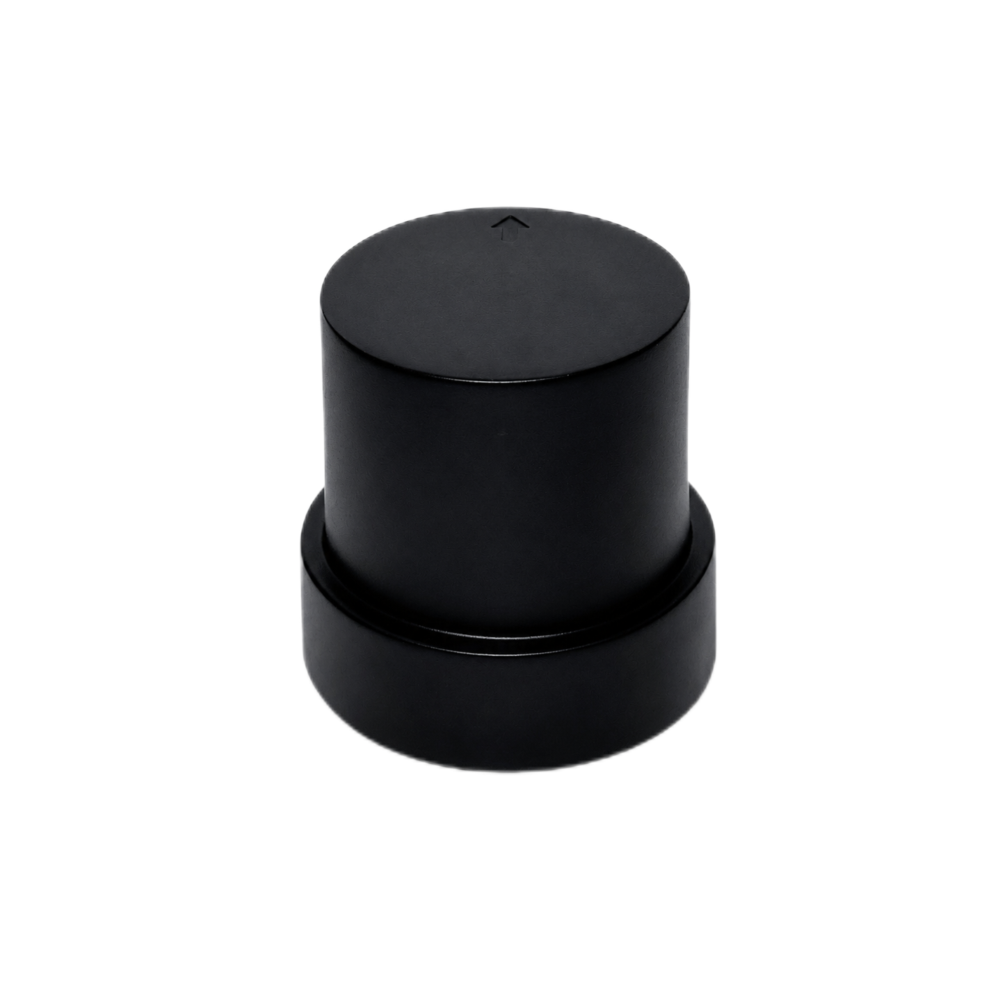
The HM-D20 combines a helical antenna, GNSS positioning electronics, and correction communication options in a compact 38.2 g assembly. It supports L1/L5 dual-frequency RTK and six satellite systems. Its listed RTK accuracy is 1.0 cm + 1 ppm horizontally and 1.5 cm + 1 ppm vertically. The maximum update rate is 10 Hz, while the specified RTK time to first fix is 45 seconds.
Correction options include a 4G version for CORS or NTRIP and a LoRa configuration. The LoRa version uses 915 MHz by default and lists a range of up to 6 km. It supports one base station communicating with one or multiple rovers, with a stated maximum of 4,096 rovers. Regional frequency rules and actual field range must be confirmed.
| Category | Specification |
|---|---|
| Positioning capability | L1/L5 dual-frequency RTK |
| Horizontal accuracy | 1.0 cm + 1 ppm |
| Vertical accuracy | 1.5 cm + 1 ppm |
| Maximum update rate | 10 Hz |
| RTK time to first fix | 45 seconds |
| Satellite systems | GPS, BeiDou, Galileo, QZSS, GLONASS, and IRNSS |
| Tracking channels | 200 |
| Cold start and hot start | 28 seconds and 1 second |
| Antenna system gain | 40 dB |
| 4G version | CORS and NTRIP |
| LoRa default frequency | 915 MHz |
| LoRa communication range | Up to 6 km |
| LoRa networking | One base station to one or multiple rovers |
| Maximum rover count | 4,096 |
| Dimensions and weight | Φ54.5 × 53 mm and 38.2 g |
| Operating voltage | 5 V ±0.5 V |
| Data and interface | 8-pin interface, NMEA, and UBX |
| Magnetometer | QMC5883L with SCL and SDA |
A downloadable HM-D20 GNSS RTK receiver module document is also available for technical review. Interface details should be checked against the intended flight controller, computer, or custom PCB before wiring.
HM-D13 Multiband RTK Survey Module
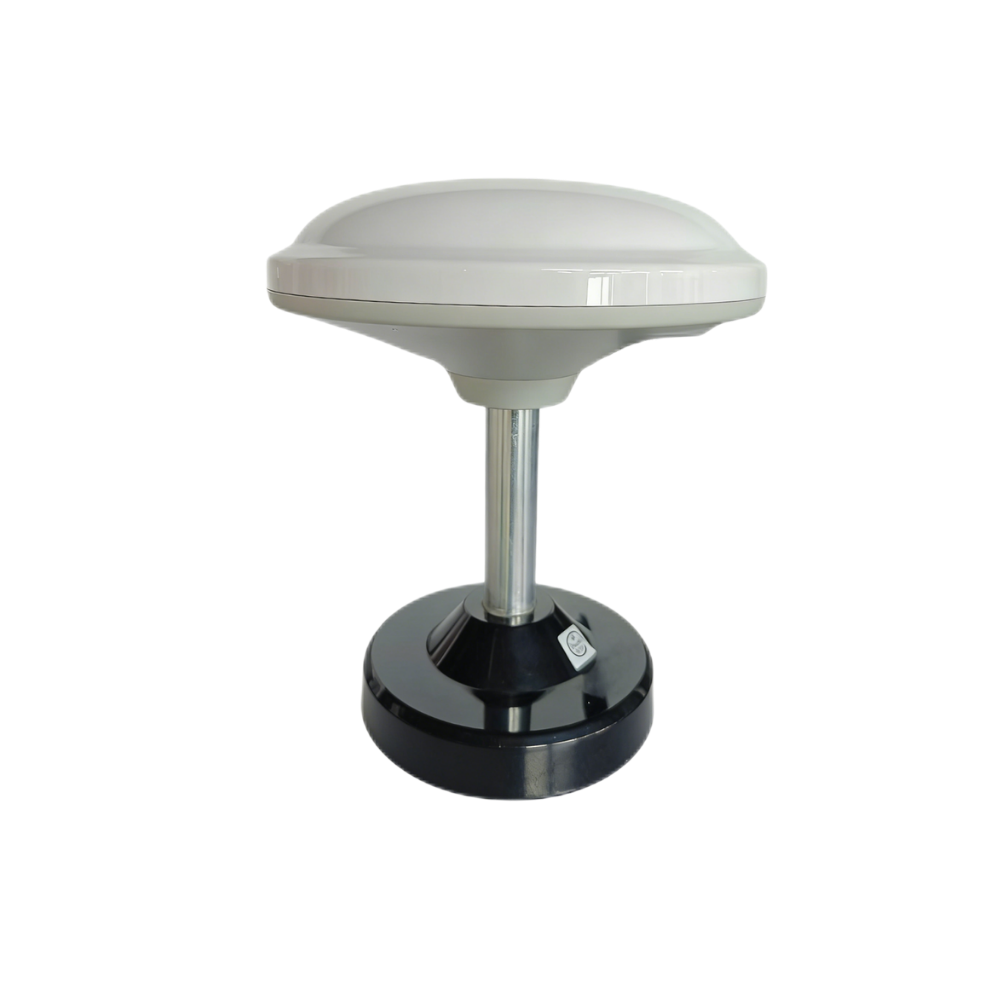
The HM-D13 combines a multiband GNSS receiver with an integrated mushroom-style antenna. It supports GPS L1/L5, BeiDou B1/B2A/B2I, Galileo E1/E5, QZSS L1/L5, GLONASS G1, and IRNSS. Its listed RTK accuracy is 1 cm + 1 ppm horizontally and 1.5 cm + 1 ppm vertically.
The module provides NMEA 0183 output and RTCM input on the rover side, with RTCM output on the base side. It uses a TTL-level UART interface at 115200 bps, specifies timing synchronization accuracy of 20 ns, and supports an optional 4G radio module. Its specified operating-temperature range is -40°C to 85°C.
| Category | Specification |
|---|---|
| Frequency bands | GPS L1/L5; BeiDou B1/B2A/B2I; Galileo E1/E5; QZSS L1/L5; GLONASS G1; IRNSS |
| Horizontal RTK accuracy | 1 cm + 1 ppm |
| Vertical RTK accuracy | 1.5 cm + 1 ppm |
| Rover protocol | NMEA 0183 output and RTCM input |
| Base protocol | RTCM output |
| Baud rate | 115200 bps |
| Dimensions | Φ152 × 67.9 mm |
| Weight | Less than 550 g |
| Interface | TTL-level UART |
| Timing synchronization accuracy | 20 ns |
| Operating temperature | -40°C to 85°C |
| Communication option | Optional 4G radio module |
| Antenna arrangement | Integrated mushroom-style GNSS antenna |
The integrated design is intended to simplify signal reception and installation for survey, mapping, rover, and outdoor RTK workflows. The supplied product information describes UV-resistant PC material and wind- and rain-resistant outdoor performance, but it does not provide a formal ingress-protection rating. Buyers requiring a certified IP level should request documented verification.
| Specification | HM-D20 | HM-D13 |
|---|---|---|
| Primary design orientation | UAVs, autonomous driving, robotics, and survey mapping | Surveying, mapping, and outdoor RTK integration |
| GNSS frequency capability | L1/L5 dual-frequency RTK | GPS L1/L5; BeiDou B1/B2A/B2I; Galileo E1/E5; QZSS L1/L5; GLONASS G1; IRNSS |
| Satellite systems | GPS, BeiDou, Galileo, QZSS, GLONASS, and IRNSS | BDS, GPS, GLONASS, Galileo, QZSS, and IRNSS |
| Horizontal RTK accuracy | 1.0 cm + 1 ppm | 1 cm + 1 ppm |
| Vertical RTK accuracy | 1.5 cm + 1 ppm | 1.5 cm + 1 ppm |
| Maximum update rate | 10 Hz | Not stated in the supplied specifications |
| RTK time to first fix | 45 seconds | Not stated in the supplied specifications |
| Cold start / hot start | 28 seconds / 1 second | Not stated in the supplied specifications |
| Tracking channels | 200 | Not stated in the supplied specifications |
| Correction communication | 4G version for CORS/NTRIP or LoRa option | Optional 4G radio module |
| LoRa capability | 915 MHz default; up to 6 km stated communication range | Not stated |
| LoRa networking | One base to one or multiple rovers; up to 4,096 rovers | Not stated |
| Protocols | NMEA and UBX | NMEA 0183 output and RTCM input at rover; RTCM output at base |
| Interface | 8-pin interface | TTL-level UART |
| Baud rate | Not stated in the supplied specifications | 115200 bps |
| Integrated magnetometer | QMC5883L with SCL/SDA | Not stated |
| Timing synchronization accuracy | Not stated | 20 ns |
| Dimensions | Φ54.5 × 53 mm | Φ152 × 67.9 mm |
| Weight | 38.2 g | Less than 550 g |
| Operating voltage | 5 V ±0.5 V | Not stated in the supplied specifications |
| Operating temperature | Not stated in the supplied specifications | -40°C to 85°C |
| Antenna configuration | Integrated helical antenna; 40 dB antenna system gain | Integrated mushroom-style GNSS antenna |
| Published price | Request a project-based quote | Request a project-based quote |
Choose the HM-D20 for Evaluation When
- ✅ Low weight and compact dimensions are critical.
- ✅ The receiver will be installed on a drone or compact mobile robot.
- ✅ A maximum 10 Hz update rate satisfies the application.
- ✅ Integrated 4G/CORS/NTRIP or LoRa correction options are relevant.
- ✅ NMEA or UBX and the 8-pin interface suit the host design.
- ✅ A QMC5883L magnetometer with SCL and SDA is useful.
Choose the HM-D13 for Evaluation When
- ✅ The deployment is survey-oriented.
- ✅ A larger integrated antenna assembly is acceptable.
- ✅ TTL UART at 115200 bps aligns with the controller.
- ✅ RTCM input at the rover or RTCM output at the base is required.
- ✅ A specified -40°C to 85°C operating range is important.
- ✅ Timing synchronization is part of the requirement.
Compare HM-D20 and HM-D13 for Your Project
A Practical GNSS Receiver Selection Workflow
⚙️ Step 1: Define the Positioning Requirement
Specify whether the job needs meter, decimeter, centimeter, or repeatable relative positioning. Separate horizontal and vertical requirements, and identify whether measurements are static or dynamic. Define the acceptable outage duration and the minimum required percentage of RTK fixed operation.
⚙️ Step 2: Define the Operating Environment
Document open-sky visibility, buildings, tree cover, temperature, vibration, precipitation, dust, electromagnetic interference, mounting orientation, vehicle materials, and expected correction outages. A receiver selected only from laboratory specifications may behave very differently on the completed machine.
⚙️ Step 3: Select the Correction Strategy
Choose between public or private CORS/NTRIP, a local base station, a cellular correction link, LoRa or another radio, or host-provided RTCM. Consider service coverage, recurring fees, regional radio rules, base-to-rover distance, rover count, and what the machine should do during a communication loss.
⚙️ Step 4: Confirm Mechanical and Electrical Compatibility
Verify dimensions, weight, supply voltage, current demand, connector, pinout, UART logic level, baud rate, antenna clearance, cable length, mounting pattern, and environmental needs. Do not connect a serial interface until its electrical standard has been confirmed.
⚙️ Step 5: Confirm Data Compatibility
List the required NMEA sentences, binary messages, RTCM versions and message types, update rate, coordinate frame, datum, height reference, time source, and fix-status information. Make sure the host can process the resulting data volume without creating latency.
⚙️ Step 6: Prototype Under Real Conditions
Test the intended antenna position, correction link, host processor, wiring, motion profile, and operating environment. Bench tests are useful for verifying communications, but they cannot reproduce multipath, foliage, radio congestion, vibration, or vehicle-generated interference.
⚙️ Step 7: Calculate Total Deployed Cost
Compare the full bill of materials, engineering effort, subscription expense, maintenance, replacements, support, and downtime. That produces a meaningful GNSS receiver price comparison instead of a misleading unit-price comparison.
Integration and Deployment Requirements
Power Design
The HM-D20 specifies an input of 5 V ±0.5 V. The final design should also confirm current demand, startup behavior, ripple tolerance, grounding, connector polarity, transient protection, and reverse-polarity protection. Motors, switching regulators, radios, and servos can introduce electrical noise, so the receiver should be tested from the actual vehicle power system.
Serial Interfaces
Logical protocol compatibility does not guarantee electrical compatibility. TTL UART, RS-232, RS-485, and USB use different electrical layers. Use the correct adapter, voltage level, signal direction, and common-ground arrangement. Baud rate and message-output settings must also fit the host’s serial bandwidth.
Host Computing
GNSS receivers can be integrated with flight controllers, Raspberry Pi systems, Jetson platforms, Arduino-class controllers, or custom computers when the electrical and software requirements are satisfied. Teams developing a custom controller can examine the HM-RV1 RISC-V development board as an example of an embedded host platform. Confirmed GNSS compatibility should not be assumed until the exact interface, voltage, drivers, and software have been validated.
Antenna Placement
Provide clear sky visibility and mount the antenna rigidly in its specified orientation. Keep it away from high-current wiring, switching converters, motors, and transmitting antennas where practical. Avoid conductive structures that obstruct or reflect signals. Carbon-fiber frames and metal enclosures can substantially alter reception, so testing must take place on the final structure.
Software and Coordinate Handling
Software must correctly interpret latitude, longitude, altitude, timestamps, fix status, and quality indicators. Projects may require conversion into a local coordinate frame. Engineers should distinguish ellipsoid height from orthometric height, apply the intended geoid model, maintain datum consistency, and manage timestamps and leap-second behavior correctly.
Coordinate conversion errors can create large application errors even when the GNSS solution itself is accurate. This is one of those issues that can look like a receiver fault until somebody checks the datum, units, axis direction, or height reference.
Fail-Safe Behavior
The host should continuously monitor fix quality and correction age. Control logic must define what happens when RTK fixed changes to float, differential, or standalone. Depending on the application, the platform may slow down, stop, switch to sensor fusion, mark data as lower quality, or wait for reinitialization.
Safety-critical systems must never continue operating on the assumption of centimeter accuracy after corrections are lost. That operating rule belongs in the control software and acceptance test, not just in an operator manual.
How to Reduce GNSS Receiver Cost Without Sacrificing Reliability
- ✅ Buy only the required capabilities. Avoid paying for unused communication links, frequency bands, or interfaces, but preserve enough performance margin for the real environment.
- ✅ Use an existing correction network when coverage is reliable. NTRIP or CORS may remove the need for a private base, although subscription cost and cellular dependence remain.
- ✅ Choose integrated hardware when engineering resources are limited. A board may have a lower unit price, but an integrated antenna and communication solution may reduce development time and RF risk.
- ✅ Standardize the platform. One approved receiver, connector, cable, firmware configuration, and software interface across multiple robots simplifies inventory, training, maintenance, and support.
- ✅ Validate samples before volume purchasing. A representative field trial can reveal communication, multipath, vibration, or software problems before an expensive production commitment.
- ✅ Request prototype, volume, and OEM pricing. Suppliers may quote samples, pilot batches, and annual production volumes differently.
- ✅ Separate mandatory and optional requirements. A must-have, preferred, and optional feature list helps prevent over-specification.
- ✅ Measure fixed-solution availability. An inexpensive receiver becomes costly if repeated float periods cause downtime, unsafe control, or survey rework.
- ✅ Include technical support in the comparison. Clear documentation and application engineering can save weeks of integration effort.
What to Provide for an Accurate GNSS Receiver Quote
A project-based quotation is more useful than a generic price because it lets the supplier match the positioning hardware, correction method, interfaces, and accessories to the real application. The more specific the input, the less back-and-forth will be needed later. Include the following information:
- ✅ Application: drone, survey rover, UGV, agriculture, marine, timing, or OEM product
- ✅ Required horizontal and vertical accuracy
- ✅ Static or dynamic operation
- ✅ Maximum platform speed
- ✅ Required update rate and latency
- ✅ Target countries and operating regions
- ✅ Required satellite systems and bands
- ✅ Correction source: NTRIP, CORS, local base, LoRa, radio, or host-provided RTCM
- ✅ Expected base-to-rover distance
- ✅ Cellular availability
- ✅ Number of simultaneous rovers
- ✅ Required protocols and message types
- ✅ Electrical interface and logic level
- ✅ Supply voltage
- ✅ Maximum dimensions and weight
- ✅ Operating-temperature requirement
- ✅ Weather or ingress-protection requirement
- ✅ Host processor or flight controller
- ✅ Antenna and mounting constraints
- ✅ Prototype quantity and annual volume
- ✅ Required accessories
- ✅ Custom firmware, cable, connector, label, or enclosure needs
- ✅ Delivery country and target schedule
- ✅ Documentation and technical-support requirements
Send Your Technical Requirements
GNSS Receiver Price and RTK Selection FAQ
What GNSS receiver price should I expect for centimeter-level accuracy?
Can an affordable GNSS receiver deliver sub-centimeter or centimeter-level positioning?
Which GNSS receiver is suitable for an RTK drone, survey rover, or robot?
Do I need a base station to use an RTK GNSS receiver?
Is a more expensive GNSS receiver always more accurate?
What is the difference between RTK accuracy and GNSS update rate?
How far can an RTK rover operate from its base station?
What should I test before purchasing GNSS receivers in volume?
How to Choose the Best GNSS Receiver for the Price
Here’s the bottom line: the best GNSS receiver price is not necessarily the lowest unit price. It is the lowest total cost for a system that consistently meets the project’s positioning, communication, mechanical, and environmental requirements. Do not compare a receiver board directly with a complete survey kit. Define the required accuracy, fixed-solution availability, update rate, correction method, interface, antenna arrangement, dimensions, weight, voltage, and operating environment before comparing quotations.
For lightweight drones and compact autonomous platforms, the HM-D20 offers an all-in-one 38.2 g design with L1/L5 RTK, a maximum 10 Hz update rate, and 4G/CORS/NTRIP or LoRa correction options. For survey-oriented deployments that can accept a larger integrated antenna assembly and need TTL UART, RTCM base-and-rover operation, 20 ns timing synchronization accuracy, and a specified extended temperature range, the HM-D13 is the stronger candidate to evaluate.
Because final cost depends on configuration, quantity, accessories, destination, correction strategy, and integration support, submit the actual project requirements for a configuration-specific quotation. Prototype testing in the real operating environment should come before volume procurement. That is the inexpensive time to discover power noise, correction gaps, antenna-placement problems, interface mismatches, or weak fixed-solution availability.
Request Sample, Volume, or OEM Pricing
📚 References & Further Reading
-
- Industry Standard: South Survey equipment and surveying ecosystem
- Official Product Source: HM-D20 RTK GNSS module specifications
- Official Product Source: HM-D13 multiband RTK survey module specifications