

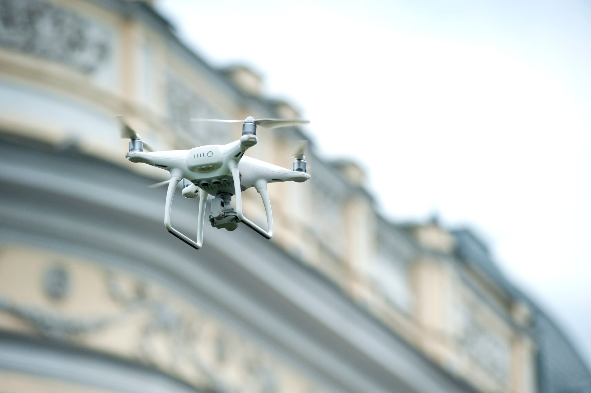
DJI Drone LiDAR: How Compact dToF Sensing Changes UAV Perception
If you are searching for dji drone lidar, here’s the deal: you are probably not just shopping for another sensor. You are trying to solve a real UAV problem. You need reliable depth perception on a drone without wrecking the payload budget, draining the battery, or turning a clean aircraft into a wiring project. In DJI-style workflows, the hard part is not proving that LiDAR works. The hard part is finding a LiDAR module that is compact enough, fast enough, and practical enough to live inside a real flight stack.
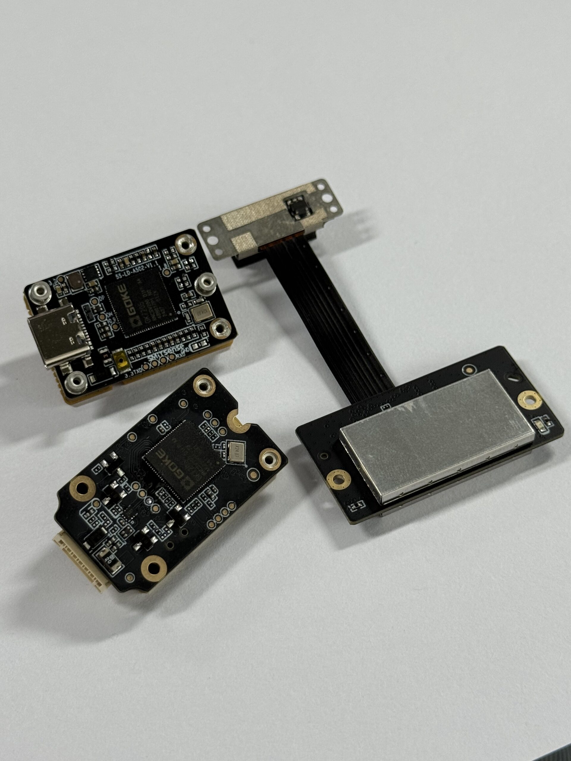
The DTOF Solid state LiDAR HM-LD1 is a compact dToF module built for depth sensing, point cloud output, and embedded integration across drones, robots, cameras, and smart devices. It is not a DJI-branded sensor, and that distinction matters. What it is, though, is the kind of module engineers evaluate when they need DJI-compatible UAV perception for altitude hold, terrain following, obstacle awareness, inspection work, and autonomous navigation.
Table of Contents
For drone teams, a good perception sensor has to do more than spit out a distance number. It has to protect flight time, survive vibration, deliver data the controller can actually use, and behave in a way that is predictable both indoors and outdoors. Compact LiDAR gets attention because it can provide real range and depth information in places where camera-only systems start guessing: low texture floors, glare, shadow transitions, haze, dark materials, shiny metal, and changing light.
In the shop, this is where theory meets hardware. A sensor that looks great in a brochure can still be painful if it needs too much power, produces awkward data, or forces the team to redesign the mount. That is why small solid-state dToF modules are getting serious attention. They are not magic, and they do not replace every mapping payload, but they can give a UAV the kind of short-range spatial awareness that makes autonomous behavior safer and more repeatable.
The rest of this guide walks through what “DJI drone LiDAR” usually means in practical buying terms, how compact dToF sensing works, where it helps most, what the HM-LD1 specifications mean for flight integration, and how to think about mounting, interfaces, software, and real-world testing. Look, the right answer is rarely the biggest sensor. The right answer is the one that solves the mission without creating three new engineering problems.
What DJI Drone LiDAR Means
The phrase dji drone lidar usually reflects buyer intent more than a literal brand requirement. Most people are not necessarily looking for a DJI-manufactured LiDAR unit. They are looking for LiDAR that can work in a DJI-style drone workflow, whether that means mounting on a compact UAV, feeding a companion computer, supporting obstacle avoidance, or improving autonomy during inspection and navigation. In practical engineering terms, the phrase points to compact sensing hardware that can survive the real constraints of drone integration.
Those constraints are not small details. A drone payload has to share space and energy with the battery, gimbal, camera, compute module, telemetry equipment, mounting hardware, and airframe structure. Every extra gram affects hover power. Every extra watt shows up in endurance. Every cable adds assembly time and another possible failure point. That is why a compact solid-state LiDAR module can be a better fit than a larger mapping-grade system when the mission is obstacle avoidance, altitude control, close-range inspection, or environment awareness.
DJI-class platforms, and the broader ecosystem built around them, often rely on flight controllers, companion computers, payload mounts, and software pipelines that were not designed around heavy sensing stacks. Engineers need a sensor that can slot into mixed hardware and software environments without forcing a full aircraft redesign. That means dimensions, weight, interface options, temperature behavior, and output format need to be reviewed before anyone gets too excited about map quality or feature count.
DJI Ecosystem Considerations
In DJI-adjacent deployments, the sensor rarely works alone. It usually feeds a companion computer or embedded controller that interprets range data and then sends decisions into the autonomy stack. That workflow requires clean data transport, manageable latency, stable mounting, and software support across operating systems and processor architectures. If the sensor is too difficult to integrate, the drone may look capable on paper but become frustrating in the field.
A practical UAV team will ask blunt questions early. Can the module be powered safely from the onboard system? Can the data be parsed without weeks of custom middleware? Can the physical mount hold alignment after vibration, takeoff, landing, and transport? Can the output feed ROS, an embedded application, or a custom controller without becoming a science project? These are not glamorous questions, but they are the questions that decide whether a sensor actually flies.
Mapping vs. Obstacle Avoidance
Buyers often combine these use cases, but they are not the same job. Mapping and survey workflows want dense spatial information, repeatability, large-area coverage, and well-controlled calibration. Obstacle avoidance prioritizes response speed, predictable detection ranges, and enough field of view to spot hazards before the aircraft runs out of room. Terrain following and altitude hold sit somewhere in between. A compact dToF module may not replace an enterprise mapping payload, but it can be excellent for reactive flight safety and close-range perception.
Here’s the practical split: if the deliverable is a high-density map of a large site, you probably need a mapping-grade system. If the deliverable is a drone that can maintain distance from a wall, hold height over rough ground, or detect near-field obstacles, a compact dToF unit can be the smarter tool. A lot of wasted money comes from buying survey hardware for control problems or buying control sensors for survey-grade mapping.
When LiDAR Beats Camera-Only Systems
Cameras are powerful, but they depend on lighting, texture, and stable scene interpretation. LiDAR does not need a richly textured surface to measure distance. That makes it especially useful over water, concrete, dust, metal, shadows, dark surfaces, bright exterior scenes, and areas where exposure shifts can confuse vision-only perception. For drone operators, that difference can be the gap between smooth autonomy and unreliable avoidance.
This does not mean cameras are obsolete. A camera still gives rich visual context, object identity, and scene detail. The best UAV systems often combine vision and depth because each sensor covers the other’s weak spots. LiDAR gives direct range. Cameras give semantic information. In a serious autonomy stack, that combination can be stronger than either sensor alone.
How Drone LiDAR Works
Drone LiDAR measures distance by timing how long emitted light takes to return from a target. In direct time-of-flight systems, the module sends out pulses of light and detects reflected energy with fast sensors. The time between emission and return is translated into range. In compact solid-state systems, this process is optimized for low mass, low power, and integration simplicity rather than mechanical scanning hardware.
The HM-LD1 uses SPAD-based dToF technology to generate real-time depth images and 3D point cloud data. That matters because a drone autonomy stack does not just want a single distance number forever. It wants structured environmental information that can be fused into navigation, obstacle avoidance, or inspection logic. Even a modest-resolution depth map can be extremely valuable if the latency is reasonable, the ranging is stable, and the data arrives in a format the system can consume.
From Photons to Depth
The sensing chain starts with light emission and ends with software interpretation. The module emits a pulse, receives the return, calculates the flight time, and converts that timing into distance. Multiple measurements across the field of view form a depth frame. In downstream systems, those depth values can be transformed into point clouds, obstacle masks, range zones, or control inputs depending on the application.
In the shop, this matters because control software does not care how elegant the sensor physics are if the output is noisy, late, or hard to parse. A good dToF module gives the engineering team a repeatable data stream they can test, filter, and use. The cleaner that path is, the faster a team can move from bench testing to tethered flight to field validation.
Point Cloud and Depth Map Output
Depth maps are easier for control logic to consume because they represent a structured grid of distances. Point clouds are more useful for visualization, spatial analysis, inspection review, and mapping pipelines. A drone developer may use both: the depth map for immediate avoidance behavior and the point cloud for logging, operator review, or local environment modeling. That dual output is one reason LiDAR is so useful in autonomy workflows.
For example, a forward-facing module can support a basic obstacle zone by flagging close returns in the central field of view. The same data can be stored as a point cloud for later review. A downward-facing module can support height estimation over rough terrain while still preserving spatial data for inspection records. The value comes from turning raw range into decisions the aircraft can act on.
Why Frame Rate and Resolution Matter
HM-LD1 provides a 40×30 resolution at 10 fps. Those numbers are not just product sheet details; they shape how the module behaves in a control loop. Higher frame rates usually reduce response delay, while resolution affects how much structure the system can resolve in the scene. For avoidance and altitude support, the key question is often not whether the image is beautiful, but whether the data is timely enough and consistent enough to help keep the aircraft safe.
Look at it like an industrial control problem. A sensor does not have to produce a photorealistic scene to be useful. It has to provide the right signal at the right time with enough confidence for the controller to make a good decision. For close-range UAV perception, predictable range behavior can matter more than visual richness.
Where It Helps Most
Compact drone LiDAR is most valuable when the aircraft needs dependable environmental awareness at close to medium range. It is especially effective when flight paths are constrained, GPS is weak, visual contrast is poor, or the aircraft is working near structures. In those situations, direct depth sensing can support safer autonomous behavior than a camera-only stack, especially when the mission includes repeated motion near buildings, equipment, ground features, or uneven terrain.
The use cases below are where compact dToF sensing tends to earn its keep. These are not abstract lab scenarios. They are the kinds of jobs where operators need the drone to hold spacing, avoid surprises, and behave consistently even when the environment is not friendly.
UAV Altitude Hold and Terrain Following
Downward-facing ranging helps a drone keep stable altitude even when the ground rises, falls, or changes texture. This is valuable over agriculture, roadways, utility corridors, construction sites, embankments, and terrain with abrupt elevation changes. For operators, the benefit is simple: better consistency and fewer control corrections when the aircraft is flying close to the ground.
Barometers and GPS altitude can be useful, but they do not always tell the aircraft what is directly below it. A compact LiDAR module can provide a more immediate measurement of ground distance. That matters when the aircraft needs to maintain a set standoff distance rather than simply hold a global altitude.
Obstacle Avoidance in Tight Environments
Industrial sites, forest edges, building facades, bridge undersides, warehouses, tunnels, and narrow corridors are all environments where late obstacle detection becomes expensive. LiDAR gives the autonomy stack a better chance of reacting before a collision risk becomes critical. This is one of the strongest reasons engineers choose direct depth sensing over a purely visual approach.
Tight environments punish uncertainty. A drone may only have a short window to slow down, stop, climb, or shift laterally. If the perception system hesitates because lighting changes or textures disappear, the aircraft can run out of room quickly. A compact dToF module helps by providing distance information that is not dependent on surface texture.
Inspection and Close-Range Perception
Bridges, dams, rooftops, façades, tanks, towers, and similar assets often require slow, close inspection with exact spacing from the structure. A compact dToF module supports that kind of work by giving a controller direct range awareness. It does not replace a full inspection strategy, but it can improve operator confidence and automation quality in close quarters.
In inspection work, repeatability matters. If the drone can maintain a consistent distance from the surface, image quality improves and the operator has less manual correction to manage. That can reduce fatigue, improve data quality, and make repeat inspections easier to compare over time.
SLAM and Autonomous Navigation
Depth data is useful for SLAM because it helps the system model space more directly than color imagery alone. Even where LiDAR is not the sole localization sensor, it can strengthen the overall navigation stack. That is particularly useful when the drone must operate in areas where lighting changes quickly, visual features are sparse, or GPS is unreliable.
For indoor robotics-style UAV projects, depth sensing can make a major difference. Warehouses, plants, and test facilities often include repeated patterns, blank walls, reflective surfaces, and odd lighting. A camera may see a scene that looks simple or confusing. A depth module can still provide shape and range information the navigation stack can use.
Camera and Security-Adjacent Uses
The same sensing principles can support autofocus, user presence detection, object recognition, volume measurement, and zone intrusion monitoring. That makes the module relevant not only to drones and robots but also to broader embedded vision applications. For teams working across hardware categories, that flexibility can simplify procurement and software reuse.
This matters for companies that do not build only one product. A team may prototype on a drone, reuse the module in a mobile robot, and later evaluate it for a camera or security device. A sensor with practical interfaces and multi-platform support gives engineering teams more room to reuse validated code and test methods.
For related technical resources on integration workflows and deployment challenges, see the technical blog hub.
HM-LD1 Specs
HM-LD1 is a compact solid-state dToF LiDAR module built for practical integration in drones, robots, cameras, and embedded systems. This section focuses on the actual product data so you can compare it against your payload, range, power, interface, and compute requirements without guessing.
Specs should be read like engineering constraints, not marketing decorations. Weight affects flight time. Range affects mission envelope. Interface options affect software workload. Temperature range affects where the system can be used. Power consumption affects battery planning. When those numbers line up with the mission, integration gets easier.
| Specification | HM-LD1 |
|---|---|
| Dimension | 43.5mm*30mm*26.5mm |
| Ranging Capability | Indoor: 0.5-25m; Outdoor: 0.2-8m |
| Ranging Accuracy | ±3cm |
| FOV | 60°(H) x45°(V) |
| Weight | 28g |
| Resolution | 40*30 |
| Frame Rate | 10fps |
| Interface | UART/UDP/UVC |
| Operating Temperature | -20 ℃ – 60 ℃ |
| Power Consumption | 1.2 W |
What the Specs Mean for Drones
The 28 g weight is important because drones feel every gram in the air. The compact dimensions help with mounting on smaller frames and reduce the chance that the sensor dominates the payload budget. The 1.2 W power draw is also meaningful because low-power perception modules are easier to support on battery-limited platforms.
The 0.5 to 25 m indoor range and 0.2 to 8 m outdoor range fit a practical sensing envelope for avoidance, proximity awareness, and close-range navigation. The ±3 cm accuracy is strong enough for many control and inspection tasks, especially where the goal is safe spacing rather than survey-grade mapping. The 60° horizontal by 45° vertical field of view offers a useful balance between coverage and focus.
Interface flexibility is one of the strongest advantages here. UART is ideal for embedded controllers, UDP works well in networked stacks, and UVC simplifies PC-based prototyping. That kind of interface diversity can shorten development time and make integration easier across lab, bench, and field setups.
The operating temperature range also deserves attention. UAVs may sit in a hot vehicle before deployment, fly in cold morning conditions, or operate around equipment that changes the local thermal environment. A module intended for real embedded use needs more than clean lab performance. It needs to behave when the work site is not comfortable.
Integration Guide
The hardest part of adding LiDAR to a DJI-compatible drone is usually not the sensor itself. It is the system integration. You need to balance power, placement, data transport, software architecture, vibration, and field testing before the aircraft ever leaves the bench. If those pieces are thought through early, compact dToF modules can move from concept to flight much faster.
Look, the cleanest integrations start with boring discipline. Confirm power first. Confirm mechanical fit second. Confirm data path third. Then build the software pipeline and test it under real mission conditions. Skipping those steps usually leads to troubleshooting in the field, and field troubleshooting is always more expensive than bench troubleshooting.
Power Budget Planning
At 1.2 W, HM-LD1 is relatively light on power, but battery planning still matters. On a small UAV, even modest draw can affect endurance if the aircraft already carries a camera, compute module, telemetry radio, lighting, and auxiliary sensors. The correct engineering move is to model total system load, not just sensor load, and verify the real flight time impact under expected mission profiles.
In the shop, this means measuring current draw under the same configuration the aircraft will actually fly. Bench numbers are useful, but they do not replace a full system test. The sensor, companion computer, radios, and payload hardware should be powered together so the team can see the real thermal and battery behavior before committing to a mission plan.
Interface Selection: UART, UDP, UVC
UART is often the simplest path for embedded controllers and direct sensor-to-host communication. UDP is useful when the perception system runs over a networked compute stack or when low-latency transport is more important than heavy framing overhead. UVC is particularly convenient for PC prototyping because it fits into standard imaging workflows. Choosing the right interface early reduces software churn later.
The interface choice should follow the architecture, not the other way around. If the drone uses a small embedded controller for immediate range response, UART may be the cleanest path. If the system uses an onboard Linux computer with multiple networked sensors, UDP may be easier to manage. If the team is still validating basic behavior on a bench PC, UVC can make early testing faster.
For teams building wireless or distributed sensor links, the communication layer can matter as much as the sensor itself. A helpful implementation reference is this embedded communication guide, which illustrates how practical data transport choices influence integration quality.
Mounting and Payload Tradeoffs
A LiDAR module should be mounted where it has a stable view of the environment and minimal vibration contamination. Placement affects center of gravity, airframe drag, and sensor occlusion. On smaller drones, a poor mount can create more problems than the sensor solves. Good integration means designing the mount as part of the flight system, not as an afterthought.
Mounting angle depends on the job. A downward-facing setup supports altitude hold and terrain following. A forward-facing setup supports obstacle awareness. A tilted setup can support mixed sensing, but it needs careful calibration so the software knows what the sensor is actually seeing. The mount should be rigid enough to hold alignment and light enough not to punish the aircraft.
Flight Controller and Companion Computer Workflow
In many UAV systems, the flight controller handles stabilization while the companion computer handles perception. HM-LD1 fits naturally into that architecture because it can deliver data to an onboard compute host that performs obstacle detection, SLAM, or terrain analysis before passing decisions back to the aircraft. This separation of duties is common in serious autonomy systems because it keeps control loops predictable.
The key is to avoid overloading the flight controller with processing it was never meant to do. Let the companion computer interpret depth data, filter noise, identify zones, and generate high-level commands. Let the flight controller keep the aircraft stable. That split makes the whole system easier to debug and safer to test.
ROS and Embedded Integration
Teams often prototype perception logic in ROS, then migrate the validated pipeline into a more compact embedded deployment. That progression is easier when the sensor produces usable depth and point cloud data over straightforward interfaces. If your broader system has visual-inertial stability issues, a practical discussion of deployment friction can be found in this VIO deployment guide.
A realistic development path usually starts with logging raw data, then visualizing the output, then building filters, then connecting behavior to the drone. Trying to jump straight from an unopened sensor box to autonomous flight is asking for trouble. A steady integration path gives the team confidence in each layer before the aircraft is in the air.
Testing in Daylight and Low Light
HM-LD1 supports indoor, nighttime, and outdoor daytime use, but every environment affects perception differently. Indoor and nighttime conditions can support longer ranging, while outdoor daytime operation is more constrained. That does not make the module less useful. It simply means the autonomy stack should be tested under the same lighting and scene conditions it will face in real missions.
Field validation should include the ugly cases: bright sun, dark surfaces, angled targets, reflective objects, vibration, dust, and mixed lighting. If the mission includes bridge inspection, test near concrete and steel. If the mission includes agriculture, test over plants and uneven ground. The sensor should be judged against the job, not against a perfect lab target.
For broader system-level evaluation criteria, it helps to look at how enterprise LiDAR vendors frame performance and deployment expectations. References such as Cepton Technologies and Blickfeld are useful reminders that buyers should evaluate not only raw range, but also reliability, software fit, and system integration maturity.
Comparison and Buying Criteria
The best sensor is not the most advanced one on paper. It is the one that best matches your mission profile, payload limit, power budget, and software stack. For many drone projects, that means comparing compact dToF LiDAR against camera-only perception and larger enterprise LiDAR systems before making a purchase decision.
Here’s the deal with buying sensors for drones: maximum capability is not the same as best fit. A big sensor may deliver more data, but it may also demand more power, more mounting structure, more processing, and more money. A smaller sensor may be less impressive on a spec sheet but far easier to fly, test, and maintain.
| Option | Best Strength | Main Tradeoff |
|---|---|---|
| Compact dToF LiDAR | Lightweight depth sensing with real range data | Lower resolution than mapping-grade systems |
| Camera-only perception | Rich visual context and low cost | Sensitive to lighting, texture, glare, and shadow |
| Larger LiDAR systems | Higher coverage and enterprise mapping capability | Greater size, weight, power, and cost |
Range vs. Payload
On a drone, the lightest sensor that still solves the mission is often the right choice. If your use case is short-range avoidance, altitude hold, or inspection support, a compact unit like HM-LD1 can be a better engineering fit than a heavier mapping payload. Payload efficiency usually matters more than maximum theoretical capability.
A sensor with more range can still be the wrong part if it shortens flight time, shifts the center of gravity, or forces a larger aircraft. For compact UAVs, range should be evaluated against actual speed, stopping distance, control response, and mission geometry. The right range is the one that gives the system enough time to react.
Accuracy vs. Scenario
±3 cm accuracy is not survey-grade mapping precision, but it is very useful for navigation, spacing, and many inspection tasks. A buyer should judge accuracy against the scenario. If the need is safe distance awareness, terrain following, or obstacle detection, that level of precision can be enough. If the need is dense mapping of large sites, a bigger system may be warranted.
Accuracy also has to be considered alongside repeatability and latency. A control system can work well with modest resolution if the distance readings are stable and timely. It can struggle with beautiful data if the update rate is too slow or the integration path is unreliable.
Field of View Tradeoffs
The 60° by 45° field of view gives useful coverage without turning the sensor into a bulky multi-head system. That balance is often ideal for compact UAVs because it provides actionable perception while keeping integration manageable. The right FOV depends on motion profile, mounting angle, and whether the drone needs forward, downward, or mixed sensing.
Wider coverage is not always better. A very wide field can introduce extra data that the controller has to interpret, and it may capture parts of the aircraft if the mounting is poor. A narrower field can be cleaner but may miss hazards at the edge of the path. The correct field of view is the one matched to the motion and the mission.
Indoor-Outdoor Expectations
HM-LD1 is strongest indoors and at night, with outdoor daytime performance that remains practical within its stated range. Buyers should interpret that realistically. A module with this profile is best seen as a compact operational sensor, not a replacement for every enterprise outdoor mapping scenario. Setting expectations correctly prevents disappointment later.
Outdoor sunlight, target reflectivity, angle, and environmental conditions can all affect LiDAR performance. That is not unique to this module; it is part of real-world optical sensing. The smart move is to test the module in the same conditions where the drone will actually fly and then tune the autonomy stack around verified behavior.
When to Upgrade to Elite Mapping LiDAR
If the mission demands large-area survey coverage, high-density mapping, or more advanced terrain modeling, then a larger enterprise LiDAR platform may be the better investment. If the mission is compact UAV integration, short-range autonomy, close inspection, and fast deployment, a lighter dToF module is often the smarter first purchase.
The upgrade decision should be based on deliverables. If customers need a dense point cloud for engineering documentation, do not under-buy. If the drone needs to avoid obstacles and hold distance, do not over-buy. Matching the sensor to the job is basic engineering discipline.
Why HM-LD1 Fits DJI Workflows
HM-LD1 fits DJI-style workflows because it solves the most common UAV integration bottlenecks: size, weight, power, and software connectivity. That makes it relevant to small drones where depth sensing must be added without turning the aircraft into a test bench. The module is also a good match for mixed development stacks because it supports multiple interfaces and multiple operating systems.
This is the kind of sensor that makes sense when the team wants to move quickly but still build something serious. It gives developers a practical path from bench testing to embedded deployment without demanding a heavy payload platform or a complicated mechanical scan system.
Small Drone Compatibility
At 28 g, HM-LD1 is light enough to be considered in small aircraft designs where every gram matters. The compact body helps preserve payload margin and makes mounting less disruptive. For drone teams, that can be the difference between a useful prototype and a drone that no longer flies as expected.
Small drone compatibility is not only about weight. It is also about how much bracketry, wiring, power regulation, and processing overhead the module forces into the system. A compact sensor with simple interface options is easier to package cleanly and easier to maintain.
Fast Prototyping to Deployment
UART, UDP, and UVC give engineering teams practical paths from bench setup to system deployment. That flexibility lowers friction when moving between embedded controllers, networked companion computers, and PC-based test environments. It is much easier to validate a sensor when the interface matches the development stage.
In early testing, teams may simply want to view depth data on a PC and confirm basic behavior. Later, they may need low-latency data on an embedded host. Eventually, the system may need to run unattended on a compact onboard computer. Multiple interfaces help support that progression without forcing a new sensor choice at every stage.
Multi-Platform Development
SDK support for x86 Windows, x86 Linux, and arm Linux means teams can work across common lab and deployment environments without rewriting the entire toolchain. That matters in real product development because autonomy stacks often evolve across operating systems before they stabilize in production.
A practical development workflow may start on a Windows bench machine, move into a Linux workstation, and finish on an arm-based onboard computer. If the sensor ecosystem supports that path, engineers can focus on perception logic instead of constantly fighting platform changes.
Source Factory and Customization
Procurement confidence matters in robotics and UAV projects. MRP positions itself as a source factory with in-house production, technical support, independent R&D, and product customization options. For engineering and operations teams, that can reduce supply uncertainty and make long-term integration more practical.
This matters more than many buyers admit. A prototype sensor is only useful if the team can get support, documentation, replacement units, and practical answers when something does not behave as expected. Hardware projects need suppliers that understand both the part and the application.
Product Showcase
DTOF Solid state LiDAR HM-LD1

HM-LD1 is a solid-state dToF LiDAR module designed for real-time depth images and 3D point cloud output. It is aimed at drone, robot, camera, and security-related integration where compact size and simple interfaces are important. The module supports indoor and outdoor ranging, operates across a wide temperature range, and offers a practical balance of performance and integration convenience for embedded systems.
- ✅ Compact 43.5mm*30mm*26.5mm footprint
- ✅ 28 g weight for payload-sensitive systems
- ✅ Indoor ranging up to 25 m and outdoor ranging up to 8 m
- ⚙️ UART, UDP, and UVC interface options
- ⚙️ SDK support for x86 Windows, x86 Linux, and arm Linux
a short-flex design and a long-flex design for different robotics and UAV d…
FAQ
Is DJI drone LiDAR worth it for mapping in 2025?
Is there LiDAR for small drones?
How do I integrate LiDAR with DJI platforms?
What makes compact dToF LiDAR better than camera-only sensing?
Can HM-LD1 be used for indoor and outdoor drones?
What should I check before buying LiDAR for a drone project?
Why does HM-LD1 matter for embedded developers?
📚 References & Further Reading
- ✅ Industry Standard: Cepton Technologies | Blickfeld
- ⚙️ Related Guide: MyRobotProject Technical Blogs






