


LiDAR for Drone: How to Choose a Lightweight, Budget-Friendly Sensor for UAV Mapping and Autonomy
Choosing the right LiDAR for drone projects is not as simple as buying the sensor with the longest range or the highest point count. Here’s the deal: a UAV is not a pickup truck. You do not have unlimited payload, power, cooling, or mounting space. A drone has hard limits on weight, current draw, vibration tolerance, field of view, interface compatibility, and onboard processing capacity. A LiDAR that works beautifully on a ground robot or survey vehicle may be too heavy, too power-hungry, too expensive, or too fussy for a small quadcopter.
For UAV mapping, obstacle avoidance, altitude hold, terrain following, inspection, and autonomy research, the best sensor is the one that fits the aircraft and the job. In the shop, that means looking past the marketing number on the front page and asking practical questions: Can the drone carry it safely? Can the battery support it? Can the companion computer read the data? Can the flight stack use that data quickly enough to matter? And can the whole setup survive real vibration, sunlight, dust, cable strain, and operator mistakes?
This guide explains how drone LiDAR works, how to compare solid-state dToF modules with rotating survey-grade payloads, and how to select a lightweight, budget-friendly sensor for UAV development. We will cover range, accuracy, field of view, resolution, frame rate, interfaces, SDK support, and real-world integration factors such as Raspberry Pi, Jetson, flight controllers, ROS, and embedded Linux.
We will also use the DTOF Solid State LiDAR HM-LD1 as a practical example of a compact 28g dToF LiDAR module designed for real-time depth sensing, obstacle detection, altitude sensing, terrain following, and robotic vision development. It is not a magic replacement for a full survey-grade mapping payload. But for a small UAV that needs local awareness, it is the kind of sensor class that deserves a serious look.
Table of Contents
- 👉 What Is LiDAR for Drone Applications?
- 👉 How Drone LiDAR Works: dToF, Solid-State, and 3D Point Clouds
- 👉 Main Use Cases: Mapping, Obstacle Avoidance, Inspection, and Autonomy
- 👉 Survey-Grade LiDAR vs Lightweight Autonomy LiDAR
- 👉 How to Choose a Lightweight, Budget-Friendly LiDAR for Drone Projects
- 👉 Drone LiDAR Integration Workflow: Hardware, Software, and Calibration
- 👉 Recommended Lightweight LiDAR for Drone Development: HM-LD1
- 👉 Real Product Specifications Table
- 👉 Which LiDAR Setup Fits Your Drone Application?
- 👉 Common Mistakes When Buying LiDAR for Drone Projects
- 👉 Drone LiDAR FAQ
- 👉 Conclusion: Choosing the Right Drone LiDAR Without Overspending
What Is LiDAR for Drone Applications?
LiDAR stands for Light Detection and Ranging. A LiDAR sensor emits light, receives the reflected signal, and calculates distance based on the return. On a drone, that simple idea can be used in several very different ways. It may help build a 3D map, measure altitude above ground, detect obstacles, support terrain following, assist autonomous navigation, feed SLAM algorithms, inspect structures, or provide depth data for robotics research.
That is why the phrase “drone LiDAR” can get confusing fast. A professional mapping crew may use the term to describe a high-end aerial survey payload with a LiDAR scanner, RTK or PPK GNSS, IMU, time synchronization, and post-processing software. A robotics developer may use the same phrase to describe a compact dToF module mounted on a small quadcopter for obstacle detection. A hobbyist may mean a single-point rangefinder used for landing assistance. All of these are legitimate, but they are not interchangeable.
For small UAV development, a practical lidar for drone system often means a compact depth sensor that can output distance data quickly enough to support real-time decisions. This may include a solid-state LiDAR module, a dToF depth sensor, a 2D scanning LiDAR, or a 3D depth camera-style LiDAR. The goal is usually not to produce centimeter-level georeferenced topographic deliverables. The goal is to help the drone understand what is nearby, how far it is from the ground, whether an obstacle is in the flight path, or how to maintain a safe standoff distance from a wall, bridge, dam, machine, or landing zone.
That distinction matters because it prevents expensive purchasing mistakes. A drone used for survey mapping needs a different payload than a drone used for indoor navigation. A high-density rotating LiDAR may deliver excellent point clouds, but it may also be too heavy, expensive, or power-intensive for a small UAV. A lightweight solid-state LiDAR may be excellent for real-time perception, but it should not be treated as a complete survey mapping solution. If your goal is centimeter-level georeferenced mapping rather than short-range perception, read our related Drone RTK Guide for a deeper look at UAV positioning and mapping accuracy.
How Drone LiDAR Works: dToF, Solid-State, and 3D Point Clouds
Direct Time-of-Flight Basics
Direct Time-of-Flight, often written as dToF, measures distance by calculating how long emitted light pulses take to return. The sensor sends a light pulse toward a target, detects the reflected signal, and calculates distance using the time delay and the speed of light. Because light moves so fast, accurate timing and sensitive detection are the whole game. SPAD-based dToF modules use single-photon avalanche diode technology to detect very weak reflected photons, which makes them useful for compact depth-sensing applications.
For drones, dToF is attractive because it provides direct distance information rather than estimating depth indirectly. This is different from stereo vision. A stereo camera estimates depth by comparing two images and finding matching features between them. Stereo can work very well, but it depends heavily on texture, lighting, calibration, and processing quality. LiDAR actively emits light and measures distance, which can make it more straightforward for obstacle thresholds, altitude hold, and terrain-following tasks. Teams comparing these approaches can also review our guide to stereo vision camera navigation.
Solid-State LiDAR vs Mechanical LiDAR
Solid-state LiDAR has no large rotating scan mechanism. That can reduce weight, size, power consumption, mechanical wear, and integration complexity. For UAVs, those advantages are not small details. Every gram affects flight time, and every moving part has to deal with vibration, shock, dust, mounting limitations, and field maintenance. A compact solid-state module can be easier to mount on the front, bottom, or side of a small drone without badly shifting the aircraft’s center of gravity.
Mechanical LiDAR systems still have major advantages in many applications. They can provide wider scan coverage, higher point density, and mature workflows for mapping, surveying, robotics, and industrial scanning. They are often the correct choice for professional topographic mapping, forestry, construction measurement, corridor mapping, and large-area data acquisition. For a broader reference on industrial LiDAR and scanning sensor categories, see HOKUYO.
The key tradeoff is mission fit. Solid-state modules are often better for short-range perception, embedded autonomy, and lightweight development. Mechanical survey systems are often better for high-end mapping. If the drone needs to avoid a wall at low speed, hold altitude indoors, or detect a nearby inspection target, a compact dToF module can be more practical. If the drone must produce a georeferenced point cloud for engineering deliverables, a survey-grade payload is usually required.
Depth Maps and Point Clouds
A depth map stores distance values in a 2D image-like format. Each pixel or zone represents the measured distance in that direction. This format is convenient for embedded perception because developers can apply image-processing logic, create obstacle masks, define danger zones, and estimate landing area conditions. A point cloud represents 3D points in space, which is useful for spatial filtering, mapping, SLAM, object detection, and geometric reasoning.
For drones, both outputs can be valuable. A downward-facing depth map can help identify distance to the ground or detect uneven terrain during landing. A forward-facing point cloud can help define a safe corridor, detect obstacles, or support indoor navigation. The DTOF Solid State LiDAR HM-LD1 provides real-time depth images and 3D point cloud data, which makes it suitable for developers who need practical depth output rather than one single-distance reading.
Main Use Cases: Mapping, Obstacle Avoidance, Inspection, and Autonomy
UAV Obstacle Avoidance
Short-range obstacle detection is one of the strongest use cases for compact LiDAR. A drone may need to detect walls, poles, trees, machinery, shelves, railings, structural elements, or other aircraft before they enter the flight path. Important sensor specifications include outdoor range, field of view, frame rate, latency, weight, and interface. A sensor that produces excellent data but is too slow or too difficult to connect to the flight stack may not be useful for real-time avoidance.
Field of view is especially important. A narrow sensor can miss obstacles outside its small detection cone. A wider field of view improves spatial awareness and gives the control system more context. The HM-LD1’s 60° horizontal by 45° vertical field of view is relevant for forward-facing obstacle detection or downward-facing terrain sensing. It gives developers a practical sensing window without requiring a large rotating scanner.
Altitude Hold and Terrain Following
A downward-facing LiDAR can estimate the drone’s distance to the ground. This is useful for low-altitude flight, landing assistance, indoor altitude hold, GPS-denied environments, and terrain following. Compared with barometric altitude alone, a range sensor provides direct local height information relative to the surface below the aircraft. That matters when flying over steps, slopes, loading docks, industrial floors, uneven terrain, or cluttered indoor areas.
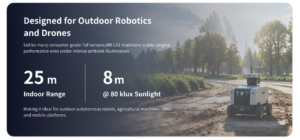
Engineers should remember that real surfaces affect measurements. Grass, water, glass, dark materials, angled surfaces, and bright sunlight can reduce reliability. A sensor that performs well indoors may have shorter effective range outdoors. For this reason, outdoor range should be evaluated under realistic lighting, target reflectivity, and flight-motion conditions. HM-LD1 specifies indoor ranging of 0.5–25m and outdoor ranging of 0.2–8m, which makes it better suited to short-range outdoor sensing than high-altitude aerial mapping.
Indoor MAV Navigation and Robotics Research
Indoor drones, also called micro aerial vehicles or MAVs, often operate without reliable GPS. They need local perception to avoid walls, navigate corridors, maintain distance from structures, dock, or interact with robotic systems. In these environments, compact LiDAR can provide useful range data for SLAM, wall following, obstacle avoidance, and navigation experiments.
For universities, developer teams, and robotics labs, lightweight dToF modules are often more practical than high-end survey payloads. They are easier to mount, less expensive to experiment with, and more suitable for embedded perception. Developers can test depth maps, point cloud filtering, obstacle zones, and flight-control logic without building a full aerial survey system.
Inspection of Bridges, Expressways, Dams, and Industrial Sites
Drone LiDAR can also assist with distance measurement to hard-to-reach structures. In bridge inspection, dam wall monitoring, industrial facility navigation, utility structure inspection, and confined-space exploration, the drone may need to maintain a safe standoff distance from surfaces. A compact LiDAR can help measure distance to the target while the operator or autonomous control system keeps the UAV at a safer position.
The HM-LD1 product information notes accurate ranging even at outdoor distances up to 8 meters on a clear summer day under approximately 80,000 lux conditions. This type of short-range outdoor measurement can be useful when inspecting bridges, expressways, dams, walls, and other infrastructure where people may not be able to approach safely. As always, engineers should validate performance against the actual material, surface angle, sunlight level, vibration profile, and flight speed of the intended mission.
Survey-Grade LiDAR vs Lightweight Autonomy LiDAR
Many buyers searching for lidar for drone mix up two very different categories: survey-grade LiDAR and lightweight autonomy LiDAR. Understanding the difference is critical before selecting hardware.
Survey-Grade Drone LiDAR
Survey-grade drone LiDAR is designed to produce accurate, georeferenced mapping data. It is used for topographic mapping, forestry, mining, construction monitoring, corridor mapping, powerline inspection, and engineering measurement. These systems usually include more than a LiDAR sensor. They typically require RTK or PPK GNSS, an IMU, time synchronization, boresight calibration, trajectory processing, and point cloud post-processing software.
Survey-grade systems are usually heavier and more expensive because they must solve the full measurement problem: where the drone was, how it was oriented, when each point was captured, and how the point should be transformed into a real-world coordinate system. If the deliverable is a professional georeferenced point cloud, this workflow is necessary. Our Drone RTK Guide explains why precise positioning is essential for mapping-grade UAV results.
Lightweight Drone LiDAR for Autonomy
Lightweight autonomy LiDAR is designed for real-time perception and control. It usually prioritizes low weight, low power, compact size, short-range depth output, and easy interface options. It may produce depth maps and point clouds, but it is not automatically a complete mapping payload. This type of sensor is ideal for drone development, short-range obstacle avoidance, indoor navigation, terrain following, robotic vision development, and embedded AI perception.
For a small UAV, a 28g sensor can be much easier to integrate than a multi-component mapping payload. It also reduces the burden on the aircraft structure, power system, and flight-time budget. If the goal is autonomy rather than survey deliverables, a lightweight dToF sensor may offer the best balance of usability, cost, and integration speed.
Survey vs Autonomy LiDAR Comparison
| Category | Survey-Grade Drone LiDAR | Lightweight Autonomy LiDAR |
|---|---|---|
| Primary Goal | Georeferenced mapping and measurement | Real-time perception and obstacle sensing |
| Typical Payload | LiDAR scanner plus GNSS and IMU | Compact dToF or solid-state depth module |
| Cost Level | High | Lower and more developer-friendly |
| Best For | Land surveying, forestry, construction mapping | Autonomy, obstacle avoidance, altitude hold, R&D |
| Integration Difficulty | High | Moderate to low with SDK support |
For developers comparing LiDAR with visual navigation, see our guide on stereo vision camera navigation.
How to Choose a Lightweight, Budget-Friendly LiDAR for Drone Projects
1. Start With the Mission, Not the Maximum Range
The first engineering question should not be “What is the longest range I can buy?” It should be “What decision does the drone need to make?” A drone used for indoor obstacle avoidance may need reliable depth within several meters. A low-altitude inspection drone may need stable distance measurement to a wall or structure. A terrain-following drone may need downward range data and conservative control thresholds. A mapping drone may need a completely different payload with GNSS, IMU, and post-processing.
For many autonomy tasks, short-range accuracy, field of view, latency, and data access matter more than theoretical maximum range. A 100m-plus sensor that is heavy, expensive, or difficult to integrate may be less useful than a lightweight sensor that provides reliable depth output at the distances where the drone actually operates.
2. Weight and Payload Budget
Every gram reduces flight time, maneuverability, and safety margin. Small drones may only tolerate tens of grams of additional sensor payload before performance declines. A compact 28g LiDAR module is much easier to integrate than a heavy survey payload, especially when the drone also carries a companion computer, camera, communication module, battery, and protective enclosure.
Mounting location also matters. A forward-facing LiDAR can detect obstacles in the flight path. A downward-facing LiDAR can support altitude hold, landing assistance, and terrain following. A gimbal-mounted system may provide flexible targeting but adds weight and complexity. A multi-sensor array can improve coverage but increases power draw, cost, and processing load.
3. Ranging Capability: Indoor vs Outdoor
Indoor and nighttime performance is often stronger than bright outdoor performance because sunlight can interfere with optical sensing. The HM-LD1 specifies indoor ranging from 0.5m to 25m and outdoor ranging from 0.2m to 8m. This distinction is important when selecting a drone depth sensor. If the drone operates outdoors in bright daylight, engineers should plan for the outdoor specification, not only the indoor maximum range.
Target reflectivity also matters. White walls, matte surfaces, dark objects, glass, water, polished metal, vegetation, and angled surfaces can produce different returns. For safety-critical obstacle avoidance, always test the sensor against the actual materials likely to appear in the mission environment.
4. Accuracy and Repeatability
Accuracy is important for distance control and obstacle thresholds. HM-LD1 specifies ±3cm ranging accuracy. In practical drone control, this can support short-range distance decisions, but the system should still use safety margins. If the drone triggers avoidance at exactly the measured obstacle boundary, noise, latency, vibration, and control delay may cause unsafe behavior.
It is useful to distinguish accuracy, precision, resolution, repeatability, and update rate. Accuracy describes closeness to true distance. Precision describes consistency of repeated readings. Resolution describes the size of the depth grid or measurement increments. Repeatability describes whether the sensor returns stable values under similar conditions. Update rate determines how frequently the drone receives new information. All of these affect autonomy performance.
5. Field of View
Field of view determines the coverage area. HM-LD1 provides a 60° horizontal by 45° vertical FOV. For forward-facing use, this can help detect obstacles across a practical portion of the flight path. For downward-facing use, it defines the ground footprint available for altitude sensing, terrain profile estimation, or landing-zone analysis.
A wider field of view can reduce blind spots but may require more processing and careful interpretation. A narrow sensor may provide strong range measurement in one direction but miss side obstacles. For full 360° awareness, multiple sensors or a different scanning architecture may be required. The right FOV depends on drone speed, mission geometry, mounting angle, and control strategy.
6. Resolution and Frame Rate
HM-LD1 has a 40 × 30 resolution and a 10fps frame rate. That means it can provide 1,200 depth points per frame and 10 updates per second. For short-range perception, obstacle zones, simple point cloud output, and development workflows, this can be useful. It is not equivalent to a high-density survey scanner, but it is far more informative than a single-point rangefinder.
Frame rate must be evaluated against drone speed. A slow indoor drone may have enough time to react to 10fps data. A fast outdoor drone may need longer range, faster updates, or more conservative safety zones. Developers should calculate how far the drone travels between sensor updates and include processing and control latency in the safety model.
7. Interfaces and Embedded Compatibility
Interface choice can determine whether integration is simple or painful. HM-LD1 supports UART, UDP, and UVC. UART is useful for simple embedded integration, microcontrollers, and flight-controller-style data pipelines. UDP is practical for companion computers and network-style data transport. UVC can make the sensor behave more like an image device, which may simplify visualization and camera-like depth processing on PCs or embedded platforms.
The product details also mention integration with PCs, Raspberry Pi, flight controllers, and embedded platforms. For drone projects, this flexibility matters because different teams use different architectures. Some rely on a flight controller plus companion computer. Others build custom embedded Linux systems. The best sensor is one that fits your existing data path and development tools.
8. Power Consumption and Thermal Design
HM-LD1 power consumption is specified as 1.2W. Low power helps preserve flight time and simplifies thermal design. A drone power system must support motors, ESCs, flight controller, communication modules, cameras, companion computers, and sensors. Even a small sensor can cause problems if it is powered from a noisy rail or installed without thermal and electrical planning.
Use stable voltage regulation, avoid noisy motor power rails, route cables away from high-current motor wires, and consider shielding and grounding where appropriate. Thermal design is also important inside compact UAV enclosures. Airflow, sensor heat, sunlight exposure, and nearby electronics can all affect reliability.
9. SDK, ROS, OpenCV, and Development Support
A LiDAR sensor is only useful if developers can access the data reliably. HM-LD1 offers SDKs for x86 Windows, x86 Linux, and ARM Linux. This is important because many drone development workflows use Linux PCs, Raspberry Pi, Jetson, or other ARM-based embedded systems.
Typical workflows include depth visualization, point cloud generation, ROS publishing, OpenCV processing, MAVLink logic, obstacle masks, and safety-zone monitoring. For teams comparing LiDAR with other depth sensing technologies, it is also useful to understand structured-light alternatives. See our guide to 3D structured light cameras for a different approach to depth measurement.
Drone LiDAR Integration Workflow: Hardware, Software, and Calibration
Step 1 — Mechanical Mounting
Use a rigid mount that holds the sensor angle consistently during flight. Avoid vibration transfer where possible, and make sure the field of view is not blocked by propellers, landing gear, frame arms, cables, payload brackets, or protective covers. A sensor mounted behind a transparent cover may behave differently depending on material, reflectivity, scratches, dirt, condensation, and sun angle, so test the final enclosure rather than only the bare module.
For downward-facing use, consider landing gear height, dust, prop wash, and the sensor’s view of the ground at different pitch and roll angles. For forward-facing use, confirm that the software’s coordinate assumptions match the physical mounting angle. Even a small mounting error can create incorrect obstacle locations in the drone’s control logic.
Step 2 — Electrical Integration
Provide stable power and avoid connecting sensitive optical sensors directly to noisy motor or ESC rails. Use appropriate voltage regulation and grounding practices. HM-LD1’s 1.2W power consumption is modest, but power quality still matters. Voltage dips, electromagnetic interference, and loose connectors can cause data dropouts or unstable readings during flight.
Cable routing is part of engineering reliability. Keep sensor cables away from high-current motor wires where possible. Secure connectors against vibration. If the aircraft is used in industrial environments, consider strain relief, shielding, and environmental protection.
Step 3 — Data Interface Selection
Select the data interface based on the onboard architecture. UART is useful when a microcontroller or flight controller needs relatively simple range or depth information. UDP is often a good fit for companion computers that process point cloud or depth data over a network-style link. UVC is convenient when developers want camera-like behavior for visualization or image-processing pipelines.
Bandwidth and latency should be evaluated before flight. A data stream that looks smooth on a bench may behave differently when the companion computer is also running navigation, logging, communication, and AI inference. Test with the full software stack before relying on the sensor for autonomous control.
Step 4 — Coordinate Frames and Calibration
Drone perception requires consistent coordinate frames. The LiDAR has a sensor frame. The aircraft has a body frame. Navigation may also use a world frame or map frame. If these frames are not defined and transformed correctly, the drone may interpret obstacles in the wrong direction. Downward sensors need pitch and roll compensation. Forward sensors need known mounting angle and translation relative to the drone center.
For basic obstacle alerts, approximate mounting may be acceptable during early tests. For SLAM, mapping, landing-zone analysis, or control loops, extrinsic calibration becomes more important. For survey mapping, GNSS and IMU time synchronization, boresight calibration, and trajectory processing are essential.
Step 5 — Flight Testing and Safety Thresholds
Start testing in controlled environments. Validate range readings against known distances. Test reflective, dark, angled, transparent, textured, and low-reflectivity surfaces. Log raw data before enabling autonomous avoidance. Begin with simple alerts, then conservative speed limits, then controlled autonomous responses.
Build safety thresholds around real drone behavior. Include sensor range limits, frame rate, processing latency, control response delay, braking distance, and wind or turbulence. Gradually increase speed and complexity only after the system performs reliably in repeated tests.
Recommended Lightweight LiDAR for Drone Development: HM-LD1
The DTOF Solid State LiDAR HM-LD1 is a compact solid-state dToF LiDAR module designed for real-time depth images and 3D point cloud data. It is based on SPAD dToF technology and is suitable for obstacle avoidance, distance detection, autonomous navigation, smart inspection, and robotic vision development. For drone teams, it is best understood as a lightweight autonomy and perception module rather than a replacement for a full survey-grade UAV LiDAR payload.

Product page: DTOF Solid State LiDAR HM-LD1
View Product Details & Pricing ➔
Why HM-LD1 Fits Small Drone Development
HM-LD1 fits small drone development because it combines low mass, compact dimensions, low power consumption, and developer-friendly data outputs. The module weighs 28g, which is practical for many small UAV payload budgets. It measures 43.5mm × 30mm × 26.5mm, making it easier to mount in compact airframes, inspection platforms, and embedded robotics systems.
Its ranging capability is specified as 0.5–25m indoors and 0.2–8m outdoors, with ±3cm accuracy. The 60° horizontal × 45° vertical field of view provides a practical sensing window for forward-facing or downward-facing configurations. The 40 × 30 resolution and 10fps frame rate provide real-time depth data for short-range perception workflows. The sensor supports UART / UDP / UVC interfaces and SDKs for x86 Windows, x86 Linux, and ARM Linux.
Best-Fit Applications
HM-LD1 is suitable for small UAV obstacle avoidance, downward altitude sensing, terrain following, indoor MAV navigation, robotics research, SLAM prototyping, industrial inspection distance sensing, smart security, intrusion-zone monitoring, object detection, and volume measurement prototypes. It can be used with PCs, Raspberry Pi, flight controllers, and embedded platforms, depending on the integration method and software architecture.
For drone research teams, this makes the module useful as a practical development sensor. It can help engineers prototype perception pipelines, visualize depth data, build point cloud logic, and test safety thresholds without starting with a large survey payload.
When to Choose a Different LiDAR
HM-LD1 is not the ideal choice for every drone LiDAR project. If the application requires long-range outdoor mapping over large areas, survey-grade georeferenced point clouds, high-density aerial topographic deliverables, professional forestry canopy penetration, or large-area corridor mapping at high altitude, a different LiDAR payload is required. Those applications usually need a scanner, RTK or PPK GNSS, IMU, precise synchronization, calibration, and post-processing.
For real-time drone awareness, short-range obstacle detection, altitude sensing, terrain following, and embedded development, HM-LD1 is a strong compact option. For professional aerial surveying, choose a mapping-grade system designed for that workflow.
Real Product Specifications Table
The table below summarizes the real available specifications for the DTOF Solid State LiDAR HM-LD1. These values should be used during payload planning, enclosure design, software integration, and application matching.
| Specification | DTOF Solid State LiDAR HM-LD1 |
|---|---|
| Product Name | DTOF Solid State LiDAR HM-LD1 |
| Product URL | https://myrobotproject.com/product/dtof-solid-state-lidar-hm-ld1/ |
| LiDAR Type | Solid-state dToF LiDAR module based on SPAD dToF technology |
| Dimension | 43.5mm × 30mm × 26.5mm |
| Weight | 28g |
| Ranging Capability | Indoor: 0.5–25m; Outdoor: 0.2–8m |
| Ranging Accuracy | ±3cm |
| Field of View | 60° horizontal × 45° vertical |
| Resolution | 40 × 30 |
| Frame Rate | 10fps |
| Interface | UART / UDP / UVC |
| Operating Temperature | -20℃ to 60℃ |
| Power Consumption | 1.2W |
| Output Data | Real-time depth images and 3D point cloud data |
| Development Support | SDKs for x86 Windows, x86 Linux, and ARM Linux |
| Typical Drone Applications | Obstacle avoidance, altitude hold, terrain following, distance detection, autonomous navigation, robotic vision development |
Download the product brochure: DTOF SSL HM-LD1 Product Brochure
Which LiDAR Setup Fits Your Drone Application?
For Indoor Drone Autonomy
For indoor drone autonomy, choose a lightweight dToF LiDAR module, a companion computer such as Raspberry Pi, Jetson, or another embedded Linux board, and a software pipeline that can process depth or point cloud data. Optional stereo vision or optical flow can improve localization and motion estimation. HM-LD1 is suitable for this category because it is compact, lightweight, supports indoor range up to 25m, and provides SDK support for common development platforms.
For Short-Range Outdoor Obstacle Detection
For short-range outdoor obstacle detection, use a forward-facing or downward-facing solid-state LiDAR and conservative safety margins. Account for sunlight, surface reflectivity, angle of incidence, speed, vibration, and latency. HM-LD1’s outdoor range of 0.2–8m can fit slow-speed inspection, landing assistance, low-altitude terrain following, and short-range obstacle awareness.
For Land Surveying and Mapping
For land surveying and mapping, use a survey-grade LiDAR scanner, RTK or PPK GNSS, IMU, calibration workflow, and post-processing software. A compact dToF module alone is not enough for professional georeferenced deliverables. If this is your goal, review the Drone RTK Guide to understand how positioning accuracy fits into the mapping workflow.
For Beginners Under a Limited Budget
Beginners should start with a lightweight dToF or depth LiDAR module and a simple project objective. First validate data indoors. Then build a basic altitude display, obstacle alert, or safety-zone detector. After that, integrate with ROS, MAVLink, or a custom flight-control routine. Avoid buying an expensive survey payload before defining whether the goal is real-time autonomy or professional mapping output.
Common Mistakes When Buying LiDAR for Drone Projects
Mistake 1 — Buying for Maximum Range Only
Maximum range does not guarantee better drone performance. A long-range sensor may be too heavy, too costly, too slow, or too difficult to integrate. For small UAV autonomy, field of view, short-range accuracy, latency, data access, and payload weight may matter more.
Mistake 2 — Ignoring Payload Weight
Payload weight reduces flight time, maneuverability, and safety margin. It can also shift the drone’s center of gravity and affect control stability. A 28g sensor is much easier to integrate on a small drone than a heavy scanner, gimbal, battery, and survey-grade navigation package.
Mistake 3 — Confusing Mapping LiDAR With Avoidance LiDAR
Mapping LiDAR and avoidance LiDAR solve different problems. A survey payload is designed to produce accurate georeferenced point clouds. A lightweight autonomy LiDAR is designed to provide local depth data for real-time decisions. Buying the wrong category can waste budget and delay development.
Mistake 4 — Forgetting Interface and SDK Support
A great sensor can become unusable if your team cannot access the data reliably. Before purchasing, confirm interface compatibility, SDK availability, operating system support, data format, sample code, and processing requirements. HM-LD1 supports UART, UDP, UVC, and SDKs for x86 Windows, x86 Linux, and ARM Linux.
Mistake 5 — Testing Only in Ideal Indoor Conditions
Outdoor sunlight, low-reflectivity surfaces, transparent materials, vibration, flight motion, and electrical noise can change performance. Always test in conditions that match the final mission. Log raw data, evaluate failure cases, and build conservative safety margins before enabling autonomous flight behavior.
Drone LiDAR FAQ
Is there any LiDAR for small drones?
Can I get recommended LiDAR for a drone under $1k?
What is the best drone LiDAR setup for beginners or land surveying?
Is LiDAR better than a camera for drone obstacle avoidance?
How much LiDAR range does a drone need?
Can a lightweight drone LiDAR be used for land surveying?
Which interface is best for drone LiDAR: UART, UDP, or UVC?
Why does LiDAR power consumption matter on a drone?
What field of view is good for drone LiDAR?
Do I need a depth map or a point cloud for drone autonomy?
Conclusion: Choosing the Right Drone LiDAR Without Overspending
The best LiDAR for drone projects is application-specific. Long range and high point density are not always necessary. If the goal is professional survey mapping, users need a payload with LiDAR, GNSS, IMU, calibration, synchronization, and post-processing. If the goal is autonomy, obstacle avoidance, altitude hold, terrain following, inspection, and embedded drone research, a compact dToF solid-state LiDAR can be a more practical and budget-friendly choice.
For small UAVs, the engineering balance is clear: minimize weight, reduce power draw, choose the right field of view, confirm indoor and outdoor range, verify interface compatibility, and test in realistic conditions. HM-LD1 provides a practical example of this category with 28g weight, 1.2W power consumption, 0.5–25m indoor range, 0.2–8m outdoor range, ±3cm accuracy, 60° × 45° FOV, 40 × 30 resolution, 10fps output, UART / UDP / UVC interfaces, and SDK support for x86 Windows, x86 Linux, and ARM Linux.
If you are building a lightweight UAV perception system, indoor drone navigation platform, or short-range obstacle avoidance prototype, explore the DTOF Solid State LiDAR HM-LD1 for compact dToF depth sensing, point cloud output, and embedded development support.
📚 References & Further Reading
- Industry Standard: HOKUYO
- Related Guide: Drone RTK Guide: Build Centimeter-Accurate UAV Mapping Systems






