


What Is Drone LiDAR? A Buyer’s Guide to UAV Mapping, Obstacle Avoidance, and Sensor Selection
Drone LiDAR is a UAV-mounted sensing technology that uses laser light to measure distance and build 3D information about terrain, buildings, vegetation, infrastructure, or nearby obstacles. LiDAR stands for Light Detection and Ranging. Here’s the deal: instead of guessing depth from camera images, a drone LiDAR system measures distance directly by sending out light pulses and reading the return signal. That direct depth measurement is why LiDAR is so useful for UAV mapping, inspection, terrain following, obstacle avoidance, altitude hold, and autonomous navigation.
Look, the phrase “drone LiDAR” gets used pretty loosely. A high-end survey LiDAR payload for georeferenced mapping is not the same animal as a compact solid-state dToF LiDAR module used for short-range UAV perception. Range, accuracy, field of view, resolution, frame rate, weight, power draw, interface, SDK support, and outdoor performance all matter. Pick the wrong class of sensor and you either overspend badly or end up with a system that cannot do the job.
Table of Contents
- 👉 What Is Drone LiDAR?
- 👉 How Drone LiDAR Works
- 👉 Core Components of a Drone LiDAR System
- 👉 Drone LiDAR for Mapping vs Obstacle Avoidance
- 👉 Drone LiDAR vs Photogrammetry
- 👉 Industrial Applications of Drone LiDAR
- 👉 How to Select a Drone LiDAR Sensor
- 👉 DTOF Solid State LiDAR HM-LD1 for Compact UAV and Robotics Integration
- 👉 How to Integrate Drone LiDAR into a UAV Platform
- 👉 Drone LiDAR Buyer Checklist
- 👉 Drone LiDAR FAQ
- 👉 Choosing the Right Drone LiDAR for Your UAV Project
What Is Drone LiDAR?
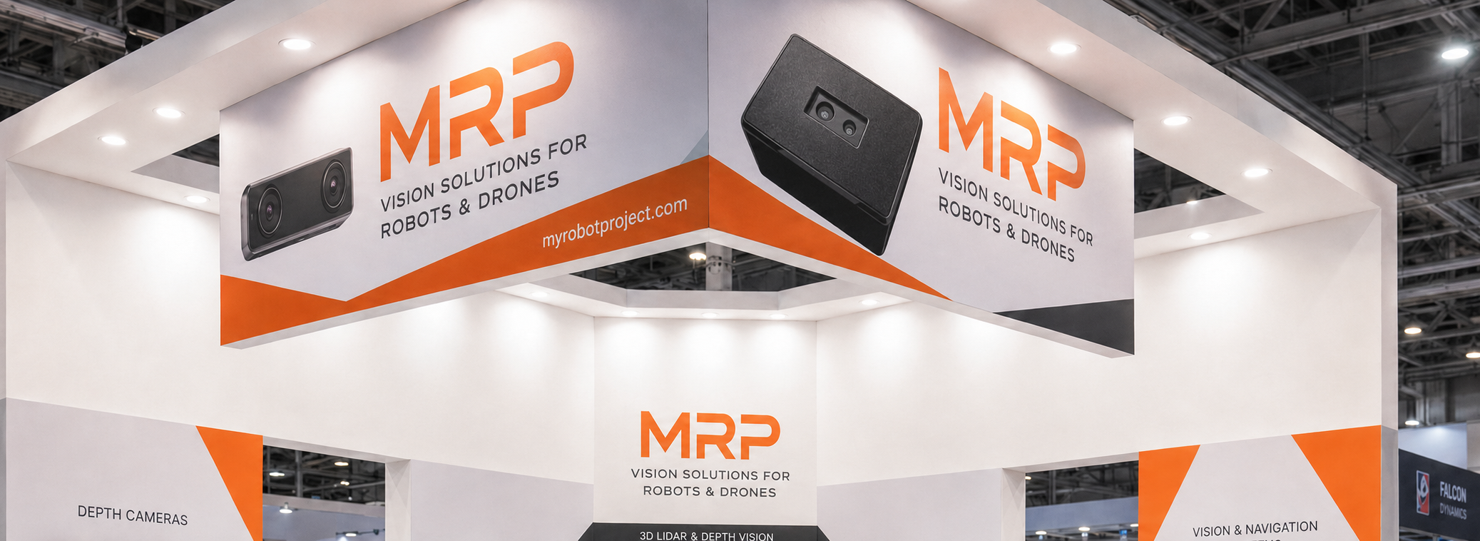
Drone LiDAR is LiDAR technology mounted on an unmanned aerial vehicle. The UAV carries a sensor payload that emits laser pulses, receives reflections from objects or surfaces, and calculates distance. Those measurements can become point clouds, depth maps, terrain models, obstacle zones, or local perception data for navigation. In the shop, I would describe it as a laser tape measure that takes many measurements very quickly while the aircraft is moving.
For mapping, drone LiDAR helps reconstruct the shape of the ground, structures, corridors, and vegetation. For real-time UAV control, LiDAR helps the drone understand what is nearby and how far away it is. Those two jobs sound related, but they are not identical. A mapping system is usually judged by georeferenced deliverables. A perception system is judged by whether it gives timely, useful distance data to the onboard controller.
Drone LiDAR in Simple Terms
In simple terms, drone LiDAR works like an extremely fast laser-based measuring tool. The sensor sends out light, waits for the reflection, and measures how long the light takes to return. Because the speed of light is known, the system calculates distance. When this happens thousands or millions of times across a field of view, the result becomes a 3D representation of the environment. For a drone, that 3D awareness can be used after the flight for mapping or during the flight for decision-making.
Drone LiDAR in Industrial Terms
In industrial terms, drone LiDAR is a UAV perception and measurement subsystem. It may include the LiDAR sensor, mechanical mount, vibration isolation, onboard computer, storage, flight controller interface, GNSS receiver, IMU or INS, and processing software. For surveying, the system must not only measure distance but also georeference every measurement using accurate position and attitude information. For embedded autonomy, the system may care more about latency, frame rate, field of view, weight, and power consumption than survey-grade output.
The Difference Between Mapping LiDAR and Depth-Sensing LiDAR
Mapping LiDAR and depth-sensing LiDAR get mixed up all the time. Mapping LiDAR is normally selected for high-density point cloud generation, topographic survey, corridor mapping, forestry, construction, and engineering documentation. Depth-sensing LiDAR is normally selected for real-time distance detection, obstacle avoidance, altitude hold, terrain following, indoor navigation, or robotics perception. Both use laser-based distance measurement, but the system architecture, price, output data, and integration work can be very different.
How Drone LiDAR Works
A drone LiDAR system starts with laser emission. The sensor sends light toward a target surface. That light reflects and returns to the receiver. Electronics measure the return signal and calculate distance. Depending on the design, the sensor may scan mechanically, use multiple beams, use flash illumination, or use solid-state depth sensing. The output may be a point cloud, a depth image, or distance values that flight software can use.
Time-of-Flight Measurement
Time-of-flight measurement is one of the most common principles behind LiDAR. The sensor measures how long light takes to travel from emitter to target and back to receiver. That round-trip time is converted into distance. This makes LiDAR a direct distance measurement technology, unlike passive camera-based 3D reconstruction, which estimates depth from overlapping images and visual features.
Direct Time-of-Flight, or dToF
Direct time-of-flight, often written as dToF, measures the actual return time of emitted light pulses. This is useful when a compact sensor needs to provide depth information in real time. A dToF module can be practical for UAV obstacle avoidance, short-range inspection, and robotic vision because it produces distance data directly. The DTOF Solid State LiDAR HM-LD1 is based on SPAD dToF technology and is designed to output real-time depth images and 3D point cloud data for environmental perception.
SPAD-Based Solid-State LiDAR
SPAD means single-photon avalanche diode. At a high level, a SPAD detector can detect extremely weak light returns. That matters because reflected light can be limited, especially at distance or on darker surfaces. SPAD dToF technology enables compact, low-power depth sensors that can be integrated into mobile platforms. Solid-state construction is also attractive for small drones and robots because it reduces mechanical complexity compared with larger rotating systems.
From Distance Measurements to Point Clouds
A point cloud is a set of spatial points that represents the shape of an object or environment. Each point usually has position information and may include intensity or other attributes depending on the sensor. In drone mapping, point clouds can represent terrain, roadways, buildings, bridges, dams, stockpiles, vegetation, or powerline corridors. In obstacle avoidance, point clouds or depth maps can represent nearby objects, open space, and danger zones around the UAV.
Why Frame Rate Matters
Frame rate matters because drones move. A slow-updating sensor may be acceptable for stationary measurement or controlled indoor testing, but moving UAVs need fresh data. Frame rate must be considered with flight speed, stopping distance, processing latency, field of view, and control-loop design. A 10 fps depth sensor can work for many slow-to-moderate UAV and robotics perception tasks, but high-speed autonomous flight may require higher frame rates, multiple sensors, or additional safety systems.
Core Components of a Drone LiDAR System
A practical drone LiDAR system is more than the LiDAR sensor. The UAV must carry the payload, provide stable power, collect or process data, and manage flight safely. For survey-grade applications, the system also needs accurate positioning and attitude measurement so the point cloud can be georeferenced. For obstacle avoidance, the system must deliver timely data to the onboard controller or companion computer.
| Component | Role in a Drone LiDAR System |
|---|---|
| LiDAR sensor | Measures distance and generates depth data, point data, or local perception information. |
| UAV platform | Carries the payload and determines flight time, stability, payload capacity, and operating envelope. |
| Flight controller | Stabilizes the aircraft and manages flight behavior, navigation, and safety actions. |
| GNSS module | Provides global positioning for mapping, navigation, and mission planning. |
| IMU or INS | Measures attitude, acceleration, rotation, and motion for stabilization or georeferencing. |
| Onboard computer | Processes depth data, point clouds, obstacle logic, or mapping information. |
| Power system | Supplies stable voltage and current without overloading the UAV battery budget. |
| Software or SDK | Enables data access, configuration, visualization, algorithm development, and deployment. |
| Storage or transmission | Saves data onboard or streams it to a ground station, companion computer, or networked device. |
Sensor Payload
The sensor payload must be evaluated for weight, dimensions, field of view, thermal behavior, mounting direction, and mechanical robustness. On a small drone, every gram affects flight time and stability. A front-facing LiDAR may be useful for collision avoidance, while a downward-facing LiDAR may be better for altitude hold or terrain following. If the drone experiences vibration, the mounting design should protect both the sensor and the quality of the data.
Positioning and Attitude Data
Survey-grade drone LiDAR normally requires high-quality position and attitude data. GNSS provides global position, while an IMU or INS measures the orientation and motion of the aircraft. Without this information, the point cloud may not be accurately placed in real-world coordinates. For obstacle avoidance, however, a UAV may only need local distance data relative to the aircraft, so the system can be simpler and lighter.
Processing Hardware and Interfaces
Processing may happen on an embedded computer, Raspberry Pi, ARM Linux device, x86 Linux computer, Windows PC, or a flight-controller-connected companion computer. Interface selection matters. UART is common for embedded control and lightweight communication. UDP is useful for networked data transmission. UVC can simplify camera-like depth data handling. Other systems may use USB, Ethernet, CAN, or proprietary interfaces. The right choice depends on UAV architecture and the software team’s development environment.
Drone LiDAR for Mapping vs Obstacle Avoidance
One of the first buyer questions is simple: does the drone need LiDAR for mapping or real-time perception? Mapping focuses on accurate data products. Obstacle avoidance focuses on helping the aircraft detect nearby objects quickly enough to react. Those jobs call for different priorities.
| Requirement | Mapping LiDAR | Obstacle Avoidance LiDAR |
|---|---|---|
| Main goal | Accurate 3D reconstruction | Real-time perception |
| Typical output | Georeferenced point cloud | Depth map, distance data, or local point cloud |
| Accuracy focus | Survey or engineering accuracy | Reliable detection and control logic |
| Payload size | Often larger and heavier | Often compact and lightweight |
| Processing | Post-processing is common | Real-time processing is required |
| Key specs | Range, scan rate, GNSS/INS, calibration, point density | FOV, frame rate, latency, power, size, interface |
| Typical buyer | Surveyor, mapper, engineering firm | UAV developer, robotics team, OEM, system integrator |
When You Need Survey-Grade Mapping LiDAR
Survey-grade mapping LiDAR is appropriate for topographic survey, corridor mapping, forestry analysis, mine site modeling, construction progress measurement, road inspection, and powerline clearance analysis. These projects often require calibrated equipment, repeatable workflows, accurate GNSS/INS integration, professional post-processing, and validation against known control points.
When You Need Compact Obstacle Avoidance LiDAR
Compact obstacle avoidance LiDAR is appropriate when a UAV needs local awareness. Example missions include altitude hold, terrain following, landing assistance, indoor navigation, warehouse drone operation, bridge inspection, dam inspection, and low-speed autonomous flight. In these cases, weight, power consumption, field of view, latency, frame rate, and development support may matter more than long-range geospatial mapping capability.
Why Small Drones Need Lightweight Sensors
Small drones have limited payload capacity and limited battery energy. A heavy sensor reduces flight time, shifts center of gravity, and may limit mission duration. High-power sensors increase electrical load and thermal management problems. A compact 28 g LiDAR module can be practical for UAV developers who need real-time distance sensing without the weight and complexity of a larger survey payload.
Drone LiDAR vs Photogrammetry
Drone LiDAR and drone photogrammetry both create 3D information, but they use different measurement principles. LiDAR directly measures distance with laser pulses. Photogrammetry reconstructs 3D geometry from overlapping images. For broader positioning and perception module ecosystems, buyers may also review suppliers such as Beitian. For advanced long-range LiDAR innovation in mobility markets, companies such as Luminar Technologies show how LiDAR continues to evolve across industrial and automotive applications.
| Factor | Drone LiDAR | Drone Photogrammetry |
|---|---|---|
| Measurement method | Direct distance measurement using laser pulses | 3D reconstruction from overlapping photos |
| Lighting dependence | Can work in low light depending on sensor design | Requires sufficient lighting and surface texture |
| Vegetation handling | Can capture gaps through vegetation depending on system | Often reconstructs canopy surface |
| Output | Point cloud, depth map, terrain model | Orthomosaic, mesh, textured model |
| Cost | Often higher | Usually lower entry cost |
| Workflow | Sensor calibration and point cloud processing | Image capture and photogrammetry processing |
| Best for | Terrain, structures, low-texture surfaces, obstacle sensing | Visual documentation, orthomosaics, textured sites |
Accuracy Is Not Only About the Sensor
Here’s the part buyers sometimes miss: drone LiDAR accuracy is not only a datasheet number. Calibration, flight altitude, point density, GNSS quality, INS performance, mounting rigidity, timestamp synchronization, target reflectivity, and processing workflow all affect the final result. A sensor may have centimeter-level ranging accuracy, while the final mapped point cloud has different accuracy because the complete system adds its own errors.
When Photogrammetry Is Better
Photogrammetry is often better for visual documentation, low-cost orthomosaics, textured construction sites, roof inspection photos, marketing visuals, and large-area image capture. If the project mainly needs a visually rich model or map-like image product, photogrammetry may be the more economical approach. It is also widely supported by many drone platforms and software workflows.
When LiDAR Is Better
LiDAR is often better when surfaces have low visual texture, lighting is limited, vegetation is present, or real-time distance measurement is required. It is also better suited for obstacle sensing because it directly measures distance instead of estimating geometry from images. For autonomous UAVs, direct depth data can simplify the perception pipeline and improve local awareness.
Industrial Applications of Drone LiDAR
Drone LiDAR is used across surveying, inspection, infrastructure, robotics, security, and autonomous navigation. The correct LiDAR type depends on whether the goal is post-flight analysis, live control, or embedded perception. Readers evaluating LiDAR for mobile robots can also review our related guide: LiDAR Sensors for Robotics.
UAV Mapping and Topographic Survey
In mapping and topographic survey, drone LiDAR can generate point clouds for terrain modeling, construction planning, mine site measurement, stockpile estimation, road design, and drainage analysis. Survey users often need accurate georeferencing, controlled flight planning, ground validation, and professional data processing.
Bridge, Expressway, and Dam Inspection
LiDAR can help measure distances to structures that are difficult or unsafe for people to approach, such as bridges, expressways, and dams. A compact UAV with LiDAR can support inspection planning, standoff distance monitoring, and local obstacle awareness. In short-range inspection, a lightweight module may help maintain distance from walls, beams, slopes, or structural surfaces.
Powerline and Corridor Inspection
Drone LiDAR is widely used in corridor inspection for powerlines, railways, roads, and pipelines. Survey-grade systems can help measure clearance, vegetation encroachment, and asset geometry. Compact perception modules may support local obstacle detection when flying near poles, wires, towers, or vegetation, although wire detection requires careful sensor selection and field validation.
UAV Altitude Hold and Terrain Following
A downward-facing LiDAR can support altitude hold by measuring distance to the ground. This is useful because GNSS altitude may not be precise enough for low-altitude flight, and barometers can drift. Terrain following uses distance measurements to maintain a more consistent height over changing ground surfaces. For small UAVs, a lightweight and low-power depth sensor can make this function easier to integrate.
Drone Obstacle Avoidance
Obstacle avoidance uses LiDAR to detect objects in front of, below, or around the drone. A front-facing sensor can help detect walls, trees, shelves, vehicles, people, or structural elements. Multi-directional sensing may be needed for more advanced autonomy. The control system should combine sensor data with flight speed, braking distance, safety thresholds, and failsafe behavior.
Indoor and GPS-Denied Navigation
Indoors, GNSS may be unavailable or unreliable. LiDAR can help provide local spatial awareness for navigation, landing, inspection, and SLAM development. A drone operating in a warehouse, tunnel, plant room, or industrial facility may benefit from depth data that does not depend on satellite positioning.
Robotics, Security, and Smart Monitoring
The same depth-sensing LiDAR principles used on drones can also support robots, cameras, and security systems. Applications include user presence detection, object recognition, volume measurement, zone intrusion monitoring, robot navigation, and smart inspection. This crossover matters for teams building multi-platform perception systems across UAVs and ground robots.
How to Select a Drone LiDAR Sensor
Selecting drone LiDAR starts with the mission. A sensor that is excellent for mapping may be too heavy for a small UAV. A compact obstacle avoidance module may be ideal for local perception but not sufficient as a complete survey-grade payload. For a focused introduction to the HM-LD1 module, see HM-LD1: The Reliable dToF Solid-State LiDAR.
Define the Mission First
Ask whether the drone is mapping terrain, avoiding obstacles, holding altitude, measuring distance to structures, navigating indoors, or operating outdoors in sunlight. Also define whether the output must be a georeferenced point cloud, a depth map, a simple range value, or control-loop data. Mission clarity prevents overbuying and prevents selecting the wrong sensor class.
Evaluate Range
Range is not one universal number. Indoor and nighttime range may be longer than outdoor daytime range because sunlight increases optical noise. Surface reflectivity, target size, color, angle, and environmental conditions also affect performance. Buyers should test the sensor against realistic targets at the expected flight distance.
Evaluate Accuracy
Accuracy must be interpreted at the correct level. Sensor-level ranging accuracy describes distance measurement capability under specified conditions. System-level UAV mapping accuracy includes GNSS/INS accuracy, calibration, flight path, and processing. A ±3 cm ranging specification may be excellent for obstacle avoidance and distance detection, but survey certification requires complete workflow validation.
Evaluate Field of View, Resolution, and Frame Rate
Field of view determines how much area the sensor observes. A wider field of view can help with obstacle detection, while a narrower field may be useful for focused measurement. Resolution determines the density of the depth grid. For example, a 40 × 30 depth map provides a structured set of distance points that can support object zone detection and basic point cloud generation. Frame rate determines how often the data updates, which is critical for moving UAVs.
Evaluate Weight, Power, Interfaces, and SDK Support
Weight affects flight time, payload capacity, and center of gravity. Power consumption affects battery budget and system heat. Interfaces affect integration architecture. UART is useful for embedded control, UDP for networked data, and UVC for camera-style depth handling. SDK support is also important. Development teams should confirm compatibility with x86 Windows, x86 Linux, ARM Linux, Raspberry Pi, embedded boards, and companion computer workflows.
DTOF Solid State LiDAR HM-LD1 for Compact UAV and Robotics Integration
The DTOF Solid State LiDAR HM-LD1 is a compact SPAD dToF LiDAR module designed for real-time depth sensing and 3D perception. Unlike heavy survey-grade UAV LiDAR payloads, HM-LD1 is suitable for compact platforms where weight, power consumption, field of view, and interface compatibility are critical. It can provide depth images and point cloud data for UAVs, mobile robots, smart cameras, security systems, and embedded perception development.
HM-LD1 is designed for environmental perception tasks such as obstacle avoidance, distance detection, autonomous navigation, smart inspection, and robotic vision development. It supports indoor or nighttime ranging up to 25 m and outdoor daytime ranging up to 8 m. With UART, UDP, and UVC interfaces, it can be integrated with PCs, Raspberry Pi platforms, flight controllers through companion computers, and embedded development systems.
View product page: DTOF Solid State LiDAR HM-LD1
Download brochure: DTOF SSL HM-LD1 Product Brochure
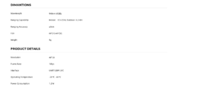
| Specification | DTOF Solid State LiDAR HM-LD1 |
|---|---|
| Dimension | 43.5 mm × 30 mm × 26.5 mm |
| Ranging Capability | Indoor: 0.5–25 m; Outdoor: 0.2–8 m |
| Ranging Accuracy | ±3 cm |
| Field of View | 60° horizontal × 45° vertical |
| Weight | 28 g |
| Resolution | 40 × 30 |
| Frame Rate | 10 fps |
| Interface | UART / UDP / UVC |
| Operating Temperature | -20 ℃ to 60 ℃ |
| Power Consumption | 1.2 W |
View Product Details & Pricing ➔
Why HM-LD1 Fits Small Drone Development
HM-LD1 fits small drone development because it combines compact dimensions, 28 g weight, and 1.2 W power consumption. Those are not minor details. On a small UAV, every gram and watt shows up in flight time, thermal behavior, and payload margin. The 60° horizontal by 45° vertical field of view supports local perception, while the 40 × 30 resolution provides a structured depth map for obstacle zones and point cloud generation. Its 10 fps frame rate can support many slow-to-moderate UAV, robot, and inspection applications.
Best-Fit Use Cases
Best-fit use cases include UAV obstacle avoidance, altitude hold, terrain following, short-range inspection, autonomous navigation, robot SLAM support, smart security monitoring, user presence detection, object recognition, volume measurement, and zone intrusion monitoring. It can also support robotics development where real-time depth images and 3D point cloud data are needed on compact embedded platforms.
Buyer Note on Survey-Grade Mapping
HM-LD1 should be understood as a compact dToF perception module, not a complete survey-grade georeferenced LiDAR mapping payload by itself. It can provide accurate ranging and local depth information, but survey-grade mapping usually requires GNSS/INS integration, calibration, data synchronization, mission planning, and professional processing. This distinction is important for buyers comparing drone LiDAR for mapping versus drone LiDAR for real-time sensing.
How to Integrate Drone LiDAR into a UAV Platform
Drone LiDAR integration should be planned as a system engineering task. The sensor must be mounted correctly, powered reliably, connected to the processing platform, validated under realistic conditions, and integrated into safe flight behavior. The workflow below applies especially to compact depth-sensing LiDAR modules used for UAV perception.
Step 1 — Define Mounting Direction
⚙️ Mounting direction depends on the application. A front-facing sensor supports forward obstacle detection. A downward-facing sensor supports altitude hold and landing assistance. An angled sensor can support terrain following or inspection standoff measurement. Multiple sensors may be required for broader coverage around the UAV.
Step 2 — Confirm Payload and Power Budget
⚙️ Confirm payload capacity, center of gravity, vibration behavior, cable routing, available voltage regulation, and electromagnetic interference risks. Even a low-power sensor should be integrated with clean power and secure wiring. The UAV should be tested for flight stability after installation.
Step 3 — Select the Data Interface
⚙️ Select the interface based on software architecture. UART is useful for embedded control loops and compact messages. UDP is practical for networked systems and streaming to onboard computers. UVC can be convenient when developers want camera-style access to depth data. The HM-LD1 supports UART, UDP, and UVC, giving development teams flexibility.
Step 4 — Connect to the Processing Platform
⚙️ The processing platform may be a PC, Raspberry Pi, ARM Linux board, x86 Linux computer, x86 Windows system, or companion computer connected to the flight controller. MRP offers SDKs for x86 Windows, x86 Linux, and ARM Linux, which helps developers move from prototyping to embedded deployment.
Step 5 — Validate Data in Real Conditions
⚙️ Validation should include indoor low light, outdoor sunlight, different target colors, different reflectivity surfaces, vibration, UAV motion, mounting angle, and realistic flight speed. Dust, rain, fog, and other environmental factors should be considered when applicable. Outdoor performance is especially important because sunlight can reduce effective range for compact optical sensors.
Step 6 — Build Safety Logic
⚙️ Obstacle thresholds, warning zones, velocity limits, braking behavior, no-fly zones, failsafe triggers, and sensor redundancy should be designed before deployment. LiDAR data should be treated as one part of a safety system, not as a guarantee of collision-free flight by itself.
Drone LiDAR Buyer Checklist
- ✅ What is the mission: mapping, obstacle avoidance, altitude hold, inspection, or navigation?
- ✅ What range is required indoors and outdoors?
- ✅ What accuracy is required at the system level?
- ✅ What is the maximum payload weight?
- ✅ What is the available power budget?
- ✅ What field of view is needed?
- ✅ What frame rate is required for the UAV speed?
- ✅ Does the sensor provide point cloud, depth map, or raw distance data?
- ✅ Which interfaces are supported: UART, UDP, UVC, USB, Ethernet, CAN?
- ✅ Does the supplier provide SDKs for the target platform?
- ✅ Is the UAV operating indoors, outdoors, or both?
- ✅ Is survey-grade certification required?
- ✅ Does the project require GNSS/INS integration?
- ✅ Is technical support available for integration?
- ✅ Can the supplier provide stable production supply?
Ready to evaluate a compact dToF LiDAR module for UAV or robotics development? View the HM-LD1 product page or proceed to the cart.
Drone LiDAR FAQ
Is there any LiDAR suitable for small drones?
What is the difference between drone LiDAR and fixed-wing photogrammetry?
Can drone LiDAR be used for land surveying, waterways, or minefield detection on a budget?
How accurate is drone LiDAR?
Does LiDAR work outdoors in sunlight?
Can drone LiDAR replace GPS?
What interface is best for drone LiDAR integration?
Choosing the Right Drone LiDAR for Your UAV Project
Drone LiDAR is not a single category. The right solution depends on whether you need survey-grade mapping, real-time obstacle avoidance, altitude hold, terrain following, inspection distance measurement, or embedded robotic perception. For compact UAVs, weight, power consumption, range, field of view, interfaces, SDK support, and outdoor validation are often just as important as raw accuracy. A large mapping payload may be the right tool for geospatial deliverables, while a compact dToF module may be the right tool for UAV perception and integration development.
If your project requires a lightweight solid-state dToF LiDAR module for UAV or robotics integration, the DTOF Solid State LiDAR HM-LD1 provides real-time depth data, point cloud support, 28 g weight, 1.2 W power consumption, and UART/UDP/UVC interfaces for flexible development. It is especially relevant for obstacle avoidance, altitude hold, terrain following, short-range inspection, smart monitoring, and robot vision development.
Explore the product: DTOF Solid State LiDAR HM-LD1
View Product Details & Pricing ➔
Related reading: HM-LD1: The Reliable dToF Solid-State LiDAR | LiDAR Sensors for Robotics
📚 References & Further Reading
- Industry Standard: Beitian | Luminar Technologies
- Related Guide: HM-LD1: The Reliable dToF Solid-State LiDAR | LiDAR Sensors for Robotics | DTOF Solid State LiDAR HM-LD1






