


Obstacle Avoidance Drones: How to Choose Reliable LiDAR & Vision Sensors for Safer UAV Autonomy
Obstacle avoidance drones are not just camera drones with a nice safety add-on anymore. They are becoming working platforms for inspection, mapping, logistics, warehouse inventory, security patrol, agriculture, infrastructure monitoring, and autonomous robotics. Here’s the deal: avoiding a wall in a clean demo room is easy. Avoiding wires, tree branches, glass, poles, beams, shelves, cranes, reflective panels, bridge structures, and low-texture surfaces in the real world is a different job entirely.
In the shop, we usually separate marketing claims from engineering reality pretty quickly. A drone may be advertised as having “obstacle avoidance,” but that does not mean it can see every hazard, in every direction, at every speed, under every lighting condition. A system that reacts too late, only senses forward, loses depth under strong sunlight, or misses thin objects can still put the aircraft into a wall, cable, rack, or structure.
This guide explains how to choose reliable LiDAR and vision sensors for safer UAV autonomy, with a practical focus on engineering trade-offs. We will look at how obstacle avoidance drones sense the environment, how LiDAR, stereo vision, dToF, structured light, radar, ultrasonic, and optical flow sensors compare, and which specifications matter when you are designing a real system instead of reading a brochure.
We will also look at a compact UAV-ready module, the DTOF Solid State LiDAR HM-LD1, for short-range obstacle detection, terrain following, altitude assist, robotics development, distance measurement, smart inspection, and autonomous navigation. Look, no sensor is magic. But the right sensor, mounted correctly and matched to a conservative control strategy, can make a drone much more predictable and much less fragile in the field.
Table of Contents
- 👉 What Are Obstacle Avoidance Drones?
- 👉 Why Obstacle Avoidance Matters for UAV Autonomy
- 👉 How Drone Obstacle Avoidance Works
- 👉 Main Sensor Types Used in Obstacle Avoidance Drones
- 👉 LiDAR vs Vision Sensors for UAV Obstacle Avoidance
- 👉 Specifications That Matter When Choosing UAV Sensors
- 👉 Recommended Compact dToF LiDAR Module for Drone Obstacle Avoidance
- 👉 Integration Workflow for Custom UAV Projects
- 👉 Industrial Application Scenarios for Obstacle Avoidance Drones
- 👉 Common Mistakes When Designing Obstacle Avoidance Drones
- 👉 Buyer Checklist for LiDAR and Vision Sensors
- 👉 FAQ: Obstacle Avoidance Drones
What Are Obstacle Avoidance Drones?
Obstacle avoidance drones are unmanned aerial vehicles equipped with sensors, processing hardware, and control logic that detect nearby objects and adjust flight behavior to reduce collision risk. That may mean warning the pilot, braking automatically, hovering, rerouting, maintaining a standoff distance, assisting landing, following terrain, or feeding depth data into SLAM and autonomous navigation software.
At the simplest level, a drone obstacle avoidance sensor measures distance in one direction and triggers a threshold response. If something is too close, the drone slows down or stops. At a more advanced level, the UAV builds a local perception model using LiDAR, cameras, IMU data, GNSS, barometer readings, optical flow, radar, and flight controller telemetry. That model can then support autonomous movement through warehouses, along bridges, around buildings, inside tunnels, or across uneven terrain.
Consumer Obstacle Avoidance vs Industrial UAV Autonomy
Consumer drones usually use closed obstacle avoidance systems designed to help a pilot avoid obvious crashes. Those systems can work well for photography and manual flying, but they often do not expose raw depth maps, point clouds, SDK interfaces, or custom control options. For a casual pilot, that is fine. For a developer building a custom inspection drone, warehouse drone, research aircraft, or autonomous robotics platform, it is usually too limited.
Industrial UAV autonomy needs predictable data, repeatable behavior, integration flexibility, and testable assumptions. Engineers may need access through UART, UDP, UVC, ROS, Python, C++, Windows, Linux, or ARM Linux tools. They may also need to mount sensors in specific directions: forward for collision avoidance, downward for altitude hold, upward for ceiling clearance, or side-facing for inspection standoff. For a broader look at sensing technology, see our guide on obstacle avoidance sensors for robots and drones.
Why “Obstacle Avoidance” Does Not Mean “Collision-Proof”
No experienced engineer should treat obstacle avoidance as a guarantee. Real performance depends on detection range, field of view, frame rate, processing delay, braking distance, blind spots, target reflectivity, lighting, vibration, and the physical obstacle itself. A slow indoor inventory drone has a completely different risk profile than a fast outdoor inspection drone flying near powerlines or tree branches.
A single forward-facing sensor cannot see behind the aircraft. A low-resolution depth module may detect a wall but miss a thin wire. A vision system may work beautifully in daylight and then struggle against glare, darkness, or a plain white wall. A ToF sensor may perform differently indoors than under strong summer sunlight. The goal is not perfection. The goal is risk reduction through good sensing, conservative speed limits, redundancy where needed, and testing under real mission conditions.
Why Obstacle Avoidance Matters for UAV Autonomy
Obstacle avoidance matters because drones increasingly operate close to expensive assets, people, structures, and mission-critical payloads. Bridge inspection, dam inspection, warehouse inventory, mining, tunnel mapping, forestry, agriculture, security patrol, and industrial inspection all put drones into places where manual piloting can get tight. One bad sensor decision can turn a good aircraft into broken carbon fiber and a delayed job.
The cost of a crash is not just a propeller and an arm. You may lose a thermal camera, mapping payload, gimbal, battery, radio, onboard computer, or customer data. You may also lose a workday, a client’s trust, and a scheduled inspection window. In commercial UAV work, downtime is often more expensive than the damaged parts.
Safety Is More Than Detection
A safer drone must detect an obstacle early enough to do something useful. The system needs time to sense, process, decide, command the flight controller, and physically slow the aircraft. That is why range alone is not enough. A long-range sensor with slow updates and high latency may not help a fast aircraft. A compact short-range sensor may be excellent for slow indoor navigation, close inspection, terrain following, or altitude assist if the speed limits and stop zones are designed correctly.
Safety also means deciding what happens after detection. Should the drone brake, hover, climb, descend, back away, move sideways, reduce speed, alert the pilot, or return home? In a warehouse aisle, stopping and waiting may be the right answer. During terrain following, the better response may be a smooth altitude correction. In inspection work, the drone may need to hold a consistent standoff distance rather than simply stop.
How Drone Obstacle Avoidance Works
Drone obstacle avoidance is a feedback loop. The aircraft collects sensor data, estimates distance or depth, filters unreliable readings, identifies relevant obstacles, decides whether action is required, and sends commands to the flight controller or companion computer. This loop repeats many times per second while the drone moves through the environment.
Sensing Layer
The sensing layer observes the world. LiDAR and dToF modules measure distance using light. Cameras capture visual texture and color. Stereo cameras infer depth from two viewpoints. Ultrasonic sensors estimate distance using sound. Millimeter-wave radar uses radio waves and can work in dust, fog, rain, and poor visibility. Optical flow sensors estimate movement relative to the ground. IMUs measure acceleration and angular velocity, while GNSS and barometers provide broader position and altitude references.
For background on photonics and optical sensing technologies, readers can explore resources from the IEEE Photonics Society. Understanding the physics behind optical sensing helps explain why sunlight, reflectivity, surface material, target angle, and signal processing affect real-world depth performance.
Perception Layer
The perception layer turns raw measurements into useful spatial information. A LiDAR or dToF depth sensor may output a depth map, point cloud, or distance values. A camera system may output images, disparity maps, optical flow, object detections, or semantic labels. A more advanced UAV may combine several sources into an occupancy grid, local map, or SLAM estimate.
Filtering matters. Dust, reflections, propeller interference, vibration, moving shadows, sunlight, and bad calibration can create false positives. Thin wires, glass, black surfaces, low-reflectivity material, water, and angled surfaces can cause missed detections. A good perception layer does not blindly trust every reading. It decides what data is stable enough to influence flight.
Control Layer
The control layer turns perception into action. Basic systems use distance thresholds: safe, caution, stop, or emergency. More advanced systems use velocity limiting, yaw adjustment, altitude correction, path replanning, and mission-level decisions. On a custom UAV, this logic often runs on a companion computer and sends commands to a flight controller. On a tightly integrated aircraft, the function may be built directly into the flight stack.
Look, the control layer should be boring, conservative, and testable. Define maximum speed for each sensing mode. Define what happens when data is lost. Define manual override. Log everything. A drone should not keep flying fast just because the depth stream disappears or becomes noisy.
Why Latency Matters
Latency is one of the quiet killers in obstacle avoidance. A 10 fps sensor updates every 100 ms before communication and processing delays. At 2 m/s, the drone moves 0.2 m during that sensor interval alone. Add compute time, flight controller response, and braking distance, and your real safety margin gets bigger fast.
That does not mean a 10 fps sensor is bad. It means aircraft speed and mission profile must match the sensing loop. Low-speed inspection, indoor development, terrain following, altitude assist, and robotics prototyping can work well with compact depth sensing. High-speed autonomous flight needs more range, faster updates, more compute, and usually sensor fusion.
Main Sensor Types Used in Obstacle Avoidance Drones
There is no single best sensor for every obstacle avoidance drone. The right choice depends on environment, speed, obstacle size, lighting, payload capacity, compute budget, and whether the system needs raw distance, 3D structure, image recognition, or redundancy.
LiDAR Sensors
LiDAR sensors measure distance using light. Depending on the architecture, they may output single-point distances, 2D scans, 3D point clouds, or depth images. LiDAR is valuable because it provides geometry directly related to distance. It is widely used in robotics, mapping, autonomous navigation, terrain following, and local obstacle avoidance.
Mechanical spinning LiDAR can provide wide coverage and dense point clouds, but it may be heavier, more power-hungry, and more complex. Solid-state LiDAR and dToF modules are attractive for drones because they reduce moving parts, cut weight, and simplify mounting.
dToF Solid-State LiDAR
dToF means direct time-of-flight. The sensor emits light and measures how long the reflected light takes to return. SPAD-based dToF technology can support compact, low-power, real-time depth sensing. For drones, that is useful because weight, power draw, and mechanical simplicity matter every time the aircraft leaves the ground.
A dToF LiDAR module is not a complete avoidance system by itself. It is a perception component. You still need mounting, power, data handling, filtering, software, control logic, and validation. But for many compact UAV and robotics projects, a dToF module offers a practical balance of range, size, weight, power, and integration effort.
Stereo Vision Cameras
Stereo vision uses two cameras separated by a known baseline. By comparing left and right images, the system estimates depth from parallax. Stereo can work well in textured environments with good lighting. It is especially useful when the drone also needs images for inspection, recognition, tracking, or navigation.
The limitations are real. Stereo can struggle with low texture, darkness, glare, reflective surfaces, motion blur, calibration drift, and repetitive patterns. It can also require more compute than simple depth sensors. On a small UAV, GPU processing, calibration management, and software complexity can become major constraints.
Monocular Vision and AI Detection
Monocular vision uses one camera, often with AI models, optical flow, or learned depth estimation. It can be lightweight and cost-effective. It is strong for recognizing people, vehicles, landing markers, equipment, signs, and visual hazards. But depth is less direct than LiDAR or stereo.
AI systems require training data, compute resources, testing, and validation across lighting and environmental conditions. They are powerful when the drone needs semantic awareness, but they should not be treated as a universal replacement for direct distance sensing in safety-related applications.
Ultrasonic Sensors
Ultrasonic sensors are inexpensive and common in simple landing assist systems. They can work at short range, but they have limited spatial detail and can be affected by surface angle, soft materials, wind, propeller noise, and acoustic interference. For industrial drones, ultrasonic sensing is usually best used as a supplementary layer rather than the main obstacle avoidance system.
Millimeter-Wave Radar
Millimeter-wave radar is useful in dust, fog, rain, smoke, and low-visibility environments. Radar can provide valuable redundancy where cameras and optical sensors degrade. The trade-off is resolution. Radar typically provides less geometric detail than LiDAR or cameras, so it is often strongest when fused with other sensors.
Optical Flow Sensors
Optical flow sensors estimate movement by tracking texture beneath the aircraft. They are useful for indoor stabilization, position hold near the ground, and low-altitude navigation. They are not a complete forward obstacle avoidance solution. A good UAV system may combine optical flow with LiDAR, barometer, IMU, and flight controller data.
LiDAR vs Vision Sensors for UAV Obstacle Avoidance
The LiDAR versus vision question is not about picking a universal winner. LiDAR is strong for direct range and geometry. Vision is strong for recognition, inspection, and context. Many professional UAV perception systems use both. Industrial LiDAR vendors such as Ouster show how point cloud sensing is used across robotics, mapping, and autonomous systems.
| Factor | LiDAR / dToF Depth Sensor | Vision / Stereo Camera |
|---|---|---|
| Distance Measurement | Direct range measurement using time-of-flight or laser scanning | Depth inferred from image features, parallax, or AI models |
| Lighting Dependence | Less dependent on visible texture, but outdoor sunlight can affect range | Highly dependent on lighting, texture, exposure, and camera quality |
| Output | Depth map, distance values, point cloud | Images, disparity maps, semantic detection, optical flow |
| Integration Complexity | Often simpler for direct obstacle distance thresholds | May require calibration, feature matching, AI processing, or GPU acceleration |
| Best Use Cases | Obstacle detection, terrain following, short-range mapping, navigation | Object recognition, visual inspection, semantic awareness, tracking |
| Limitations | FOV, range under strong sunlight, reflective/absorbing surfaces | Low light, glare, low texture, high compute load, depth ambiguity |
When LiDAR Is the Better Choice
LiDAR is often the better choice when the project needs direct range data, predictable geometry, short-range safety zones, and straightforward integration. A LiDAR obstacle avoidance drone can use distance thresholds to slow down or stop when objects enter a defined region. This is useful for indoor navigation, close-structure inspection, terrain following, altitude assist, and robotics development.
When Vision Is the Better Choice
Vision is the better choice when the UAV must understand visual meaning. Cameras are essential for inspection imagery, object classification, QR or barcode recognition, human detection, vehicle tracking, landing marker identification, and structural defect analysis. Cameras answer questions LiDAR does not answer well: what is the object, what condition is it in, and does it match the mission target?
Why Sensor Fusion Often Wins
Sensor fusion usually wins in serious applications because each sensor covers another sensor’s weakness. LiDAR provides geometry. Cameras provide context. IMU and flight controller data provide motion state. GNSS supports outdoor positioning. Barometers and range sensors support altitude awareness. In professional UAV work, the better question is not “LiDAR or camera?” It is “What combination gives the required safety margin without blowing up weight, power, cost, and integration time?”
Specifications That Matter When Choosing UAV Sensors
Choosing sensors for obstacle avoidance drones requires more than chasing “long range” or “AI obstacle avoidance” labels. Buyers should connect specifications to aircraft speed, mission environment, obstacle size, and control response.
Ranging Capability
Ranging capability defines how far the sensor can measure under specified conditions. Indoor and nighttime range is often better for optical sensors because ambient sunlight is reduced. Outdoor daytime range depends on sunlight, reflectivity, optics, signal processing, target angle, and surface material. If the drone will fly outdoors, design around the outdoor specification.
Ranging Accuracy
Accuracy matters for close navigation, altitude hold, terrain following, and standoff control. A level such as ±3 cm can be useful for short-range UAV obstacle detection, especially when the aircraft is moving slowly or maintaining distance from walls, shelves, ground surfaces, or structural elements. Accuracy should still be considered with noise, resolution, frame rate, and filtering.
Field of View
Field of view determines how much space the sensor covers. A wider horizontal FOV helps cover more of the forward collision zone. Vertical FOV matters for objects above and below the sensor centerline. For drones, FOV must match movement direction. Downward terrain following has different needs than forward collision avoidance or side-facing inspection.
Resolution
Resolution determines depth detail. A 40 × 30 depth resolution can be useful for detecting larger obstacles, building simple depth maps, and defining safety zones. It is not the same as high-density mapping LiDAR. Thin wires, small branches, cables, and narrow rods may require higher resolution, slower flight, different sensor geometry, or sensor fusion.
Frame Rate
Frame rate affects reaction time. A 10 fps sensor updates every 100 ms before additional compute and control delay. That can be suitable for low-speed inspection, indoor robotics, terrain following, and prototyping. It is not something you ignore while letting the drone fly fast toward obstacles.
Weight and Power
Every gram and every watt matters on a UAV. Sensor weight affects flight time, balance, payload budget, and motor load. Power consumption affects battery life and electrical design. A compact 28 g, 1.2 W depth module is easier to integrate than a heavy LiDAR or a compute-hungry camera stack, especially on small drones.
Interface and SDK Support
Interface options determine how quickly a team can build a working system. UART can support embedded control. UDP can support networked streaming. UVC can simplify PC-style depth workflows. SDK support for x86 Windows, x86 Linux, and ARM Linux helps teams prototype on PCs and deploy on embedded platforms.
Recommended Compact dToF LiDAR Module for Drone Obstacle Avoidance
For UAV developers building custom obstacle avoidance drones, the sensor must be small, lightweight, power-efficient, and easy to integrate with embedded platforms. The DTOF Solid State LiDAR HM-LD1 is designed for short-range 3D sensing using solid-state dToF technology. With a 28 g weight, 60° horizontal × 45° vertical field of view, UART/UDP/UVC interfaces, and SDK support for Windows, Linux, and ARM Linux, it is suitable for prototyping and deployment on drones, robots, Raspberry Pi systems, PCs, and embedded development platforms.
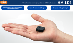
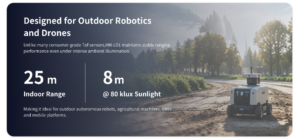
The HM-LD1 is a solid-state LiDAR module based on SPAD dToF technology, delivering real-time depth images and 3D point cloud data for accurate environmental perception. It supports indoor or nighttime ranging up to 25 m and outdoor daytime ranging up to 8 m, making it relevant for obstacle avoidance, distance detection, autonomous navigation, smart inspection, and robotic vision development. With UVC, UDP, and UART interfaces, HM-LD1 can be integrated with PCs, Raspberry Pi systems, flight controllers, and embedded platforms for both prototyping and system deployment.
Download the DTOF SSL HM-LD1 Product Brochure for detailed product information.
DTOF Solid State LiDAR HM-LD1 Specifications
| Specification | DTOF Solid State LiDAR HM-LD1 |
|---|---|
| Product Name | DTOF Solid State LiDAR HM-LD1 |
| Technology | SPAD dToF solid-state LiDAR |
| Dimension | 43.5 mm × 30 mm × 26.5 mm |
| Ranging Capability | Indoor: 0.5–25 m; Outdoor: 0.2–8 m |
| Ranging Accuracy | ±3 cm |
| Field of View | 60° horizontal × 45° vertical |
| Weight | 28 g |
| Resolution | 40 × 30 |
| Frame Rate | 10 fps |
| Interface | UART / UDP / UVC |
| Operating Temperature | -20 ℃ to 60 ℃ |
| Power Consumption | 1.2 W |
| Supported Development Platforms | x86 Windows, x86 Linux, ARM Linux SDKs |
| Typical Applications | UAV obstacle avoidance, altitude hold, terrain following, robot navigation, SLAM assistance, distance detection, smart inspection, security monitoring |
Why HM-LD1 Fits Compact UAV Projects
The HM-LD1 fits compact UAV projects because it respects the two things small aircraft never have enough of: payload capacity and power budget. At 28 g and 1.2 W, it is easier to integrate into drones, mobile robots, Raspberry Pi platforms, and embedded systems than many larger perception sensors. The compact 43.5 mm × 30 mm × 26.5 mm housing gives developers more freedom when payload space is tight.
Depth Map and Point Cloud Output
The module supports real-time depth images and 3D point cloud data. That is useful during development because depth maps can become safety zones, distance thresholds, obstacle masks, or local occupancy information. Point cloud output helps with visualization, debugging, robotic perception, and SLAM assistance. In early prototyping, seeing the distance data makes threshold tuning and mounting validation much easier.
Where HM-LD1 Should Not Be Overclaimed
Here’s the honest version: HM-LD1 is not a long-range, high-density mapping LiDAR for fast aircraft, and a 40 × 30 depth resolution should not be oversold for fine wire detection. It is better understood as a compact dToF LiDAR module for short-range perception, obstacle zones, altitude assistance, terrain following, distance detection, smart inspection, robot navigation, SLAM assistance, and UAV autonomy development.
Integration Workflow for Custom UAV Projects
Adding obstacle avoidance to a custom drone is a systems job. The sensor is only one piece. Teams need to define the risk direction, calculate stopping distance, mount the sensor correctly, connect it to the right compute platform, build detection logic, and test in real conditions.
- ⚙️ Define the avoidance direction. Forward sensing protects forward motion. Downward sensing supports altitude hold, landing, and terrain following. Side-facing sensing helps maintain distance from walls, bridge surfaces, racks, or inspection targets.
- ⚙️ Define speed and stopping distance. At 2 m/s, a 100 ms update interval means the aircraft moves 0.2 m before processing and braking are even included. This calculation should drive speed limits and obstacle thresholds.
- ⚙️ Mount the sensor correctly. Avoid propeller wash, landing gear obstruction, body occlusion, vibration, cable strain, and poor alignment. The field of view must cover the real collision zone.
- ⚙️ Connect to the companion computer or flight controller. UVC or UDP may suit Raspberry Pi, Jetson, or PC-based processing. UART may suit embedded controllers or simpler distance reporting.
- ⚙️ Build a zone-based safety algorithm. Use safe, caution, stop, and critical zones. Filter isolated noise. Degrade safely if data becomes unavailable.
- ⚙️ Test indoors before outdoor flight. Start with bench testing, visualization, logging, low-speed movement, and manual override. Do not begin testing near expensive infrastructure.
- ⚙️ Validate under real lighting. Test in bright sun, shade, reflective scenes, dark materials, dust, vibration, and mission-specific conditions.
If you need help with sensor selection or integration support, visit the My Robot Project Help Center.
Industrial Application Scenarios for Obstacle Avoidance Drones
Obstacle avoidance drones are most valuable when the aircraft must fly close to structures, through constrained spaces, or in areas where manual piloting is difficult. A compact drone depth sensor can improve control confidence, support repeatable routes, and reduce collision risk during autonomous or semi-autonomous missions.
Bridge, Dam, and Expressway Inspection
Bridges, dams, and expressways require drones to work near concrete, steel, cables, beams, and surfaces that are difficult or dangerous for people to approach. Compact LiDAR can help measure standoff distance and support safer inspection paths. For these missions, engineers should pay close attention to outdoor range, sunlight, surface reflectivity, and mounting direction.
Warehouse and Indoor Inventory Drones
Warehouses are GPS-denied environments filled with racks, shelves, pallets, forklifts, signs, ceilings, and narrow aisles. Obstacle avoidance helps indoor drones move predictably and reduce collision risk. A compact dToF LiDAR module can provide direct depth data for aisle navigation, shelf clearance, and slow autonomous inspection. Vision systems can add barcode reading and inventory recognition.
Power and Utility Inspection
Utility inspection involves poles, towers, transformers, cables, and complex structures. Obstacle avoidance can support standoff control, but thin wire detection is difficult for many sensing systems. Teams should not assume a low-resolution sensor will reliably detect fine powerlines at speed. Conservative planning, slow flight, multiple sensing directions, and sensor fusion are strongly recommended.
Agriculture and Forestry
Agriculture and forestry drones may need terrain following, canopy avoidance, and low-altitude navigation over uneven ground. Lighting changes quickly between open fields, shadows, and tree cover. Depth sensing can support altitude and obstacle zones, while cameras can identify crops, plant health, and visual features.
Thermal Aerial Inspection
Thermal missions often involve electrical faults, roof surveys, building diagnostics, solar farm inspection, and industrial equipment monitoring. Obstacle avoidance is important because thermal payloads are expensive and the aircraft may need to fly close to structures. For more detail, read our guide on why a thermal camera is essential for aerial inspection.
Common Mistakes When Designing Obstacle Avoidance Drones
Many UAV obstacle avoidance failures come from mismatch, not defective hardware. The sensor may be working exactly as designed, but the aircraft is flying too fast, the field of view is wrong, the lighting is harsher than expected, or the software does not handle uncertainty.
- ✅ Choosing based only on maximum range. Outdoor range, target reflectivity, frame rate, FOV, resolution, latency, and SDK support matter just as much.
- ✅ Ignoring blind spots. A forward sensor does not protect the rear, sides, top, or bottom of the drone.
- ✅ Flying too fast for the update rate. If the perception-control loop cannot react in time, the drone can still crash.
- ✅ Assuming cameras work in all lighting. Darkness, glare, low texture, repetitive patterns, and motion blur can weaken vision systems.
- ✅ Assuming LiDAR detects everything. Glass, reflective metal, black surfaces, water, angled surfaces, and thin wires can be challenging.
- ✅ Skipping outdoor validation. ToF and optical sensors can behave differently in sunlight than they do indoors.
- ✅ No fail-safe logic. The drone needs safe behavior when sensor data becomes noisy, delayed, or unavailable.
Buyer Checklist for LiDAR and Vision Sensors
Use this checklist before selecting a drone obstacle avoidance sensor, dToF LiDAR module, stereo camera, radar, or fusion system:
- ✅ What direction must the drone sense: forward, downward, side, rear, upward, or all directions?
- ✅ What is the required detection range indoors and outdoors?
- ✅ What is the expected drone speed and stopping distance?
- ✅ Does the sensor provide direct distance data, depth maps, or point clouds?
- ✅ What is the field of view?
- ✅ Is the resolution enough for the obstacle size?
- ✅ Is the frame rate fast enough for the control loop?
- ✅ Can the drone carry the sensor, mounting hardware, and cables?
- ✅ Can the power system support the sensor and companion computer?
- ✅ Does the interface match the flight controller or companion computer?
- ✅ Is SDK support available for the target development platform?
- ✅ Has the sensor been tested in sunlight, low light, reflective scenes, and vibration?
- ✅ Does the system need ROS, OpenCV, Python, C++, or embedded integration?
- ✅ Is technical support available from the supplier?
- ✅ Can the supplier support customization if needed?
For compact UAV depth sensing, obstacle detection, and robotic perception development, explore the DTOF Solid State LiDAR HM-LD1 or contact the team for integration support.
FAQ: Obstacle Avoidance Drones
Is drone obstacle avoidance really effective, or is it just a marketing feature?
What is a low-cost obstacle avoidance setup for a student or DIY drone project?
Is LiDAR better than camera vision for obstacle avoidance drones?
Can obstacle avoidance drones detect thin wires, branches, or glass?
What specifications matter most for a drone obstacle avoidance sensor?
Does outdoor sunlight affect LiDAR and ToF obstacle avoidance sensors?
📚 References & Further Reading
- Industry Standard: IEEE Photonics Society | Ouster
- Related Guide: Obstacle Avoidance Sensors for Robots & Drones: What Really Works | Thermal Camera Essential for Aerial Inspection | My Robot Project Help Center






