

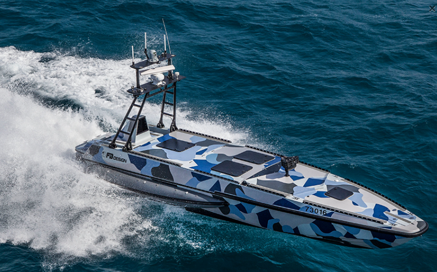
What Is a USV and Why Should You Care?
A USV – uncrewed surface vessel – is basically a robot boat. It floats on the ocean, collects data, and does all sorts of useful stuff, but there’s nobody on board. Operators on land or on a ship can remote-control it, or just set a mission plan and let the USV figure out the details on its own.
You might have heard people call them drone boats or autonomous surface vehicles. Whatever name you use, the idea is the same: these little vessels are taking over some of the dull, dirty, and dangerous jobs that used to require a crewed ship. And honestly, they’re surprisingly good at it.
The National Oceanic and Atmospheric Administration (NOAA) has been pushing USV technology forward for years. According to their ocean exploration team, USVs are quickly becoming a favorite tool in marine science – not because they’re flashy, but because they just work. They’re cheaper than traditional ships, safer (since no humans need to go into rough seas), and can stay out for months at a time.
What Can a USV Actually Do?
Mapping and surveying. A USV can carry sonar systems to map the seafloor, measure water depth, and chart underwater habitats. This matters for shipping safety, underwater cable laying, and even finding shipwrecks.
Environmental monitoring. These vessels track water temperature, salinity, dissolved oxygen, currents, wave height – all the stuff that helps us understand climate change and ocean health. They also measure air temperature, wind speed, humidity, and atmospheric pressure above the surface.
Wildlife and fishery management. A USV can count marine mammals, assess fish stocks, and figure out whether a habitat is suitable for certain species. No need to disturb the animals with a loud, smelly ship.
Emergency response and security. They spot oil spills, find marine debris, detect illegal fishing or smuggling, and help with search and rescue operations. Some USVs even sail into hurricanes to collect data that forecasters desperately need.
Beyond data collection. Newer USVs are starting to carry cargo and even passengers. Think of them as small,无人 ferries or supply boats. It’s still early days, but the potential is huge.
The bottom line? A USV won’t replace a full-sized research ship. But it can do a lot of the routine work for a fraction of the cost, freeing up ships and people for the jobs that really need them.
How Does a USV Work? (And What Tech Keeps It Afloat?)
There’s no single way to build a USV. Some look like regular motorboats. Others resemble sailboats, surfboards, or even bathtub toys. The design depends entirely on the job.
Power sources. Many USVs run on renewable energy – wind, solar, waves. That’s how they can stay out for three months to a full year without refueling. Others use diesel for short trips or heavy lifting.
Sensors and payload. A USV carries whatever instruments the mission needs: echo sounders for depth, fluorometers for water quality, cameras for video, sampling systems for water and plankton. The payload changes with the task.
Deployment and operation. You can launch a USV from a pier, a dock, or even a ship. Some have their own launch systems. Once in the water, it can run alone, join a fleet of other USVs, or work alongside underwater robots like AUVs and ROVs. In fact, a USV often acts as a communications bridge – relaying data from underwater vehicles back to shore via satellite.
Navigation and control. This is where things get tricky. A USV needs to know exactly where it is, where it’s going, and how to avoid obstacles. That means high-precision positioning. Standard GPS isn’t good enough – especially in shallow coastal waters, near glaciers, or in marine protected areas where the terrain changes fast.
That’s where RTK technology comes in.
Why RTK Is a Big Deal for USV Navigation
RTK stands for Real-Time Kinematic. It’s a fancy way of saying “really, really accurate GPS.”
Regular GPS can tell you where you are within a few meters. That’s fine for driving a car. But for a USV trying to map the seafloor in centimeter detail, or navigate through a narrow channel without hitting rocks, meter-level accuracy is useless.
RTK fixes that. It uses a base station on land or a ship to correct the satellite signal in real time. The result? Horizontal accuracy down to 1 centimeter, and vertical accuracy around 1.5 centimeters. That’s good enough to guide a USV through tricky waters, avoid obstacles automatically, and produce survey data you can trust.
Without RTK, a USV would drift, misread its position, and likely fail at any precision task. With RTK, it becomes a reliable survey platform.
Meet HM-D20: The Helical Antenna RTK Module Built for Marine Use
If you’re building or operating a USV, you need an RTK module that’s compact, tough, and easy to integrate. The HM-D20 helical antenna RTK module from MyRobotProject ticks all those boxes.
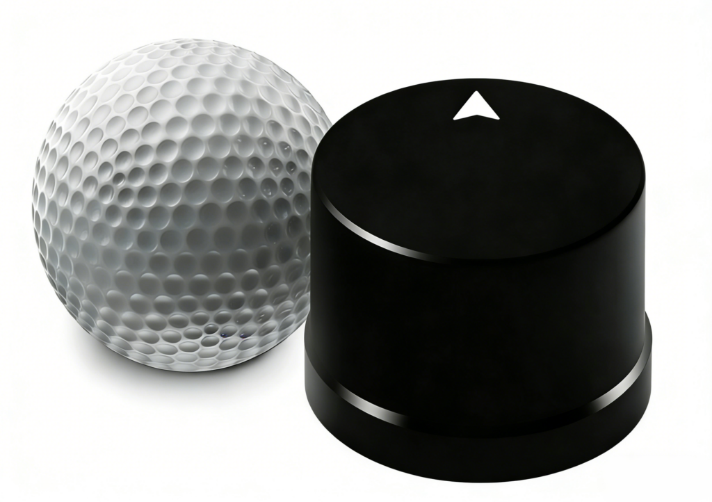
What makes it special? Most RTK modules need a separate antenna and a lot of wiring. The HM-D20 puts the GNSS module and the helical antenna inside one small housing. Just plug it in and it works – no external antenna, no complicated setup. It’s truly plug-and-play.
Key specs you should know:
- Weight: 20 grams (light enough for small USVs and even drones)
- Size: Φ44×37mm (fits almost anywhere)
- Frequency bands: GPS L1/L5, BeiDou B1/B2A/B2I, GLONASS G1, Galileo E1/E5 – basically every major satellite system
- Accuracy: Horizontal 1cm + 1ppm, Vertical 1.5cm + 1ppm
- Timing sync: 20ns (fast enough for real-time control)
- Waterproof rating: IP67 (can handle splashes, rain, and even brief submersion)
- Temperature range: -40℃ to 85℃ (works from the Arctic to the tropics)
- Output: NMEA 0183 via TTL UART, accepts RTCM input
Why choose HM-D20 for your USV?
First, the precision. Centimeter-level RTK accuracy is exactly what a USV needs for seafloor mapping, obstacle avoidance, and station-keeping in currents.
Second, the ruggedness. Marine environments are brutal – salt spray, constant humidity, temperature swings. The IP67 housing keeps the electronics safe.
Third, the compatibility. The HM-D20 works with ROS1 and ROS2, and comes with Python and C++ examples. You can hook it up to a Pixhawk flight controller, a Raspberry Pi, or any MCU that speaks TTL serial. No proprietary lock-in.
Fourth, the ease of use. It comes pre-configured from the factory. You don’t need to fiddle with serial debugging tools or upload firmware. Just connect power and UART, and you’re getting RTK positions.
Where can you use it? Seafloor mapping, marine sanctuary surveys, Arctic navigation, harbor dredging inspections, long-range USV voyages – anywhere you need reliable, low-latency positioning.
A honest limitation: Like all RTK systems, the HM-D20 needs a clear view of the sky. It won’t work indoors, underground, or in tunnels. But out on the open ocean? That’s exactly where it shines.
The Bottom Line
USVs are changing how we explore the ocean – not by replacing ships, but by doing the jobs that ships are too expensive or too risky for. They map, monitor, and measure for months at a time, using wind, waves, and sun for power.
But none of that works without good navigation. And good navigation in the marine environment starts with RTK. The HM-D20 helical antenna module gives you centimeter-level accuracy in a tough, compact, easy-to-use package. Whether you’re a researcher, a marine tech developer, or a hobbyist building your own USV, it’s worth a serious look.
Ready to try it? Check out the HM-D20 product page for specs, wiring diagrams, and ordering info:
👉 https://myrobotproject.com/product/helical-antenna-rtk-module-hm-d20/






