Standard GNSS just can’t keep up with today’s demanding drone missions. Whether you’re mapping uneven terrain, monitoring large‑scale construction sites, or safely flying beyond visual line of sight in complex urban areas, you need location data you can trust down to the centimeter. Casual consumer‑grade positioning leads to inconsistent mapping results, missed inspection details, and unreliable autonomous flight paths. That’s where RTK steps in to turn unstable, error‑prone flights into highly repeatable, professional‑grade operations suitable for commercial and industrial applications.
How RTK Works for Drones
Drones rely on global navigation satellite systems including GPS, Galileo, GLONASS, and BeiDou to determine their real‑time position. On its own, standalone satellite positioning only delivers meter‑level accuracy, which works fine for casual hobby flying or basic navigation tasks but falls far short for high‑precision commercial work.
RTK (Real‑Time Kinematic) resolves these limitations by introducing a fixed ground‑based base station with a precisely surveyed, known geographic location. The base station continuously compares satellite signals it receives with those captured by your drone, acting as a mobile rover unit. It calculates positioning errors caused by atmospheric delays, satellite clock drift, orbital noise, and environmental interference, then sends real‑time correction data to the drone via cellular connection using the NTRIP protocol.
Once the drone successfully resolves carrier‑phase ambiguities, it locks into a stable Fixed RTK solution. This delivers instant centimeter‑level accuracy without time‑consuming post‑processing work. Most modern drone positioning systems also combine RTK data with IMU sensors and dead‑reckoning technology to maintain steady positioning even when satellite signals are temporarily blocked by tall buildings, dense tree cover, or mountainous terrain, ensuring continuous flight stability in challenging environments.
RTK vs. PPK vs. Standard GNSS: What’s the Difference?
Choosing the right drone positioning system directly impacts your workflow efficiency, final data quality, long‑term operational costs, and project reliability. Below is a practical, real‑world breakdown to help you select the best solution for your specific drone missions.
表格
| Method | Typical Accuracy | Processing | GCPs Needed | Best Use Cases |
|---|---|---|---|---|
| Standard GNSS | 1–3 m | None | Required | Recreational flying, basic navigation, low‑detail aerial footage |
| PPK | 1–5 cm (post‑processed) | After flight | Fewer, for validation | Offline mapping, remote site surveys with no cellular coverage |
| RTK | 1–3 cm (real‑time) | In‑flight | Minimal to none | Professional surveying, BVLOS flight, autonomous navigation, precision inspection |
PPK uses the same high‑precision carrier‑phase technology as RTK, but all positioning corrections are calculated after the flight is complete. It performs well in remote areas without cellular service but adds significant waiting time for post‑flight data processing. RTK, by contrast, provides precise positioning live during flight, which is essential for real‑time autonomous navigation, obstacle avoidance, and immediate data collection. Many professional teams combine both methods: using RTK for stable real‑time flight control and PPK for secondary verification of final mapping and survey data.
How Accurate Is Drone RTK?
Under ideal conditions with unobstructed sky view, strong multi‑constellation satellite signals, and a short baseline distance to the nearest base station, RTK consistently delivers 1–3 cm horizontal and 2–4 cm vertical accuracy—roughly 100 times more precise than standard consumer‑grade GNSS positioning.
Real‑world operational accuracy depends on several practical factors that drone operators must consider:
- Sky view and multipath interference: Dense trees, high‑rise buildings, metal structures, and radio noise weaken satellite signals and create positioning errors.
- Baseline distance: Accuracy gradually decreases as the drone flies farther from the base station or virtual reference point.
- Fix status reliability: Only a steady Fixed RTK solution offers true centimeter‑level precision; float solutions provide meter‑level accuracy only.
- Multi‑constellation support: Receivers tracking multiple satellite systems achieve faster fix times and stronger signal stability in complex environments.
Modern network RTK solutions use virtual reference station networks to maintain consistent high accuracy across wide geographic areas, eliminating the need to manually set up individual base stations for every job site and greatly improving operational flexibility.
Why Your Drone Needs RTK
Upgrading your drone with professional‑grade RTK positioning is not just a minor hardware tweak—it fundamentally transforms how you plan, execute, and analyze entire field operations.
Ditch Time‑Consuming Ground Control Points
Setting out, marking, and surveying ground control points (GCPs) wastes hours of valuable field time, especially on large or hard‑to‑access job sites. With a reliable Fixed RTK lock, every aerial image captured by your drone comes pre‑geotagged with precise global coordinates. You simply deploy your drone, complete the flight mission, and leave the site with ready‑to‑process data.
Slash Post‑Processing Workloads
Creating orthomosaics, high‑density point clouds, and detailed 3D site models requires strict georeferencing. RTK positioning embeds accurate location data directly into every captured frame from takeoff to landing, cutting post‑processing time by up to 90% and reducing manual correction work significantly.
Repeat Flight Paths Perfectly Over Time
For long‑term construction progress monitoring, seasonal farm health scanning, and regular infrastructure inspections, flying identical routes repeatedly is critical for reliable comparison. RTK maintains centimeter‑level flight path consistency, ensuring observed environmental or structural changes stem from real‑world conditions rather than positioning drift errors.
Enable Safe, Compliant BVLOS Flight
Beyond visual line of sight (BVLOS) missions demand rock‑solid real‑time positioning for regulatory compliance and operational safety. RTK provides the precision required for geofencing, real‑time collision avoidance, and coordinated airspace management, making autonomous drone flights safer and more legally compliant.
Boost Fleet Coordination and Hazard Avoidance
In busy industrial and urban airspace, knowing each drone’s exact position relative to obstacles, power lines, and other aircraft prevents costly accidents. Centimeter‑level positioning allows multi‑drone fleets to operate with tighter spacing, higher efficiency, and greater scalability for large‑area monitoring tasks.
Top RTK Drone Applications
Once limited to niche professional surveying tools, RTK has evolved into an industry standard across dozens of commercial and industrial fields.
- Aerial surveying & mapping: Fast, reliable data compatible with GIS, CAD, and BIM modeling platforms for land development and urban planning.
- Construction monitoring: Precise tracking of earthwork volumes, project progress, and site changes against official design models.
- Precision agriculture: Accurate alignment of multispectral crop scans and targeted chemical application to minimize waste and improve yield.
- Industrial asset inspection: Stable hovering and repeatable flight paths for wind turbines, bridge structures, power transmission lines, and solar farms.
- Urban last‑mile delivery: Dependable positioning even in dense city environments with heavy multipath signal interference.
- Mining and stockpile volumetrics: Safe, remote measurement of material stockpiles without sending personnel into hazardous mine zones.
- Public safety and emergency response: Resilient, anti‑interference positioning for search‑and‑rescue missions and disaster site assessment.
Upgrade Your Drone with the HM‑D20 Helical Antenna RTK Module
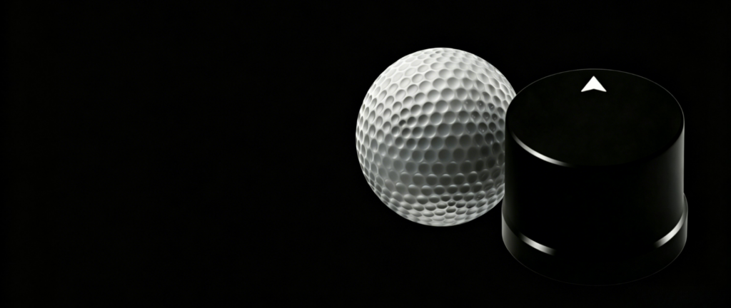
If you’re ready to integrate steady, high‑performance RTK positioning into your drone or robotic navigation project, the HM‑D20 module delivers professional industrial‑grade performance within a compact, rugged package. It fully integrates a high‑sensitivity GNSS receiver and built‑in helical antenna, removing the need for separate external antenna hardware and simplifying system assembly. Key functional features and specifications include:
- RTK positioning precision: Horizontal 1 cm + 1 ppm, Vertical 1.5 cm + 1 ppm
- Full multi‑constellation support for GPS L1/L5, BeiDou B1/B2A/B2I, GLONASS G1, Galileo E1/E5
- Ultra‑light 20‑gram weight with compact Φ44×37 mm dimensions, ideal for lightweight drone payload integration
- Standard NMEA 0183 output, RTCM correction input, and TTL UART interface for seamless system communication
- IP67‑rated waterproof construction with an extreme operating temperature range of ‑40℃ to 85℃
- Plug‑and‑play compatibility with PX4, ArduPilot, and other widely used open‑source flight controllers
Engineered specifically for drones, mobile robots, and autonomous navigation systems, the HM‑D20 maintains consistent centimeter‑level positioning accuracy even under harsh field conditions. Its straightforward integration process and robust performance give operators full confidence to execute complex, long‑term commercial drone missions reliably day after day.
Learn more about the HM‑D20 Helical Antenna RTK Module: https://myrobotproject.com/product/helical‑antenna‑rtk‑module‑hm‑d20/