


Small Cheap LiDAR Sensors for Robots & Drones: How to Choose a Compact dToF Module Without Sacrificing Performance
Finding small cheap lidar sensors for robots and drones is not just about grabbing the lowest-price module you can find online. Here’s the deal: in real robotics work, a “cheap” sensor that gives unstable range data, has a narrow field of view, lacks usable software support, or cannot talk cleanly to your controller will cost you more in failed prototypes than it ever saved on the purchase order.
For compact AMRs, UAVs, inspection devices, smart cameras, security systems, and education robots, the right LiDAR module has to balance size, weight, power draw, ranging accuracy, outdoor behavior, point cloud output, and platform compatibility. In the shop, those tradeoffs matter. A sensor that looks good on a datasheet can still be a headache if it does not mount cleanly, stream data reliably, or survive the lighting conditions your machine actually sees.
Table of Contents
- 👉 What Are Small Cheap LiDAR Sensors?
- 👉 Why Compact LiDAR Matters for Robots and Drones
- 👉 How dToF LiDAR Works
- 👉 Key Specs to Compare Before Buying Small Cheap LiDAR Sensors
- 👉 Indoor vs Outdoor LiDAR Performance
- 👉 Robotics Applications for Compact dToF LiDAR
- 👉 Drone and UAV Applications
- 👉 Interface and Software Integration
- 👉 Product Example: DTOF Solid State LiDAR HM-LD1
- 👉 How to Choose the Right Small Cheap LiDAR Sensor
- 👉 Common Mistakes When Buying Budget LiDAR Modules
- 👉 FAQ About Small Cheap LiDAR Sensors
- 👉 Conclusion: Choosing Cost-Effective LiDAR Without Sacrificing Performance
What Are Small Cheap LiDAR Sensors?
Small cheap LiDAR sensors are compact, cost-effective distance or depth-sensing modules used in robots, drones, embedded devices, cameras, security systems, and automation equipment. In engineering terms, “small” usually means a manageable mechanical footprint, low weight, and reasonable power consumption. “Cheap” should mean cost-effective across the whole development cycle, not flimsy, undocumented, or unsuitable for deployment.
Look, the demand for these sensors has grown because modern machines need environmental perception without carrying a large rotating scanner or a high-end industrial 3D sensor. A delivery robot may need a front-facing obstacle sensor. A UAV may need downward range data for altitude hold. A smart camera may need depth information for user presence detection. An inspection device may need reliable standoff measurement where sending a person is unsafe, slow, or expensive.
Full LiDAR setups are powerful — but often too heavy, too complex, or just …
Defining “Small” in LiDAR Modules
A small LiDAR sensor is usually a board-level or compact enclosed module designed to fit inside another product. Mechanical size affects enclosure design, field-of-view placement, cable routing, mounting brackets, weather protection, heat management, and service access. A module that looks inexpensive but requires a custom optical window, tricky alignment fixture, or oversized bracket can quietly raise the real mechanical cost of the project.
For drones, every gram matters because payload mass directly affects flight time, stability, and safety margin. For robots, the sensor footprint affects bumper geometry, chassis height, blind spots, and mounting angle. For embedded products, a compact sensor can be the difference between a clean industrial enclosure and a bulky prototype that never scales into production.
Defining “Cheap” Without Compromising the Project
In industrial engineering, cheap should be read as low total cost of ownership. The purchase price is only one line item. A low-price module without SDKs, documentation, stable firmware, or suitable interfaces can burn weeks of engineering time. A more cost-effective LiDAR sensor reduces integration risk while still meeting the sensing job.
When evaluating small cheap lidar sensors, compare the full project impact: sensor price, integration time, interface compatibility, SDK availability, calibration needs, mounting complexity, environmental stability, and vendor support. A sensor that supports your preferred controller and operating system may be far less expensive in real terms than a lower-cost module that forces your team to write drivers from scratch.
Main Types of Compact LiDAR Sensors
Compact LiDAR products generally fall into several practical categories. Single-point ToF sensors provide one distance value and work for basic proximity detection. 2D scanning LiDAR sensors sweep a laser line across a plane and are common in indoor navigation and planar SLAM. 3D solid-state LiDAR modules provide depth information without a rotating mechanism. dToF depth modules use direct Time-of-Flight principles to generate depth maps and, in many cases, point cloud data. Flash LiDAR or array-based ToF sensors capture depth across a field of view, making them useful for compact robots and smart devices.
For background on the physics of time-based distance measurement, see this overview of Time of Flight.
Why Compact LiDAR Matters for Robots and Drones
Compact LiDAR matters because robotics and UAV designs are constrained by space, weight, power, processor capability, and safety requirements. A sensor is not useful just because it can measure distance on a bench. It must fit the machine, survive the operating environment, communicate with the controller, and provide data quickly enough for the control loop.
Space Constraints in Mobile Robots
AMRs, AGVs, service robots, delivery robots, warehouse robots, inspection robots, and education robots often have limited front-panel and side-panel space. A large sensor may create blind spots, interfere with bumpers, or require a raised mounting tower that changes the robot’s center of gravity. Compact solid-state modules let designers place depth sensors closer to the actual viewing angle they want.
Small LiDAR sensors can also complement cameras, IMUs, wheel encoders, ultrasonic sensors, and 2D LiDAR. In many systems, the dToF sensor is not the only perception device. It is part of a multi-sensor stack. A compact depth module can cover near-field obstacles, detect people or boxes, or provide a confidence layer when visual perception is degraded by low texture, poor lighting, glare, or shadows.
Weight Constraints in UAVs and Drones
For UAVs, a compact LiDAR module in the 28g class is attractive because payload weight affects endurance and maneuverability. A heavy scanning sensor may be acceptable on a large industrial UAV, but it can be impractical for smaller drones used in education, inspection, agriculture, and prototyping. Solid-state modules are easier to mount on fixed frames or lightweight payload assemblies because they avoid rotating mechanical parts.
Drone applications include altitude hold, terrain following, obstacle detection, and approach assistance. A downward-facing LiDAR can support low-altitude stabilization, while a forward-facing or angled module can support obstacle awareness. The sensor still needs to be tested under vibration, sunlight, changing surface reflectivity, and variable flight angles. That is where many early prototypes either prove themselves or fall apart.
Power Budget and Embedded Design
Power consumption is often overlooked during early prototyping. A LiDAR module that consumes several watts may require additional power regulation, heat dissipation, and battery capacity. Low-power modules in the 1W to 2W class are valuable for battery-powered robots and drones because they reduce thermal load and preserve runtime.
For example, a 1.2W compact dToF module is easier to integrate into embedded devices than a larger perception system that requires dedicated thermal management. Engineers still need to verify power rail stability, startup behavior, cable length, EMI, enclosure temperature, and shutdown behavior. But a low-power module gives the design more room to breathe.
For a deeper robotics-focused overview, read our guide on dToF LiDAR for robotics and compact 3D sensing modules.
How dToF LiDAR Works
dToF stands for direct Time-of-Flight. The basic principle is straightforward: the sensor emits a light pulse, the pulse reflects from an object, and the receiver measures how long it takes for the light to return. Because the speed of light is known, the sensor estimates distance from the round-trip travel time.
Direct Time-of-Flight Explained
Conceptually, distance equals the speed of light multiplied by the round-trip time, divided by two. The division by two matters because the light travels from the sensor to the object and then back to the sensor. In practice, the timing intervals are extremely short, so a useful dToF sensor requires precise emission control, sensitive photon detection, accurate timing circuitry, and good signal processing.
For industrial users, the practical point is that dToF provides direct distance measurement rather than relying only on image texture or stereo matching. That makes it useful in scenes where conventional cameras may struggle, such as plain walls, low-texture surfaces, changing ambient lighting, or scenes with strong shadows.
SPAD-Based dToF Sensing
SPAD means single-photon avalanche diode. SPAD detectors are highly sensitive devices capable of detecting very small amounts of returned light. In a dToF LiDAR module, SPAD technology supports photon detection and timing measurement across multiple pixels or zones. The result can be a depth image that shows the distance to objects across a field of view.
This makes SPAD dToF attractive for compact 3D sensing modules. It can deliver useful depth information without requiring a large mechanical scanning assembly. For robots and UAVs, that can reduce size, weight, mechanical complexity, and integration cost.
Depth Map vs Point Cloud
A depth map is a two-dimensional grid where each pixel or zone contains a distance value. It is useful for fast obstacle detection because the system can determine whether an object exists within a certain distance zone. A point cloud is a 3D representation of measured surfaces, usually expressed as coordinates. Point clouds are useful for perception, object estimation, spatial analysis, and some mapping-related workflows.
Robots may use depth maps for quick local obstacle avoidance and point clouds for richer perception. The right format depends on the processor, software stack, bandwidth, and required control behavior. A compact module that can provide both depth data and point cloud data gives engineers more flexibility during prototyping.
Solid-State LiDAR vs Mechanical Scanning LiDAR
| Feature | Solid-State dToF LiDAR | Mechanical Scanning LiDAR |
|---|---|---|
| Moving parts | No rotating scanner | Rotating or oscillating parts |
| Size | Usually compact | Often larger |
| Weight | Lower | Higher |
| Cost position | Often cost-effective for embedded use | Often higher for dense scanning applications |
| Typical output | Depth image and point cloud | 2D or 3D scan |
| Best for | Compact robots, drones, embedded vision | Long-range mapping or wide-area scanning |
For more about dToF sensing reliability in obstacle detection, see dToF technology for reliable obstacle sensing.
Key Specs to Compare Before Buying Small Cheap LiDAR Sensors
The best way to choose small cheap lidar sensors is to compare specifications in the context of the application. A sensor that is excellent for user presence detection may not be suitable for high-speed outdoor navigation. A sensor that works well on a slow indoor robot may need additional fusion and safety logic on a fast UAV.
Ranging Capability
Indoor and outdoor range should be evaluated separately. Indoor range is usually longer because ambient light is controlled and surfaces are easier to detect. Outdoor range is affected by sunlight, target reflectivity, target size, surface angle, and optical noise. For indoor robots, reliable short-to-mid range may be more important than maximum range. For drones and outdoor inspection devices, stable outdoor daytime ranging is often critical.
Ranging Accuracy
Ranging accuracy describes how close the measured distance is to the true distance. A specification such as ±3cm can be useful for obstacle avoidance, approach behavior, docking support, drone height control, object detection, and volume estimation. Accuracy still has to be judged together with repeatability, frame stability, minimum range, surface material, and environmental conditions.
For control engineers, the practical question is not only “How accurate is the sensor?” The better question is “How much safety margin do I need?” A robot approaching a docking station may use accurate range data to slow down and align. A drone flying close to uneven terrain must consider sensor latency, frame rate, vehicle speed, and control loop response.
Field of View
Field of view determines how much of the scene the sensor can observe at one time. This is especially important for compact solid-state LiDAR because the sensor is not mechanically sweeping across a full 360-degree environment. A wide FOV helps detect obstacles without adding moving parts. A narrow FOV may be better for focused distance measurement, but it can miss side obstacles.
For the HM-LD1 reference module, the field of view is 60° horizontal by 45° vertical. The horizontal field helps cover walls, boxes, furniture, people, pallets, and side objects. The vertical field helps detect floors, ramps, steps, hanging objects, terrain changes, and objects at different heights.
Resolution
Resolution determines how many depth measurement points are available across the field of view. Higher resolution provides more spatial detail, but it may increase data bandwidth, processing load, and cost. Lower resolution can still be useful when the application requires obstacle zones, distance estimation, presence detection, or terrain following rather than dense mapping.
The HM-LD1 provides 40 × 30 depth resolution. That is suitable for compact obstacle detection, presence detection, terrain following, basic 3D perception, and embedded sensing. It should not be treated as a replacement for every high-density mapping LiDAR in every application, especially where dense long-range point clouds are required.
Frame Rate
Frame rate matters because the environment and the robot may be moving. A 10fps sensor provides ten updates per second. That may be adequate for slow indoor robots, presence detection, approach control, and many embedded perception tasks. Faster drones or vehicles require careful analysis of speed, stopping distance, processing latency, and control loop behavior.
When choosing a budget LiDAR module, do not evaluate frame rate alone. A fast but noisy sensor may be less useful than a stable sensor with a lower update rate. The real metric is whether the complete system can detect, classify, and respond to obstacles in time.
Interface Options
| Interface | Best For | Notes |
|---|---|---|
| UART | Embedded controllers, flight controllers, microcontrollers | Simple and low overhead |
| UDP | Ethernet-based systems, Linux computers, robotics middleware | Useful for streaming depth or point cloud data |
| UVC | PC, Raspberry Pi, vision pipelines | Camera-like integration model in compatible systems |
SDK and Platform Support
SDK support can be the difference between a weekend prototype and a long integration project. Look for support for x86 Windows, x86 Linux, ARM Linux, Raspberry Pi-class platforms, embedded Linux systems, and industrial computers. If you plan to use ROS, OpenCV, or custom middleware, confirm whether the vendor provides drivers, examples, data format documentation, or sample code that can be wrapped into your application.
Indoor vs Outdoor LiDAR Performance
One of the most common mistakes when buying small cheap lidar sensors is assuming that indoor range equals outdoor range. Many low-cost sensors perform well in controlled indoor environments but degrade outdoors under strong sunlight. Outdoor performance depends on optical design, emitted signal strength, receiver sensitivity, filtering, signal processing, target reflectivity, and environmental conditions.
Why Sunlight Reduces LiDAR Range
Sunlight adds background photons that compete with the sensor’s returned signal. This reduces signal-to-noise ratio and can make weak reflections harder to detect. Direct sunlight, high ambient illumination, and reflective surroundings may all affect measurement stability. Good optical filtering and robust signal processing help, but outdoor range is still typically shorter than indoor or nighttime range.
Target Reflectivity and Surface Angle
Different surfaces return different amounts of light. A white wall is usually easier to detect than black rubber. Glossy surfaces may create specular reflections that send light away from the receiver. Glass and transparent obstacles can be difficult because light may pass through, reflect unpredictably, or create multiple returns. Angled surfaces can reduce the amount of reflected energy returning to the sensor. Thin objects such as chair legs, cables, or wires may be missed if they occupy too little of the sensor’s field.
What “Outdoor 8m” Means in Practice
For the HM-LD1, the specified outdoor ranging capability is 0.2m to 8m, while indoor ranging capability is 0.5m to 25m. Outdoor 8m can support obstacle detection, inspection distance measurement, terrain following, and object approach assistance when the system is designed with appropriate margins. It should not be read as a guarantee that every object will be detected at 8m under every sunlight, angle, and material condition.
Application Safety Margins
Engineers should avoid designing a system that depends on operation at the absolute maximum range. If a sensor claims 8m outdoor range, the control system should include braking margin, confidence thresholds, redundant sensing where needed, and behavior for uncertain measurements. Safety-critical systems require system-level validation rather than relying on one sensor specification.
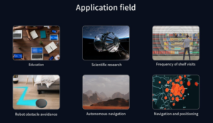
Robotics Applications for Compact dToF LiDAR
Compact dToF LiDAR modules are valuable in robotics because they can provide depth perception without the size and mechanical complexity of larger scanning systems. They are especially useful for near-field awareness, local obstacle detection, docking support, inspection, and embedded perception.
Obstacle Avoidance
Obstacle avoidance is one of the most common applications for small cheap lidar sensors. A robot can use depth data to detect people, boxes, walls, pallets, furniture, machinery, doors, and unexpected objects. A wide field of view helps the robot detect obstacles across a broader scene instead of relying on a single beam.
Navigation and Local Planning
Depth data can support local path planning by identifying occupied regions in front of the robot. A compact dToF sensor can complement wheel odometry, IMU data, cameras, and 2D LiDAR. In indoor mobile robots, the depth sensor may help the robot slow down, stop, turn, or select a safer route around near-field obstacles.
SLAM Support
Not all LiDAR sensors are intended to be full SLAM sensors. A low-resolution dToF module may not replace a high-density mapping LiDAR for every navigation system. However, it can support perception, obstacle layers, near-field sensing, and environmental awareness. For compact robots, this can be a practical balance between cost, size, and functionality.
Docking and Approach Control
Docking requires controlled approach behavior. A robot approaching a charger, workstation, rack, or machine interface needs reliable short-range distance information. A compact depth module with centimeter-level accuracy can help the robot slow down and align more intelligently, especially when combined with markers, cameras, mechanical guides, or odometry.
Smart Inspection Robots
Inspection robots may need to measure distances to objects or structures that are difficult or unsafe for people to approach. Examples include bridges, expressways, dams, tunnels, industrial facilities, and warehouses. A compact dToF module can help inspection equipment estimate distance, detect obstacles, maintain standoff spacing, or provide depth context for cameras and other sensors.
To understand how dToF acts as an “invisible eye” for 3D perception, see dToF: the invisible eye seeing the 3D world.
Drone and UAV Applications
Drones and UAVs are highly sensitive to sensor size, weight, power consumption, and outdoor performance. A small LiDAR sensor can provide valuable ranging data without forcing the airframe to carry a large payload. This is important for compact UAVs, education drones, inspection drones, mapping assistance platforms, and agricultural systems.
Altitude Hold
A downward-facing LiDAR can help a drone estimate height above the ground, especially at low altitude. This can improve stability during takeoff, landing, hovering, and close-to-ground operation. Compared with relying only on barometric pressure or visual estimates, direct distance measurement can provide more immediate ground-relative information.
Terrain Following
Terrain following is useful in agriculture, inspection, survey assistance, and uneven outdoor environments. A compact dToF LiDAR can help the UAV estimate the distance to the surface below or ahead. Engineers should test terrain-following behavior across grass, soil, concrete, reflective materials, slopes, and changing sunlight conditions.
Obstacle Detection
Forward-facing or angled LiDAR mounting can support obstacle detection. The field of view must match the flight path and expected obstacle size. For high-speed flight, frame rate and processing latency become critical. For slower inspection drones, a compact solid-state module can provide useful awareness for walls, beams, equipment, terrain, or large objects.
Lightweight Payload Design
A 28g-class LiDAR module helps preserve flight time compared with heavier scanning sensors. Lightweight payload design also simplifies mounting, reduces vibration stress, and improves the feasibility of using smaller airframes. However, the complete payload must include cables, brackets, protection, power regulation, and any processing board required by the application.
Outdoor Daytime Ranging
Outdoor ranging must be validated under sunlight. UAV projects should test the sensor during the actual expected operating time, altitude, angle, and surface condition. Bright concrete, dark soil, vegetation, metal roofs, water, glass, and shadows can all affect readings. A cost-effective LiDAR sensor is one that remains useful in the operating conditions that matter to the mission.
Interface and Software Integration
Software integration is one of the biggest hidden costs in LiDAR selection. A sensor that supports multiple interfaces gives engineers more freedom to prototype on one platform and deploy on another. The best small cheap lidar sensors are not only compact and affordable; they are also practical to connect, configure, and process.
UART for Embedded Control
UART is a familiar interface for microcontrollers, embedded controllers, and many flight control systems. It is simple, widely supported, and suitable for applications where the data rate and message format are manageable. For basic distance data, status information, or simplified measurement outputs, UART can reduce development complexity.
UDP for Robotics Computers
UDP is useful for Linux computers, Ethernet-based systems, and robotics controllers that need to stream depth or point cloud data. UDP can fit well into embedded Linux platforms and industrial computers. Engineers should confirm packet format, bandwidth needs, timestamp behavior, dropped-packet handling, and synchronization requirements.
UVC for Vision-Like Workflows
UVC can allow a depth module to behave more like an imaging device in compatible systems. This can be useful for PC, Raspberry Pi, and vision-style workflows. If your application uses camera pipelines, UVC support may reduce integration time. Engineers should still confirm frame format, resolution, frame rate, and how depth values are encoded.
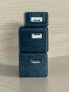
SDKs for Windows, Linux, and ARM Linux
SDK availability is important for prototyping and deployment. Support for x86 Windows helps PC-based evaluation. x86 Linux support is useful for robotics development stations and industrial computers. ARM Linux support is important for Raspberry Pi-class systems, embedded AI computers, and compact robots. MRP offers SDKs for x86 Windows, x86 Linux, and ARM Linux for the HM-LD1 module.
ROS, OpenCV, and Middleware Considerations
When evaluating ROS or OpenCV workflows, confirm whether the vendor provides drivers, SDK examples, frame format documentation, or sample code that can be wrapped into your robotics middleware. Avoid assuming that every LiDAR module has production-ready ROS support. Integration planning should include data conversion, coordinate frames, calibration, filtering, confidence handling, and application-specific safety behavior.
For broader positioning and navigation technology context, visit Bynav Technology.
Product Example: DTOF Solid State LiDAR HM-LD1
The DTOF Solid State LiDAR HM-LD1 is a compact SPAD dToF-based 3D sensing module designed for robots, drones, embedded vision devices, security systems, smart cameras, inspection equipment, and development platforms. It outputs real-time depth images and point cloud data, supporting distance detection, obstacle avoidance, autonomous navigation, altitude hold, terrain following, object recognition, volume measurement, and zone intrusion monitoring.
This module is positioned for teams that need cost-effective 3D sensing in a compact package. Its 28g weight, 1.2W power consumption, 60° by 45° FOV, UART/UDP/UVC interfaces, and SDK support for x86 Windows, x86 Linux, and ARM Linux make it practical for prototyping and embedded deployment. In my experience, those integration details are often just as important as raw ranging specifications.
View DTOF Solid State LiDAR HM-LD1
| Product Name | DTOF Solid State LiDAR HM-LD1 – DTOF SSL |
|---|---|
| Technology | SPAD dToF solid-state LiDAR |
| Dimension | 43.5mm × 30mm × 26.5mm |
| Weight | 28g |
| Indoor Ranging Capability | 0.5–25m |
| Outdoor Ranging Capability | 0.2–8m |
| Ranging Accuracy | ±3cm |
| Field of View | 60° horizontal × 45° vertical |
| Resolution | 40 × 30 |
| Frame Rate | 10fps |
| Interface | UART / UDP / UVC |
| Operating Temperature | -20℃ to 60℃ |
| Power Consumption | 1.2W |
| SDK Support | x86 Windows, x86 Linux, ARM Linux |
| Typical Applications | Robot navigation, obstacle avoidance, UAV altitude hold, terrain following, inspection, presence detection, object recognition, volume measurement, zone intrusion monitoring |
| Product Page | DTOF Solid State LiDAR HM-LD1 |
| Brochure | Download DTOF SSL HM-LD1 Product Brochure |
View Product Details & Pricing ➔
The HM-LD1 is described as suitable for point cloud and depth map output. An example use case is ranging measurement data displayed as point cloud and depth data. Its measurement range is useful for measuring distances to objects that are difficult for people to approach, including bridges, expressways, and dams. The product’s compact and lightweight housing supports integration into autonomous mobile robots with limited space for depth sensors and drones where weight affects flight distance.
Note for mechanical engineers: use the official table dimension of 43.5mm × 30mm × 26.5mm for preliminary evaluation. If other marketing material references a different housing size, check the latest mechanical drawing or datasheet before final enclosure design, mounting hole placement, cable routing, or optical window design.
How to Choose the Right Small Cheap LiDAR Sensor
Choosing the right compact LiDAR should begin with the sensing task, not the price list. The most cost-effective module is the one that provides enough data for the application while fitting mechanical, electrical, software, and environmental constraints.
Step 1 — Define the Sensing Task
⚙️ Decide whether you need single-point distance, a depth map, or a 3D point cloud. Obstacle avoidance, docking, inspection, altitude hold, user presence detection, object recognition, and volume measurement all have different requirements. If the target is moving, frame rate and latency become more important. If the task is detection rather than detailed mapping, a compact depth module may be more cost-effective than a high-density scanner.
Step 2 — Define Range Requirements
⚙️ Specify minimum detection range, maximum useful range, indoor range, outdoor range, and safety margin. Do not choose only by maximum range. A warehouse robot may need reliable detection from 0.5m to 5m more than a theoretical long-range number. A UAV may need stable outdoor performance in bright light. Control systems should be designed around useful reliable range, not ideal laboratory maximums.
Step 3 — Define Mechanical Limits
⚙️ Measure the available mounting space, weight limit, vibration environment, cable routing, and lens protection needs. Consider whether the sensor will be behind a transparent cover or exposed. Protective windows can introduce reflection, signal loss, or contamination. For outdoor or industrial equipment, also consider dust, moisture, cleaning, and service access.
Step 4 — Define Processing Platform
⚙️ Identify whether the sensor will connect to a microcontroller, flight controller, Raspberry Pi, ARM Linux board, industrial PC, or embedded AI computer. This decision affects interface choice, SDK requirements, power design, and data processing. UART may be ideal for simple embedded control, while UDP or UVC may be better for depth streaming and vision pipelines.
Step 5 — Validate in Real Conditions
⚙️ Test the sensor with dark targets, bright targets, reflective surfaces, transparent obstacles, angled objects, moving people, vibration, sunlight, and temperature variation. If the system is a robot, test at actual driving speed and braking distance. If it is a drone, test with real vibration, flight angle, and outdoor illumination. Production readiness depends on stable performance across the complete operating environment.
Common Mistakes When Buying Budget LiDAR Modules
Budget LiDAR selection often fails when buyers compare only headline specifications. A low-cost module can be an excellent engineering choice, but only if it fits the full system. The following mistakes are common in robotics, UAV, and embedded sensing projects.
Mistake 1 — Choosing Only by Maximum Range
✅ Maximum range is usually measured under specific conditions. It does not guarantee stable operation on every surface, in every lighting condition, or at every mounting angle. Engineers should compare useful range, minimum range, accuracy, repeatability, and confidence behavior.
Mistake 2 — Ignoring Outdoor Sunlight Performance
✅ Many low-cost modules work well indoors but lose stability outdoors. If the application includes outdoor inspection, UAV flight, construction environments, or sunlight through windows, test outdoor performance early. Do not wait until mechanical design is complete to discover that the sensor cannot handle the lighting environment.
Mistake 3 — Ignoring Field of View
✅ A long-range sensor with a narrow FOV may miss important obstacles. Field of view must match mounting height, vehicle speed, obstacle size, and required detection zone. For compact robots and drones, a wider FOV can reduce blind spots without adding mechanical scanning.
Mistake 4 — Forgetting Software Integration
✅ A cheap module without SDKs or documentation can cost more in engineering labor than a better-supported module. Before purchasing, verify interfaces, operating system support, data format, sample code, and vendor support. If possible, test the sensor on the actual target platform before committing to production design.
Mistake 5 — Assuming All LiDAR Is Suitable for SLAM
✅ Some LiDAR modules are excellent for obstacle avoidance and local perception but are not intended to replace high-density mapping sensors. If your main requirement is full SLAM, compare scan pattern, resolution, range, field of view, update rate, driver support, and mapping software compatibility. For compact perception tasks, a dToF module may still be the best cost-effective option.
FAQ About Small Cheap LiDAR Sensors
Where can I find a cheap but effective LiDAR sensor for robotics?
Is there a small LiDAR sensor suitable for drones or lightweight UAV projects?
What budget LiDAR should I choose for indoor SLAM and localization?
Are cheap LiDAR sensors accurate enough for obstacle avoidance?
What is the difference between dToF LiDAR and ordinary ToF distance sensors?
How important is field of view when choosing small cheap LiDAR sensors?
Can compact dToF LiDAR work outdoors?
What interfaces should I look for in a LiDAR module?
Is a compact solid-state LiDAR better than a mechanical scanning LiDAR?
What should I test before using a small LiDAR sensor in production?
Conclusion: Choosing Cost-Effective LiDAR Without Sacrificing Performance
The best small cheap lidar sensors are not simply the lowest-priced modules. They are compact, efficient, accurate, stable enough for the intended environment, and easy to integrate into real systems. For robots and drones, buyers should prioritize ranging capability, accuracy, FOV, resolution, frame rate, interfaces, SDK support, mechanical size, weight, power consumption, and environmental robustness.
If you are developing a compact robot, UAV, inspection device, smart camera, or embedded 3D sensing system, the DTOF Solid State LiDAR HM-LD1 offers a lightweight SPAD dToF module with depth map and point cloud output, UART/UDP/UVC interfaces, 28g weight, 1.2W power consumption, and SDK support for Windows, Linux, and ARM Linux platforms.
View HM-LD1 Product Page
Download Product Brochure
📚 References & Further Reading
- Industry Standard: Time of Flight overview
- Related Guide: dToF LiDAR for robotics and compact 3D sensing modules






