


LiDAR vs Radar for Robotics: Which Sensor Delivers Better Navigation, Obstacle Avoidance, and 3D Perception?
Here’s the deal: robots rarely fail because a motor is too weak or a processor is too slow. They fail when they misread the world around them. In warehouses, factories, outdoor inspection routes, UAV corridors, and autonomous mobile robot deployments, perception quality decides whether a machine can see a pallet edge, avoid a glass partition, follow uneven terrain, hold altitude, or build a stable 3D map. That is why the lidar vs radar discussion is not just a sensor comparison. It is a decision about navigation accuracy, obstacle avoidance reliability, environmental resilience, integration complexity, and overall system safety.
Radar has earned its reputation for long-range detection and harsh-weather performance. LiDAR, on the other hand, is widely used for high-resolution depth sensing, SLAM, robotic mapping, and precise free-space understanding. Look, both technologies are useful. The real question is not which one sounds better on a spec sheet. The real question is which sensor gives your robot the kind of information it needs at the exact moment the control system has to make a decision.
In the shop, that difference matters. A robot does not just need to know that “something” is nearby. It needs to know whether that object is a wall, a human leg, a pallet fork, a hanging cable, a glass panel, a dock edge, or a moving vehicle. Sometimes the robot needs dense geometry. Sometimes it needs velocity. Sometimes it needs both, plus vision, IMU, and GNSS data to keep the autonomy stack honest.
Three Core Advantages — Elevating Perception Capability
This guide breaks down how LiDAR and radar work, where each sensor performs best, how they compare in 3D perception, and when a compact solid-state dToF LiDAR module such as the DTOF Solid state LiDAR HM-LD1 becomes the more practical choice for robotics development. We will also look at stereo vision as a complementary technology, because a serious robotics platform usually benefits from more than one way of seeing the world.
Table of Contents
- 👉 Quick Answer: LiDAR vs Radar for Robotics
- 👉 What Is LiDAR?
- 👉 What Is Radar?
- 👉 How LiDAR Works in Robotics
- 👉 How Radar Works in Robotics
- 👉 Navigation Accuracy Comparison
- 👉 Obstacle Avoidance: LiDAR vs Radar
- 👉 3D Perception and Mapping
- 👉 Environmental Performance
- 👉 Range, Resolution, Accuracy, and Frame Rate
- 👉 Sensor Fusion with Vision, IMU, GNSS, and Radar
- 👉 Best Sensor by Robotics Use Case
- 👉 Product Example: HM-LD1 dToF Solid-State LiDAR
- 👉 Complementary Product: Stereo Vision Camera RoboBaton Mini
- 👉 How to Choose Between LiDAR, Radar, and Vision
- 👉 FAQ: LiDAR vs Radar
Quick Answer: LiDAR vs Radar for Robotics
LiDAR uses laser light to measure distance and generate high-resolution depth data. Radar uses radio waves to detect objects, estimate distance, and measure relative velocity. In robotics, LiDAR is usually the better fit for detailed navigation, close-range obstacle avoidance, SLAM, 3D mapping, zone detection, docking, and object geometry. Radar is usually the better fit for rain, fog, dust, smoke, long-range awareness, and speed measurement.
The practical answer is simple. Use LiDAR when spatial detail matters. Use radar when environmental robustness and motion detection matter. Use sensor fusion when the robot is safety-critical, expensive, fast-moving, or operating around people. For compact robot navigation and depth sensing, a solid-state dToF module such as the DTOF Solid state LiDAR HM-LD1 can provide a direct path to real-time depth maps and point cloud output. If your team is comparing time-of-flight technologies, this iToF vs dToF guide is also useful for understanding how direct time-of-flight differs from indirect time-of-flight in robotic perception.
| Requirement | Better Fit | Reason |
|---|---|---|
| 3D mapping and SLAM | LiDAR | Higher spatial resolution and point cloud detail |
| Rain, fog, dust, smoke | Radar | Radio waves penetrate atmospheric interference better |
| Close-range obstacle avoidance | LiDAR | More accurate object edges and free-space detection |
| Long-range speed detection | Radar | Direct Doppler velocity measurement |
| Autonomous robot navigation | LiDAR or fusion | LiDAR supports mapping; fusion improves robustness |
What Is LiDAR?
LiDAR Definition for Robotics
LiDAR stands for Light Detection and Ranging. It emits laser pulses or modulated light and measures the returned signal to calculate distance. In robotics, LiDAR is used to create depth maps, 2D scans, 3D point clouds, occupancy grids, and spatial models that help machines navigate, avoid obstacles, estimate free space, and understand their surroundings. Unlike a passive camera, LiDAR is an active sensor, so it provides its own illumination and can work in dark environments where visible-light imaging may fail.
Why LiDAR Matters in Industrial Robots
Industrial robots need reliable geometry. An AMR must know the boundary of an aisle, the position of a pallet, the location of a charging dock, and the clearance around a human worker. A UAV may need accurate altitude hold, terrain following, or obstacle detection while flying near shelves, bridges, roofs, dams, tunnels, or inspection targets. A smart inspection robot may need point cloud data for surface measurement or safe path planning near infrastructure that is difficult or dangerous for people to approach.
In the shop, this comes down to usable shape data. LiDAR gives the robot a measurable picture of space. It helps answer questions such as: How far away is the object? Where are its edges? Is the path clear? Is the floor rising? Is there enough clearance to pass? That is why LiDAR remains one of the most trusted sensing technologies for mobile robots, drones, warehouse automation, industrial inspection, mapping systems, and embedded perception platforms.
Common LiDAR Types
Robotics teams may choose from mechanical spinning LiDAR, MEMS LiDAR, flash LiDAR, solid-state LiDAR, dToF LiDAR, and iToF LiDAR. Mechanical LiDAR can provide broad scanning coverage, but it often adds size, weight, moving parts, and system complexity. Solid-state LiDAR is attractive for embedded robotics because it can reduce mechanical complexity while enabling compact integration. dToF LiDAR measures the direct travel time of light, while iToF estimates distance from phase shift. For a deeper comparison, see this guide to iToF vs dToF.
In compact robotics, dToF LiDAR is especially attractive because it can deliver depth information without the size, power draw, and moving assemblies associated with some traditional scanning systems. That makes it useful in drones, mobile robots, service robots, research platforms, embedded vision devices, and industrial automation equipment where space and weight are tightly constrained.
What Is Radar?
Radar Definition for Robotics
Radar stands for Radio Detection and Ranging. It transmits radio-frequency waves and analyzes reflected signals to estimate range, angle, and velocity. Many robotic radar systems use frequency-modulated continuous wave technology to measure distance and speed. Radar has been widely adopted in automotive safety, outdoor monitoring, collision warning, and autonomous systems because radio waves can remain usable when optical sensors are degraded by rain, fog, smoke, dust, or darkness.
Why Radar Is Used in Autonomous Systems
Radar is strong when the main question is whether a large object is present, how far away it is, and whether it is moving toward or away from the robot. This makes radar useful for long-range object detection, relative motion measurement, forklift collision warning, industrial vehicle safety, outdoor perimeter monitoring, and large autonomous platforms. Radar also pairs well with positioning and navigation systems in outdoor autonomy stacks. When discussing autonomous navigation, GNSS, positioning, and sensor integration, companies such as Bynav Technology show how navigation technology fits into broader autonomy ecosystems.
Radar Limitations in Robotics
Radar is powerful, but it is not a universal replacement for LiDAR. It usually has lower angular resolution than LiDAR, which means it is less effective at describing exact object shape, narrow edges, small obstacles, and detailed surface geometry. Radar can also experience multipath reflections around metal racks, machinery, vehicles, and structural steel, which are common in industrial environments. For close-range SLAM, detailed docking, volume measurement, fine obstacle avoidance, and free-space mapping, radar data is often less intuitive and less dense than LiDAR point cloud data.
That does not make radar weak. It just means radar answers a different kind of question. Radar is excellent at telling a robot that something is out there and that it may be moving. LiDAR is better at telling the robot exactly what nearby space looks like. A good engineering team treats those as complementary capabilities instead of forcing one sensor to do every job.
How LiDAR Works in Robotics
Time-of-Flight Measurement
LiDAR calculates distance by measuring how long emitted light takes to travel to an object and return to the receiver. With direct time-of-flight, the sensor measures the direct time delay between emitted and returned photons. SPAD-based dToF modules are designed to detect very small light signals, enabling compact depth sensing in robots, drones, inspection platforms, and embedded systems. This principle gives LiDAR its strength in robotic geometry: every valid return becomes a distance measurement that can be used for mapping, obstacle avoidance, or control.
From Distance Measurements to Point Clouds
Each LiDAR measurement becomes a depth value. Multiple measurements across a field of view form a depth image, and depth images can be transformed into point clouds. These point clouds represent physical space in 3D coordinates. Robotics software can then perform obstacle detection, ground segmentation, object clustering, free-space estimation, volume measurement, localization, and motion planning. In an industrial warehouse, point clouds can describe pallets, racks, walls, doors, forklifts, charging stations, and human workers. In outdoor inspection, they can describe bridge surfaces, road edges, terrain changes, or structural features.
Field of View, Resolution, and Frame Rate
Field of view, resolution, frame rate, and accuracy strongly affect the performance of a LiDAR system. A wider field of view helps a robot see more of its surroundings. Higher resolution captures finer object geometry. Higher frame rate gives the control system more frequent updates, which matters when a drone, AMR, or inspection robot is moving. Accuracy determines how confidently a robot can estimate distance, define stop zones, dock with equipment, avoid collision, or maintain altitude.
Product Integration Example
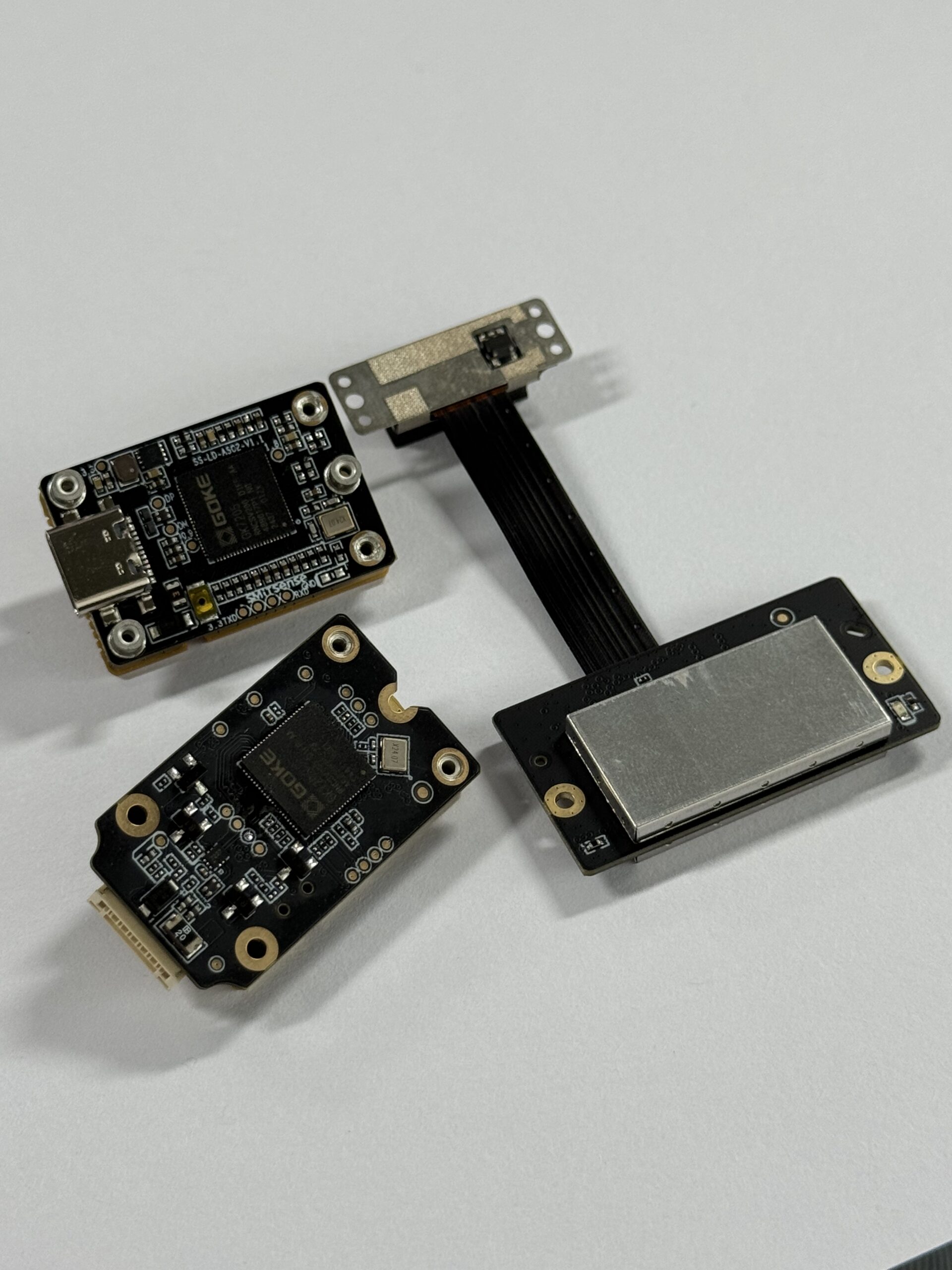
The DTOF Solid state LiDAR HM-LD1 is a compact SPAD dToF solid-state LiDAR module designed to deliver real-time depth images and 3D point cloud data. It supports indoor ranging from 0.5 m to 25 m, outdoor ranging from 0.2 m to 8 m, ±3 cm ranging accuracy, a 60° horizontal by 45° vertical field of view, and UART, UDP, and UVC interfaces. SDK support for x86 Windows, x86 Linux, and ARM Linux helps shorten integration time for PCs, Raspberry Pi systems, embedded platforms, and robotic development projects.
How Radar Works in Robotics
Radio Wave Transmission and Reflection
Radar emits radio-frequency energy into the environment. Objects reflect part of that energy back to the radar receiver. The radar system then estimates distance based on signal timing, frequency shift, or phase characteristics. Because radio waves have much longer wavelengths than optical LiDAR signals, radar behaves differently around atmospheric particles, surfaces, and object materials. This is why radar can remain useful in conditions where camera or LiDAR performance may be reduced.
Doppler Velocity Measurement
One of radar’s strongest advantages is Doppler velocity measurement. Radar can detect whether an object is moving toward or away from the sensor and estimate relative speed. This is especially valuable for autonomous vehicles, industrial vehicles, outdoor mobile robots, and collision-warning systems. Standard LiDAR modules can detect position changes over time, but radar directly measures velocity in a way that is extremely useful for tracking moving hazards.
Radar Point Clouds vs LiDAR Point Clouds
Modern radar systems may output point-like detections, but radar point clouds are usually sparser and less geometrically detailed than LiDAR point clouds. A LiDAR point cloud can describe surfaces, edges, height changes, and object contours in a way that is often more suitable for mapping and close-range planning. Radar detections are excellent for awareness and tracking, especially in poor visibility, but they generally provide less dense 3D structure. This difference matters for SLAM, object classification, free-space analysis, and fine obstacle avoidance.
Radar in Industrial Environments
Radar is useful in forklift collision warning, large moving machinery detection, outdoor mobile robots, docking areas, low-visibility monitoring, and harsh-weather navigation. In dusty yards, rainy loading docks, foggy outdoor routes, and smoke-prone industrial spaces, radar can help maintain awareness when optical sensors face scattering or signal loss. The best industrial systems often use radar as a redundancy layer rather than a replacement for every other perception sensor.
Navigation Accuracy Comparison
LiDAR for SLAM and Localization
LiDAR is widely used for SLAM and localization because it produces stable geometric measurements. Robots can use LiDAR for scan matching, occupancy grid mapping, loop closure, 2D SLAM, 3D SLAM, free-space mapping, and landmark-based localization. Indoor robots can identify walls, shelves, doorways, pallets, machinery, charging docks, and navigation corridors. Outdoor robots can use LiDAR to model terrain, objects, and structural features when range and lighting conditions are within sensor capability.
Radar for Navigation Assistance
Radar contributes more to detection and tracking than detailed mapping. It can support navigation by identifying large obstacles, estimating distance, and measuring relative speed, but it is usually less suitable as the only sensor for high-detail indoor mapping. In environments with metal racks, vehicles, beams, and complex structures, radar reflections may be harder to interpret than LiDAR geometry. For this reason, radar often plays a supporting role in navigation systems that require both robustness and precision.
When Navigation Requires Sensor Fusion
Navigation becomes more reliable when multiple sensors cover each other’s weaknesses. LiDAR provides geometry, stereo vision provides texture and visual features, radar provides harsh-weather detection, IMU provides motion continuity, and GNSS or RTK provides outdoor global positioning. When comparing LiDAR, stereo vision, structured light, and ToF sensing, it is also useful to understand what phase means in 3D structured light cameras, because different depth technologies produce different data quality, range, and lighting behavior.
Obstacle Avoidance: LiDAR vs Radar
Why LiDAR Is Strong for Close-Range Avoidance
LiDAR is strong for close-range obstacle avoidance because it can detect object boundaries, distance, width, height, and free space with high spatial detail. A robot does not only need to know that something is present; it needs to know whether the object blocks the path, whether the robot can pass beside it, and how quickly the robot should slow down. LiDAR supports stop-zone definition, obstacle segmentation, static object detection, and real-time avoidance algorithms.
Why Radar Is Strong for Moving Hazards
Radar is strong for moving hazards because it can measure relative velocity and operate through rain, fog, dust, and smoke. For outdoor robots and industrial vehicles, radar can provide early warning when a vehicle, worker, or machine is approaching. It can also extend perception range beyond short-range LiDAR modules in certain applications. This makes radar valuable in safety-critical systems where environmental interference is the dominant risk.
Difficult Objects for Each Sensor
Every sensor has difficult targets. LiDAR may struggle with highly reflective, transparent, very dark, or optically challenging surfaces depending on wavelength, exposure, distance, and target angle. Radar may struggle with small, low-reflectivity, or geometrically complex objects, and it may produce ambiguous reflections near metal structures. Vision may struggle with darkness, glare, motion blur, and textureless surfaces. Sensor fusion improves confidence because it allows the robot to compare multiple forms of evidence before making navigation decisions.
Recommended Robotics Takeaway
For warehouse robots, drones, inspection robots, and embedded navigation platforms, LiDAR is often the more direct solution for precise obstacle avoidance because it provides usable geometry. Radar is valuable when environmental interference, moving hazards, or longer-range awareness are the dominant concerns. In many production systems, LiDAR and radar should not be viewed as competitors but as complementary layers in a robust perception architecture.
3D Perception and Mapping
What 3D Perception Means
3D perception is the ability to estimate position, distance, volume, surface layout, object boundaries, and free-space structure. A robot with good 3D perception can understand where it is, where obstacles are, which surfaces are safe, and how the environment changes over time. This capability is important for navigation, inspection, docking, manipulation, mapping, inventory measurement, and safety-zone monitoring.
LiDAR for Depth Maps and Point Clouds
LiDAR is one of the most direct ways to generate depth maps and point clouds. Depth maps provide pixel-like distance values across a field of view, while point clouds represent physical space in 3D coordinates. Robots use these data structures to detect obstacles, estimate ground planes, measure volume, plan paths, localize against maps, and evaluate clearance. In advanced LiDAR ecosystems and industrial 3D perception, companies such as Ouster help illustrate how point cloud sensing supports autonomous machines and perception development.
Radar for Object-Level Awareness
Radar can detect objects and motion, but it often lacks the spatial detail needed for dense 3D reconstruction. It is excellent for tracking large moving objects, measuring relative speed, and operating in low-visibility conditions. However, when a robot needs to understand exact object shape, surface structure, or close-range free space, LiDAR is usually stronger. Radar becomes most powerful when its detections are fused with LiDAR, camera, IMU, and navigation data.
Stereo Vision as a Complement
Stereo vision can complement both LiDAR and radar by adding visual odometry, texture, wide-angle scene awareness, and GPS-denied localization. The Stereo Vision Camera RoboBaton Mini provides 640 × 480 resolution at 40 fps, global shutter imaging, 164.7° horizontal field of view, 60 mm baseline, IP68 protection, ROS2 support, and 200 Hz algorithm output / IMU. This makes it useful for drones, indoor robots, embedded platforms, and applications where visual positioning improves navigation reliability.
Environmental Performance
Rain, Fog, Dust, and Smoke
Radar usually performs better in rain, fog, dust, and smoke because radio waves are less affected by atmospheric particles than optical wavelengths. LiDAR can experience signal scattering, reduced range, or false returns in dense fog, heavy rain, dust clouds, or smoke. This does not mean LiDAR is unsuitable outdoors, but it does mean that environmental risk must be considered during system design. Robots operating in mines, ports, farms, construction sites, or outdoor yards may need radar redundancy.
Bright Sunlight and Outdoor Use
Outdoor LiDAR performance depends on optical design, receiver sensitivity, filtering, ambient light handling, target reflectivity, and distance. The HM-LD1 supports outdoor ranging from 0.2 m to 8 m in daytime conditions, including clear summer daytime scenarios with high ambient illumination. For short-to-mid-range outdoor obstacle detection, compact dToF LiDAR can be practical, especially when the robot needs more geometry than radar alone can provide.
Indoor and Nighttime Use
LiDAR performs very well indoors and at night because it provides its own active illumination. The HM-LD1 supports indoor or nighttime ranging from 0.5 m to 25 m, making it suitable for warehouses, indoor robots, research platforms, smart inspection, distance detection, and controlled industrial environments. For AMRs and AGVs, indoor LiDAR can support mapping, localization, docking, obstacle detection, and defined zone monitoring without relying on room lighting.
Temperature, Vibration, and Enclosure Design
Industrial sensor selection must also consider operating temperature, mechanical mounting, vibration, ingress protection, calibration stability, cable routing, cleaning, and electrical noise. The HM-LD1 operates from -20 °C to 60 °C. The RoboBaton Mini adds IP68 protection and a metal reinforcement process for improved deformation resistance. These details matter because a sensor that performs well in a lab may behave differently on a vibrating drone, a dusty robot chassis, or a temperature-varying inspection platform.
Range, Resolution, Accuracy, and Frame Rate
Range Is Not the Only Metric
Many buyers focus too heavily on maximum range. For robotics, usable range must be evaluated alongside minimum detection distance, accuracy, angular resolution, frame rate, field of view, latency, interface, power consumption, weight, software support, and environmental tolerance. A long-range sensor with poor close-range detail may not help an indoor AMR avoid a chair leg or pallet edge. A compact short-range LiDAR may be far more useful when the robot’s main task is obstacle avoidance within a controlled distance envelope.
Why Resolution Matters for Navigation
Resolution affects how clearly a robot can interpret object shape. A low-resolution sensor may detect that something exists but fail to describe whether it is a cable, curb, chair leg, human foot, pallet edge, wall corner, or transparent barrier. Higher spatial resolution helps with segmentation, classification, clearance calculation, and safe path planning. This is one reason LiDAR is widely used in robotic mapping and obstacle avoidance.
Why Frame Rate Matters for Moving Robots
Frame rate determines how frequently the robot receives updated distance data. A slow robot in a predictable environment may not need extremely high frame rates, but UAVs, AMRs, and fast inspection robots need fresh sensor data before collision risk increases. Frame rate also affects control smoothness, obstacle tracking, and reaction time. The correct frame rate depends on robot speed, braking distance, field of view, latency, and the complexity of the environment.
Why Accuracy Matters
Accuracy determines how reliable the distance estimate is. For obstacle avoidance, docking, shelf detection, altitude hold, and zone monitoring, centimeter-level accuracy can significantly improve control quality. If the distance estimate is noisy or inconsistent, the robot may slow unnecessarily, stop too late, oscillate during docking, or misjudge clearance. Accuracy should therefore be evaluated under the actual target materials, lighting, distance, temperature, and mounting conditions expected in deployment.
Sensor Fusion with Vision, IMU, GNSS, and Radar
Why No Single Sensor Is Perfect
No single sensor is perfect. LiDAR has optical limitations, radar has lower spatial detail, vision depends on lighting and texture, IMU drifts over time, and GNSS becomes weak indoors or near tall structures. A robot that relies on only one sensor is vulnerable to that sensor’s blind spots. Sensor fusion improves reliability by combining different measurements into a more complete estimate of the world.
Recommended Fusion Architectures
Common fusion architectures include LiDAR plus IMU for mapping and motion correction, LiDAR plus stereo vision for geometry and visual features, LiDAR plus radar for harsh-weather redundancy, vision plus IMU for visual odometry, and GNSS/RTK plus LiDAR for outdoor localization. Safety-critical outdoor robots may use LiDAR, radar, camera, IMU, and GNSS together so that detection, mapping, motion estimation, and global positioning are all covered.
ROS and Embedded Development
Integration requirements are as important as sensor physics. Robotics teams should evaluate ROS or ROS2 compatibility, Linux and ARM support, Windows tools, UART, UDP, UVC, USB Type-C, Ethernet, CAN, SDK availability, sample applications, timestamp synchronization, calibration tools, and technical support. A sensor with strong software support can reduce development time, especially when integrating with Raspberry Pi, Jetson, flight controllers, embedded PCs, industrial controllers, or custom perception stacks.
Best Sensor by Robotics Use Case
AMR and AGV Warehouse Navigation
For AMR and AGV warehouse navigation, LiDAR or LiDAR plus vision is usually the best fit. These robots need precise mapping, aisle navigation, pallet detection, obstacle boundary recognition, safe stop zones, and reliable localization. Radar can help in special conditions, but LiDAR usually provides the geometry needed for indoor navigation.
UAV Altitude Hold and Terrain Following
For UAV altitude hold and terrain following, lightweight LiDAR plus IMU is often a practical choice. Drones are sensitive to size, weight, and power consumption, so compact dToF modules can be useful when the mission requires distance measurement without a large sensor payload. Stereo vision can add visual odometry, while radar may be valuable in poor visibility or larger outdoor platforms.
Outdoor Inspection Robots
Outdoor inspection robots often benefit from LiDAR plus radar plus GNSS/IMU. LiDAR provides mapping and inspection detail, radar helps in low visibility or harsh weather, GNSS supports global positioning, and IMU maintains motion continuity. This combination is useful for bridges, expressways, dams, industrial yards, tunnels, power facilities, and other environments where safety and reliability matter.
Autonomous Vehicles and Large Outdoor Platforms
Autonomous vehicles and large outdoor platforms generally use LiDAR, radar, camera, GNSS, and IMU together. These platforms require long-range detection, object classification, 3D mapping, speed measurement, lane or route understanding, and redundancy. Radar contributes speed and weather resilience, while LiDAR contributes high-resolution geometry and map structure.
Security and Zone Intrusion Monitoring
For security and zone intrusion monitoring, LiDAR is useful when accurate zone boundaries matter, while radar is useful when motion detection in poor visibility is more important. A LiDAR system can define spatial zones with clear geometry, while radar can detect movement through dust, fog, or darkness. The correct choice depends on whether the application prioritizes boundary precision, weather robustness, or both.
GPS-Denied Indoor Robots
GPS-denied indoor robots often need LiDAR, stereo vision, and IMU working together. LiDAR supports map-based navigation, stereo vision supports visual odometry and scene understanding, and IMU supports short-term motion estimation. This combination is useful in warehouses, tunnels, factories, labs, underground facilities, and indoor inspection sites where GNSS is unavailable.
Product Example: HM-LD1 dToF Solid-State LiDAR for Robotics
For robotics projects that require compact 3D sensing, close-to-mid-range obstacle avoidance, depth maps, and point cloud output, a solid-state dToF LiDAR module can be easier to integrate than large mechanical LiDAR systems. The DTOF Solid state LiDAR HM-LD1 is designed for robot navigation, UAV altitude sensing, smart inspection, distance detection, SLAM support, obstacle avoidance, zone intrusion monitoring, object recognition, volume measurement, and embedded perception development.
HM-LD1 is a solid-state LiDAR module based on SPAD dToF technology. It delivers real-time depth images and 3D point cloud data for accurate environmental perception. It supports indoor or nighttime ranging up to 25 m and outdoor daytime ranging up to 8 m, making it suitable for robots, drones, cameras, security systems, autonomous navigation, robotic vision development, and smart inspection. With UVC, UDP, and UART interfaces, it can be integrated with PCs, Raspberry Pi systems, flight controllers, and embedded platforms. MRP also offers SDK support for x86 Windows, x86 Linux, and ARM Linux.
DTOF Solid state LiDAR HM-LD1 Specifications

| Specification | DTOF Solid state LiDAR HM-LD1 | Why It Matters for Robotics |
|---|---|---|
| Technology | SPAD dToF solid-state LiDAR | Supports compact active depth sensing without mechanical scanning parts. |
| Dimensions | 43.5 mm × 30 mm × 26.5 mm | Small enough for AMRs, UAVs, embedded platforms, and space-limited robots. |
| Weight | 28 g | Lightweight design helps drones and mobile robots preserve payload capacity. |
| Indoor Ranging Capability | 0.5–25 m | Suitable for indoor navigation, warehousing, inspection, and robot vision development. |
| Outdoor Ranging Capability | 0.2–8 m | Useful for daytime outdoor obstacle detection and short-range inspection tasks. |
| Ranging Accuracy | ±3 cm | Provides centimeter-level distance data for obstacle avoidance and positioning. |
| Field of View | 60° horizontal × 45° vertical | Captures a practical forward-facing perception area for robots and UAVs. |
| Resolution | 40 × 30 | Generates depth map and point cloud data for environmental awareness. |
| Frame Rate | 10 fps | Provides real-time updates for navigation and obstacle detection workflows. |
| Interfaces | UART / UDP / UVC | Supports embedded controllers, PCs, Raspberry Pi, and robotic development platforms. |
| Operating Temperature | -20 °C to 60 °C | Supports deployment in industrial and outdoor environments. |
| Power Consumption | 1.2 W | Low power draw is helpful for battery-powered robots and UAVs. |
| SDK Support | x86 Windows, x86 Linux, ARM Linux | Reduces integration time for research, prototyping, and product deployment. |
View Product Details & Pricing ➔
How to Choose Between LiDAR, Radar, and Vision
Step 1 — Define the Robot’s Operating Environment
Start by defining whether the robot operates indoors, outdoors, in bright sunlight, in low light, in fog, in dust, in rain, near smoke, or around water exposure. Also define whether the environment is mostly static or filled with moving objects. A controlled indoor warehouse usually favors LiDAR and vision. A rainy outdoor logistics yard may require radar redundancy. A GPS-denied tunnel may need LiDAR, stereo vision, and IMU fusion.
Step 2 — Define the Required Perception Output
Next, define what the robot actually needs from the sensor. If the requirement is a 3D point cloud, depth map, object boundary, free-space model, or centimeter-level distance measurement, LiDAR is often the best starting point. If the requirement is object speed, long-range motion detection, or poor-visibility awareness, radar becomes more important. If the requirement is visual odometry, texture, or semantic scene cues, stereo vision should be considered.
Step 3 — Define Mechanical and Electrical Constraints
Robotics engineers must evaluate size, weight, power budget, interface requirements, processor availability, thermal design, enclosure constraints, mounting rigidity, and cable routing. A drone may reject a sensor that is too heavy or power-hungry. A compact AMR may need a low-profile module. An outdoor inspection robot may need stronger environmental sealing. Mechanical and electrical constraints often determine whether a technically capable sensor is actually deployable.
Step 4 — Define Software Integration Requirements
Software integration can decide project success. Confirm whether the sensor supports ROS or ROS2, Linux or Windows, ARM or x86, UART, UDP, UVC, USB, Ethernet, or CAN. Also evaluate SDK availability, documentation, sample code, timestamping, calibration tools, and technical support. A sensor with good integration support can reduce development risk, especially during prototyping, field testing, and product deployment.
Step 5 — Use the Practical Decision Matrix
| Project Requirement | Recommended Sensor Strategy |
|---|---|
| Indoor robot navigation and mapping | LiDAR, optionally fused with stereo vision and IMU |
| Outdoor robot in rain, fog, or dust | Radar plus LiDAR for redundancy |
| Drone altitude hold and terrain following | Lightweight dToF LiDAR plus IMU |
| GPS-denied localization | Stereo vision plus IMU, optionally supported by LiDAR |
| High-detail 3D perception | LiDAR or LiDAR plus vision |
| Long-range speed detection | Radar |
| Industrial safety zone detection | LiDAR for defined zones; radar for harsh environments |
If your robot needs compact active depth sensing, low power consumption, standard interfaces, and practical embedded integration, the HM-LD1 is a strong candidate to evaluate. If your system also requires wide-FOV visual odometry or GPS-denied localization, the RoboBaton Mini can complement LiDAR with stereo vision data. For harsh outdoor environments, radar should be considered as an additional detection layer rather than ignored.
FAQ: LiDAR vs Radar
Is LiDAR or radar better for robot obstacle avoidance?
Why do self-driving and robotics teams still use LiDAR if radar works in bad weather?
Can radar replace LiDAR in drones, AGVs, or industrial robots?
What is the biggest difference between LiDAR and radar?
Is LiDAR more accurate than radar?
Which sensor is better for SLAM?
Which sensor works better outdoors?
Which sensor is better indoors?
Does LiDAR work in the dark?
Does radar create 3D point clouds like LiDAR?
Is solid-state LiDAR better than mechanical LiDAR for robots?
Is LiDAR safe for robots operating near people?
What specifications matter most when choosing a robotics LiDAR?
Should a robot use LiDAR and stereo vision together?
📚 References & Further Reading
- Industry Standard: Bynav Technology
- Industry Standard: Ouster
- Related Guide: iToF vs dToF
- Related Guide: What Phase Means in 3D Structured Light Cameras
- Product Reference: DTOF Solid state LiDAR HM-LD1
- Product Reference: Stereo Vision Camera RoboBaton Mini






