

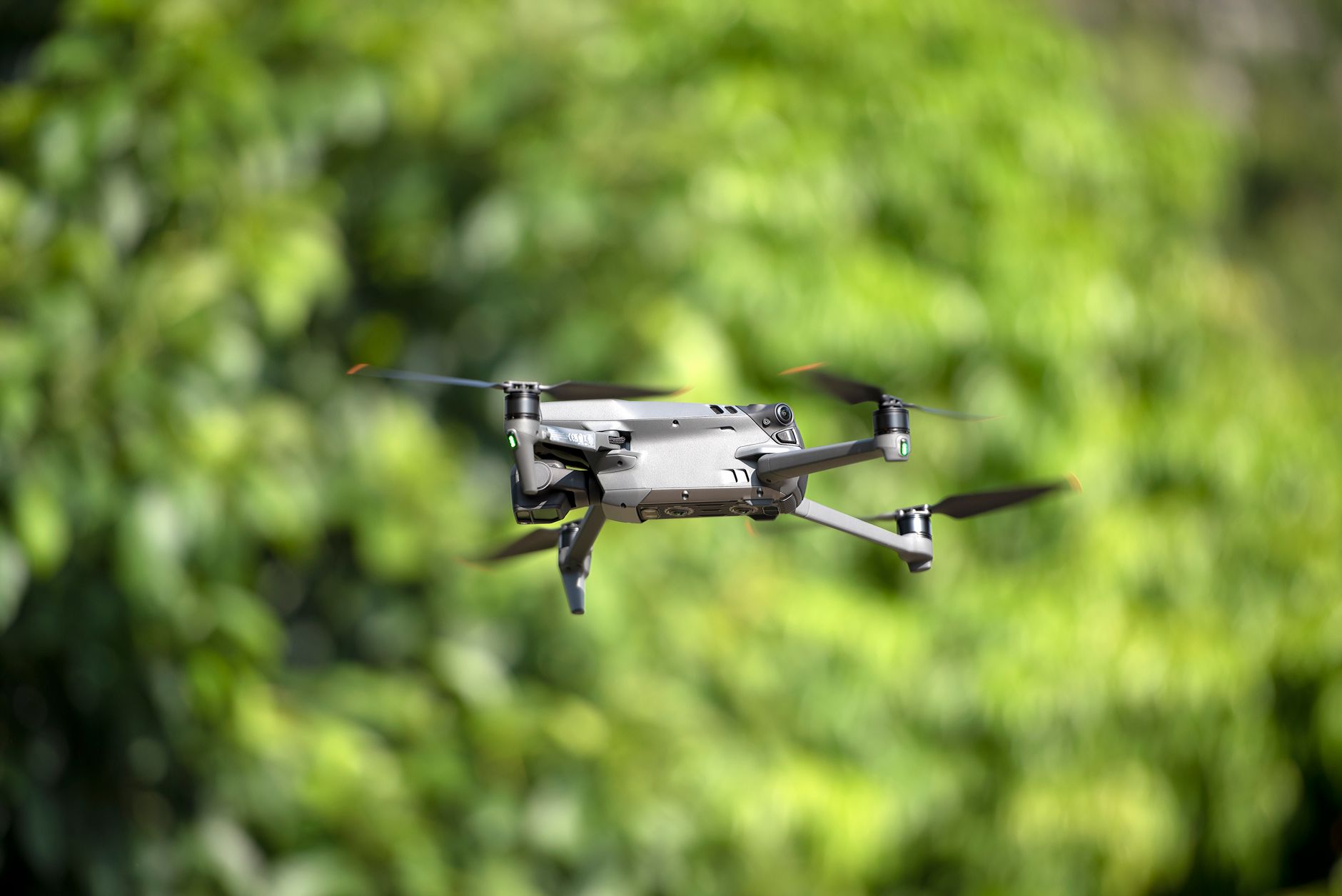
Lidar Drone News 2026: Is Drone LiDAR Worth It for Surveying, Mapping, and Autonomous Inspection?
Drone LiDAR is not some exotic payload anymore, and that is the big shift heading into 2026. A few years back, you mostly saw it with national mapping teams, mining groups, large civil engineering firms, and crews with enough budget to justify a serious airborne survey package. Now the conversation around lidar drone news has moved into a more practical lane. The question is no longer, “Can LiDAR beat photogrammetry?” The better question is, “Where does LiDAR save time, reduce risk, and give us data we can actually trust?” For surveying teams, that often means faster terrain capture under vegetation. For infrastructure crews, it means safer inspection around bridges, dams, towers, tunnels, and industrial plants. For drone builders, it means adding a depth-sensing layer that helps a UAV understand the space around it instead of flying blind between GPS updates and camera frames.
Here’s the deal: drone LiDAR is worth it when the job needs either measurement-grade 3D data or reliable real-time distance awareness. Those are related, but they are not the same thing. A survey-grade LiDAR payload is built to produce point clouds, terrain models, corridor maps, stockpile volumes, and engineering deliverables. A compact perception LiDAR module is built to help a drone detect obstacles, hold altitude, follow terrain, support SLAM, or inspect close to structures without depending only on cameras. This guide walks through how drone LiDAR works, where it beats photogrammetry, where it does not, what buyers should watch in 2026, and where compact dToF solid-state modules such as the DTOF Solid State LiDAR HM-LD1 fit into UAV prototyping, industrial inspection, embedded perception, and robotics development.
Table of Contents
- 👉 Drone LiDAR News 2026: What Changed?
- 👉 What Is Drone LiDAR?
- 👉 How LiDAR Drones Work
- 👉 LiDAR vs Photogrammetry for Surveying
- 👉 Surveying and Mapping Use Cases
- 👉 Autonomous Inspection and UAV Perception
- 👉 Drone LiDAR Sensor Specs That Matter
- 👉 DTOF Solid State LiDAR HM-LD1 Specs
- 👉 Integration Workflow for UAV Developers
- 👉 Cost, ROI, and When Drone LiDAR Is Worth It
- 👉 2026 Drone LiDAR Buying Checklist
- 👉 Drone LiDAR FAQ
Drone LiDAR News 2026: What Changed?
The biggest lidar drone news story in 2026 is not one flashy aircraft or one record-setting sensor spec. It is the broader move from LiDAR as a premium mapping tool into LiDAR as practical industrial perception. Survey-grade LiDAR payloads still matter, especially in mapping, civil engineering, forestry, mining, and corridor inspection. But there is now a second lane growing fast: compact embedded LiDAR modules built for real-time depth awareness, obstacle detection, terrain following, altitude hold, smart inspection, and robotic navigation. Look, these two categories both use laser-based ranging, but they do different jobs. Mixing them up is one of the fastest ways to buy the wrong equipment.
Survey-grade drone LiDAR systems focus on point density, trajectory accuracy, GNSS/RTK/IMU integration, calibrated scanning geometry, and post-processed point clouds. Embedded perception LiDAR modules focus on size, power draw, frame rate, field of view, interface support, SDK availability, and real-time control integration. A surveyor may care most about producing a reliable DTM under brush or tree cover. A UAV developer may care more about whether a lightweight module can see a wall, shelf, bridge beam, storage rack, pallet, dam face, or slope quickly enough for the onboard computer to react. In the shop, those are two very different acceptance tests.
That is why drone LiDAR adoption is now coming from more than traditional mapping crews. Infrastructure owners want safer inspections around bridges, expressways, dams, tunnels, power stations, and industrial plants. Mining and aggregates teams want repeatable stockpile volumes and pit monitoring without sending people into rough ground every week. Forestry teams want vegetation structure and ground modeling beneath canopy. Robotics engineers want perception layers that support more autonomous behavior. Logistics and warehouse automation teams want better spatial awareness in GPS-challenged spaces. For readers who want the physics before the UAV discussion, this how LiDAR works guide is a useful companion.
Another important 2026 trend is the practical maturity of time-of-flight measurement in compact sensing devices. Direct time-of-flight, often shortened to dToF, measures distance by evaluating how long emitted light takes to return from a surface. In solid-state sensing modules, that can deliver useful depth perception without the same mechanical complexity found in some scanning systems. For drones, every gram and watt matters. Lower sensor weight can improve endurance, reduce motor load, simplify payload balancing, and make LiDAR realistic for smaller UAV platforms that cannot carry a heavy survey package.
What Is Drone LiDAR?
Drone LiDAR is a laser-based distance measurement system mounted on or integrated into a UAV. Depending on the architecture, it can generate dense georeferenced point clouds for surveying and mapping, or it can provide real-time depth information for navigation, inspection, obstacle awareness, and assisted autonomy. A complete drone LiDAR setup may include the LiDAR sensor, GNSS or RTK receiver, IMU, flight controller, onboard computer, data logger, power system, vibration isolation, communication links, software tools, calibration workflow, and post-processing environment. The sensor is only one part of the job. The whole stack determines whether the data is useful.
Survey Payload vs Perception Module
Not all drone LiDAR products are built for the same mission. A survey payload is designed to create geospatial deliverables such as classified point clouds, digital terrain models, digital surface models, contours, cross sections, volume reports, corridor maps, and engineering measurements. It usually depends on precise positioning, accurate timing, IMU trajectory correction, calibration, and data processing. A perception module is built to help a drone or robot understand its nearby environment in real time. It may output a depth map, point cloud, or distance stream that supports obstacle avoidance, height estimation, terrain following, docking, collision reduction, SLAM assistance, object detection, or smart inspection.
This distinction matters. A compact perception module should not be judged like a full geospatial mapping system, and a survey payload should not automatically be treated as the best answer for small UAV autonomy. If a drone must produce engineering-grade terrain deliverables, it needs survey-grade hardware and workflow. If a drone must maintain distance from a wall, detect nearby structures, follow uneven ground, or add local spatial awareness, a compact LiDAR module may be the better fit. Similar tradeoffs show up across other 3D sensing approaches, including structured light 3D vision, stereo cameras, ToF cameras, radar, ultrasonic sensors, and visual-inertial systems.
Why Drone LiDAR Matters for Industrial Teams
Industrial teams adopt drone LiDAR because it closes the gap between the physical site and reliable digital measurement. Surveyors can cover difficult terrain faster. Asset owners can inspect areas that are dangerous, expensive, or disruptive for humans to access. Engineering teams can compare repeat 3D captures over time instead of arguing from photos alone. UAV developers can add local sensing in environments where GNSS is not enough. When positioning hardware is required, GNSS and RTK ecosystems from companies such as Beitian can complement LiDAR-based drone systems by providing location and navigation data for mapping, route control, and system-level awareness.
For infrastructure work, drone LiDAR can reduce human exposure around bridge undersides, steep embankments, dam faces, tall industrial structures, powerline corridors, restricted zones, and unstable ground. For robotics and UAV autonomy, LiDAR adds direct distance measurement that can help when lighting, texture, or visual contrast are poor. The value of LiDAR is not that it replaces every other sensor. The value is that it provides spatial measurements that image-only workflows cannot always deliver reliably under real industrial conditions.
How LiDAR Drones Work
LiDAR drones work by combining laser-based distance measurement with UAV motion, positioning, and data processing. At the sensor level, LiDAR emits light toward a target and evaluates the return signal. In a direct time-of-flight system, distance is estimated from the travel time of light. Conceptually, distance equals the speed of light multiplied by the measured time delay, divided by two because the signal travels out to the object and back to the receiver. The sensor converts many of those measurements into spatial data describing surfaces, obstacles, terrain, structures, or objects.
The Measurement Principle
The basic principle sounds simple, but the implementation is not. The sensor has to emit light, detect weak return signals, manage ambient light, process reflections, handle different target materials, and produce usable distance measurements. On a drone, that job gets harder because the platform is moving, vibrating, changing angle, and operating under changing sunlight, weather, target reflectivity, and flight conditions. That is why buyers should evaluate more than maximum range. Accuracy, repeatability, field of view, frame rate, sunlight performance, interface latency, mechanical mounting, SDK support, and real-world validation all matter.
From Distance Points to 3D Data
Individual distance measurements can become depth maps, point clouds, obstacle maps, terrain models, inspection geometry, or SLAM inputs. In mapping-grade systems, raw measurements must be combined with precise pose data from GNSS, RTK, IMU, and trajectory processing to generate georeferenced point clouds. The quality of the final deliverable depends on the complete system, not just the LiDAR unit. Calibration, flight planning, sensor timing, ground control, check points, scan angle, overlap, altitude, and post-processing all influence the final result. For a deeper general explanation, see this complete LiDAR working principle guide.
For embedded perception, the output may never become a formal survey deliverable. Instead, the onboard computer may use LiDAR data to determine that the drone is approaching a wall, passing over uneven ground, flying too close to a shelf, moving toward a bridge beam, or changing altitude relative to terrain. This kind of perception can support flight-control logic, local mapping, object detection, safety limits, or operator alerts. In many UAV systems, LiDAR works alongside cameras, IMUs, barometers, GNSS, RTK, radar, ultrasonic sensors, and software filters to build a more dependable autonomy stack.
dToF, SPAD, and Solid-State LiDAR
Compact solid-state dToF modules can use SPAD-based sensing to generate depth data without relying on a large mechanical scanning assembly. That matters on drones because moving parts, payload weight, power draw, vibration exposure, and mounting complexity all affect endurance and reliability. A compact dToF sensor can support real-time navigation and object detection when a full survey-grade payload is unnecessary. In practical UAV development, these modules may be used for altitude hold, terrain following, short-range obstacle detection, presence detection, or smart inspection, especially on platforms where payload capacity is limited.
What the Drone Adds
A LiDAR sensor alone is not a complete drone LiDAR solution. The UAV platform adds flight stability, payload mounting, power delivery, vibration exposure, communication links, mission planning, safety logic, and system integration. A small LiDAR module may be electrically simple to connect, but the engineering work includes mechanical alignment, cable routing, thermal behavior, data synchronization, control-loop response, and environmental validation. In survey applications, the drone also contributes flight path consistency, altitude control, positioning quality, and data capture repeatability. In autonomy applications, the drone must turn sensor information into safe, predictable behavior.
LiDAR vs Photogrammetry for Surveying
LiDAR and photogrammetry are often compared as if one must defeat the other. That is the wrong way to look at it. Photogrammetry uses overlapping images to reconstruct 3D geometry and create visual deliverables such as orthomosaics and textured models. It is often cost-effective, visually rich, and excellent for open terrain, construction progress, roofs, facades, and sites where color information matters. LiDAR measures distance directly, which makes it valuable when vegetation, low texture, poor lighting, complex geometry, or elevation modeling beneath canopy are part of the job.
Where LiDAR Wins
LiDAR usually wins when the project is geometry-first. Vegetated terrain, forestry, powerline corridors, open-pit mining, road and railway embankments, dams, bridges, industrial plants, and complex infrastructure can all benefit from direct distance measurement. LiDAR can collect useful spatial data in conditions where photogrammetry struggles with shadows, repetitive textures, low contrast, or partially hidden ground. In forestry and corridor mapping, the ability to capture returns related to canopy and ground structure can be especially valuable. In inspection, LiDAR can support measurement and spatial awareness when visual texture alone is not enough.
Where Photogrammetry Still Wins
Photogrammetry remains a strong choice when the project mainly needs high-resolution imagery, color detail, visual documentation, or cost-efficient mapping of open surfaces. Construction progress reporting, roof inspection, facade documentation, general site mapping, and orthomosaic production often benefit from camera-based workflows. If vegetation is minimal and accuracy requirements are modest, photogrammetry may deliver a better cost-to-output ratio. It can also be easier for teams that already have image processing workflows, ground control procedures, and trained operators in place.
Best Practice: Hybrid Data Capture
Many industrial teams use both LiDAR and cameras because the two technologies complement each other. LiDAR provides geometry, elevation, and spatial structure. RGB imagery provides visual context, color, surface details, and human-readable inspection records. RTK or PPK improves positioning, and ground control or check points support quality assurance. For broader 3D vision context, this LiDAR and structured light comparison helps explain why different 3D technologies are selected for different distance ranges, object types, and industrial environments.
| Factor | Drone LiDAR | Photogrammetry |
|---|---|---|
| Vegetation | Better for ground modeling beneath canopy, depending on sensor and workflow | Limited to visible surfaces and image reconstruction quality |
| Lighting | Less dependent on image texture and illumination | Highly dependent on lighting, shadows, overlap, and surface texture |
| Output | Point clouds, terrain models, geometry, elevation data | Orthomosaics, textured models, visual records, surface geometry |
| Cost | Usually higher total system cost | Often lower entry cost |
| Best Fit | Vegetation, complex structures, elevation-critical mapping, inspection geometry | Visual mapping, open terrain, construction imagery, documentation |
Surveying and Mapping Use Cases
Drone LiDAR is valuable in surveying and mapping because it captures 3D structure quickly while reducing the need for crews to physically access difficult ground. In topographic surveying, it can help produce DEMs, DTMs, DSMs, contours, slope models, cross sections, and volume calculations. In terrain with vegetation, uneven surfaces, unstable ground, or restricted access, a UAV LiDAR workflow can reduce field time and improve safety. The highest return usually comes from projects where repeatable geometry is more valuable than a single good-looking image.
Topographic Surveying
Topographic surveying benefits from LiDAR when ground shape and elevation matter. A drone can fly over a site and collect spatial data that supports engineering models, drainage analysis, grading plans, slope evaluation, earthwork planning, and design verification. Final accuracy depends on the full workflow, but LiDAR can reduce the burden of walking dangerous or inaccessible areas. This is especially useful for steep slopes, construction sites, flood channels, remote land parcels, and areas where dense vegetation makes ground measurement difficult.
Forestry and Vegetation Mapping
Forestry teams use LiDAR to analyze canopy structure, tree height, vegetation density, corridor clearance, biomass indicators, and ground models beneath vegetation. Photogrammetry can produce excellent visual canopy models, but LiDAR is often preferred when the job is to understand vertical structure and terrain beneath trees. That supports forest inventory, utility corridor planning, fire risk analysis, road planning, environmental monitoring, and vegetation encroachment management. In the field, the difference often shows up when the ground is hidden from the camera but still partially reachable by LiDAR returns.
Mining, Aggregates, and Earthworks
Mining and aggregates operations benefit from repeatable 3D measurement. Drone LiDAR can support stockpile volume calculations, pit wall monitoring, haul road inspection, slope stability checks, quarry updates, and production reporting. In earthworks, repeated LiDAR captures can help compare design surfaces against actual site conditions. This improves communication between owners, contractors, machine operators, and engineering teams. For field integration involving UART-connected sensors or flexible data links, this UART sensor integration guide is relevant to developers building connected sensing systems.
Road, Railway, and Utility Corridors
Long linear assets are a natural fit for drone LiDAR. Road embankments, railway corridors, powerline routes, pipelines, drainage channels, and right-of-way areas often require repeat surveys, vegetation monitoring, clearance checks, and slope assessment. UAVs can collect data quickly while reducing the need for crews to work near traffic, rail lines, steep terrain, or energized infrastructure. LiDAR is especially useful when clearance, shape, and ground surface matter more than visual imagery alone.
Construction and Industrial Sites
Construction teams use drone-based 3D data for progress tracking, cut/fill analysis, quality verification, dispute reduction, and digital recordkeeping. Industrial sites can use LiDAR for asset documentation, plant inspection, warehouse mapping, and safety planning. Where UAV autonomy is involved, perception LiDAR may also help maintain distance from structures, support indoor navigation, or reduce collision risk near equipment, racks, walls, tanks, or machinery. The practical value is not just prettier data. It is fewer blind spots, fewer site walks, and better repeatability.
Autonomous Inspection and UAV Perception
Inspection drones do not always need survey-grade point clouds. Many need reliable real-time spatial awareness. A lightweight LiDAR module can help drones understand distance to nearby structures, maintain altitude, avoid obstacles, support terrain following, or assist SLAM in GPS-denied environments. This is an important distinction in 2026 because many UAV applications are moving from manual piloting toward assisted autonomy. The drone may still have a human operator, but onboard sensing can improve safety, consistency, and mission repeatability.
Infrastructure Inspection
Bridges, expressways, dams, industrial plants, warehouses, tunnels, large equipment, and perimeter security zones are strong inspection use cases. These environments often include surfaces that are difficult for people to approach safely. LiDAR can support distance awareness when a drone is moving near concrete walls, steel structures, beams, shelves, machinery, or uneven terrain. In some cases, LiDAR data may be logged for later analysis. In others, it may simply help the drone maintain a safer standoff distance or alert an operator that the UAV is getting too close.
Obstacle Avoidance and Collision Reduction
Obstacle avoidance is one of the most practical applications for compact drone LiDAR modules. Real-time depth data can help detect walls, columns, machinery, poles, cables, shelves, pallets, or irregular ground. LiDAR should not be treated as a magic safety layer, because collision avoidance depends on sensor placement, field of view, latency, speed, control logic, and fail-safe behavior. However, when combined with IMU data, visual sensors, ultrasonic sensors, radar, GNSS, RTK, or flight-controller logic, LiDAR can make the autonomy stack more robust.
Altitude Hold and Terrain Following
Altitude based only on barometer or GNSS can be insufficient near uneven terrain, reflective surfaces, indoor environments, or GPS-challenged areas. LiDAR can provide local height awareness to help a drone maintain a more stable relationship to the ground or nearby structure. This is useful for terrain following, low-altitude inspection, warehouse flight, agricultural operations, and close-range industrial monitoring. The correct range and frame rate depend on flight speed, mounting direction, control-loop design, and expected surface conditions.
SLAM-Assisted Navigation
LiDAR can support local mapping and pose estimation when GNSS signals are weak, blocked, or unreliable. In tunnels, warehouses, under bridges, near tall structures, or inside industrial plants, local spatial sensing can be more reliable than satellite positioning alone. However, LiDAR alone is not a complete navigation system. It should be fused with IMU, odometry, visual data, flight-control inputs, or other positioning sources. The final system must be validated in real operating conditions, not only in a lab or a clean demo area.
Drone LiDAR Sensor Specs That Matter
Drone LiDAR buying decisions should start with the mission, not the longest number on a specification sheet. A sensor designed for survey mapping and a compact dToF module designed for perception may both be called LiDAR, but they should be evaluated differently. The most important specifications include range, accuracy, precision, field of view, resolution, frame rate, weight, power consumption, interface options, SDK support, environmental tolerance, mounting requirements, and real-world behavior under sunlight, vibration, dust, weather, and target reflectivity.
Range
Range needs context. Indoor, nighttime, and outdoor daytime performance can differ significantly. Sunlight, surface reflectivity, target angle, weather, optical design, and background noise can reduce reliable outdoor range. A sensor that reaches farther indoors may have a shorter practical range outdoors. For UAV developers, the correct range depends on flight speed, stopping distance, control-loop response, altitude, inspection distance, and required safety margin. Look at the working envelope, not just the best-case number.
Accuracy and Precision
Accuracy describes closeness to the true distance, while precision describes repeatability. Survey-grade mapping requires system-level accuracy, not only sensor-level ranging accuracy. GNSS, RTK, IMU, calibration, ground control, trajectory processing, and flight planning all affect final results. For obstacle avoidance, local consistency, low latency, and stable detection may matter more than absolute geospatial accuracy. Buyers should avoid confusing sensor accuracy with deliverable accuracy because that mistake can create expensive disappointment.
Field of View and Resolution
Field of view determines how much of the scene the sensor can observe. A wider horizontal and vertical field of view helps with obstacle awareness and scene coverage, but resolution determines how much detail is available inside that view. For example, a 40 × 30 module produces 1,200 depth points per frame. That can be useful for obstacle detection, presence sensing, terrain awareness, and robotics development, but it is not the same as a high-density survey scanner designed for detailed geospatial mapping.
Frame Rate, Weight, Power, and Interfaces
Frame rate affects how often the system receives updated spatial information. A 10 fps module may be suitable for slower robotic perception, altitude awareness, smart inspection, and near-field sensing, while high-speed drones may require faster updates or additional sensor fusion. Weight and power directly affect endurance, motor load, battery sizing, heat management, and mounting design. Interfaces also matter. UART is useful for simple embedded communication, UDP supports networked data transfer, and UVC can support camera-like video or depth data workflows. SDK support for Windows, Linux, ARM Linux, Raspberry Pi, Jetson, flight controllers, and embedded platforms can reduce integration time. For additional ToF context, see the time-of-flight reference.
DTOF Solid State LiDAR HM-LD1 Specs
The DTOF Solid State LiDAR HM-LD1 is a compact SPAD dToF LiDAR module designed for real-time depth images and 3D point cloud data in robotics, UAVs, cameras, security systems, and embedded perception platforms. Its small size, 28 g weight, 1.2 W power consumption, UART/UDP/UVC interfaces, and SDK support for x86 Windows, x86 Linux, and ARM Linux make it suitable for prototyping and integration on PCs, Raspberry Pi, embedded controllers, and UAV development platforms.
HM-LD1 is best positioned as an embedded perception module rather than a full survey-grade drone mapping payload. It supports obstacle avoidance, distance detection, autonomous navigation, smart inspection, robotic vision development, UAV altitude hold, terrain following, object recognition, presence detection, autofocus, volume measurement, and zone intrusion monitoring. Its compact housing is useful for drones where weight affects flight time and where available mounting space is limited. The module is also relevant for robots, cameras, security systems, and development platforms that need practical depth sensing without the size and complexity of larger LiDAR systems.

| Specification | Real Product Data |
|---|---|
| Product Name | DTOF Solid State LiDAR HM-LD1 |
| Technology | SPAD dToF solid-state LiDAR |
| Dimension | 43.5 mm × 30 mm × 26.5 mm |
| Weight | 28 g |
| Indoor Ranging Capability | 0.5–25 m |
| Outdoor Ranging Capability | 0.2–8 m |
| Ranging Accuracy | ±3 cm |
| Field of View | 60° horizontal × 45° vertical |
| Resolution | 40 × 30 |
| Frame Rate | 10 fps |
| Interfaces | UART / UDP / UVC |
| Operating Temperature | -20 ℃ to 60 ℃ |
| Power Consumption | 1.2 W |
| SDK Support | x86 Windows, x86 Linux, ARM Linux |
| Typical Applications | UAV altitude hold, terrain following, obstacle avoidance, SLAM support, robot navigation, autofocus, presence detection, object recognition, volume measurement, and zone intrusion monitoring |
Download the DTOF SSL HM-LD1 Product Brochure
View Product Details & Pricing ➔
Integration Workflow for UAV Developers
A successful UAV LiDAR integration starts with a clear mission definition. The developer has to decide whether the drone needs survey mapping, obstacle avoidance, altitude hold, terrain following, indoor navigation, inspection assistance, SLAM support, or security monitoring. Each mission drives different hardware and software decisions. A mapping payload may require high point density, GNSS/RTK, IMU integration, trajectory correction, and post-processing software. A compact perception module may require low weight, low power, a useful frame rate, a practical field of view, SDK access, and easy integration with a flight controller or onboard computer.
Step 1 — Define the Mission
Before selecting a sensor, define what success looks like. If the goal is a topographic deliverable, the requirements may include system-level accuracy, ground control, classified point clouds, and a repeatable survey workflow. If the goal is obstacle detection, the requirements may include detection distance, update rate, latency, field of view, object size, and control response. If the goal is terrain following, the requirements may include downward-facing range, outdoor sunlight performance, stable height readings, and predictable behavior over uneven surfaces. In the shop, this step saves money because it keeps the team from buying a sensor for the wrong job.
Step 2 — Choose the Right LiDAR Category
A mapping payload and a compact dToF module solve different problems. Survey payloads prioritize point density, scanning geometry, trajectory accuracy, and georeferenced outputs. Compact dToF modules prioritize size, power, interfaces, and real-time perception. Selecting the wrong category can create poor results even if the sensor specifications look attractive. A small depth module may be excellent for obstacle sensing but unsuitable for survey deliverables. A survey-grade system may be excellent for mapping but too heavy, expensive, or complex for a small autonomy prototype.
Step 3 — Select Interfaces
Interface selection affects development speed. UART is useful for simple embedded control and lightweight data communication. UDP is useful when the system needs network-based transfer to an onboard computer. UVC can simplify camera-style depth streaming workflows. Developers should confirm bandwidth, latency, data format, sample code, SDK support, and operating system compatibility before designing the final architecture. If wireless field data links or sensor bridges are relevant, this wireless odometry and sensor bridge article provides related integration ideas.
Step 4 — Mount, Calibrate, and Fuse Data
Mechanical integration affects sensor performance. The LiDAR should be mounted rigidly, protected from excessive vibration, aligned with the intended frame of reference, and supported with proper cable strain relief. Developers should consider sensor orientation, extrinsic calibration, thermal behavior, weather exposure, propeller wash, and electromagnetic noise. For navigation and mapping workflows, LiDAR may need to be fused with IMU, RTK, GNSS, vision, odometry, or flight-controller logic. Positioning hardware ecosystems from companies such as Beitian can be part of the broader navigation stack when GNSS or RTK support is required.
Step 5 — Validate in Real Conditions
Indoor bench tests are useful, but they are not enough. Outdoor sunlight, reflective surfaces, dark materials, vibration, dust, weather, sensor angle, drone movement, and target geometry can change performance. Developers should validate across real flight scenarios, including expected speed, altitude, lighting, surface types, and mission geometry. Validation should include failure behavior, noisy readings, occlusion, control-loop response, and operator override procedures. Industrial deployment requires evidence that the complete system behaves safely and repeatably, not only that the sensor works under ideal conditions.
Cost, ROI, and When Drone LiDAR Is Worth It
Drone LiDAR is worth it when it reduces total project risk, labor, rework, site access cost, or operational uncertainty. The business case is strongest when terrain has vegetation, elevation accuracy matters, ground access is unsafe, repeat surveys are required, 3D geometry is more valuable than visual imagery, manual inspection creates safety risk, or autonomous flight requires real-time depth awareness. In these cases, LiDAR is not just a sensor cost. It is part of a workflow that can make data collection safer, faster, and more repeatable.
When LiDAR Is Worth It
LiDAR is usually worth serious consideration for forestry, mining, corridor mapping, infrastructure inspection, dams, bridges, road embankments, utility clearance, industrial plants, and robotics applications where direct distance measurement improves results. Survey-grade LiDAR can justify its cost when it produces deliverables that are difficult or unreliable with photogrammetry. Compact perception LiDAR can justify its cost when it reduces collision risk, supports terrain following, enables altitude awareness, or helps a UAV operate in environments where visual sensing alone is not enough.
When LiDAR May Not Be Worth It
LiDAR may not be necessary when the project only requires visual orthomosaics, when terrain is open and easy to model with photogrammetry, when budget is limited, when accuracy requirements are modest, or when the team lacks the processing workflow to use the data effectively. If a lower-cost camera workflow solves the business problem, LiDAR may add unnecessary complexity. Similarly, if a drone only needs very simple range sensing, a full survey payload would be excessive. Good engineering means using the right tool, not the most expensive one.
ROI Factors and Buyer Mistakes
ROI should include labor savings, reduced site access risk, faster data collection, better repeatability, reduced rework, improved inspection safety, better autonomous reliability, lower payload weight, and integration cost. The biggest buyer mistake is comparing only sensor price or headline range. Total system cost includes mounting, drone platform, power design, integration, software, SDK support, data processing, operator training, calibration, validation, maintenance, and technical support. Buyers should define the mission first, then choose the LiDAR category that matches the required output.
2026 Drone LiDAR Buying Checklist
A practical 2026 drone LiDAR checklist starts with mission type. Decide whether the system is for mapping, inspection, obstacle avoidance, altitude hold, SLAM support, robotics, security monitoring, or smart industrial sensing. Then define required range in indoor, nighttime, and outdoor daylight conditions. Confirm whether the project requires sensor-level ranging accuracy or full system-level mapping accuracy. Evaluate resolution, frame rate, field of view, payload weight, power consumption, operating temperature, mounting requirements, environmental tolerance, and expected target materials.
Buyers should also review interfaces such as UART, UDP, UVC, Ethernet, CAN, USB, or other required links. SDK support matters, especially for Windows, Linux, ARM Linux, ROS, OpenCV, Raspberry Pi, Jetson, or custom embedded APIs. Mechanical fit should include cable routing, vibration control, calibration access, and thermal design. Data workflow should be clear: real-time control, logging, post-processing, cloud analytics, or operator display. Finally, evaluate documentation, sample code, integration guidance, support responsiveness, product availability, and supply reliability. Drone LiDAR is not just a sensor purchase; it is an engineering and workflow decision.
We’ve recently been testing the HM-LD1 compact dToF LiDAR in a variety of r…
Drone LiDAR FAQ
Is drone LiDAR actually worth it for surveying now?
What should I look for when choosing a LiDAR drone or sensor module?
Can LiDAR help drones work better where GPS or signal reliability is poor?
What is the difference between drone LiDAR for mapping and LiDAR for obstacle avoidance?
Can compact solid-state LiDAR replace a full survey LiDAR payload?
How accurate does drone LiDAR need to be?
What drone LiDAR range is enough?
Is LiDAR better than cameras for autonomous drones?
What makes dToF LiDAR useful for UAV development?
What are the biggest mistakes when buying drone LiDAR?
📚 References & Further Reading
- Industry Standard: Time-of-flight measurement
- Industry Standard: Beitian GNSS and positioning modules
- Related Guide: How LiDAR works
- Related Guide: Structured light 3D vision
- Related Guide: UART sensor integration and wireless odometry bridge






