


Drones for LiDAR: How to Choose a Lightweight, Accurate UAV LiDAR Solution for Surveying, Mapping, and Inspection
Choosing drones for LiDAR is not about buying the biggest payload or the most expensive scanner on the shelf. Here’s the deal: a good UAV LiDAR setup has to match the job. Surveying, inspection, autonomous navigation, and UAV development all put different loads on the aircraft and different demands on the sensor. Payload weight, ranging distance, accuracy, field of view, power consumption, interface compatibility, point cloud output, and real-world outdoor behavior all matter.
Look, a drone carrying a survey-grade scanner for corridor mapping is playing a very different game from a small UAV using compact dToF LiDAR for obstacle avoidance, altitude hold, terrain following, or near-field inspection. One system is built around georeferenced deliverables. The other is built around local awareness and real-time decision-making. Mixing those two up is how teams overspend, underperform, or end up with hardware that looks good in a datasheet but does not work well in the air.
This guide walks through how drone LiDAR works, how to evaluate lightweight UAV LiDAR sensors, and how to decide whether you need professional surveying equipment or a compact perception module. It is written for engineers, integrators, UAV builders, robotics teams, inspection crews, and technical buyers who need practical answers, not marketing fluff.
We will also look at a real-world example of a lightweight solid-state dToF LiDAR module, the DTOF Solid State LiDAR HM-LD1. It is designed for depth mapping, point cloud output, UAV perception, robotic navigation, smart inspection, and embedded development where size, weight, power, and interface flexibility matter.
Sharing a compact dToF sensor we’ve been working with for drone obstacle av…
Table of Contents
- 👉 What Are Drones for LiDAR?
- 👉 How Drone LiDAR Works
- 👉 Main Use Cases for Drones for LiDAR
- 👉 Types of LiDAR Sensors Used on Drones
- 👉 Key Specs to Compare Before Choosing a UAV LiDAR
- 👉 Why Lightweight LiDAR Matters for Small Drones
- 👉 Survey-Grade LiDAR vs Perception-Level LiDAR
- 👉 Drone LiDAR Integration Workflow
- 👉 Recommended Lightweight Drone LiDAR Module: DTOF Solid State LiDAR HM-LD1
- 👉 Drone LiDAR Buying Checklist
- 👉 Choose a Lightweight LiDAR Module for Your UAV Project
- 👉 FAQ: Drones for LiDAR
What Are Drones for LiDAR?
The phrase “drones for LiDAR” can mean a few different things, and this is where buyers often get tangled up. In one case, it means UAV platforms strong enough to carry professional LiDAR mapping payloads. In another, it means LiDAR sensors designed specifically for drone integration. It can also mean a complete drone LiDAR mapping system that combines a laser scanner, GNSS receiver, inertial measurement unit, data logger, calibration workflow, and post-processing software.
For robotics engineers and UAV developers, the phrase may mean something simpler: a compact distance or depth sensor mounted on a drone for local perception. In the shop, that distinction matters. A survey crew may need a georeferenced point cloud with validated accuracy. A drone manufacturer may need a low-power module for obstacle avoidance. An inspection team may need short- to mid-range sensing near bridges, expressways, dams, buildings, or industrial structures.
A university robotics lab may need real-time depth maps for autonomy research. A startup may need a compact sensor that can connect over UART, UDP, or UVC without forcing the whole aircraft design to change. These are all legitimate drone LiDAR applications, but they are not the same engineering problem.
Drone LiDAR as a Complete Mapping System
Professional drone LiDAR mapping systems are typically engineered as complete airborne measurement platforms. They may include a laser scanner, GNSS receiver, RTK or PPK positioning, calibrated IMU, timestamp synchronization, flight planning, data storage, boresight calibration, and specialized post-processing software. The final value is not just the LiDAR sensor. It is the complete measurement chain that turns raw laser returns into a usable geospatial deliverable.
Professional surveying workflows often combine UAV LiDAR with GNSS, IMU, and geospatial processing tools from established positioning technology providers such as Trimble. These workflows are especially important for topographic mapping, corridor mapping, utility surveys, construction verification, forestry measurements, and engineering-grade terrain modeling.
If the project requires legal or engineering deliverables, the total system accuracy, calibration, and validation workflow matter as much as the sensor specification sheet. A sensor that measures distance well still does not automatically produce a certified survey output. The aircraft position, aircraft attitude, time synchronization, processing workflow, and quality control all have to line up.
Drone LiDAR as a Lightweight Perception Sensor
Not every drone LiDAR application needs a high-end survey scanner. Many small UAVs need lightweight obstacle detection, altitude hold, terrain following, collision prevention, landing assistance, or inspection support. For these missions, the sensor does not necessarily need long-range georeferenced mapping capability. It needs reliable local distance information, low mass, low power draw, a useful field of view, and interfaces that developers can integrate into flight controllers or companion computers.
This is where solid-state dToF LiDAR modules earn their keep. A compact module can provide real-time depth information and 3D point cloud data without the weight, cost, and complexity of a survey-grade payload. For drones with limited payload capacity, every gram affects endurance and safety margin. A lightweight module can help teams add perception capability while preserving flight time and system simplicity.
Here’s the practical way to think about it: if the aircraft needs to know where a tree, wall, bridge surface, floor, or landing zone is relative to itself, a perception-level LiDAR may be enough. If the aircraft needs to produce a validated map in global coordinates, then you are in survey-grade territory.
How Drone LiDAR Works
LiDAR stands for Light Detection and Ranging. In drone applications, LiDAR sensors emit light and measure how long it takes for reflected light to return from objects or surfaces. The sensor converts that time measurement into distance. Depending on the sensor architecture, the output may be a single distance reading, a 2D scan, a depth image, or a 3D point cloud.
The drone then uses that information for mapping, localization, obstacle detection, altitude control, or inspection assistance. The basic physics are straightforward, but the system design is not. UAVs vibrate, move, pitch, roll, yaw, fly in sunlight, pass over mixed surfaces, and deal with limited payload and power budgets. Good LiDAR performance comes from choosing the right sensing architecture for that mess of real-world conditions.
Time-of-Flight Ranging
Time-of-flight ranging is the core principle behind many LiDAR sensors. A light pulse is emitted, the pulse reflects from an object, the sensor detects the return signal, and the system calculates distance from the measured time delay. Because light travels very quickly, the timing electronics and signal processing must be precise.
In direct time-of-flight, or dToF, the sensor directly measures the travel time of emitted light pulses. This approach is useful for compact 3D depth sensing modules because it can produce real-time depth information without mechanical scanning. For UAVs, time-of-flight sensing can support practical functions such as maintaining a target distance from the ground, detecting nearby obstacles, measuring standoff distance from a wall, or feeding a perception algorithm with local depth information.
Real-world performance depends on lighting, surface reflectivity, target angle, vibration, environmental conditions, and data processing. A white wall indoors is an easy target. A dark angled surface outdoors in harsh sunlight is a different animal. When you are designing for drones, test conditions matter.
From Distance Measurements to Point Clouds
A LiDAR sensor becomes more powerful when many distance measurements are combined across a field of view. In a depth image, each pixel represents a distance value. When the sensor’s geometry and field of view are known, those depth pixels can be converted into 3D coordinates, creating a point cloud.
Point cloud data can then be filtered, segmented, visualized, or used for obstacle zones and navigation decisions. For a small UAV, that point cloud may not need to be dense enough for professional mapping. It may only need to tell the flight stack that there is an object ahead, that the ground is rising, or that a surface is too close for safe inspection distance.
Important output characteristics include field of view, resolution, and frame rate. Field of view determines how much of the scene the sensor can observe. Resolution determines how many depth samples are available. Frame rate determines how quickly the sensor updates. For a drone moving through an environment, these parameters influence reaction time, spatial coverage, and the type of algorithms that can be supported.
Why UAV Motion Makes LiDAR More Complex
Drone LiDAR is more complex than fixed LiDAR because the platform is constantly moving. A mapping-grade UAV LiDAR system must know the drone’s position and orientation at the time each measurement is captured. This is why professional systems rely on GNSS, RTK or PPK processing, calibrated IMUs, and accurate time synchronization.
Without these elements, the sensor may measure distance correctly in its own local coordinate frame, but the final point cloud may not align accurately in real-world coordinates. That is why a mapping payload is not just a sensor bolted under a drone. It is a synchronized measurement system.
Perception-level LiDAR is different. A small drone using LiDAR for obstacle awareness may not need global mapping accuracy. It may only need to know that an object is two meters ahead, that the ground is 1.5 meters below, or that a wall is too close on one side. For these use cases, local depth sensing can be enough, and the integration can be much simpler.
Main Use Cases for Drones for LiDAR
Drones for LiDAR are used across surveying, mapping, inspection, robotics, and autonomy development. The correct sensor depends on the mission. A drone LiDAR surveying payload is not the same as a lightweight LiDAR obstacle avoidance module. Understanding the use case first prevents overbuying, underbuying, and mismatched system design.
Land Surveying and Topographic Mapping
Drone LiDAR surveying is commonly used for elevation mapping, topographic modeling, corridor mapping, vegetation analysis, and terrain modeling. Compared with camera-only photogrammetry, LiDAR can measure distance directly and may perform better in certain environments with complex geometry or vegetation structure, depending on scanner class and processing workflow.
Survey-grade projects often require dense point clouds, accurate georeferencing, ground control validation, calibrated IMU data, and professional software. If your UAV mapping workflow requires centimeter-level positioning, review our guide to GPS RTK for robotics, drones, and surveying before selecting the LiDAR payload.
RTK or PPK positioning is a critical part of many professional mapping systems, but it is not always required for local perception, obstacle avoidance, or prototype robotics development. Look at the output you need before you buy the sensor. If the deliverable is a survey map, you need a complete mapping workflow. If the deliverable is safer local flight behavior, you may need a much lighter perception module.
Infrastructure Inspection
Infrastructure inspection is a strong application area for drone LiDAR. Bridges, dams, expressways, tunnels, building facades, industrial structures, and power infrastructure often include surfaces that are difficult, dangerous, or time-consuming for people to approach. A UAV equipped with distance sensing can help maintain standoff distance, measure proximity to surfaces, and support safer inspection planning.
For applications such as bridges, expressways, and dams, a compact ranging module can help detect distance to surfaces that are difficult or unsafe for people to approach. In these missions, the LiDAR may not need to produce a certified survey deliverable. Instead, it may provide real-time local distance information that supports pilot awareness, automation, or data collection near structures.
In the field, this kind of short-range sensing can be very useful. A drone flying close to a concrete wall, steel truss, dam face, or industrial pipe rack needs reliable awareness of nearby surfaces. Cameras help, but lighting, shadows, glare, and low texture can make vision-only systems struggle. LiDAR gives direct distance measurements that can support a more stable inspection workflow.
Obstacle Avoidance and Collision Prevention
Obstacle avoidance is one of the most practical reasons to integrate LiDAR into a drone. Cameras can struggle in low-texture environments, changing lighting, glare, or repetitive patterns. LiDAR provides direct distance measurements that can help identify nearby obstacles. A forward-facing LiDAR can detect objects in the flight path, a downward-facing LiDAR can support ground clearance, and side-facing or angled modules can support wall following or facade inspection.
Obstacle avoidance performance depends on more than the LiDAR sensor. The flight controller, autonomy stack, update rate, control latency, drone speed, obstacle type, and fail-safe logic all matter. A compact LiDAR module can provide useful depth data, but safe autonomy requires complete system design and validation.
Here’s the deal: no sensor is a magic shield. A good LiDAR module gives the system better information. The aircraft still needs enough time, processing, and control authority to act on that information. For slow inspection drones and development platforms, short-range LiDAR can be extremely useful. For high-speed outdoor flight, range and reaction time become much more demanding.
Altitude Hold and Terrain Following
Downward-facing LiDAR is often used for altitude hold, low-altitude navigation, landing assistance, and terrain following. Barometers and GPS altitude can be useful, but they may not provide precise local distance to the ground. A LiDAR module can measure height above surfaces directly, which is especially helpful near the ground, over uneven terrain, or during landing.
Terrain following requires careful tuning. The drone must account for speed, slope, sensor field of view, latency, and the type of terrain being measured. For small UAVs, a lightweight LiDAR module can be a practical way to add local ground-distance information without installing a heavy mapping payload.
For example, an agricultural inspection drone, warehouse drone, or low-altitude research UAV may not need a full survey scanner to maintain safer clearance. It may only need a compact downward-facing depth module that updates reliably and fits within the aircraft’s payload and power limits.
Robotics and UAV Development
Development teams often use drones and robots as test platforms for perception algorithms. In these applications, the sensor must be easy to connect, easy to read, and compatible with common development environments. Teams may use PCs, Raspberry Pi, Jetson-class computers, embedded Linux platforms, or flight controllers.
Interfaces such as UART, UDP, and UVC can reduce development friction because they offer different ways to access depth or point cloud data. SDK support is also important. A sensor that supports x86 Windows, x86 Linux, and ARM Linux gives engineers more flexibility during prototyping and deployment.
For research, robotics, and UAV product development, this can be more valuable than maximum range alone. A sensor that integrates cleanly can save weeks of engineering time. In a real development schedule, that matters.
Types of LiDAR Sensors Used on Drones
LiDAR technology is not one single category. Different sensors use different scanning methods, optical designs, and data outputs. The right sensor for drones depends on payload capacity, required range, point density, field of view, environmental conditions, and integration budget.
Mechanical Scanning LiDAR
Mechanical scanning LiDAR uses rotating or oscillating mechanisms to scan laser measurements across a scene. These sensors can provide broad coverage and dense point clouds, making them useful in autonomous vehicles, robotics, mapping, and industrial automation. However, mechanical designs can be larger, heavier, more expensive, and more mechanically complex than compact solid-state modules.
For drone applications, mechanical LiDAR may be appropriate when high point density and wide coverage are required, especially in professional mapping. The tradeoff is payload weight, power consumption, mounting complexity, cost, and the need for precise positioning and calibration.
Mechanical scanners are not bad equipment. They are often excellent when used for the right job. But on a small UAV, the added mass and mechanical complexity can become a real design constraint. If the mission is local perception rather than survey mapping, a smaller module may be the better engineering choice.
Solid-State LiDAR
Solid-state LiDAR avoids large rotating mechanisms and is often designed for compact, robust sensing. For small UAVs and embedded systems, this can be a major advantage. Solid-state modules can fit into tight spaces, reduce mechanical complexity, and provide real-time depth data for obstacle avoidance, terrain following, and robotic perception.
The DTOF Solid State LiDAR HM-LD1 discussed later in this article is an example of a compact solid-state dToF module. Its role is not to replace a complete survey-grade payload, but to provide lightweight depth sensing and point cloud output for drones, robots, and embedded perception projects.
Flash and dToF LiDAR Modules
Flash and dToF LiDAR modules often provide depth image style output. Instead of building a point cloud with a rotating scanner, they can capture distance values across a field of view and output depth maps or point cloud data in real time. This architecture is useful for UAV perception, smart inspection, embedded development, user presence detection, object recognition, and distance monitoring.
These modules are attractive when the project requires compact form factor, low power consumption, and simple data integration. However, they typically have lower point density and shorter effective range than high-end survey LiDAR systems. That is not a defect. It is a tradeoff. The question is whether that tradeoff fits your drone.
Survey-Grade UAV LiDAR Payloads
Survey-grade UAV LiDAR payloads are built for georeferenced mapping deliverables. They are usually heavier and more expensive than perception modules because they integrate LiDAR scanning with GNSS, IMU, time synchronization, calibration, storage, and post-processing. They are the right choice when the mission requires land surveying, corridor mapping, terrain modeling, or engineering-grade deliverables.
Industrial LiDAR companies such as Blickfeld show how LiDAR technology is evolving toward compact, robust 3D sensing for automation and mapping applications. As the technology matures, UAV developers have more choices between professional mapping payloads and smaller perception-level modules.
Key Specs to Compare Before Choosing a UAV LiDAR
A strong drone LiDAR buying decision starts with technical requirements. Do not compare sensors only by maximum range or price. For UAVs, the practical value of a LiDAR module depends on its weight, range under real conditions, accuracy, field of view, resolution, frame rate, interface options, power consumption, operating temperature, and development support.
Weight and Payload Capacity
Every gram affects drone endurance, maneuverability, and safety margin. The real payload is not only the LiDAR module. It may also include a mounting bracket, enclosure, cables, companion computer, power converter, vibration isolation, and additional battery margin. A sensor that looks light on paper may become a heavier subsystem after integration.
Lightweight modules are attractive for compact UAV designs. A 28g LiDAR module can be much easier to integrate than a heavy mapping payload, especially when the drone is designed for inspection, obstacle awareness, or low-altitude navigation rather than professional terrain surveying.
Ranging Distance: Indoor, Outdoor, and Sunlight Conditions
Ranging distance must be evaluated in context. Outdoor performance is usually more difficult than indoor performance because sunlight adds optical noise. Target reflectivity, surface color, distance, incident angle, ambient light, and weather conditions can all affect performance. A datasheet maximum range is useful, but it should not be the only factor.
For example, HM-LD1 is specified for indoor ranging from 0.5–25m and outdoor ranging from 0.2–8m, making it more suitable for short-range UAV perception than long-range aerial corridor mapping. That difference is important. A drone flying slowly near a structure may benefit from an 8m outdoor sensing range, while a high-speed mapping drone may require a very different class of sensor.
Accuracy and Repeatability
Accuracy determines how much confidence the system can place in each distance measurement. Repeatability matters for control loops, filtering, and stable behavior. In perception applications, centimeter-level ranging accuracy can support obstacle detection, distance sensing, and close-range control. In surveying, however, the final accuracy depends on the complete georeferencing system, not just the LiDAR sensor.
The HM-LD1 has a stated ranging accuracy of ±3cm. That can be useful for local perception, distance monitoring, terrain following, and inspection assistance. It should not be interpreted as a complete survey-grade point cloud accuracy specification, because mapping accuracy requires GNSS, IMU, calibration, synchronization, and processing.
Field of View
Field of view determines how much of the environment the sensor can see. A wide horizontal and vertical field of view helps obstacle awareness and depth perception across a larger area. A narrower field of view may be useful for focused distance measurement. Mounting orientation also matters. A forward-facing module behaves differently from a downward-facing or side-facing module.
The HM-LD1 provides a 60° horizontal by 45° vertical field of view. For small drones and robots, this can support compact depth awareness, obstacle zones, and local distance sensing when mounted appropriately for the mission.
Resolution and Frame Rate
Resolution determines how many depth samples are available. Frame rate affects responsiveness. A high-speed drone needs enough update rate and processing speed to react before reaching an obstacle. A low-speed inspection drone may be able to use lower resolution depth data effectively if the control logic and safety margins are designed correctly.
The HM-LD1 offers 40 × 30 resolution at 10fps. This can support lightweight depth awareness and prototype perception, but it is not intended to replace dense point cloud output from high-end survey LiDAR. The correct interpretation is important: it is a compact real-time depth sensing module, not a complete professional aerial mapping payload.
Interfaces: UART, UDP, and UVC
Interface compatibility can determine how quickly a development team can integrate LiDAR into a UAV. UART is useful for embedded communication and flight-controller-style architectures. UDP is useful when data is processed over a network-style connection by a companion computer. UVC can simplify camera-like integration on PCs and embedded Linux systems.
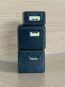
A module that supports multiple interfaces gives engineers flexibility. They can prototype on a desktop, move to a Raspberry Pi or ARM Linux platform, and later connect to a custom embedded system. The HM-LD1 supports UART, UDP, and UVC, making it practical for different UAV and robotics development workflows.
Power Consumption
Drone power budgets are limited. Lower wattage reduces battery burden, heat generation, and power conversion requirements. It can also make the system easier to integrate into compact airframes. High-power sensors may require additional regulation, thermal design, or larger batteries, which can reduce flight time.
The HM-LD1 has a specified power consumption of 1.2W. For lightweight embedded UAV designs, this is a meaningful advantage because it reduces the power and thermal load compared with larger sensing payloads.
SDK and Platform Support
Development support is critical for engineering teams. The best hardware can still slow a project if data access is difficult or documentation is limited. SDKs for x86 Windows, x86 Linux, and ARM Linux give developers flexibility across prototyping, lab testing, and field deployment.
For UAV and robotics teams, platform compatibility with PCs, Raspberry Pi, Jetson-style embedded computers, ARM Linux systems, and flight controllers should be checked before purchase. Interface and SDK support are often the difference between a quick prototype and a long integration cycle.
Why Lightweight LiDAR Matters for Small Drones
Small drones have limited payload capacity, limited power budgets, and limited internal mounting space. A heavy sensor can shorten flight time, shift the center of gravity, increase vibration sensitivity, and reduce safety margin. Lightweight LiDAR modules help engineers add perception capability without transforming the UAV into a much larger platform.
Payload Weight Affects Flight Time
Drone endurance is affected by the mass of the sensor, bracket, enclosure, cabling, companion computer, and power electronics. Added payload forces the motors to work harder, which increases current draw and reduces available flight time. It can also reduce responsiveness and make the drone less stable in wind.
When evaluating LiDAR for small drones, use the total installed weight, not only the sensor weight. A compact 28g module can provide a major advantage when compared with heavier payloads, especially for inspection and autonomy projects where the drone must remain agile and efficient.
Compact Modules Enable More Mounting Options
Compact LiDAR modules can be installed in positions that are difficult for larger sensors. A front-facing module can support collision detection. A downward-facing module can support altitude hold and landing. An angled module can support terrain following or near-ground sensing. A side-facing module can assist with facade inspection or wall following.
Small modules can also be protected inside compact housings or integrated into multi-sensor layouts with cameras, IMUs, ultrasonic sensors, or radar. This flexibility is useful when building UAVs for specialized environments.
Low Power LiDAR Helps Embedded UAV Designs
Low power consumption reduces thermal load and simplifies power design. A 1.2W module places less demand on the drone’s power system than many larger sensors. This can help engineers keep battery size, converter size, and heat dissipation under control. In compact UAVs, this is a practical engineering advantage.
Survey-Grade LiDAR vs Perception-Level LiDAR
One of the most important decisions when choosing drones for LiDAR is whether you need survey-grade mapping or perception-level sensing. These categories overlap in terminology, but they serve different goals. Confusing them can lead to poor purchasing decisions and unrealistic expectations.
When You Need Survey-Grade Drone LiDAR
You need survey-grade drone LiDAR when the mission requires georeferenced mapping deliverables, validated accuracy, professional point cloud processing, and engineering or legal confidence. Typical requirements include RTK or PPK GNSS, calibrated IMU, high-density scanning, accurate time synchronization, boresight calibration, quality control, and post-processing.
These systems are more expensive and complex because they solve a full measurement problem, not just local ranging. If the job needs to stand up in an engineering review, construction workflow, utility survey, or legal boundary-related environment, do not try to fake it with a lightweight perception module.
When You Need Perception-Level LiDAR
You need perception-level LiDAR when the drone must detect obstacles, maintain altitude, follow terrain, support navigation, assist with inspection, or provide robotic vision data. In these applications, local distance information is often more important than georeferenced survey output. A solid-state dToF module can be a strong fit because it provides compact depth sensing with lower integration complexity.
Look at the aircraft and the job. If you are building a small UAV that needs to sense nearby structure, ground, or obstacles, then payload weight, power, field of view, interfaces, and SDK support may matter more than long-range survey point density.
Why This Difference Matters
| Requirement | Survey-Grade UAV LiDAR | Lightweight Perception LiDAR |
|---|---|---|
| Main Goal | Georeferenced mapping deliverables | Real-time depth sensing and obstacle awareness |
| Typical Hardware | LiDAR scanner, GNSS, IMU, data logger | Compact dToF or solid-state LiDAR module |
| Best For | Land surveying, corridor mapping, terrain modeling | UAV navigation, inspection, altitude hold, robotics |
| Integration Complexity | High | Low to moderate |
| Cost Level | High | Lower and development-friendly |
This difference matters because a compact perception module may be excellent for drone autonomy but insufficient for certified surveying. Conversely, a survey-grade payload may be unnecessary, too heavy, or too expensive for a small drone that only needs local obstacle detection.
Drone LiDAR Integration Workflow
Successful drone LiDAR integration requires more than mounting a sensor and reading data. A practical workflow should define the mission, verify payload and power budget, choose the mounting position, connect the right interface, process depth data, and validate performance in realistic conditions.
Step 1 — Define the Mission
Start by defining what the drone must accomplish. Is it mapping terrain, inspecting a bridge, avoiding obstacles, holding altitude, following terrain, or feeding a SLAM or navigation stack? A clear mission statement determines the required range, field of view, accuracy, frame rate, interface, and output format.
Step 2 — Check Drone Payload and Power Budget
Calculate the full installed payload. Include the LiDAR sensor, bracket or enclosure, cable weight, companion computer, power converter, and battery margin. Also review the drone’s center of gravity and vibration characteristics. A lightweight module can reduce risk, but it still must be mounted securely and powered correctly.
Step 3 — Choose the Mounting Position
Mounting position depends on the mission. Forward-facing placement supports collision avoidance. Downward-facing placement supports altitude hold and landing. Angled placement can help with terrain following. Side-facing placement can support wall, bridge, or building facade inspection. The field of view should cover the region where decisions must be made.
Step 4 — Connect Data Interfaces
Choose the interface that matches your system architecture. UART may be useful for compact embedded systems and flight controllers. UDP may be appropriate for companion computers and network-style data handling. UVC can simplify access to depth data in PC or embedded Linux workflows. Interface planning should happen before mechanical design because cables, connectors, and data routing affect the final layout.
Step 5 — Process Depth Maps and Point Clouds
After data is available, the system must process it into useful information. A raw depth image may be converted into a point cloud, filtered to remove invalid measurements, segmented into obstacle zones, or reduced into distance thresholds. Robotics teams may combine LiDAR with cameras, IMUs, optical flow, or flight controller data. The processing method should match the mission and the sensor’s resolution and frame rate.
Step 6 — Validate in Indoor and Outdoor Conditions
Validation is essential. Test the LiDAR in bright sunlight, indoor lighting, dark surfaces, reflective surfaces, angled targets, vibration, changing temperature, and real flight motion. Outdoor LiDAR range may be shorter than indoor range. Testing should include the actual mounting position and expected drone speed. A sensor that works on a bench must still be validated in the air.
Recommended Lightweight Drone LiDAR Module: DTOF Solid State LiDAR HM-LD1
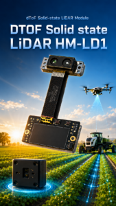
For small drones, robotic systems, and embedded perception projects, the DTOF Solid State LiDAR HM-LD1 offers a compact way to add real-time depth sensing and 3D point cloud data. It is designed for applications such as obstacle avoidance, distance detection, autonomous navigation, smart inspection, terrain following, and robotic vision development.
With a 28g weight, low 1.2W power consumption, and UART/UDP/UVC interfaces, it is suitable for development teams that need a lightweight LiDAR module rather than a heavy survey-grade UAV payload. In the shop, that means less payload penalty, simpler wiring, less heat, and more flexibility during integration.
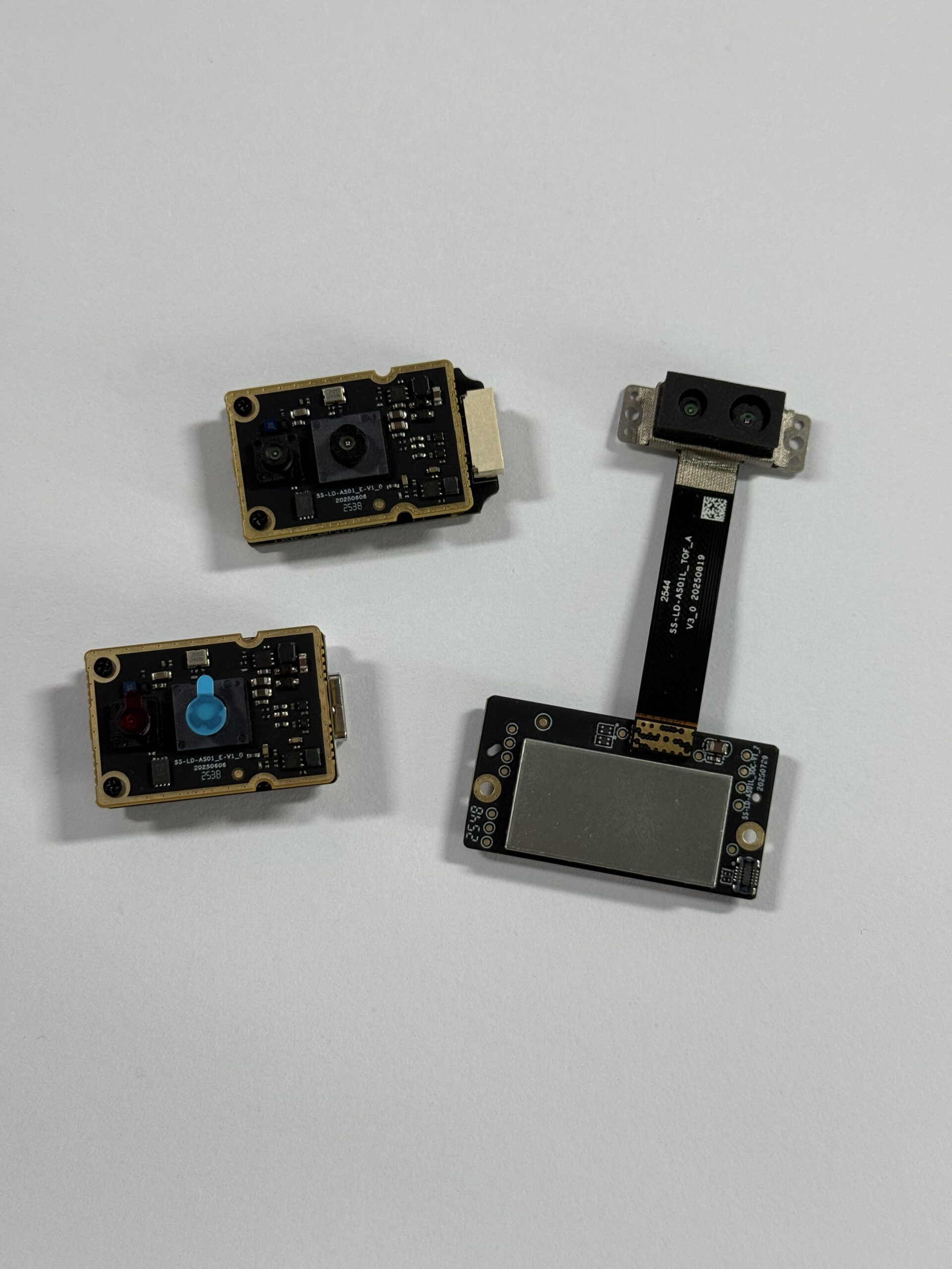
The HM-LD1 is a solid-state LiDAR module based on SPAD dToF technology. It delivers real-time depth images and 3D point cloud data for accurate environmental perception. Its ranging capability is specified as 0.5–25m indoors and 0.2–8m outdoors, with ±3cm ranging accuracy. This makes it useful for compact UAV perception, robotic navigation, short-range inspection, altitude hold, distance detection, and embedded vision development.
View the product page:
DTOF Solid State LiDAR HM-LD1
| Specification | DTOF Solid State LiDAR HM-LD1 |
|---|---|
| Product Name | DTOF Solid State LiDAR HM-LD1 |
| Product URL | https://myrobotproject.com/product/dtof-solid-state-lidar-hm-ld1/ |
| Dimensions | 43.5mm × 30mm × 26.5mm |
| Ranging Capability | Indoor: 0.5–25m; Outdoor: 0.2–8m |
| Ranging Accuracy | ±3cm |
| Field of View | 60° horizontal × 45° vertical |
| Weight | 28g |
| Resolution | 40 × 30 |
| Frame Rate | 10fps |
| Interface | UART / UDP / UVC |
| Operating Temperature | -20℃ to 60℃ |
| Power Consumption | 1.2W |
| Technology | Solid-state LiDAR based on SPAD dToF technology |
| Output | Real-time depth images and 3D point cloud data |
| Development Platform Support | SDKs for x86 Windows, x86 Linux, and ARM Linux |
| Typical Applications | UAV obstacle avoidance, altitude hold, terrain following, robotic navigation, smart inspection, distance detection, and robotic vision development |
| Brochure | Download DTOF SSL HM-LD1 Product Brochure |
View Product Details & Pricing ➔
Best-Fit Applications for HM-LD1
The HM-LD1 is best suited for lightweight perception applications where compact size, low weight, low power consumption, and flexible interfaces matter. Good-fit applications include small UAV obstacle detection, low-altitude navigation, terrain following, altitude hold, smart inspection near bridges, expressways, dams, and industrial structures, robotic navigation, distance detection, and embedded development using PCs, Raspberry Pi-class platforms, ARM Linux, or flight controllers.
Its 60° × 45° field of view and 40 × 30 depth resolution can support local awareness and prototype perception tasks. Its UART, UDP, and UVC interfaces allow different integration paths, while SDK support for x86 Windows, x86 Linux, and ARM Linux helps development teams move from lab prototypes to embedded systems.
Use it where local perception is the goal. That includes close-range sensing, distance monitoring, development platforms, indoor robotics work, UAV prototyping, and short-range outdoor inspection where the specified outdoor range fits the job. Do not use it as a shortcut for certified survey mapping.
When HM-LD1 Is Not the Right Choice
The HM-LD1 is not a complete survey-grade UAV LiDAR system by itself. It does not replace RTK or PPK GNSS, a calibrated IMU, time synchronization, mapping software, or professional survey validation. If your project requires certified land surveying, high-density georeferenced point clouds, or long-range corridor mapping, you should evaluate a full survey-grade LiDAR payload.
HM-LD1 is better positioned for depth sensing, navigation support, smart inspection, obstacle awareness, distance measurement, and close-range UAV perception. This distinction helps teams choose the right tool and avoid expecting a compact perception sensor to perform like a professional aerial mapping system.
Drone LiDAR Buying Checklist
Before selecting LiDAR for drones, compare both the technical requirements and the supplier support model. The right sensor should fit your airframe, mission, development platform, and commercial workflow. Look past the headline range number and ask what the system will really do once it is mounted, powered, wired, and flown.
Technical Checklist
- ✅ What is the drone’s usable payload capacity after battery and safety margin?
- ✅ What is the required ranging distance indoors and outdoors?
- ✅ Is the application survey-grade mapping or perception-level sensing?
- ✅ What accuracy is required for the mission?
- ✅ What field of view is needed?
- ✅ What resolution and frame rate are required?
- ✅ Does the LiDAR support UART, UDP, UVC, or another required interface?
- ✅ Can the development platform run the SDK?
- ✅ Does the system require ROS, OpenCV, Raspberry Pi, Jetson, or embedded Linux integration?
- ✅ What is the power consumption and thermal impact?
Commercial Checklist
- ✅ Is the module available from a direct manufacturer or source factory?
- ✅ Is technical support available for integration?
- ✅ Are SDKs and documents available?
- ✅ Can the product be customized if the project scales?
- ✅ Is the supplier experienced in perception and positioning modules for robots and UAVs?
MyRobotProject specializes in perception and positioning modules for robots and UAVs, with technical support for product integration and application development. For account management, order history, or customer access, visit My Account. If you are ready to purchase or request checkout details, continue to Checkout.
Choose a Lightweight LiDAR Module for Your UAV Project
If your drone project requires compact 3D sensing, obstacle detection, terrain following, altitude hold, or embedded robotic vision, the DTOF Solid State LiDAR HM-LD1 provides a lightweight and development-friendly option. Its 28g body, 1.2W power consumption, real-time depth image output, 3D point cloud data, and UART/UDP/UVC interfaces make it suitable for small UAVs, robots, and inspection systems where size and weight are critical.
The key is to match the LiDAR to the mission. For survey-grade mapping, choose a complete LiDAR payload with GNSS, IMU, calibration, and post-processing. For lightweight UAV perception, choose a compact sensor that provides the right local distance data, interface compatibility, and power efficiency. HM-LD1 is designed for the second category: practical, compact, real-time depth sensing for drones and robotic systems.
Here’s the deal in plain shop-floor language: buy the sensor for the job you actually have. If you need certified terrain deliverables, build a full mapping system. If you need a small drone to understand what is nearby, keep the system light, simple, and easy to integrate.
FAQ: Drones for LiDAR
Is there any LiDAR for small drones?
What should beginners consider before buying a LiDAR drone?
Can a budget drone LiDAR setup be used for land surveying?
What is the difference between drone LiDAR and photogrammetry?
How accurate is LiDAR on a drone?
What LiDAR range is needed for drone obstacle avoidance?
Can drone LiDAR work outdoors in sunlight?
Is solid-state LiDAR better for drones?
What interfaces are useful for integrating LiDAR with drones?
Can LiDAR help drones fly close to bridges, dams, and buildings?
Can a lightweight LiDAR module create a 3D point cloud?
Do I need RTK for drone LiDAR?
📚 References & Further Reading
- Industry Standard: Trimble positioning and geospatial technology
- Industry Standard: Blickfeld industrial LiDAR technology
- Related Guide: GPS RTK for robotics, drones, and surveying
- Product: DTOF Solid State LiDAR HM-LD1






