Drone Object Avoidance: How to Choose LiDAR & Vision Sensors for Safer Autonomous UAVs
A drone that can fly automatically is not automatically safe. Here’s the deal: in industrial UAV work, “it flies” is only the starting point. The real test is whether the aircraft can stay out of trouble when it gets close to bridge beams, warehouse racks, tree branches, power structures, cranes, walls, moving vehicles, and the kind of awkward obstacles that never show up in clean demo videos. Reliable drone object avoidance depends on more than a camera view. It takes accurate depth perception, low-latency processing, environmental toughness, a useful field of view, and a clean connection into the flight-control stack.
This guide walks through how drone object avoidance actually works, how LiDAR and vision sensors compare, and which specifications matter when you’re choosing a sensor for autonomous UAVs. We’ll cover detection range, field of view, frame rate, outdoor performance, payload weight, interface options, point cloud output, and integration with embedded platforms. We’ll also look at the HM-LD1 compact dToF solid-state LiDAR module as a practical example of how lightweight depth sensing can support safer UAV navigation, altitude hold, terrain following, inspection, and robotic perception.
Table of Contents
- 👉 What Is Drone Object Avoidance?
- 👉 Obstacle Detection vs Object Avoidance
- 👉 How Drone Object Avoidance Works
- 👉 Sensor Types for Drone Object Avoidance
- 👉 LiDAR vs Vision Sensors for UAV Object Avoidance
- 👉 Key Specifications to Compare When Choosing a Drone Object Avoidance Sensor
- 👉 Lightweight dToF LiDAR Example for Drone Object Avoidance
- 👉 How to Integrate LiDAR into a Drone Object Avoidance System
- 👉 Where Drone Object Avoidance Matters Most
- 👉 Drone Object Avoidance Sensor Selection Checklist
- 👉 Final Recommendation
- 👉 FAQ: Drone Object Avoidance
What Is Drone Object Avoidance?
Drone object avoidance is the ability of an unmanned aerial vehicle to perceive nearby objects, estimate their distance and position, judge collision risk, and change its flight path before impact. You’ll hear people call it drone obstacle avoidance, UAV collision avoidance, autonomous drone perception, or flight safety. In the shop, we usually care less about the label and more about the behavior: does the aircraft know what is around it quickly enough to make a safe move?
For industrial UAVs, object avoidance is not a nice-to-have feature. It can be the difference between a completed inspection and a damaged aircraft sitting under a bridge span. Inspection drones may need to fly close to concrete, steel, cables, and irregular surfaces. Warehouse drones may need to move through narrow aisles with racks, forklifts, workers, and reflective packaging. Agricultural drones may need to hold altitude over uneven crop canopies or terrain. A forward-facing setup can reduce frontal collision risk. A downward-facing setup can support altitude hold and terrain following. Side-facing sensors can help maintain wall clearance. Multi-directional sensing gives the drone a better chance when the mission is complex.
We’ve recently been testing the HM-LD1 compact dToF LiDAR in a variety of r…
Look, object avoidance is not one magic sensor bolted to the airframe. It is a chain of functions. First, the sensor has to detect the surrounding environment. Second, the system has to estimate depth or distance. Third, the onboard computer or flight controller has to decide whether the object sits inside the drone’s safety corridor. Finally, the aircraft has to slow down, stop, climb, descend, sidestep, or reroute. If one link in that chain is weak, the drone may still crash even though the sensor technically “saw” the obstacle.
Industrial drone object avoidance demands more discipline than many consumer-style avoidance features. These missions often happen near expensive assets, workers, moving equipment, reflective metal, cables, beams, glass, vegetation, or infrastructure that cannot be inspected safely by hand. A false positive can stop a mission for no good reason. A false negative can damage the UAV, payload, facility, or inspected structure. For more detail on lightweight UAV sensing options, see our guide on LiDAR with drone: how to choose a lightweight sensor for UAV mapping.
Obstacle Detection vs Object Avoidance
One common mistake in UAV development is treating obstacle detection and object avoidance as the same thing. They are not. Detection means the system noticed something. Avoidance means the aircraft used that information to stay out of trouble. That gap matters once you move from a bench test to a flying platform dealing with changing light, vibration, wind, motion blur, limited power, and real-world control delays.
Obstacle Detection
Obstacle detection means a sensor identifies that something is present. The information may come from a camera, LiDAR sensor, ultrasonic sensor, radar, optical flow module, stereo depth camera, or dToF depth module. A basic ultrasonic sensor may report that an object is nearby. A depth camera may produce a depth map. A LiDAR module may output distance values or a 3D point cloud. A camera running AI may recognize a person, vehicle, landing pad, shelf, pallet, pipe, or structural feature.
But here’s the catch: a drone can detect a wall and still fly into it. Detection by itself does not guarantee safe braking distance, correct control behavior, useful filtering, or a valid avoidance path. The output has to be interpreted against the drone’s speed, direction of travel, allowed flight corridor, payload clearance, braking limits, and mission objective.
Object Avoidance
Object avoidance adds decision-making. The onboard system must decide whether the detected object matters to the current flight path. A beam off to the side may be harmless. A thin pole directly ahead may need an immediate slowdown. The control stack must decide whether to stop, hover, climb, descend, turn, sidestep, or reroute around the obstacle.
For reliable UAV object avoidance, accurate range and low latency matter. If the drone is moving quickly, even a small delay eats up reaction distance. That is why frame rate, interface bandwidth, processing architecture, and flight-controller integration matter just as much as the sensor’s advertised maximum range.
Why This Difference Matters in Industrial UAVs
Industrial environments are messy. Warehouses have narrow aisles, metal racks, forklifts, workers, shiny packaging, dark corners, and repetitive geometry. Inspection sites have cables, concrete edges, bridge spans, towers, dams, beams, and irregular surfaces. Outdoor UAVs face sunlight, shadows, wind, rain, dust, vibration, and changing surface reflectivity.
In these environments, a perception sensor needs to do more than produce occasional distance readings. The system should support continuous data capture, filtering, safety-zone evaluation, and predictable control response. In many serious UAV builds, the strongest approach combines LiDAR, dToF depth sensing, vision, IMU, GNSS, optical flow, radar, and flight-control logic instead of leaning on one sensor and hoping for the best.
How Drone Object Avoidance Works
A practical drone object avoidance system is a feedback loop. Sensors measure the environment. Software turns raw data into useful spatial information. The system evaluates risk. The flight controller changes motion. Then the loop repeats again and again while the aircraft moves through the world.
⚙️ 1. Environmental Sensing
Environmental sensing is the first layer. LiDAR provides direct range or depth measurements using light. Cameras provide visual context and can support recognition. Stereo cameras estimate depth by comparing two camera views. Ultrasonic sensors give short-range proximity data. Radar can help in dust, fog, smoke, or rain. Optical flow sensors estimate relative ground motion for hover stability and indoor positioning.
In a good industrial design, multi-sensor perception often beats a single-sensor setup. A bridge inspection drone may use LiDAR to maintain distance from the structure and a camera to capture inspection imagery. A warehouse UAV may combine depth sensing with visual markers, SLAM, or map-based localization. The right mix depends on the mission, but the goal is always the same: get trustworthy spatial data into the control system before the aircraft runs out of room.
⚙️ 2. Depth Estimation and Point Cloud Generation
Depth estimation tells the drone how far objects are from the airframe. Direct time-of-flight, or dToF, measures how long light takes to travel to a target and return. Stereo vision estimates depth from image disparity. Structured light and ToF cameras generate depth maps by projecting or measuring light patterns. LiDAR and dToF modules can output depth images and 3D point cloud data, giving software a three-dimensional representation of nearby surfaces.
A depth map helps identify near and far regions across the sensor’s field of view. A point cloud supports occupancy mapping, obstacle segmentation, SLAM, and 3D perception. For drone object avoidance, the important point is not whether the visualization looks nice on a monitor. The data has to be accurate, timely, and usable for control decisions.
⚙️ 3. Obstacle Classification and Risk Assessment
Once the system has depth or distance information, it needs to decide whether the object is dangerous. That depends on current velocity, direction, acceleration limits, mission path, rotor clearance, and safety margin. A wall straight ahead is high risk. A forklift crossing a warehouse aisle may require predictive avoidance. A branch near the edge of the path may or may not be safe depending on wind, aircraft attitude, and propeller clearance.
Good risk assessment checks whether an object is static or moving, whether it sits inside the safety corridor, whether it is closer than the braking distance, and whether the drone is moving toward it. For industrial applications, it is common to define multiple zones such as a warning zone, braking zone, and emergency stop zone.
⚙️ 4. Path Planning and Flight Controller Response
After the system decides there is risk, the drone must respond. It may slow down, stop, hover, climb, descend, sidestep, return to a safe point, or reroute. A warehouse drone may stop and wait for a worker or forklift. An inspection drone may maintain a fixed standoff distance from a surface. An agricultural drone may adjust altitude to follow terrain.
Integration may involve MAVLink messages, ROS nodes, PX4, ArduPilot, a companion computer, or a custom embedded controller. The perception system must convert depth maps, point clouds, or distance values into commands the flight-control system understands. Good sensor data is not useful if the controller cannot act on it reliably.
⚙️ 5. Feedback Loop and Real-Time Correction
Avoidance is continuous. The drone does not make one decision and call the job finished. It keeps sensing, evaluating, and correcting. Frame rate, processing delay, communication latency, and control-loop frequency all affect reaction distance. A sensor with adequate range can still perform poorly if the data pipeline is slow. A moderate-range depth module can work well in controlled inspection or indoor navigation if the drone speed and safety margins are set correctly.
Sensor Types for Drone Object Avoidance
There is no universal best sensor for every UAV. The right choice depends on speed, environment, payload capacity, compute budget, safety requirements, and the type of obstacle the drone must avoid. Below are the most common sensor categories used in drone obstacle avoidance and autonomous UAV navigation.
LiDAR Sensors
LiDAR sensors measure distance using light. They are strong for geometry, depth, mapping, and 3D spatial perception. Unlike passive cameras, LiDAR does not depend entirely on visible texture in the scene, which makes it useful around blank walls, repetitive structures, low-texture industrial surfaces, and complicated infrastructure.
Mechanical LiDAR uses moving parts to scan. Solid-state LiDAR reduces or removes spinning mechanisms, which can improve compactness and durability. dToF modules provide depth data in a compact format that fits embedded platforms and smaller UAVs. Industrial LiDAR suppliers such as HOKUYO have long been used in robotics and automation, which tells you something important: dependable range sensing is still a core building block in real machine perception.
Solid-State dToF LiDAR Modules
Solid-state dToF LiDAR modules are attractive for drones because they can be compact, lightweight, and easier to mount than larger scanning systems. They use direct time-of-flight measurement to provide depth images and 3D point cloud data without large rotating assemblies. For UAVs, that can support altitude hold, terrain following, close-range inspection, object avoidance, landing assistance, and robotic vision development.
A dToF depth module can be mounted forward, downward, or in multiple directions. Since drones have limited payload capacity, low weight and low power consumption are not small details. They directly affect flight time, thermal design, and available payload budget. Modules that support UART, UDP, and UVC can also simplify development across embedded computers, flight controllers, PCs, and Linux-based platforms.
Stereo Vision Cameras
Stereo vision cameras use two image sensors to estimate depth from disparity. They are useful for visual navigation, recognition, scene understanding, SLAM, visual odometry, and object detection when paired with enough computing power. They also provide image data that can be valuable for inspection and documentation.
The limitations need to be respected. Stereo depth depends on lighting, texture, calibration, exposure, and processing resources. Blank walls, glass, reflective surfaces, repetitive warehouse patterns, low light, glare, and motion blur can reduce reliability. Stereo vision can be powerful, but it needs validation under the same conditions the drone will actually fly in.
Monocular Cameras with AI
Monocular cameras are lightweight, inexpensive, and very good for semantic understanding. With AI models, they can identify people, vehicles, shelves, signs, landing pads, crops, cracks, corrosion, and structural features. They are often used for inspection, tracking, navigation, and recognition.
A single camera, however, does not directly measure depth the way LiDAR does. Depth may be estimated using AI, known object size, motion, or other sensors. For edge-AI processing considerations, see our article on the SpacemiT K3 chip and RISC-V AI CPU. In many industrial UAV systems, monocular cameras work best beside LiDAR or dToF depth sensors that provide direct range data.
Ultrasonic Sensors
Ultrasonic sensors are low-cost short-range distance sensors. They can help with landing assistance, simple proximity detection, and low-speed experiments. They are common in basic robotics because they are simple to understand and integrate.
For fast autonomous UAVs, ultrasonic sensors are rarely enough by themselves. They have limited range, limited spatial resolution, and can be affected by soft surfaces, angled surfaces, wind, acoustic noise, and environmental conditions. They may still be useful as supporting sensors, especially for short-range downward sensing.
Millimeter-Wave Radar
Millimeter-wave radar can work well in dust, fog, smoke, rain, and poor visibility where optical systems may struggle. It can detect moving objects and provide relative velocity information. That makes radar useful for harsh environments and safety-oriented perception.
The tradeoff is spatial detail. Radar typically provides lower geometric resolution than LiDAR or vision. It may detect that something is there but provide less shape and position detail. In drone object avoidance, radar is often best used as a complement rather than a full replacement for LiDAR or depth vision.
Optical Flow Sensors
Optical flow sensors measure motion relative to the ground by tracking visual movement across an image. They are useful for indoor hover stability, low-altitude positioning, and GPS-denied flight. Many smaller drones use optical flow to improve station keeping when GNSS is unavailable.
Optical flow is not a complete object avoidance solution. It does not provide full 3D obstacle awareness and may depend on ground texture and lighting. Think of it as a positioning and stabilization aid that can support, but not replace, LiDAR, depth vision, or other obstacle detection sensors.
LiDAR vs Vision Sensors for UAV Object Avoidance
LiDAR and vision are not enemies. They solve different pieces of the perception problem. LiDAR and dToF depth sensors are strong for direct range, geometry, and obstacle distance. Vision cameras are strong for recognition, semantic understanding, and visual documentation. In many industrial systems, the best answer is both.
| Factor | LiDAR / dToF Depth Sensor | Vision Camera / Stereo Camera |
|---|---|---|
| Distance Measurement | Direct depth or range measurement | Estimated from image disparity, AI, or motion |
| Low-Texture Environments | Generally stronger | Can struggle with blank walls or repetitive surfaces |
| Object Recognition | Geometry-focused, not semantic by itself | Strong when combined with computer vision or AI |
| Outdoor Sunlight | Depends on sensor design and range capability | Can be affected by glare, shadows, and exposure |
| Weight | Varies; compact dToF modules can be very lightweight | Usually lightweight, but may require more compute |
| Best Use | Reliable depth, altitude, obstacle distance, 3D perception | Recognition, tracking, visual navigation, scene understanding |
For example, a drone inspecting a dam may use LiDAR to hold a stable distance from the surface and a high-resolution camera to capture cracks or corrosion. A warehouse UAV may use depth sensing for obstacle distance and a camera for barcode, shelf, or object recognition. An agricultural drone may use a downward dToF depth module for terrain following and a camera for crop analysis.
Companies such as Blickfeld also show how solid-state LiDAR is being used where compact depth sensing and environmental perception are required. If the main job is reliable obstacle distance, LiDAR or dToF depth sensing often becomes the foundation. If the job is classification, vision and AI matter more. If the drone operates near people or assets, a hybrid stack usually gives the better safety margin.
Key Specifications to Compare When Choosing a Drone Object Avoidance Sensor
Choosing a drone object avoidance sensor is an engineering decision, not just a catalog exercise. The best sensor for a slow indoor inventory drone may be a poor choice for a fast outdoor inspection UAV. Look at the specs in the context of real flight conditions.
Detection Range
Detection range determines how early the drone can see trouble. Faster drones need longer reaction distance because they travel farther during sensor acquisition, processing, communication, and braking. Indoor drones may need shorter range but higher precision, especially in narrow aisles or near walls. Outdoor UAVs need verified range under sunlight, changing reflectivity, and weather.
Ranging Accuracy
Ranging accuracy affects braking distance, clearance margin, and stability near obstacles. Accuracy in the ±3 cm class can be useful for close-range obstacle perception, altitude hold, and inspection distance control. Still, accuracy should be tested across different surfaces and lighting conditions. A sensor that works on a white indoor wall may behave differently on black plastic, reflective metal, vegetation, glass, or outdoor concrete.
Field of View
Field of view defines how much of the flight corridor the sensor can observe. A wider FOV covers more space but may come with resolution or range tradeoffs. A narrow FOV may require multiple sensors or tighter mounting discipline. Forward-facing sensors protect forward motion. Downward-facing sensors support landing and terrain following. Side-facing sensors help with wall clearance and indoor navigation.
Mounting matters. A sensor mounted too low may be blocked by landing gear. A sensor mounted near propellers may see vibration, airflow effects, or electrical noise. A forward sensor does not protect sideways flight unless software limits lateral motion or the UAV has additional side sensors.
Frame Rate and Latency
Frame rate tells you how often new data arrives. Latency includes sensor exposure, internal processing, data transmission, onboard computing, filtering, decision-making, and flight-controller response. A 10 fps sensor updates about every 100 milliseconds before extra processing delays. That can be fine for low-speed inspection, altitude hold, landing assistance, or controlled indoor flight, but it must match the drone’s velocity and braking ability.
Do not judge frame rate alone. Test the complete perception-control loop. The question is simple: can the aircraft detect, decide, and respond before crossing the safety boundary?
Weight and Size
Every gram matters on a UAV. Sensor weight increases motor load, reduces battery endurance, and can affect balance and stability. Compact sensors are easier to mount on crowded airframes and can make multi-directional sensing practical without overloading the aircraft.
Power Consumption
Power consumption directly affects flight energy and thermal design. Low-power sensors are valuable on battery-powered drones where every watt counts. Engineers also need to consider voltage regulation, wiring, companion computer power, enclosure heat, and cooling.
Interface and Software Support
Interface support can make or break development time. UART is useful for embedded distance data and microcontroller communication. UDP works well for networked data transmission to onboard computers or PCs. UVC can simplify image or depth-stream workflows. SDK support is also important when working with Windows, Linux, ARM Linux, Raspberry Pi, Jetson, ROS, PX4, ArduPilot, or custom embedded platforms.
Environmental Adaptability
Environmental adaptability includes sunlight, dust, fog, rain, temperature, reflective surfaces, vibration, and calibration stability. Outdoor drone object avoidance is harder than indoor testing because strong light can reduce effective range for some optical systems, while glare and shadows can challenge cameras. Real validation should include different materials, lighting conditions, angles, and flight speeds.
Lightweight dToF LiDAR Example for Drone Object Avoidance
The DTOF Solid State LiDAR HM-LD1 is a compact solid-state LiDAR module based on SPAD dToF technology. It is designed to deliver real-time depth images and 3D point cloud data for robotic perception, distance detection, obstacle avoidance, autonomous navigation, UAV altitude hold, terrain following, and inspection applications. Its 28 g weight and 1.2 W power consumption make it suitable for drone platforms where payload weight and energy use directly affect flight time.
The HM-LD1 supports indoor ranging from 0.5 m to 25 m and outdoor ranging from 0.2 m to 8 m. The product details describe accurate ranging outdoors at 8 meters on a clear summer day at roughly 80,000 lux. That outdoor capability matters for bridges, expressways, dams, and other structures that may be difficult or unsafe for people to approach. For compact UAVs, the small housing and low mass help simplify integration on airframes with limited space.
For development teams, the module supports UART, UDP, and UVC interfaces, allowing integration with embedded platforms, PCs, Raspberry Pi-class systems, flight-control architectures, and networked processing workflows. MRP also offers SDKs for x86 Windows, x86 Linux, and ARM Linux, which can reduce software integration time for robotics and UAV developers.
Learn more about the DTOF Solid State LiDAR HM-LD1.
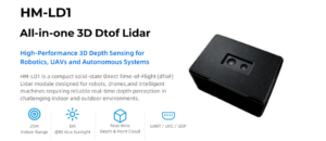
| Specification | HM-LD1 Details |
|---|---|
| Product Name | DTOF Solid State LiDAR HM-LD1 |
| Technology | SPAD dToF solid-state LiDAR |
| Dimensions | 43.5 mm × 30 mm × 26.5 mm |
| Weight | 28 g |
| Indoor Ranging Capability | 0.5–25 m |
| Outdoor Ranging Capability | 0.2–8 m |
| Ranging Accuracy | ±3 cm |
| Field of View | 60° horizontal × 45° vertical |
| Resolution | 40 × 30 |
| Frame Rate | 10 fps |
| Interfaces | UART / UDP / UVC |
| Operating Temperature | -20°C to 60°C |
| Power Consumption | 1.2 W |
| Output Data | Real-time depth images and 3D point cloud data |
| Development Support | SDKs for x86 Windows, x86 Linux, and ARM Linux |
View Product Details & Pricing ➔
Download HM-LD1 Product Brochure
How to Integrate LiDAR into a Drone Object Avoidance System
Integrating LiDAR into a drone object avoidance system takes more than mounting a sensor and reading distance values. The team needs to define where protection is needed, match sensor range to flight speed, choose a data interface, process depth information, connect that information to control logic, and validate behavior under controlled conditions before trusting the aircraft in autonomous operation.
⚙️ Step 1: Define the Avoidance Direction
Start with the mission. A forward-facing sensor protects the drone during forward flight. A downward-facing sensor supports altitude hold, terrain following, landing assistance, and ground clearance. Side-facing sensors help indoor drones maintain distance from walls, shelves, racks, or infrastructure. Rear sensors support reverse flight and automated backing maneuvers. Full 360-degree awareness usually requires multiple sensors or a panoramic perception system.
⚙️ Step 2: Match Sensor Range to Drone Speed
Sensor range must match drone speed and braking capability. A slow indoor UAV can use shorter detection distances than a fast outdoor platform. Engineers should consider the distance traveled during sensor latency, onboard processing, communication, and flight-controller response, then add braking distance and a safety margin. If the required safety distance is greater than the reliable sensor range in the target environment, the aircraft must slow down, use a longer-range sensor, add sensors, or change the mission behavior.
⚙️ Step 3: Choose the Data Interface
The data interface affects reliability and development complexity. UART is useful for simple embedded distance data or microcontroller-based systems. UDP works well when sending data across a network to a companion computer. UVC can simplify integration when the sensor behaves like a video or depth stream device. The HM-LD1 supports UART, UDP, and UVC, giving developers flexibility for prototype and deployment architectures.
⚙️ Step 4: Process Depth Data or Point Clouds
Raw depth data should be filtered and converted into actionable information. Software may remove invalid pixels, smooth noise, define danger zones, segment obstacles, or convert the depth map into an occupancy grid. Point cloud data can support 3D occupancy mapping, SLAM, and close-range spatial analysis. In many UAV object avoidance systems, engineers define a flight corridor and treat any object inside that corridor and within a critical distance as a collision risk.
⚙️ Step 5: Connect to Flight Control Logic
The perception output must reach the flight-control logic in a predictable way. In PX4 or ArduPilot systems, a companion computer such as a Raspberry Pi or Jetson may process LiDAR or depth data and send obstacle information through MAVLink. ROS-based development can use nodes for sensor input, filtering, obstacle mapping, and command generation. Custom embedded systems may use direct UART or network data to trigger speed limits, stop commands, or rerouting logic.
⚙️ Step 6: Test in Controlled Environments
Start testing with static obstacles in a controlled space. Evaluate different surfaces, distances, angles, and lighting conditions. Validate indoor and outdoor range separately. Test emergency stop behavior before autonomous rerouting. Tune speed limits, braking thresholds, and safety margins. Then introduce moving objects, narrow corridors, reflective surfaces, vegetation, vibration, and real inspection targets. Bench tests are useful, but flight tests reveal the problems that matter.
Where Drone Object Avoidance Matters Most
Drone object avoidance is valuable anywhere the UAV must fly near structures, people, assets, or terrain. The need gets stronger when the drone operates autonomously, indoors, beyond direct line-of-sight monitoring, or near expensive payloads.
Infrastructure Inspection
Infrastructure inspection drones may fly near bridges, expressways, dams, towers, power structures, concrete, and steel. Accurate distance measurement helps the UAV maintain safe clearance from surfaces that are hard or dangerous for humans to reach. Depth sensing can also support stable standoff distance for cameras, thermal imagers, or other inspection payloads.
Warehouse and Factory UAVs
Warehouses and factories are full of narrow aisles, shelving, forklifts, workers, conveyors, reflective packaging, and GPS-denied navigation. Object avoidance helps prevent collisions while supporting inventory checks, security patrols, asset monitoring, and automation research. Indoor UAVs often benefit from lightweight depth sensors because they need local perception without relying on GNSS.
Security and Zone Monitoring
Security drones may perform patrol routes, intrusion detection, perimeter monitoring, object presence detection, and zone inspection. Object avoidance helps the drone react to unexpected obstacles, people, vehicles, gates, temporary barriers, or environmental changes. Depth sensing can also support zone intrusion monitoring and presence detection in fixed or mobile platforms.
Agriculture and Terrain Following
Agricultural drones may fly over uneven terrain, crop height variations, trees, irrigation structures, and field obstacles. Downward or forward depth sensing can support terrain following, low-altitude monitoring, spraying consistency, and safer navigation near vegetation. A depth map or point cloud can be more informative than a single downward distance reading when terrain is irregular.
Research, Robotics, and SLAM Development
Research teams and robotics developers use LiDAR, depth cameras, and dToF modules for SLAM, 3D mapping, navigation algorithms, obstacle avoidance, and autonomous perception experiments. Compact sensors with SDK support and Linux compatibility are especially useful for prototyping. Depth maps and point clouds let teams test algorithms on real spatial information instead of simple proximity values.
Drone Object Avoidance Sensor Selection Checklist
Use this checklist before choosing a sensor for drone object avoidance, UAV altitude hold, terrain following, or autonomous navigation. The point is to match the sensor to the aircraft, mission, environment, and software architecture.
- ✅ What is the drone’s maximum operating speed?
- ✅ What minimum obstacle detection distance is required?
- ✅ Will the drone operate indoors, outdoors, or both?
- ✅ Does the sensor need to work under sunlight?
- ✅ Is direct depth measurement required?
- ✅ What field of view is needed for the flight corridor?
- ✅ How much payload weight can the UAV support?
- ✅ What is the available power budget?
- ✅ Does the system need UART, UDP, UVC, USB, Ethernet, or CAN?
- ✅ Does the sensor provide SDK support?
- ✅ Will the system use Raspberry Pi, Jetson, PC, or a flight controller?
- ✅ Is point cloud output required?
- ✅ Does the application require object recognition or only distance detection?
- ✅ Will multiple sensors be needed for front, side, rear, or downward coverage?
- ✅ How will avoidance decisions be tested and validated?
If your UAV project requires compact depth sensing, explore the HM-LD1 dToF solid-state LiDAR module for lightweight drone object avoidance, distance detection, and 3D perception development.
Final Recommendation
Safe drone object avoidance requires accurate sensing, reliable depth data, low-latency processing, suitable field of view, flight-controller integration, and real-world testing. No single specification should be judged by itself. Range must match speed. Frame rate must be evaluated with full system latency. Field of view must match the protected direction. Weight and power must fit the UAV payload budget. Software support must match the development platform.
Cameras and LiDAR often work best together. LiDAR and dToF depth sensors provide direct range and geometry, while vision sensors provide object recognition and scene understanding. IMU, GNSS, optical flow, radar, and flight-controller logic can further improve robustness depending on the mission. For industrial UAVs, the right perception stack reduces crash risk, protects payloads, improves mission continuity, and enables safer autonomous operation around real structures and people.
For teams needing a compact lightweight dToF LiDAR, the HM-LD1 is a practical option to evaluate. It provides real-time depth images and 3D point cloud data, 28 g weight, 1.2 W power consumption, 60° × 45° FOV, ±3 cm ranging accuracy, indoor range up to 25 m, outdoor range up to 8 m, UART / UDP / UVC interfaces, and SDK support for x86 Windows, x86 Linux, and ARM Linux.
Explore the DTOF Solid State LiDAR HM-LD1 or download the product brochure to evaluate it for your UAV object avoidance, terrain following, distance detection, and robotic perception project.
FAQ: Drone Object Avoidance
Why does my drone detect obstacles but fail to avoid them?
Is drone object avoidance worth the extra cost for DIY, research, or commercial UAVs?
What sensor should I use for drone obstacle avoidance: camera, LiDAR, or both?
How much detection range does a drone object avoidance sensor need?
Can a lightweight LiDAR sensor be used for UAV altitude hold and terrain following?
What is the difference between ToF, dToF, and LiDAR for drone perception?
Is 10 fps enough for drone object avoidance?
Can one sensor provide full 360-degree drone object avoidance?
📚 References & Further Reading
- Industry Standard: HOKUYO | Blickfeld
- Related Guide: LiDAR with drone: how to choose a lightweight sensor for UAV mapping | DTOF Solid State LiDAR HM-LD1 | SpacemiT K3 chip and RISC-V AI CPU