


Understanding LiDAR Meaning: A Comprehensive Guide to Industrial 3D Perception
In the rapidly evolving landscape of the fourth industrial revolution, the term “LiDAR meaning” has transitioned from a niche surveying acronym to a foundational pillar of autonomous technology. For industrial engineers and system integrators, LiDAR—Light Detection and Ranging—represents the “eyes” of modern machinery. It is a remote sensing method that uses light in the form of a pulsed laser to measure ranges (variable distances) to the Earth or specific objects. In an industrial context, this translates to real-time spatial intelligence, allowing machines to perceive their surroundings with millimeter-level precision, regardless of ambient lighting conditions.
As we move toward high-density automation, understanding the operational physics and the strategic advantages of LiDAR technology is paramount. Traditional sensors often fall short in high-speed, dynamic environments like busy warehouses or outdoor infrastructure sites. This is where Direct Time-of-Flight (dToF) and Solid-State LiDAR technologies emerge as the premier choice. By integrating advanced hardware like the HM-LD1 dToF Solid-State LiDAR, industries can bridge the gap between simple obstacle detection and complex environment mapping, enabling the next generation of Autonomous Mobile Robots (AMRs) and Unmanned Aerial Vehicles (UAVs) to operate with unprecedented reliability.
Look, if you’ve been on the shop floor recently, you know that “good enough” sensors just don’t cut it anymore. When we talk about the “LiDAR meaning” in a real-world setting, we aren’t just talking about a fancy laser pointer. We’re talking about the difference between a robot that constantly freezes because it’s “confused” by a sun-drenched window and a machine that gets the job done 24/7. Here’s the deal: to stay competitive, you need to understand exactly how these photons are working for you.
Table of Contents
Beyond the Acronym: Defining LiDAR for Industry
While the literal “LiDAR meaning” refers to Light Detection and Ranging, its industrial significance lies in its ability to create “Digital Twins” of physical spaces in microseconds. Unlike cameras, which rely on passive light and complex image-processing algorithms to estimate depth, LiDAR is an “active” sensor. It emits its own energy source—near-infrared laser pulses—and measures the time it takes for those pulses to bounce off an object and return to the receiver. This allows for consistent performance in total darkness or beneath the harsh glare of the midday sun.
In the professional sphere, LiDAR is the gold standard for high-accuracy surveying. Leading providers like CHC Navigation utilize this technology for large-scale geospatial mapping, where sub-centimeter accuracy is required. However, for internal logistics and robotics, the focus shifts toward miniaturization and high-speed data output. This leads us to the distinction between various LiDAR methodologies, particularly the rise of Solid-State systems which eliminate the mechanical vulnerabilities of traditional spinning mirrors.
When an engineer asks for the “LiDAR meaning” in a project brief, they are typically inquiring about the sensor’s ability to handle high-dynamic-range (HDR) environments. Modern units, such as our HM-LD1 module, are designed with SPAD (Single-Photon Avalanche Diode) detectors. These detectors are sensitive enough to capture single photons, allowing the sensor to maintain accuracy at long distances even when the target has low reflectivity, such as black plastic or matte surfaces common in manufacturing plants.
Physics of Perception: How dToF LiDAR Functions
To truly grasp LiDAR, one must understand the difference between Indirect Time-of-Flight (iToF) and Direct Time-of-Flight (dToF). Most consumer-grade depth cameras use iToF, which measures the phase shift of a continuous light wave. While effective for short distances, iToF struggles with multi-path interference and sunlight saturation.
The HM-LD1 LiDAR utilizes dToF (Direct Time-of-Flight). In this architecture, a laser driver sends a discrete pulse of light. A high-speed timer starts the moment the pulse leaves the emitter and stops the instant the SPAD detector registers the return signal. The distance is then calculated using the constant speed of light. This method is inherently more robust for industrial applications because it is less susceptible to “motion blur” and ambient light noise.
Basically, you’re getting a faster, cleaner signal that doesn’t freak out when the environment gets messy. Once thousands of these pulses are fired per second across a specific Field of View (FOV)—such as the 60° horizontal by 45° vertical coverage provided by the HM-LD1—the result is a Point Cloud. This is a 3D coordinate system where every point represents a specific X, Y, and Z coordinate in space. This data can then be processed into a Depth Map, providing a visual representation of distance that a robot’s onboard computer can use for path planning and obstacle avoidance.
The Solid-State Revolution in Robotic Vision
For years, LiDAR was synonymous with bulky, spinning cylinders mounted on top of autonomous cars. These mechanical LiDARs are excellent for 360-degree coverage but are prone to mechanical wear, calibration drift, and failure in high-vibration environments. The industry has since pivoted toward Solid-State LiDAR (SSL).
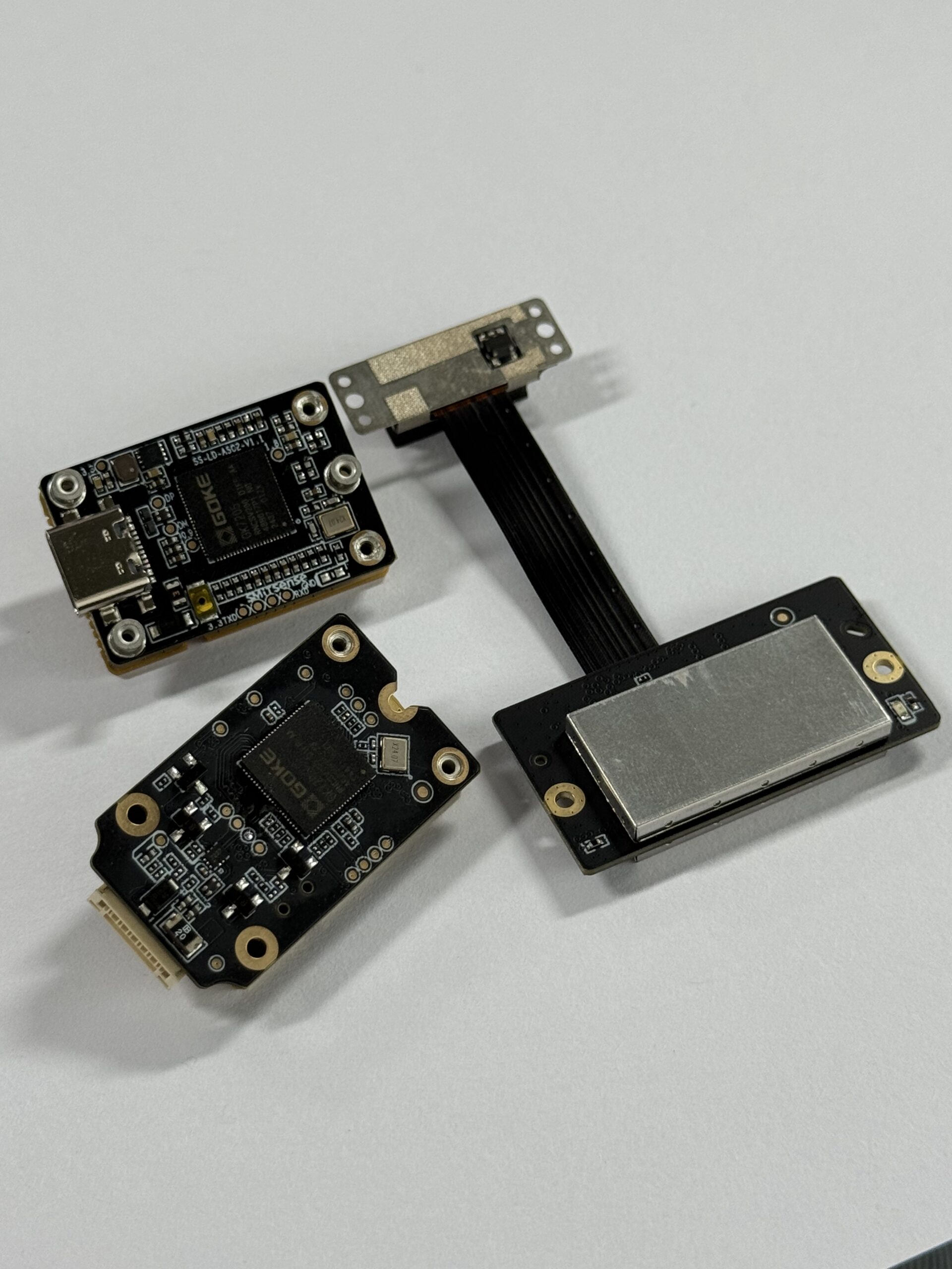
Solid-state sensors, like the HM-LD1, have no moving parts. The “scanning” is done either through an array of flash emitters or optical phase arrays. This architectural shift provides several key advantages for industrial engineering:
- ✅ Increased MTBF (Mean Time Between Failure): Without motors or bearings, the sensor’s lifespan is significantly extended.
- ✅ Vibration Resistance: Ideal for UAVs (drones) where high-frequency motor vibrations would cause mechanical sensors to fail or produce distorted data.
- ✅ Compact Form Factor: The HM-LD1 weighs only 28 grams and measures 43.5mm x 30mm x 26.5mm, making it small enough to fit into the “fingertips” of robotic grippers or the nose of a small drone.
- ✅ Cost-Efficiency: Solid-state components can be mass-produced using semiconductor processes, bringing the high cost of LiDAR down to a range accessible for small-to-medium enterprise (SME) automation.
Deep Dive: HM-LD1 Solid-State LiDAR Technical Specs
For systems designers, the value of a LiDAR sensor is found in its data sheet. The HM-LD1 is engineered to balance high resolution with low power consumption, specifically targeted at mobile platforms where battery life is a critical KPI.
| Attribute | Technical Specification | Industrial Value |
|---|---|---|
| Ranging Principle | SPAD dToF (Solid-State) | High reliability; no moving parts. |
| Indoor Range | 0.5m – 25m | Covers large warehouse aisles and halls. |
| Outdoor Range | 0.2m – 8m (at 80,000 lux) | Functional in direct summer sunlight. |
| Accuracy | ±3cm | Precise enough for pallet docking. |
| Field of View (FOV) | 60°(H) x 45°(V) | Wide-angle perception for obstacle avoidance. |
| Resolution | 40 * 30 points | Dense point cloud for object recognition. |
| Power Consumption | 1.2 W | Enables longer UAV flight times. |
| Operating Temp | -20 ℃ to 60 ℃ | Industrial-grade thermal resilience. |
View Product Details & Pricing ➔
Strategic Multi-Scenario Applications
The “lidar meaning” in modern commerce is best defined by its versatility. The HM-LD1 is not just a distance sensor; it is a multi-tool for environmental perception. Below are the primary industrial domains where this technology is currently driving ROI.
Unmanned Aerial Vehicles (UAVs)
For drones, weight is the enemy of endurance. At only 28g, the HM-LD1 allows for advanced features like **Terrain Following** and **Altitude Hold** without significantly impacting the payload. Drones can maintain a consistent distance from the ground while flying over sloping terrain, which is vital for agricultural spraying or power line inspections. Furthermore, its 8-meter outdoor range ensures that drones can detect and dodge obstacles like branches or wires in real-time.
Autonomous Mobile Robots (AMRs)
In logistics, robots must navigate dynamic environments populated by human workers. LiDAR allows these robots to perform **SLAM (Simultaneous Localization and Mapping)**. The HM-LD1 provides the necessary depth data to keep maps updated in real-time, ensuring the robot doesn’t collide with a newly placed pallet or a moving forklift. Its compact housing makes it easy to integrate into low-profile robots that need to maneuver under shelving units.
Smart Infrastructure and Security
Beyond mobility, solid-state LiDAR is a powerful tool for fixed-position monitoring. It can be used for **Zone Intrusion Monitoring**, creating an invisible “light curtain” that triggers an alarm if a person enters a dangerous work zone near heavy machinery. Because it produces 3D point clouds rather than 2D images, it also preserves privacy, making it an ideal choice for user presence detection in smart offices or public spaces.
When you’re setting up a safety perimeter, you need reliability. Here’s a quick look at how we deploy these systems in the field:
- ⚙️ Calibration: Mount the HM-LD1 at the desired height and angle for optimal coverage.
- ⚙️ Integration: Connect via UART or UVC to your controller of choice.
- ⚙️ Thresholding: Define the “Danger Zone” in your software to trigger GPIO alerts.
- ⚙️ Deployment: Run real-time diagnostics to ensure the point cloud is filtering out ambient noise.
Quality Control and Volume Measurement
In manufacturing, the HM-LD1 can be used to measure the volume of objects on a conveyor belt or detect if a bin is full. By calculating the distance to the top layer of products, the system can automate inventory levels with ±3cm accuracy, reducing the need for manual inspections.
Industrial LiDAR: Frequently Asked Questions
How is LiDAR different from Radar and Photogrammetry in industrial settings?
Why do some LiDAR sensors fail in outdoor sunlight, and how does dToF fix this?
Can I integrate the HM-LD1 with Linux, ROS, or Raspberry Pi?
Does the HM-LD1 support customized industrial requirements?
📚 References & Further Reading
- Industry Standard: South Surveying & Mapping Technology
- Industrial Insight: CHC Navigation – High Precision LiDAR Systems
- Related Guide: Download HM-LD1 Full Product Brochure & SDK






