


Here’s the deal: for survey crews, inspection teams, and industrial drone buyers, the dji matrice 350 rtk usually lands near the top of the shortlist when LiDAR mapping comes up. Pair it with the right professional LiDAR payload and it can handle corridor mapping, utility inspection, quarry measurement, construction progress tracking, terrain modeling, asset digitization, and high-value infrastructure documentation. But the buying decision is not just about the aircraft. In the real world, the money is made or lost in the full workflow: total ownership cost, payload compatibility, RTK and PPK reliability, software dependency, operator training, maintenance planning, compliance rules, and whether the system can scale across a fleet.
This guide is written as a practical investment analysis for procurement managers, UAV mapping firms, robotics integrators, and engineering teams. We’ll look at when the DJI Matrice 350 RTK earns its keep, when it becomes too expensive or restrictive, and when a modular RTK solution is the cleaner choice for custom UAVs, autonomous rovers, ground robots, embedded mapping systems, or non-DJI fleets. Centimeter-level positioning does not only come from a ready-made drone platform. It can also come from multiband RTK modules that support NMEA 0183 output, RTCM correction input or output, UART integration, tight timing synchronization, and multi-constellation GNSS reception.
Look, the Matrice 350 RTK is a serious enterprise aircraft, not a hobby drone with a fancy acronym. The platform has value because it packages aircraft reliability, payload support, battery logistics, flight planning, and field operations into one mature system. That matters when a crew is working near a substation, over a quarry, along a pipeline corridor, or on a construction site where delays cost money and bad data creates rework.
At the same time, not every team needs the whole aircraft ecosystem. In the shop, on a test bench, or inside a robotics lab, the real requirement may simply be accurate GNSS data flowing into a controller, onboard computer, ROS stack, PX4 flight controller, ArduPilot system, or proprietary navigation pipeline. In those cases, a modular RTK receiver may be the better engineering decision and the better financial decision.
Table of Contents
- 👉 Executive Summary: Is DJI Matrice 350 RTK Worth It?
- 👉 What Is the DJI Matrice 350 RTK?
- 👉 How LiDAR Mapping Works with RTK Drones
- 👉 What Really Determines Survey Accuracy?
- 👉 Cost, ROI, and Ownership Analysis
- 👉 Limitations, Restrictions, and Procurement Risks
- 👉 RTK Alternatives for Custom UAVs and Robotics
- 👉 Recommended RTK Modules and Specifications
- 👉 DJI Matrice 350 RTK vs Modular RTK Alternatives
- 👉 How to Choose the Right RTK Mapping Solution
- 👉 FAQ
Executive Summary: Is DJI Matrice 350 RTK Worth It?
The DJI Matrice 350 RTK is worth considering when an organization needs a mature enterprise UAV platform for professional LiDAR mapping, inspection, and aerial surveying. Its strength is not only RTK positioning. The real value comes from the complete working ecosystem: compatible payloads, enterprise-grade control, repeatable flight planning, battery management, integrated field procedures, and deployment practices that have already been proven on commercial jobs.
For teams that run frequent paid mapping projects, the platform can justify its cost by reducing mission time, improving repeatability, supporting professional deliverables, and helping operators standardize how work gets done in the field. A crew that can show up, plan the mission, fly safely, process the data, and deliver usable output without rebuilding the workflow every time has a serious operational advantage.
However, the DJI Matrice 350 RTK should never be evaluated as a simple aircraft purchase. A complete LiDAR mapping system may include the aircraft, LiDAR payload, batteries, charging station, controller, RTK base station or correction subscription, mapping software, point-cloud processing software, insurance, maintenance, training, spare parts, transport equipment, and operator labor. That full investment can be significant, especially for small survey teams, internal engineering departments, research labs, robotics startups, and integrators that do not need the full DJI ecosystem.
The platform is strongest when the buyer wants an enterprise-ready aerial mapping workflow rather than a custom engineering project. It fits professional drone service providers, infrastructure inspection companies, quarry and mining teams, public safety mapping units, and construction survey teams that need repeatable results and operational efficiency. If the business already uses DJI aircraft or payloads, the Matrice 350 RTK can slide naturally into existing training, maintenance, and field procedures.
It may not be the best choice when the project requires a custom UAV, autonomous rover, robot, marine vehicle, embedded controller, PX4-based aircraft, ArduPilot platform, ROS-based data pipeline, or proprietary hardware architecture. In those cases, modular RTK receivers can provide centimeter-level GNSS positioning without forcing the buyer into a complete aircraft ecosystem. Products such as the Multiband RTK Survey Module HM-D13 and the Helical Antenna RTK Module HM-D20 are designed for teams that need direct GNSS integration, UART output, NMEA and RTCM compatibility, multi-constellation reception, rugged outdoor operation, and engineering flexibility.
In plain terms, the DJI Matrice 350 RTK is a strong investment when your organization needs a complete enterprise drone system for high-value mapping and inspection. A modular RTK solution is often a better investment when the core requirement is precise positioning for a custom UAV, rover, robot, or embedded industrial system.
What Is the DJI Matrice 350 RTK?
What the Platform Is Designed For
The DJI Matrice 350 RTK is an enterprise UAV platform built for professional applications such as industrial inspection, surveying, mapping, emergency response, public safety, energy infrastructure inspection, and asset monitoring. Unlike consumer drones, an enterprise aircraft is expected to support harder field conditions, longer missions, payload flexibility, stronger control links, repeatable procedures, and compatibility with professional data workflows.
For LiDAR mapping, the aircraft is only one part of a larger measurement system. The UAV must carry the sensor safely and consistently, follow planned flight paths, maintain stable positioning, and give the crew the operational reliability required for commercial work. The value of the Matrice platform is strongest when the buyer needs an integrated aerial system rather than a component-level GNSS solution.
In the shop, engineers may focus on specifications. In the field, crews care about whether the system starts cleanly, holds its mission plan, manages batteries predictably, protects the payload, and brings back usable data. That is why the platform decision should include both technical capability and day-to-day operating behavior.
Why RTK Matters in Mapping
RTK stands for real-time kinematic positioning. In a typical RTK workflow, a base station or correction network sends correction data to the rover receiver on the drone. These corrections help reduce GNSS positioning error from meter-level to centimeter-level under suitable open-sky conditions. For aerial mapping, RTK improves the quality of the drone trajectory and can reduce the number of ground control points required, depending on project requirements and local standards.
But RTK is not magic. It does not automatically guarantee final survey accuracy. The final deliverable depends on LiDAR sensor calibration, IMU performance, boresight alignment, GNSS signal quality, base station coordinate accuracy, time synchronization, flight altitude, point density, ground control strategy, and post-processing methods. A professional buyer should evaluate the entire workflow, not only the aircraft’s positioning feature.
Where DJI Matrice 350 RTK Fits in the LiDAR Stack
A complete LiDAR mapping stack usually includes the aircraft platform, GNSS and RTK positioning, an inertial measurement unit, a LiDAR sensor, optional RGB camera, base station or correction service, flight planning software, trajectory processing tools, point-cloud processing software, coordinate transformation workflow, QA/QC procedures, and final CAD or GIS deliverables. The DJI Matrice 350 RTK can serve as the aircraft and positioning foundation inside this stack, especially when paired with a compatible professional payload.
LiDAR mapping also depends on optical sensing and photonics principles. For readers who want broader technical context on optics, photonics, and remote sensing research, SPIE is a useful industry reference. For optical sensing components, emitters, photodetectors, and industrial sensor technology, AMS Osram provides additional context on sensing hardware used across industrial systems.
How LiDAR Mapping Works with RTK Drones
Step 1 — Mission Planning
LiDAR mapping quality starts before takeoff. A professional mission plan must account for flight altitude, flight speed, scan angle, terrain variation, vegetation density, required point density, ground control strategy, weather conditions, battery planning, takeoff location, landing zone, airspace restrictions, and GNSS obstruction risk. Poor planning can produce uneven point density, weak surface returns, strip misalignment, missing coverage, or unreliable elevation models.
For corridor mapping, such as roads, pipelines, railways, and powerlines, the mission planner must maintain consistent coverage along a long route while managing terrain changes and signal obstruction. For construction sites, the planner may prioritize repeatable flight paths so progress surveys can be compared over time. For open-pit mines and quarries, terrain relief, dust, wind, and safety zones become major planning factors.
⚙️ A good mission plan usually starts with the required deliverable, then works backward into flight height, overlap, scan settings, ground control, and battery logistics. The aircraft platform matters, but a good LiDAR result is always the product of the aircraft, sensor, GNSS quality, operator skill, and processing workflow working together.
Step 2 — RTK and PPK Positioning
RTK and PPK are both correction workflows used to improve positioning quality. RTK applies correction data during flight, allowing the UAV to estimate its corrected position in real time. PPK applies correction data after the mission, usually during trajectory processing. Many professional mapping teams use RTK for operational awareness and PPK for final trajectory refinement, especially when the correction link may be unstable or when the project requires maximum post-processed reliability.
Correction quality depends on satellite geometry, base station placement, baseline distance, multipath conditions, radio or network reliability, correction message format, and time synchronization. Modular RTK receivers can be valuable in custom workflows because they allow engineering teams to manage correction data directly. For example, a receiver that supports NMEA 0183 output and RTCM input can be integrated with flight controllers, rovers, embedded computers, or survey software according to the project architecture.
Step 3 — LiDAR Acquisition
LiDAR sensors emit laser pulses and measure return timing to generate 3D point clouds. Important acquisition factors include pulse repetition rate, returns per pulse, scan pattern, range, reflectivity, surface type, vegetation penetration, and flight geometry. In forested or vegetated environments, multiple returns can help detect both canopy and ground surfaces. In industrial sites, reflective surfaces, steel structures, wires, and machinery can create complex return patterns that require careful processing.
Industrial buyers often focus on the aircraft name first, but LiDAR performance is deeply connected to sensor design, optical measurement, timing, and processing. Research communities and engineering references such as SPIE are useful for understanding the broader technical background behind optical sensing and remote sensing systems.
Step 4 — Trajectory and Point-Cloud Processing
After acquisition, the collected data must be processed into usable deliverables. GNSS and IMU data are fused to estimate the sensor trajectory. Boresight calibration aligns the LiDAR coordinate frame with the IMU and aircraft frame. Strip alignment corrects mismatches between overlapping flight lines. Ground filtering separates bare-earth points from vegetation, buildings, vehicles, and other objects. Noise removal improves cloud quality. Coordinate transformations place the data into the required local or national reference system.
Final deliverables may include classified point clouds, digital elevation models, digital surface models, contours, stockpile volumes, transmission line clearance reports, roadway surface models, construction progress documentation, or CAD/GIS layers. The DJI Matrice 350 RTK can be part of this workflow, but the quality of the final output depends heavily on the complete processing chain.
Step 5 — Accuracy Validation
Professional survey deliverables should be validated against known ground control points and independent checkpoints. Accuracy is often reported using RMSE values, horizontal error, vertical error, and project-specific tolerances. Manufacturer positioning specifications are useful, but they are not the same as project-level accuracy guarantees. A receiver or aircraft may support centimeter-level positioning, yet the final point cloud can still be affected by IMU drift, calibration error, poor satellite geometry, unstable corrections, or processing mistakes.
For this reason, serious buyers should evaluate workflow repeatability, QA/QC procedures, operator training, and field validation methods before making a purchase decision. The best system is not always the one with the most impressive single specification. The best system is the one that reliably produces acceptable deliverables for the intended work.
What Really Determines Survey Accuracy?
GNSS Frequency Bands and Constellations
Multiband and multi-constellation GNSS improves positioning reliability by allowing the receiver to access more satellite signals and better correct certain errors. Modern professional receivers may use GPS, BeiDou, Galileo, GLONASS, QZSS, and IRNSS signals. More constellations can improve satellite availability, especially in environments with partial sky obstruction, terrain blockage, structures, or vegetation.
This is one reason modular RTK receivers are attractive for custom systems. The HM-D13 supports GPS L1/L5, Beidou B1/B2A/B2I, Galileo E1/E5, QZSS L1/L5, GLONASS G1, and IRNSS. The HM-D20 supports GPS L1/L5, BeiDou B1/B2A/B2I, GLONASS G1, Galileo E1/E5, QZSS L1/L5, and IRNSS L5. These signal combinations are relevant for UAV navigation, robotics positioning, surveying, mobile mapping, and autonomous vehicle applications where robust satellite reception is important.
RTK Correction Quality
RTK accuracy depends on more than the receiver. Correction quality is affected by baseline distance, base station coordinate quality, RTCM message availability, correction stream stability, radio or cellular communication reliability, multipath environment, satellite geometry, and fix status stability. A poor base station coordinate or unstable correction link can reduce the quality of the entire mission, even if the receiver hardware is capable of high precision.
For enterprise drone mapping, operators must decide whether to use a local base station, a network correction service, or a PPK workflow. For custom UAVs and rovers, engineering teams may need direct access to correction input and output. The HM-D13 supports NMEA 0183 output and RTCM input at the rover side, and RTCM output at the base side. The HM-D20 supports NMEA 0183 output and RTCM input at the rover side. These features matter when building controlled RTK workflows outside a closed platform ecosystem.
Time Synchronization
Timing synchronization is critical when a moving platform collects sensor data. If the GNSS position, IMU measurement, camera exposure, or LiDAR pulse timing are not aligned properly, small timing errors can become spatial errors. At UAV speeds, even milliseconds can matter. That is why precise timestamping, trigger alignment, and sensor synchronization are important in LiDAR mapping and mobile robotics.
Both the HM-D13 and HM-D20 specify 20 ns timing synchronization accuracy. For integrators, this type of timing capability can be relevant when designing precise positioning systems, sensor fusion workflows, UAV navigation stacks, or robotic mapping platforms. Timing alone does not guarantee survey deliverable accuracy, but it is a key part of the measurement chain.
Antenna Placement and Phase Center
The physical location of the GNSS antenna matters. Position data corresponds to the antenna phase center, not automatically to the drone’s geometric center, LiDAR origin, camera center, vehicle control point, or robot coordinate frame. In custom platforms, the integrator must measure offsets between the antenna, IMU, LiDAR sensor, camera, and vehicle body frame. These lever-arm offsets must then be handled correctly in the navigation and processing workflow.
This factor is especially important for robotics and autonomous vehicles because the navigation controller may use one coordinate frame while the mapping sensor uses another. A compact integrated antenna module such as the HM-D20 may simplify installation on smaller platforms, while a mushroom-shaped integrated module such as the HM-D13 may suit survey and UAV applications where a larger outdoor antenna form factor is acceptable.
Environmental Conditions
Environmental conditions can strongly affect positioning and mapping quality. Urban canyons create multipath and limited sky view. Tree canopy blocks or weakens satellite signals. Bridges and steel structures can reflect signals. Open-pit mines introduce steep terrain and changing elevation. Mountain areas may have partial satellite obstruction. Rain, wind, vibration, dust, and temperature changes can affect mission safety and hardware reliability.
Industrial positioning hardware must be designed for outdoor operation. Both the HM-D13 and HM-D20 specify an operating temperature range of -40 ℃ to 85 ℃. The HM-D20 also specifies IP67 waterproof protection, while the HM-D13 is described as windproof and rainproof with UV-resistant PC material for long-term outdoor use. These details matter when the receiver is installed on a UAV, rover, unmanned vehicle, ship, or robot that must operate outside controlled laboratory conditions.
Cost, ROI, and Ownership Analysis
What the Buyer Actually Pays For
A DJI Matrice 350 RTK purchase should be treated as a system investment rather than a single product cost. A realistic budget may include the aircraft body, LiDAR payload, smart controller, batteries, battery station, RTK base station or correction service, mission planning software, mapping software, point-cloud processing software, operator training, insurance, maintenance, spare parts, transport cases, compliance documentation, and labor.
For commercial service providers, the investment may be justified by revenue from mapping projects. For internal enterprise teams, the return may come from reduced survey time, fewer site visits, improved safety, faster reporting, better asset documentation, or lower dependency on external contractors. In both cases, the buyer should calculate total cost of ownership rather than comparing aircraft prices alone.
✅ The platform earns its keep when it reduces field hours, improves repeatability, lowers rework, helps crews deliver higher-value datasets, and gives managers confidence that the workflow can be repeated across jobs and operators.
When the DJI Matrice 350 RTK Makes Financial Sense
The DJI Matrice 350 RTK makes financial sense when the team performs frequent professional mapping or inspection missions and can convert the platform’s capabilities into measurable business value. It is well suited for organizations that need repeatable field procedures, trained operators, standardized deliverables, and integration with established drone mapping workflows. It also makes sense when downtime is expensive and the buyer prefers an enterprise-ready package rather than developing a custom aerial system from individual components.
For example, a UAV mapping company that completes multiple infrastructure or terrain mapping projects each month may recover the investment through higher throughput, better data quality, and reduced field time. A construction company may justify the investment if progress surveys improve coordination, reduce rework, and speed up reporting. A utility inspection team may value safe access to difficult assets more than the hardware cost alone.
When It May Be Overkill
The platform may be overkill if the organization only needs GNSS positioning and does not need a complete enterprise aircraft. It may also be unnecessary for research prototypes, robotics platforms, ground rovers, marine vehicles, custom UAVs, or embedded systems where the main requirement is accurate position data. In these cases, buying a full aircraft and payload ecosystem can add cost, complexity, and dependency that do not match the engineering objective.
Modular RTK receivers are often more appropriate for PX4 integration, ArduPilot workflows, ROS-based robotics, Python or C++ software pipelines, OEM development, and custom sensor architectures. Instead of purchasing a complete drone platform, the engineering team can integrate an RTK module directly into the host system and control the GNSS data flow through UART, NMEA, and RTCM interfaces.
ROI Calculation Framework
A practical ROI estimate should compare annual value against total system investment. Buyers can calculate annual mapping revenue, internal cost savings, crew size reduction, survey time reduction, avoided contractor expenses, software cost, training cost, maintenance cost, insurance cost, downtime risk, and replacement cycle. The question is not whether the DJI Matrice 350 RTK is an impressive platform. The question is whether it produces enough measurable value for the buyer’s specific workload.
If the annual workload is high, a complete enterprise UAV platform may generate strong returns. If the workload is experimental, intermittent, or focused on embedded positioning rather than aerial mapping, a modular RTK receiver may provide a better cost-to-value ratio. A procurement team should also consider lifecycle control, repair strategy, operator availability, and whether future projects will require custom integration beyond the DJI ecosystem.
Limitations, Restrictions, and Procurement Risks
Regulatory and Procurement Concerns
Some organizations evaluate DJI alternatives because of government procurement restrictions, critical infrastructure policies, data governance requirements, cybersecurity review, country-specific compliance, or internal supply-chain rules. These concerns vary by region, organization type, and project sensitivity. Buyers should avoid assumptions and instead consult the actual procurement policy that applies to their organization.
For public agencies, defense-related contractors, utilities, and critical infrastructure operators, platform approval may be as important as technical capability. A drone that is technically suitable may still be difficult to purchase or deploy if it does not meet internal compliance requirements. In these cases, non-DJI platforms and modular RTK hardware can become strategically important because they allow the buyer to design a system around approved components.
Ecosystem Lock-In
Integrated ecosystems simplify operation, but they can limit hardware customization. A closed or semi-closed workflow may be attractive for teams that want predictable operation, but less attractive for engineering teams that need non-standard sensors, experimental payloads, custom GNSS configurations, direct correction stream handling, or embedded autonomy. The more specialized the system, the more important integration flexibility becomes.
Teams building robotics platforms, autonomous vehicles, or custom mapping systems may prefer modular architecture because it gives them more control over hardware selection, firmware, software interfaces, data storage, correction handling, and system behavior. A modular RTK receiver is not a complete drone, but that is exactly why it can be useful for engineering teams that already have their own platform.
Repair, Maintenance, and Lifecycle Planning
Enterprise UAV ownership includes maintenance planning. Batteries have lifecycle limits. Payloads may require calibration. Firmware must be managed. Spare parts must be available. Operators need training. Crash repair must be considered. Fleet expansion may require standardization. A buyer should evaluate not only whether the platform works today, but whether the organization can support it over multiple years.
For modular RTK integrations, maintenance planning is different. The receiver becomes one component in a larger system. The integrator must manage mounting, cabling, power, communication, firmware configuration, environmental protection, and software compatibility. This requires engineering capability, but it also provides greater control over the final system architecture.
Data Ownership and Workflow Control
Industrial buyers should evaluate where flight logs, imagery, point clouds, correction data, base station observations, processed trajectories, and final deliverables are stored and managed. Data control matters for infrastructure inspection, government projects, energy assets, mining operations, and private construction documentation. The right platform depends on the organization’s data governance requirements as well as technical performance.
A DJI-based workflow may be efficient for many commercial teams, while a custom workflow may be preferred when the buyer needs full control over data routing, onboard computing, GNSS correction streams, and processing software. This is another reason modular RTK hardware remains relevant even when enterprise drone platforms are available.
RTK Alternatives for Custom UAVs and Robotics
What Is a Modular RTK Receiver?
A modular RTK receiver is a GNSS positioning component that can be integrated into UAVs, rovers, autonomous vehicles, survey controllers, marine platforms, industrial robots, or embedded systems. Instead of buying a complete drone platform, the user installs the receiver into the target system and connects it to controllers, onboard computers, radios, or correction services. Typical integration features include positioning data output, correction input or output, UART communication, NMEA messages, RTCM correction handling, and timing synchronization.
For custom engineering projects, this approach gives teams direct control over how position data is used. A UAV integrator may connect the receiver to a flight controller. A robotics team may feed GNSS data into a ROS navigation stack. A survey system builder may combine RTK data with LiDAR, IMU, camera, or wheel encoder data. A marine or vehicle platform may use the receiver for navigation and mapping.
Why Integrators Choose Modular RTK
Integrators choose modular RTK hardware because it can reduce system cost, support custom platforms, and provide control over data flow. It is especially useful for teams working with PX4, ArduPilot, ROS, Python, C++, proprietary software, or OEM/ODM product development. Instead of adapting the entire project to a fixed drone ecosystem, the engineering team can design the positioning architecture around the needs of the vehicle or robot.
Modular RTK receivers are also attractive when the buyer needs supply-chain flexibility, non-DJI architecture, direct UART access, or compact hardware. For compact UAV and rover integration, the Helical Antenna RTK Module HM-D20 offers an integrated helical antenna design and IP67 protection. For an integrated mushroom antenna design with base and rover RTCM capability, the Multiband RTK Survey Module HM-D13 is a relevant option.
What to Look For in an RTK Alternative
When evaluating a modular RTK alternative, buyers should consider multi-band GNSS support, multi-constellation reception, RTK horizontal and vertical accuracy, RTCM correction support, NMEA output, antenna design, timing synchronization, environmental durability, interface compatibility, documentation, technical support, and optional communication modules. The best receiver is the one that matches the platform’s physical, electrical, software, and environmental requirements.
For UAVs, weight, mounting position, vibration, and antenna exposure are important. For rovers and robots, integration with navigation software and local coordinate frames may matter more. For marine or outdoor industrial systems, waterproofing and ruggedness can be critical. For survey systems, correction handling, timing synchronization, and validation workflow become major decision factors.
Recommended RTK Modules and Specifications
For teams that need centimeter-level positioning without committing to a complete DJI-based mapping ecosystem, modular RTK receivers can provide direct GNSS integration for UAVs, rovers, autonomous vehicles, survey devices, ships, and industrial robots. The following two modules support multiband, multi-constellation positioning and are designed for embedded integration through UART-based workflows. They are especially relevant when a buyer is comparing the DJI Matrice 350 RTK against custom RTK drone mapping, rover positioning, robotics navigation, or OEM hardware development.
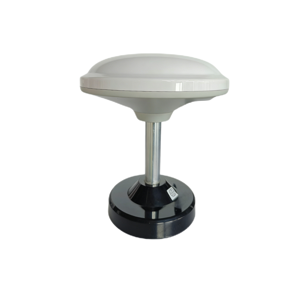
Multiband RTK Survey Module HM-D13
The HM-D13 is an integrated mushroom-shaped GNSS antenna module designed for centimeter-level RTK positioning in UAV navigation, surveying, robotics, mapping platforms, and base/rover workflows. It supports synchronous reception of BDS, GPS, GLONASS, Galileo, QZSS, and IRNSS satellite signals. Its all-in-one module and antenna design helps improve stable signal reception and precise positioning for outdoor industrial applications.
The module is made with UV-resistant PC material for long-term outdoor use and is described as windproof and rainproof for harsh environments. It supports NMEA 0183 output and RTCM input at the rover side, while also supporting RTCM output at the base side. For teams building custom mapping systems, its TTL-level UART interface, 115200 bps baud rate, optional 4G radio module support, and 20 ns timing synchronization accuracy make it suitable for embedded RTK workflows.
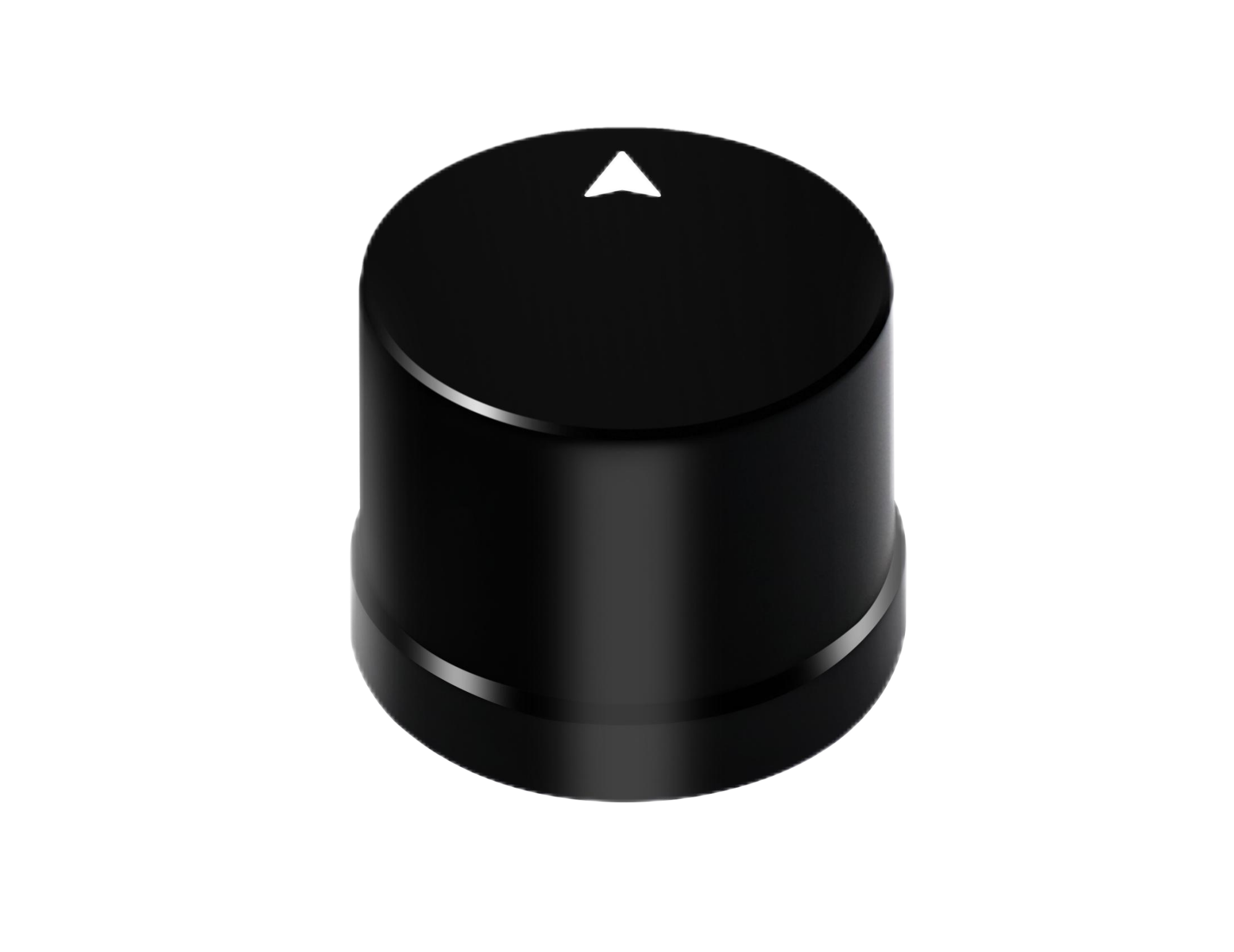
Helical Antenna RTK Module HM-D20
The HM-D20 is a compact helical antenna RTK module with a built-in GNSS module and antenna, designed for easy integration without requiring an external antenna. It is suitable for UAVs, unmanned vehicles, ships, robots, and positioning systems that need centimeter-level RTK performance in a smaller form factor. Its integrated design helps reduce installation complexity for teams building compact platforms.
The HM-D20 supports multiband and multi-constellation reception, NMEA 0183 output, RTCM input at the rover side, TTL-level UART communication, 115200 bps baud rate, and 20 ns timing synchronization accuracy. It also specifies an L1 and L5 GNSS antenna system with at least 40 dB high gain, IP67 waterproof protection, and an operating temperature range of -40 ℃ to 85 ℃, making it a strong fit for outdoor UAV, vehicle, marine, and robotics applications.
| Specification | Multiband RTK Survey Module HM-D13 | Helical Antenna RTK Module HM-D20 |
|---|---|---|
| Product URL | HM-D13 Product Page | HM-D20 Product Page |
| Frequency Band | GPS L1/L5, Beidou B1/B2A/B2I, Galileo E1/E5, QZSS L1/L5, GLONASS G1, IRNSS | GPS L1/L5, BeiDou B1/B2A/B2I, GLONASS G1, Galileo E1/E5, QZSS L1/L5, IRNSS L5 |
| RTK Position Accuracy | H: 1 cm + 1 ppm, V: 1.5 cm + 1 ppm | H: 1 cm + 1 ppm, V: 1.5 cm + 1 ppm |
| Protocol | NMEA 0183 output and RTCM input at rover side. RTCM output at base side. | NMEA 0183 output and RTCM input at rover side |
| Baud Rate | 115200 bps | 115200 bps |
| Interface | TTL level UART interface | TTL level UART interface |
| Timing Synchronization Accuracy | 20 ns | 20 ns |
| Dimensions | Φ152 × 67.9 mm | Φ44 × 37 mm |
| Weight | <550 g | Not specified |
| Antenna Design | Integrated mushroom-shaped GNSS antenna | Integrated helical antenna system |
| Antenna Gain | Not specified | L1 and L5 GNSS antenna system with at least 40 dB high gain |
| Operating Temperature | -40 ℃ – 85 ℃ | -40 ℃ – 85 ℃ |
| Waterproof or Outdoor Protection | UV-resistant PC material; windproof and rainproof outdoor performance | IP67 waterproof protection |
| Optional Communication | Supports optional 4G radio module | Not specified |
| Best Fit | Surveying, UAV navigation, mapping, robotics, base/rover RTK workflows | Compact UAVs, unmanned vehicles, ships, robotics, and industrial positioning systems |
DJI Matrice 350 RTK vs Modular RTK Alternatives
The best choice depends on whether the buyer needs a complete aerial mapping platform or a positioning component for system integration. The DJI Matrice 350 RTK is a complete enterprise UAV platform. HM-D13 and HM-D20 are RTK receiver modules that must be integrated into a host vehicle or system. That distinction is critical. A drone service provider may prefer the operational maturity of a complete UAV. A robotics integrator may prefer the flexibility of a receiver module.
| Decision Factor | DJI Matrice 350 RTK | Modular RTK Modules such as HM-D13 / HM-D20 |
|---|---|---|
| Best Use Case | Enterprise drone LiDAR mapping, inspection, and professional aerial survey workflows | Custom UAVs, rovers, robots, embedded systems, autonomous vehicles, and OEM platforms |
| System Type | Complete enterprise UAV platform | GNSS/RTK positioning component for integration |
| Initial Investment | Higher because aircraft, payload, batteries, software, accessories, and training may be required | Lower component-level investment, depending on host platform and integration work |
| Integration Flexibility | Strong inside DJI ecosystem, more limited for custom hardware architectures | High flexibility through UART, NMEA, RTCM, and embedded workflows |
| RTK Accuracy | Suitable for professional mapping when correctly configured and validated | Centimeter-level positioning with H: 1 cm + 1 ppm, V: 1.5 cm + 1 ppm under suitable RTK conditions |
| Regulatory Control | May face procurement restrictions in some organizations or regions | Better for buyers requiring non-DJI architecture or custom supply-chain control |
| Engineering Requirement | Lower integration burden because the platform is already designed as an enterprise UAV | Requires integration knowledge, controller compatibility, configuration, and validation |
How to Choose the Right RTK Mapping Solution
Choose DJI Matrice 350 RTK If…
✅ Choose the DJI Matrice 350 RTK if you need a complete, enterprise-ready UAV platform for professional LiDAR payload workflows. It is a strong fit when your team values operational efficiency over hardware customization, already works within the DJI ecosystem, needs repeatable flight planning, and has enough project volume to justify the full platform investment. It is also a logical choice when operators need a standardized field workflow and management wants a mature commercial solution instead of a custom engineering build.
The platform is especially appropriate for drone mapping businesses, infrastructure inspection providers, energy companies, quarry operators, construction survey teams, and public safety units that need reliable aerial data collection. In these cases, the value of the system comes from faster field work, consistent data capture, payload compatibility, reduced operational friction, and the ability to deliver professional outputs repeatedly.
Choose a Modular RTK Alternative If…
✅ Choose a modular RTK alternative if you are building a custom UAV, rover, robot, autonomous vehicle, marine platform, or embedded positioning system. It is also the better route if you need PX4, ArduPilot, ROS, Python, C++, proprietary software integration, direct NMEA/RTCM data handling, or OEM/ODM customization. A modular receiver gives the engineering team more control over the positioning architecture and avoids paying for an aircraft platform when the project only needs GNSS/RTK capability.
This approach is often preferred by research teams, robotics companies, industrial automation developers, custom drone manufacturers, and system integrators. The tradeoff is that integration work must be done carefully. The team must handle mounting, power, communication, correction streams, antenna placement, coordinate frames, timing, and validation.
Choose HM-D13 If…
✅ Choose the HM-D13 if you need an integrated mushroom-shaped GNSS antenna RTK module with base and rover workflow support. It is suitable when you need NMEA 0183 output and RTCM input at the rover side, RTCM output at the base side, optional 4G radio module support, and a rugged outdoor design. Its dimensions of Φ152 × 67.9 mm and weight of <550 g should be considered during platform design, especially for smaller UAVs.
The HM-D13 is a good fit for surveying, UAV navigation, mapping, robotics, and RTK workflows where a larger integrated antenna module is acceptable. It is also relevant for teams that want source-factory support, customization options, and direct technical assistance for positioning integration.
Choose HM-D20 If…
✅ Choose the HM-D20 if you need a compact RTK module with dimensions of Φ44 × 37 mm, integrated helical antenna design, IP67 waterproof protection, and high-gain L1/L5 GNSS antenna performance. It is especially suitable for compact UAVs, unmanned vehicles, ships, mobile robots, and industrial positioning systems where space and ruggedness matter.
The HM-D20 provides NMEA 0183 output, RTCM input at the rover side, TTL-level UART interface, 115200 bps baud rate, and 20 ns timing synchronization accuracy. It is a practical option for integrators who need centimeter-level RTK capability in a smaller package without using an external antenna.
Need help choosing between a complete drone system and a modular RTK receiver? Contact the engineering team to discuss RTK integration, UAV navigation, rover positioning, robotics workflows, and OEM/ODM requirements.
FAQ
Is the DJI Matrice 350 RTK with a LiDAR payload sufficient for professional geo surveying?
Is investing in a DJI Matrice 350 RTK and LiDAR workflow worth the money?
What are the main alternatives if users are worried about DJI restrictions or need a non-DJI RTK solution?
What is the difference between RTK and PPK for drone LiDAR mapping?
Does centimeter-level RTK accuracy guarantee centimeter-level survey deliverables?
What is the difference between HM-D13 and HM-D20?
Can HM-D13 or HM-D20 connect to a flight controller, rover, or embedded system?
Does the HM-D13 or HM-D20 require an external antenna?
Which RTK option is better for compact UAVs and mobile robots?
📚 References & Further Reading
- Industry Standard: SPIE | AMS Osram
- Related Guide: Multiband RTK Survey Module HM-D13 | Helical Antenna RTK Module HM-D20






