Searching for the best handheld GPS usually starts with a straightforward question: which device can deliver the most dependable position outdoors? For hikers, hunters, and backcountry users, the answer may be a self-contained navigator with a screen, batteries, buttons, and stored maps. For surveyors, robotics developers, drone integrators, and autonomous-vehicle engineers, though, “best” means something different. In the shop, the conversation quickly turns to centimeter-level positioning, correction-data connectivity, update rate, standard protocols, power requirements, and whether the receiver can be integrated without creating a wiring and software headache.
Here’s the deal: this guide covers two high-precision RTK GNSS products—the lightweight HM-D20 all-in-one module and the field-oriented HM-D13 receiver. Neither one is a conventional recreational handheld GPS with a display, keypad, trail maps, and an internal consumer battery. These are precision positioning components built for engineered systems. If your “handheld” project is really a custom survey pole, portable mapping terminal, field data collector, rover, drone, unmanned ground vehicle, or unmanned surface vessel, their RTK capabilities may matter a lot more than the features found on a consumer trail navigator.
Table of Contents
- 👉 What “Best Handheld GPS” Means for Precision Projects
- 👉 HM-D20 vs HM-D13: Quick Comparison
- 👉 HM-D20 All-in-One RTK GNSS Module
- 👉 HM-D13 RTK GNSS Receiver
- 👉 Accuracy, RTK Corrections, and Fix Quality
- 👉 Communication and System Integration
- 👉 How to Choose the Right Receiver
- 👉 Practical Deployment Considerations
- 👉 Final Verdict
- 👉 Frequently Asked Questions
What “Best Handheld GPS” Means for Precision Projects
A traditional handheld GPS is normally judged by its display, mapping software, battery life, physical controls, route-planning tools, and resistance to weather or impact. Those features still matter for hiking, hunting, geocaching, and emergency navigation. A precision GNSS receiver is evaluated by a different yardstick. Look, if the receiver is going onto a machine, the important questions involve positioning accuracy, satellite and frequency support, correction availability, update rate, data format, antenna performance, electrical requirements, and compatibility with the rest of the system.
Standard satellite navigation can produce a position without a nearby correction source, but ordinary standalone accuracy is not the same thing as an RTK fixed solution. Real-time kinematic positioning uses correction data from a known reference source to resolve errors and calculate far more precise coordinates. Under suitable conditions, the HM-D20 and HM-D13 specify horizontal accuracy of 1.0 cm + 1 ppm and vertical accuracy of 1.5 cm + 1 ppm. The “ppm” term means expected error increases with distance from the reference station. Actual results still depend on satellite visibility, correction quality, baseline length, antenna installation, interference, reflected signals, and whether the receiver can maintain an RTK fixed solution.
That puts both products firmly in the custom-positioning category rather than in the pocket of someone who simply wants to follow a marked trail. They can absolutely support portable equipment, but they still need power, correction data, a connected computer or controller, and software capable of interpreting the output. That distinction is important when these products appear in a search for the “best handheld GPS.” The keyword may be the same, but the job being done is completely different.
For developers who are still laying out the sensing architecture around a mobile platform, the broader material in the technical principles resource library can help place GNSS alongside perception, control, and navigation components. A GNSS receiver tells a platform where it is in a global coordinate frame. It does not, by itself, detect a pallet in an aisle, a tree beside a flight path, or a person walking in front of a vehicle.
HM-D20 vs HM-D13: Quick Comparison
The HM-D20 and HM-D13 have the same listed dual-frequency RTK capability, accuracy specifications, maximum update rate, correction-link choices, supported satellite constellations, and startup times. Their most obvious difference is physical design. The HM-D20 is a compact 38.2 g module aimed at drones, autonomous vehicles, robotics, and survey mapping. The HM-D13 is a much larger field-oriented receiver listed at 550 g for the base-station configuration, with product descriptions that emphasize surveying, farm machinery, robots, and demanding outdoor work.
| Comparison Point | HM-D20 | HM-D13 |
|---|---|---|
| Primary positioning capability | L1/L5 dual-frequency RTK | L1/L5 dual-frequency RTK |
| Listed horizontal accuracy | 1.0 cm + 1 ppm | 1.0 cm + 1 ppm |
| Listed vertical accuracy | 1.5 cm + 1 ppm | 1.5 cm + 1 ppm |
| Maximum update rate | 10 Hz | 10 Hz |
| Dimensions and listed weight | Φ54.5 × 53 mm; 38.2 g | Φ152 × 67.9 mm; 550 g for the base station |
| Data interface | 8-pin; NMEA; UBX | 5-pin XH2.54; NMEA; UBX |
| Notable design emphasis | Low-weight integration for UAVs and compact mobile systems | Field positioning, surveying, UGV and USV navigation |
Neither model is universally better. The HM-D20 is the natural first candidate when payload mass, available space, and compact installation are hard constraints. The HM-D13 makes more sense when a larger field receiver fits the platform and the job puts a stronger emphasis on outdoor deployment. Before buying either one, confirm which 4G or LoRa configuration is included, what cables and accessories come in the package, and whether the intended correction service is available where the equipment will actually operate.
HM-D20 All-in-One RTK GNSS Module
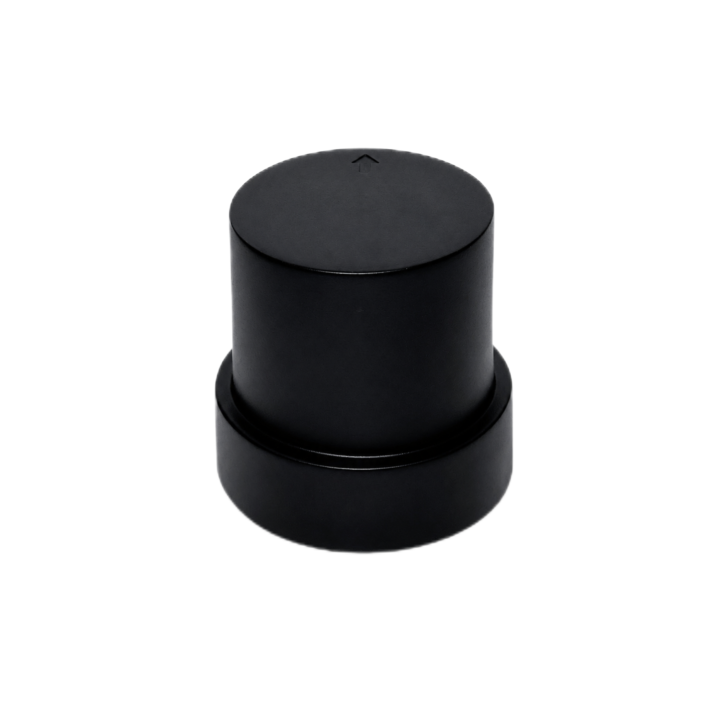
The HM-D20 is an all-in-one high-precision RTK module that combines the antenna, positioning hardware, and communication capability in one compact package. At 38.2 g and Φ54.5 × 53 mm, it is easily the lighter of these two products. It is specifically presented for UAVs, autonomous driving systems, robotics, and survey mapping. In practical terms, that combination is useful when a design team needs accurate global positioning but cannot justify the mass and installation space required by several separate components.
Its L1/L5 dual-frequency RTK capability supports a listed maximum update rate of 10 Hz. That gives the host system as many as ten position updates per second, which is much better suited to moving machinery than a slow receiver that reports only occasionally. The listed RTK time to first fix is 45 seconds, while the cold-start and hot-start values are 28 seconds and 1 second respectively. Keep those states separate when evaluating the product. A fast hot start does not mean a centimeter-level RTK solution will always be available one second after power is applied.
HM-D20 GNSS and RTK Specifications
| Positioning Capability | L1/L5 dual-frequency RTK |
| Horizontal Accuracy | 1.0 cm + 1 ppm |
| Vertical Accuracy | 1.5 cm + 1 ppm |
| Maximum Update Rate | 10 Hz |
| RTK Time to First Fix | 45 seconds |
HM-D20 Correction Communication
| 4G Version | CORS/NTRIP |
| LoRa Default Frequency | 915 MHz |
| LoRa Communication Range | Up to 6 km |
| LoRa Networking | One base station to one or multiple rovers |
| Maximum Number of Rovers | 4096 |
The correction link can be selected around the deployment model. The 4G version supports CORS/NTRIP, allowing correction data to be delivered through a compatible network service. The LoRa option uses a default frequency of 915 MHz and lists a communication range of up to 6 km. In the shop, “up to” is the phrase you pay attention to. It is not a guaranteed operating radius. Terrain, antenna height, obstructions, interference, radio regulations, and system configuration can all reduce real-world range.
The one-to-many networking model allows one base station to serve one rover or multiple rovers, with a listed maximum of 4096 units. That sounds impressive, but large deployments still require engineering discipline. Radio airtime, correction-message rate, receiver configuration, base-station uptime, and field coverage all matter. A published maximum is not a substitute for a capacity test using the intended number of active machines.
HM-D20 Receiver, Mechanical, and Interface Details
| Satellite Systems | GPS, BeiDou, Galileo, QZSS, GLONASS, IRNSS |
| Tracking Channels | 200 |
| Cold Start/Hot Start | 28 seconds/1 second |
| Antenna System Gain | 40 dB |
| Dimensions/Weight | Φ54.5 × 53 mm/38.2 g |
| Operating Voltage | 5 V ±0.5 V |
| Data and Interface | 8-pin/NMEA/UBX |
| Magnetometer | QMC5883L, SCL/SDA |
Multi-constellation support covers GPS, BeiDou, Galileo, QZSS, GLONASS, and IRNSS. The receiver also lists 200 tracking channels and 40 dB antenna system gain. Positioning data is available in NMEA and UBX formats through an 8-pin interface. Those are familiar protocol choices for embedded development, but the physical and electrical connection still needs to be checked against the flight controller, microcontroller, or host computer.
The HM-D20 also incorporates a QMC5883L magnetometer with SCL and SDA connections. That can be useful for projects that need magnetic-heading data, but placement matters. Motors, high-current wiring, permanent magnets, steel hardware, and power converters can distort magnetic readings. Do not assume that an integrated magnetometer will provide clean heading data simply because the GNSS position looks good. Calibration and interference testing still belong in the commissioning plan.
Documentation and demonstrations are described for Raspberry Pi, Jetson Orin, and Arduino integration. The device can be connected through an appropriate USB-to-serial arrangement or a compatible header connection. Before making a harness, verify supply voltage, signal voltage, ground reference, connector orientation, pin order, serial baud rate, and which messages are enabled by default. A nominal 5 V supply specification does not tell you everything needed to connect the data pins safely.
For drone use, GNSS should be treated as one element of the autonomy stack. Accurate coordinates do not independently detect a tree, wall, cable, vehicle, or person. That distinction is covered in more detail in this guide to choosing LiDAR and vision for obstacle-avoidance drones. Developers comparing complete aircraft can also review the discussion of DJI obstacle-avoidance models and their practical limits.
View Product Details & Pricing ➔
HM-D13 RTK GNSS Receiver
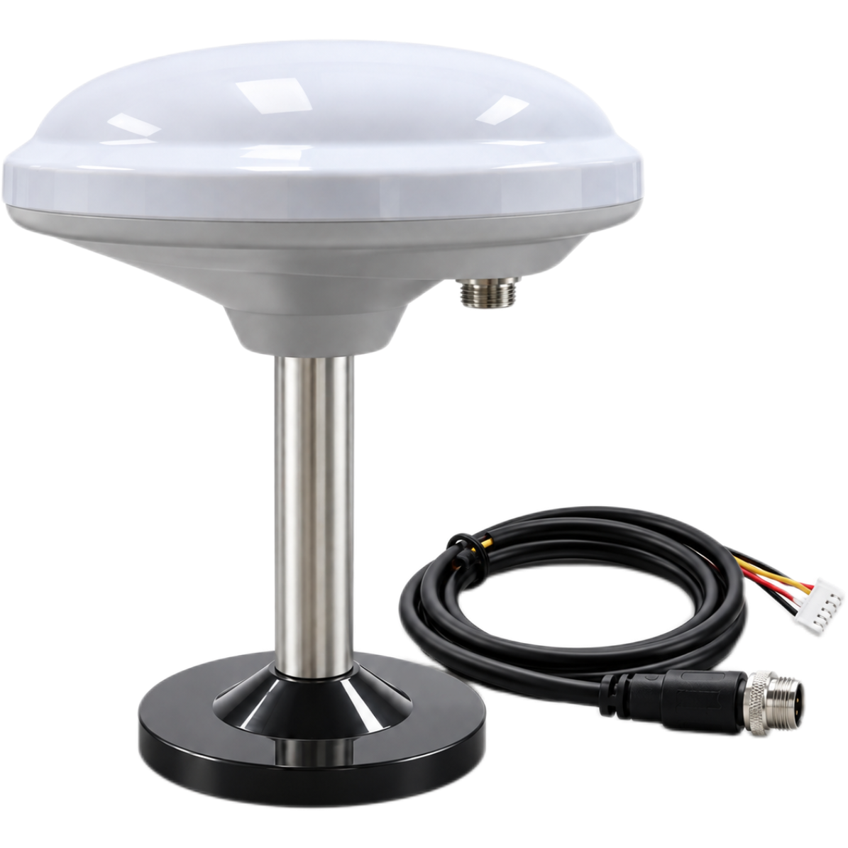
The HM-D13 is a multiband RTK survey module intended for high-precision positioning in robots, field systems, drones, UGVs, and USVs. Its product description leans heavily toward precision surveying, field mapping, autonomous outdoor systems, and one-to-many connectivity. Like the HM-D20, it combines antenna, positioning, and communication functions, but the physical package is substantially larger and heavier.
The listed dimensions and weight are Φ152 × 67.9 mm and 550 g for the base station. That last part matters. The supplied figure specifically identifies the base-station configuration, so it should not automatically be assigned to every possible rover package. A buyer should confirm the dimensions, weight, enclosure, cable set, and included components for the exact base or rover version being ordered. Experienced integrators know that assumptions made during purchasing tend to show up later as mounting problems.
HM-D13 GNSS and RTK Specifications
| Positioning Capability | L1/L5 dual-frequency RTK |
| Horizontal Accuracy | 1.0 cm + 1 ppm |
| Vertical Accuracy | 1.5 cm + 1 ppm |
| Maximum Update Rate | 10 Hz |
| RTK Time to First Fix | 45 seconds |
HM-D13 Correction Communication
| 4G Version | CORS/NTRIP |
| LoRa Default Frequency | 915 MHz |
| LoRa Communication Range | Up to 6 km |
| LoRa Networking | One base station to one or multiple rovers |
| Maximum Number of Rovers | 4096 |
The HM-D13 provides the same listed 4G CORS/NTRIP and 915 MHz LoRa correction approaches. That gives a system designer two distinct deployment paths. Network-delivered corrections can be convenient when cellular service and a suitable NTRIP provider are available across the operating area. A local LoRa base-to-rover setup can be useful when the project controls its own reference station and needs correction coverage independent of public mobile service.
Look, the correction method has to match the site. A cellular connection that works perfectly in the office parking lot may fail at the far end of a farm, mine, shoreline, or construction project. A LoRa system may avoid the cellular dependency, but it introduces its own antenna, propagation, interference, and regulatory requirements. Frequency legality varies by jurisdiction, so the 915 MHz specification should be checked against local radio rules before purchase or deployment.
HM-D13 Receiver, Mechanical, and Interface Details
| Satellite Systems | GPS, BeiDou, Galileo, QZSS, GLONASS, IRNSS |
| Cold Start/Hot Start | 28 seconds/1 second |
| Antenna System Gain | 40 dB |
| Dimensions/Weight | Φ152 × 67.9 mm/550 g (base station) |
| Operating Voltage | 5 V |
| Data and Interface | 5-pin XH2.54/NMEA/UBX |
The receiver supports GPS, BeiDou, Galileo, QZSS, GLONASS, and IRNSS and lists 40 dB antenna system gain. It operates at 5 V and provides NMEA and UBX data through a 5-pin XH2.54 interface. The product information also describes an open SDK, sample code, Windows and Linux cross-platform support, developer assistance, and resources on GitHub.
Those development resources can cut integration time, but they do not eliminate system-level validation. Developers still need to verify message configuration, serial settings, coordinate frames, timestamps, units, update rates, and recovery behavior. If the host application expects latitude and longitude at 10 Hz but receives a different message set or a lower configured rate, the receiver may appear unreliable when the real issue is setup.
Outdoor suitability is another major part of the HM-D13 description. It is presented as water resistant and designed for operation from -40°C to 85°C. Here’s the deal: “water resistant” is not the same as “waterproof,” and it is not a formal ingress-protection rating. Without a stated IP rating, do not assume the device can tolerate immersion, pressure washing, salt spray, or unlimited exposure to driving rain.
USV developers and teams operating in sustained rain should verify sealing, connector protection, installation orientation, cable entry, corrosion resistance, and the enclosure rating of the exact purchased configuration. Temperature capability and water-ingress protection are separate engineering concerns. A receiver may handle extreme ambient temperatures while still requiring an additional sealed enclosure for marine or washdown environments.
View Product Details & Pricing ➔
Accuracy, RTK Corrections, and Fix Quality
Centimeter-level accuracy is the headline feature of both receivers, but a responsible design has to separate the specification from continuous real-world performance. The listed values apply to RTK positioning, which requires usable satellite measurements and valid correction data. If corrections disappear, their latency becomes excessive, or the receiver cannot resolve carrier-phase ambiguities, the position may transition away from RTK fixed status.
The control or survey software should monitor solution type instead of trusting every reported coordinate equally. A coordinate accompanied by RTK fixed status is not equivalent to one generated during an unresolved float condition or a standalone GNSS mode. For an autonomous machine, the operating logic should define what each solution state allows the vehicle to do. Continuing full-speed operation after fix quality drops is rarely a sound default.
Satellite geometry matters too. A receiver can support several constellations and still perform poorly when its view of the sky is obstructed. Buildings, metal structures, vegetation, terrain, and parts of the host vehicle can block or reflect satellite signals. Reflected signals produce multipath errors, which are especially common near walls, roofs, industrial machinery, vehicles, and urban structures.
The supplied HM-D20 description reports favorable fixed-solution continuity in comparative urban field testing. That is useful background, but every project should still be tested in its actual installation and operating environment. A receiver mounted in an open field is working under very different conditions than the same receiver tucked beside a metal cab, under a roof edge, or near a high-power transmitter.
Repeatability and absolute accuracy are not interchangeable. A machine may trace a smooth, repeatable path while retaining a systematic coordinate offset. Another system may produce an accurate average location while individual position epochs fluctuate more than the control application can tolerate. Surveying, autonomous navigation, asset mapping, and trajectory logging each put different demands on the data.
Before selecting any product advertised as the best handheld GPS or precision GNSS solution, define the actual acceptance criteria. That should include allowable horizontal error, vertical error, initialization time, outage duration, correction latency, reacquisition behavior, and the required machine response when confidence drops. If those limits are not written down, it becomes difficult to distinguish a successful field test from a good-looking demonstration.
In higher-end navigation systems, GNSS is often combined with inertial sensors to bridge short interruptions and estimate motion and orientation. Specialist companies such as Inertial Labs demonstrate the broader role of GNSS-aided inertial navigation in professional systems. That does not mean an RTK receiver by itself provides a complete inertial solution. The sensors, timing, synchronization, calibration, coordinate frames, and estimation software must be engineered as one system.
Communication and System Integration
The best receiver on paper can still fail in the field if its correction link and host interface do not match the job. Both products list 4G and LoRa communication options. A 4G CORS/NTRIP workflow normally depends on network coverage, credentials for an appropriate correction source, correct caster and mount-point settings, and a data connection that remains stable throughout the work area.
A LoRa workflow depends on a compatible base station, matching radio configuration, suitable antennas, enough propagation clearance, and compliance with local spectrum rules. The stated range of up to 6 km is a maximum figure, not a guaranteed service radius. Low antenna height, terrain, buildings, foliage, RF noise, cable loss, and obstructed line of sight can all reduce usable range.
⚙️ During field validation, measure correction age and packet continuity across the entire work area, not just beside the base station. For autonomous equipment, define what happens when the link becomes intermittent or disappears. Depending on the risk assessment, the proper response may be to reduce speed, stop, hold position, switch modes, return to a safe area, or alert an operator.
On the host side, both receivers support NMEA and UBX, but the physical connectors are different. The HM-D20 lists an 8-pin interface, while the HM-D13 lists a 5-pin XH2.54 interface. Electrical compatibility must be checked before making a direct connection to a flight controller, microcontroller, Raspberry Pi, Jetson Orin, or industrial computer.
A shared nominal voltage does not establish compatible logic levels, pin order, grounding, serial polarity, or baud rate. In the shop, this is where reading the full interface documentation saves burned hardware and lost time. Use a proper interface cable or level conversion when required, add strain relief, and make sure the connector cannot work loose under vibration.
Timing deserves the same attention as coordinates. A 10 Hz output is useful only when the receiving application processes each message consistently and associates it with the correct measurement time. Logging should preserve timestamps, position mode, correction age when available, and relevant quality indicators. Saving only latitude and longitude throws away the information needed to understand why the system behaved badly later.
For autonomous vehicles, delayed but precise data can still destabilize control if the software assumes it is current. Integration testing should include end-to-end latency, message jitter, missing packets, duplicate data, corrupted input, host restarts, receiver restarts, and correction-link interruptions. A stationary accuracy demonstration is useful, but it is only the first step.
GNSS also performs a different job than ranging sensors such as LiDAR. Companies such as Ouster develop LiDAR technology used for environmental perception, while an RTK GNSS receiver establishes global position. A robust mobile platform may need both. Knowing the global route does not reveal every nearby obstacle, and observing local geometry does not independently provide a globally referenced coordinate.
How to Choose the Right Receiver
Choose the HM-D20 when low mass, compact size, and integration into a drone or smaller robot are primary requirements. Its listed weight of 38.2 g is a major practical advantage compared with the HM-D13 base-station figure. Its integrated QMC5883L magnetometer is another differentiator for projects that can use the SCL/SDA interface, although careful placement and calibration remain necessary.
Choose the HM-D13 when the application centers on field surveying, agricultural machinery, outdoor robots, UGVs, or USVs and the larger physical format fits the platform. The stated -40°C to 85°C operating range and the emphasis on water resistance are relevant for exposed work, provided the project verifies the environmental protection required for the actual site. Its 5-pin XH2.54 interface and 5 V supply requirement should be checked against the host electronics during design—not after the mechanical package is finished.
For a portable survey pole or custom handheld data collector, either receiver could become part of the system, but neither one is a finished handheld navigator. The complete instrument still needs a power source, processor or data logger, display or user interface, mechanical mount, correction connection, and suitable software. A professional survey workflow may also require coordinate-system conversion, point coding, quality thresholds, export tools, project management, and documented verification procedures.
For drones, every gram affects payload margin and flight endurance, so the HM-D20 is generally the more directly aligned option based on the published physical specifications. On a large ground vehicle or surface vessel, the weight difference may matter less than antenna placement, environmental exposure, cable routing, correction coverage, maintainability, and access for service.
✅ The HM-D20 stands out when compact packaging and low mass drive the design.
✅ The HM-D13 stands out when a field-oriented format, broad outdoor use, and rugged deployment considerations carry more weight.
⚙️ Before ordering, confirm the exact model variation. The supplied information refers to 4G and LoRa options, so do not assume that every unit includes both communication methods at the same time.
⚙️ Confirm the base-versus-rover configuration, regional radio frequency, included cables, antenna arrangement, connector type, documentation, correction-service requirements, and any accessories needed to connect the receiver to the host platform.
The right choice follows the system requirements, not the search keyword that brought you to the product. Start with payload, mounting, environment, interface, correction coverage, and failure behavior. Once those items are known, the comparison becomes much more practical.
Practical Deployment Considerations
Mount the GNSS antenna where it has the clearest practical view of the sky. Avoid locating it directly beside high-current wiring, transmitters, motors, switching regulators, large metal obstructions, or components likely to create interference or signal blockage. On a drone, consider structural vibration and electromagnetic noise. On a UGV or farm machine, the antenna location must represent the vehicle reference point accurately enough for the navigation model.
On a USV, the installation also has to account for water exposure, cable sealing, vessel motion, salt, and corrosion. A receiver described as water resistant may still need a secondary enclosure or protected mounting location. Connectors and cable entries are often the weakest part of an outdoor installation, so they deserve the same attention as the receiver body.
Mechanical offsets must be measured and entered correctly. The GNSS antenna phase center is rarely located at the vehicle control point, camera center, survey tip, wheel axle, implement edge, or steering reference. A system can produce centimeter-level GNSS measurements and still miss the operational target by much more if this lever arm is ignored.
The same principle applies to heading and orientation sensors. Coordinate axes, sign conventions, units, mounting angles, and reference frames must be documented. If one subsystem uses a forward-right-down convention while another assumes east-north-up, the math has to account for that explicitly. These are the kinds of errors that can look like a bad sensor even when every component is operating correctly.
Power quality is another common source of field failures. The HM-D20 specifies 5 V ±0.5 V, while the HM-D13 specifies 5 V. The power system must remain within the published requirement during startup and radio-transmission loads. A supply that measures correctly with no load can still sag when the modem transmits or the host computer starts.
Grounding, connector retention, cable strain relief, and protection from electrical noise should be designed around the host platform. Do not infer unspecified current consumption, reverse-polarity protection, transient protection, or environmental sealing. Obtain the complete product documentation before finalizing the electrical design.
⚙️ Commissioning should include open-sky static testing, repeated startup testing, dynamic testing, correction-link interruption, host reconnect behavior, obstructed-sky operation, and complete data logging.
⚙️ Test both the intended workflow and credible failures. A rover should not be accepted only because it displayed RTK fixed once during a short demonstration.
⚙️ Measure how long the receiver takes to achieve an RTK fixed solution across repeated starts, how often it drops to a lower-quality mode, how quickly it recovers, and whether the application detects each transition correctly.
For multi-rover deployments, support for as many as 4096 rovers is a potentially useful architectural feature, but the communication system still needs capacity planning. Message rate, radio airtime, terrain, network coverage, configuration control, and base-station reliability all affect deployment quality. Validate the intended rover count under realistic conditions rather than treating the theoretical maximum as guaranteed field capacity.
Final Verdict
For a compact drone, lightweight robot, or embedded precision-navigation project, the HM-D20 is the stronger fit of these two products. It offers the same listed RTK accuracy and 10 Hz maximum update rate as the HM-D13 while weighing only 38.2 g. Its 8-pin NMEA/UBX interface, 200 tracking channels, multi-constellation support, integrated magnetometer, and 4G or LoRa correction options make it a flexible component for custom systems.
For field surveying, autonomous farm equipment, UGVs, USVs, or other outdoor platforms that can accommodate a larger receiver, the HM-D13 is the more field-oriented option. It shares the central positioning specifications of the HM-D20 while placing more emphasis on outdoor operation, one-to-many connectivity, water resistance, developer resources, and a stated temperature range of -40°C to 85°C.
Neither product is the best handheld GPS for a consumer who wants turn-by-turn trail navigation in a ready-to-use unit. Both are candidates for engineers building a higher-precision instrument or autonomous platform. The final choice should come down to payload limits, environmental exposure, host interface, correction availability, regional radio rules, mounting constraints, and the amount of system integration the project can support.
Here’s the deal: if weight and packaging dominate the design, start with the HM-D20. If the job is a larger outdoor field installation and the HM-D13 format fits, examine that receiver more closely. In either case, validate the full system under real operating conditions before trusting centimeter-level coordinates for survey deliverables or machine control.
Full LiDAR setups are powerful — but often too heavy, too complex, or just …
Frequently Asked Questions
Are the HM-D20 and HM-D13 conventional handheld GPS devices?
Do these receivers always deliver centimeter-level accuracy?
Which model is better for a drone?
Should I choose 4G NTRIP or LoRa corrections?
Can these receivers connect to Raspberry Pi, Jetson, or Arduino hardware?
Is the HM-D13 waterproof and suitable for marine use?
📚 References & Further Reading
- ✅ Industry Standard: Inertial Labs GNSS-aided navigation resources
- ⚙️ Related Guide: DJI drones with obstacle avoidance: models and real limits
- ⚙️ Related Guide: Technical principles for robotics projects