


LiDAR Scanning for Robotics, Drones, and Site Mapping: A Practical Buyer’s Guide
Here’s the deal: LiDAR scanning is no longer something you only see on expensive survey trucks, autonomous vehicle test rigs, or university research benches. Today, engineers, robotics teams, drone integrators, facility managers, VFX creators, inspection crews, and site-mapping professionals all use LiDAR to turn physical spaces into measurable digital data. But buying the right LiDAR scanner is still not simple. A LiDAR scanner for a mobile robot is not the same thing as a LiDAR scanner for a drone, a construction site, an iPhone room scan, or a DIY Raspberry Pi project. Range, accuracy, field of view, sunlight tolerance, point cloud quality, frame rate, interface type, software support, weight, power draw, and integration complexity all decide whether the system works in the real world or becomes another expensive part sitting in a drawer.
Look, in the shop, nobody cares how impressive a spec sheet looks if the sensor cannot see the pallet, misses the ramp, drops frames in sunlight, or takes three weeks to get talking to the controller. This guide explains how LiDAR scanning works, what specifications actually matter, how to compare affordable and professional systems, and where compact dToF solid-state LiDAR modules fit into robotics, UAVs, site mapping, inspection, and embedded perception. For developers who need real-time depth maps and point clouds rather than a handheld consumer scan, we will also look closely at the DTOF Solid State LiDAR HM-LD1: a compact 28g module with ±3cm ranging accuracy, 60° × 45° field of view, UART/UDP/UVC interfaces, and SDK support for Windows, Linux, ARM Linux, Raspberry Pi, Jetson, and embedded platforms.
Table of Contents
- 👉 What Is LiDAR Scanning?
- 👉 How LiDAR Scanning Works
- 👉 Main Types of LiDAR Scanners
- 👉 Key LiDAR Scanning Specifications Buyers Should Compare
- 👉 LiDAR Scanning for Robotics
- 👉 LiDAR Scanning for Drones and UAVs
- 👉 LiDAR Scanning for Site Mapping, Inspection, and Measurement
- 👉 iPhone LiDAR, DIY LiDAR, and Affordable 3D Scanning
- 👉 Product Showcase: DTOF Solid State LiDAR HM-LD1
- 👉 Integration Workflow for Developers
- 👉 LiDAR Scanning Buyer’s Checklist
- 👉 Common Mistakes When Buying LiDAR Scanning Systems
- 👉 LiDAR Scanning FAQ
What Is LiDAR Scanning?
LiDAR scanning is a 3D sensing method that measures distance by emitting laser light and calculating how long it takes for that light to return after bouncing off a surface. The output might be a depth map, a distance reading, a 2D scan, or a 3D point cloud depending on the sensor architecture, optics, scanning pattern, and software pipeline. Unlike a normal camera, which records color and brightness, LiDAR creates measurable spatial data. That data helps machines understand distance, shape, position, and movement.
For industrial buyers, the important part is this: LiDAR scanning is not just visual capture. It is measurement. Those measurements can support navigation, mapping, obstacle detection, object sizing, terrain following, inspection, security monitoring, digital twin generation, robotic perception, and automation. A facility manager may use LiDAR to document a building. A drone developer may use it for altitude hold or terrain following. A robotics engineer may use it for obstacle avoidance, SLAM, or docking assistance. A camera manufacturer may use it to improve autofocus, presence detection, or depth-aware perception.
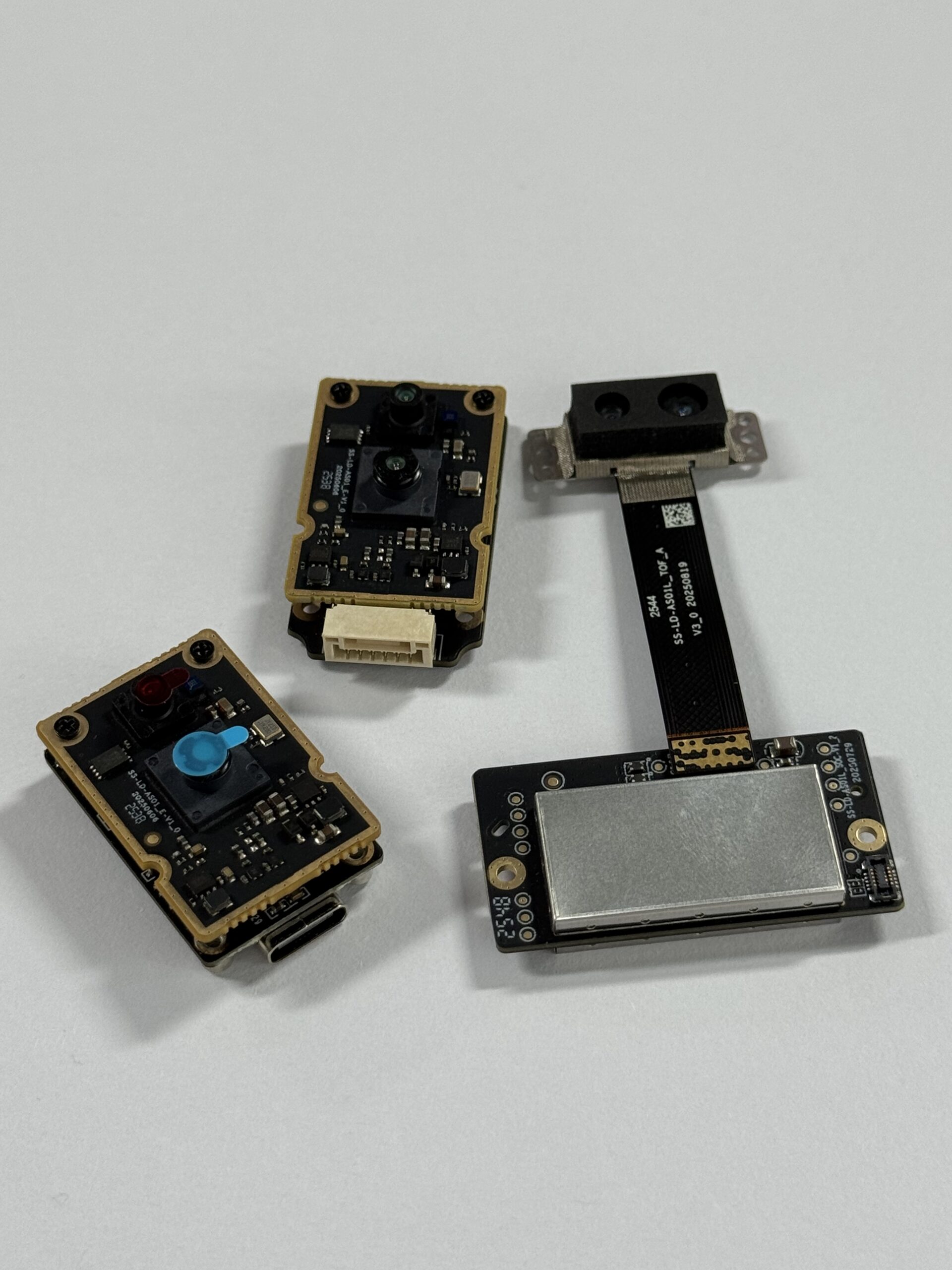
LiDAR Scanning vs. Photogrammetry
Photogrammetry reconstructs geometry from overlapping camera images. It can produce highly detailed textured models when lighting, overlap, and surface detail are suitable. However, it infers depth through image matching rather than directly measuring distance. LiDAR scanning directly measures distance, which makes it valuable in low-texture spaces, repetitive industrial environments, dim areas, robotics applications, and workflows where scale accuracy matters. In many professional projects, LiDAR and photogrammetry work together: LiDAR provides reliable geometry, while cameras provide rich texture.
LiDAR Scanning vs. Depth Cameras
Depth cameras include stereo cameras, structured-light sensors, and time-of-flight cameras. Some depth cameras are excellent for indoor short-range perception, human tracking, object detection, and robotics prototyping. LiDAR is often preferred when the application needs direct distance measurement, longer usable range, stronger performance across varied surface geometry, or more robust integration in robotic and industrial systems. The right choice depends on range, lighting, accuracy, resolution, latency, operating environment, and available software support.
What a Point Cloud Actually Represents
A point cloud is a collection of points in 3D space. Each point usually contains X, Y, and Z coordinates, and may also include intensity, timestamp, confidence, or color. A dense terrestrial scanner may generate millions of points for detailed site models, while a compact embedded LiDAR module may generate a smaller point cloud or depth grid for real-time decision-making. In robotics, a clean, timely, and predictable point cloud can be more useful than a visually beautiful but delayed scan. For buyers, the question is not simply whether a sensor produces a point cloud. The better question is whether that point cloud supports the job you need done.
LiDAR is also central to modern mobility and automotive perception. If you are evaluating vehicle-oriented systems, this related guide on LiDAR car technology explained provides additional background on how LiDAR contributes to sensing, detection, and navigation in transportation applications.
How LiDAR Scanning Works
A LiDAR scanner emits light pulses or modulated laser signals, receives reflected light through an optical detector, and converts timing or phase information into distance. In direct time-of-flight systems, the sensor measures the travel time of the emitted light pulse. Since the speed of light is known, the system can calculate distance from the round-trip time between emission and return. That is the basic principle that lets LiDAR scanning systems produce distance information without relying only on visual texture or image contrast.
A typical LiDAR scanning workflow begins with laser emission. The light is shaped, directed, or distributed across a field of view. When the light reaches a surface, some of it reflects back toward the receiver. The receiver detects the returned signal, and the sensor electronics calculate distance. Software then converts distance measurements into a depth map, point cloud, obstacle zone, measurement value, or navigation input. Filtering may remove invalid points, reduce noise, compensate for motion, or select a region of interest.
Direct Time-of-Flight LiDAR
Direct time-of-flight, often written as dToF, measures the time delay between an emitted light pulse and its returned reflection. This architecture is widely used for distance measurement because it maps naturally to real-world range. A dToF LiDAR module can be useful where a system needs real-time depth output, low latency, and compact integration. The DTOF Solid State LiDAR HM-LD1 uses SPAD dToF technology, which makes it relevant for embedded perception, robot navigation, UAV awareness, smart cameras, and inspection systems.
SPAD Detection
SPAD stands for Single-Photon Avalanche Diode. In practical terms, SPAD detectors can sense extremely weak light returns, which helps compact LiDAR systems detect reflected laser energy from surfaces at useful distances. Engineers do not need to become optical physicists to evaluate SPAD-based LiDAR, but they should understand why it matters. Sensitive detection can help make a LiDAR module smaller, more power-efficient, and more suitable for embedded sensing than large mechanical scanners in certain applications.
Depth Maps vs. Point Clouds
A depth map is a regular grid where each pixel or cell contains distance information. A point cloud is a 3D coordinate representation created from distance data and calibration geometry. For example, a 40 × 30 depth output provides 1,200 measurement cells per frame. That is not meant to replace high-density survey scanning, but it can be very practical for obstacle detection, proximity awareness, zone monitoring, robot perception, and simple point cloud reconstruction. Depth maps are often easier to process on embedded platforms because their structure resembles an image.
Why Sunlight Matters
Outdoor LiDAR has to fight ambient light, especially in bright sunlight. Strong sunlight can reduce effective range, increase noise, or make weak reflections harder to detect. That is why buyers should compare indoor range and outdoor range separately. They should also ask about target reflectivity, lux levels, mounting angle, surface color, and operating conditions. A sensor that performs well indoors or at night may have a shorter effective range outdoors during daytime.
LiDAR is frequently combined with cameras, IMUs, wheel odometry, and visual-inertial methods. If your project involves localization or sensor fusion, this guide on how to build VIO and VSLAM systems is a useful companion resource for understanding the broader perception pipeline.
Main Types of LiDAR Scanners
There is no single best LiDAR scanner for every project. A site-mapping scanner, a robot navigation sensor, a drone payload, a smart camera depth module, and a phone-based scanning app are all built around different tradeoffs. Before comparing prices, buyers should identify the category of LiDAR scanning system that matches the job.
2D LiDAR Scanners
2D LiDAR scans a single plane. It is common in AGVs, AMRs, warehouse robots, service robots, and simple obstacle detection systems. A 2D scanner can be effective on flat floors where obstacles intersect the scan plane. However, it may miss objects above or below the scanning height, such as table edges, hanging loads, ramps, low obstacles, or overhanging shelves. In the shop, that missed object can be the difference between a clean demo and a damaged cart. Many 2D systems work well when combined with bumpers, cameras, ultrasonic sensors, or additional LiDAR units.
3D LiDAR Scanners
3D LiDAR captures both horizontal and vertical structure. It is used in autonomous driving, drones, surveying, mapping, industrial automation, environmental modeling, security, and digital twin creation. Some 3D systems generate dense point clouds for site documentation, while others output lower-resolution real-time depth data for machines that need fast decisions rather than visual detail. When evaluating 3D LiDAR scanning, buyers should consider not just point count, but also accuracy, latency, range, environmental robustness, and integration workflow.
Mechanical LiDAR
Mechanical LiDAR uses rotating components, mirrors, or moving optical assemblies to scan across a field of view. These systems can offer broad coverage and high point density, but they may be larger, heavier, more expensive, and more mechanically complex. In environments with vibration, dust, impact, or strict packaging constraints, mechanical design becomes an important procurement factor. A spinning unit that looks fine on a lab bench may need serious protection once it is mounted on a machine that runs all day.
Solid-State LiDAR
Solid-state LiDAR avoids large rotating assemblies. This can make it better suited for compact integration, vibration-prone environments, low-power products, drones, robots, smart cameras, and embedded devices. Solid-state modules are not automatically superior to mechanical scanners; they are optimized for different use cases. Their advantages usually appear when size, weight, power, durability, and system integration matter more than panoramic mechanical scanning.
Handheld LiDAR Scanners
Handheld LiDAR scanners are used for architecture, real estate, cultural preservation, facility documentation, rapid site capture, and digital twins. They can be convenient for operators who want a packaged scanning workflow. However, handheld scanning is different from embedded LiDAR for robotics. A handheld scanner is usually optimized for human operation and post-processing, while a robot sensor must provide repeatable real-time data to software and controllers.
Drone LiDAR Payloads
Drone LiDAR payloads are used for topographic mapping, forestry, powerline inspection, mining, agriculture, and infrastructure monitoring. Professional mapping payloads often combine LiDAR with GNSS, IMU, synchronization, calibration, and post-processing software. Payload weight, flight time, point density, georeferencing quality, and workflow complexity all matter. A compact embedded LiDAR module may be excellent for altitude hold or obstacle awareness, but it is not the same as a complete survey-grade drone mapping payload.
Embedded LiDAR Modules
Embedded LiDAR modules are selected by engineers building products or prototypes. These buyers need interface access, SDK support, predictable data output, and physical integration flexibility. Modules like the HM-LD1 are designed for real-time depth maps and 3D point cloud data in robotics, UAVs, inspection systems, smart cameras, security, and robotic vision development. They are best evaluated as components inside a larger sensing architecture.
Key LiDAR Scanning Specifications Buyers Should Compare
LiDAR specifications can be confusing because marketing pages often emphasize maximum range or beautiful point cloud visuals. A professional buyer should read specifications in context. The right LiDAR scanning system is the one whose range, accuracy, resolution, field of view, frame rate, outdoor performance, interface, software support, weight, power consumption, and environmental limits match the actual deployment.
Range
Range defines the minimum and maximum measurable distance. Buyers should separate indoor range from outdoor range because sunlight and target reflectivity can significantly affect performance. A sensor may reach farther indoors or at night than in bright outdoor conditions. Minimum range also matters. A robot that needs near-field obstacle detection may require reliable measurements at short distances, not only impressive long-range performance.
Accuracy
Accuracy describes how close the measured distance is to the real distance. For robot navigation, ±3cm accuracy can be practical for obstacle avoidance, presence detection, short-range mapping, docking assistance, and embedded perception. For high-grade surveying, engineering metrology, or legal deliverables, buyers may require tighter specifications, calibrated workflows, control points, and georeferenced data. Always match accuracy to the application tolerance rather than assuming more precision is always necessary.
Resolution
Resolution describes how many measurement points the sensor outputs per frame or scan. Higher resolution can improve object detail, edge recognition, surface modeling, and mapping density. Lower-resolution depth sensors can still be valuable when the task is obstacle detection, zone monitoring, altitude awareness, occupancy sensing, or embedded decision-making. The key question is whether the smallest required object can be detected at the required distance.
Field of View
Field of view determines how much of the scene the LiDAR can observe. A wide horizontal field of view helps a robot detect obstacles across its path. Vertical field of view matters for ramps, shelves, hanging objects, terrain following, stairs, pallets, and multi-level scenes. If a sensor’s field of view is too narrow, the system may require multiple sensors or mechanical scanning to cover the required area.
Frame Rate
Frame rate determines how often new distance data is available. Faster frame rates help moving robots and drones respond quickly. A 10fps module can be useful for many embedded perception and monitoring tasks, especially where the platform speed and control loop are designed around that update rate. High-speed autonomous systems may require additional sensing, faster LiDAR, sensor fusion, or more conservative safety logic.
Outdoor Performance
Outdoor performance depends on ambient light rejection, target reflectivity, wavelength, optics, detector sensitivity, signal processing, and environmental conditions. Buyers should ask whether quoted range values were measured indoors, outdoors, at night, under bright sunlight, or under a defined lux level. Surface color and angle also matter. Dark, angled, or absorbent materials may return less light than bright flat targets.
Interface and SDK
Interfaces such as UART, UDP, and UVC determine how easily a LiDAR connects to controllers, PCs, embedded boards, and development platforms. UART can be practical for embedded controllers and simpler command communication. UDP is useful for networked data streaming. UVC can simplify PC-style depth workflows by treating the device like a video-class peripheral. SDK availability for x86 Windows, x86 Linux, and ARM Linux can dramatically reduce engineering time.
Weight and Power Consumption
For drones and mobile robots, every gram and watt matters. A lighter sensor improves payload flexibility, mounting options, and battery life. A lower-power LiDAR reduces thermal load and energy demand. A compact 28g, 1.2W module is easier to integrate into small drones, compact mobile robots, smart cameras, and battery-powered systems than heavier payloads that require larger mechanical and electrical design allowances.
Environmental Requirements
Operating temperature, vibration, dust, sunlight, moisture, mounting stability, cable routing, enclosure design, and electromagnetic compatibility can affect real-world LiDAR scanning performance. Industrial buyers should not select a sensor based only on laboratory specifications. They should validate the sensor in the actual environment, using real targets, real distances, real mounting positions, and expected operating temperatures.
| Specification | Why It Matters | Buyer Question |
|---|---|---|
| Range | Determines how far the LiDAR can measure reliably. | Is the stated range indoor, outdoor, or under specific lux conditions? |
| Accuracy | Impacts navigation, measurement, mapping, and object detection. | Is the accuracy enough for robotics, inspection, or survey-grade measurement? |
| Resolution | Controls point density and scene detail. | Do you need dense mapping or practical obstacle awareness? |
| Field of View | Defines scene coverage. | Does the FOV match the robot, drone, or monitoring zone? |
| Interface | Affects integration time. | Does it support your controller, PC, Raspberry Pi, or embedded platform? |
LiDAR Scanning for Robotics
Robots use LiDAR scanning to understand where objects are, how far away they are, and how the surrounding space changes over time. In industrial and service robotics, LiDAR may support obstacle avoidance, SLAM, navigation, docking, people detection assistance, security zones, and machine vision. The best LiDAR for robotics is not necessarily the highest-resolution scanner. It is the sensor that provides reliable real-time data within the robot’s control, safety, and software architecture.
Obstacle Avoidance
Robots use LiDAR to detect walls, people, furniture, shelves, pallets, machinery, steps, and other obstacles. Distance data allows the robot to slow down, stop, reroute, or trigger safety behavior. In a warehouse, a robot may need to detect pallets and forklifts. In a service environment, it may need to detect furniture and pedestrians. In an inspection system, it may need to maintain safe clearance from equipment.
SLAM and Navigation
SLAM means simultaneous localization and mapping. A LiDAR-based SLAM system uses repeated distance measurements to estimate the robot’s position while building or updating a map. Many systems combine LiDAR with cameras, IMUs, wheel odometry, visual-inertial odometry, and VSLAM. For teams designing navigation stacks, understanding VIO and VSLAM systems can help clarify how LiDAR fits into a broader sensor-fusion architecture.
Depth Maps for Embedded Perception
Depth maps are useful for compact robots because they provide structured distance data without the processing burden of ultra-dense point clouds. A 40 × 30 depth image can support zone detection, object approach logic, docking support, people detection assistance, and near-field navigation. The application logic may focus on distance thresholds, regions of interest, occupied zones, or changes over time rather than full 3D reconstruction.
Interface Requirements for Robot Developers
Roboticists should evaluate whether a LiDAR supports UART for microcontrollers, UDP for networked systems, and UVC for computer vision workflows. SDK support for x86 Windows, x86 Linux, and ARM Linux is valuable for both prototyping and deployment. If the development platform includes Raspberry Pi, Jetson, Linux PCs, flight controllers, or custom embedded boards, interface compatibility can determine whether integration takes days or months.
Compact LiDAR Placement on Robots
Sensor placement affects performance. Engineers should consider mounting height, tilt angle, blind spots, field of view, vibration isolation, cable routing, dust protection, and sensor fusion. A compact module is easier to place on small AMRs, service robots, educational robots, inspection platforms, and smart devices. However, the enclosure and mounting bracket must not block the field of view or create reflections that interfere with measurement.
LiDAR Scanning for Drones and UAVs
Drone LiDAR scanning can mean several different things. In professional surveying, it often refers to a full mapping payload with LiDAR, GNSS, IMU, calibration, and post-processing. In embedded UAV development, it may refer to a compact LiDAR module used for altitude hold, landing assistance, terrain following, obstacle avoidance, or inspection support. Buyers should define the mission before selecting hardware.
Altitude Hold
LiDAR can help drones measure distance to the ground more directly than barometric altitude alone, especially in low-altitude flight. This can be useful for landing, hovering, indoor flight, and controlled clearance near surfaces. For small UAVs, a compact low-power module may provide practical distance awareness without the size and power burden of a full mapping payload.
Terrain Following
For drones flying over uneven surfaces, LiDAR scanning can help maintain stable clearance from terrain, crops, structures, or inspection targets. Terrain following matters in agriculture, inspection, mapping support, and industrial monitoring. The system must consider range, field of view, update rate, mounting angle, flight speed, and control-loop latency.
Obstacle Avoidance
A drone can use LiDAR to detect nearby obstacles such as walls, trees, poles, shelves, machinery, and structural features. Field of view, frame rate, range, and processing latency all affect avoidance performance. Because drones move in three dimensions, vertical coverage and sensor placement are especially important. A single forward-facing sensor may not cover all hazards, so multi-sensor layouts may be needed for advanced autonomy.
Payload Weight and Power
Drone buyers must balance LiDAR capability against flight time. A heavy payload reduces endurance and may require a larger aircraft. High power consumption affects battery sizing and thermal design. A compact 28g LiDAR module with 1.2W power consumption can be useful for small UAVs where traditional mapping payloads are too heavy or where the mission requires embedded perception rather than survey-grade point cloud capture.
Mapping Payload vs. Embedded Perception Sensor
A compact dToF LiDAR module is not the same as a full drone survey payload with GNSS/IMU georeferencing. It is better suited for altitude hold, obstacle detection, development, inspection assistance, terrain awareness, and embedded perception. Professional mapping deliverables may require calibrated payloads, precise timestamps, RTK positioning, IMU integration, ground control, and specialized processing software.
LiDAR Scanning for Site Mapping, Inspection, and Measurement
LiDAR scanning is widely used in site mapping because it captures measurable geometry quickly. Construction teams use it to document as-built conditions. Facility managers use it to plan layouts and verify clearances. Inspection teams use it to measure objects or structures that may be difficult, risky, or time-consuming to approach. The correct system depends on whether the goal is professional survey documentation, short-range measurement assistance, embedded monitoring, or application-specific detection.
Construction and Facility Mapping
In construction and facility management, LiDAR scanning can support as-built documentation, floor plans, clearance checking, digital twins, clash detection, layout planning, and renovation planning. High-density terrestrial laser scanners are common when the deliverable must be accurate, registered, documented, and shared across architecture or engineering teams. Compact LiDAR modules may support equipment-level monitoring or embedded measurement, but they are not a direct replacement for full site-scanning workflows.
Infrastructure Inspection
LiDAR can support inspection around bridges, expressways, dams, tunnels, warehouses, industrial plants, and restricted areas. The HM-LD1 product details describe outdoor measurement capability up to 8 meters and note usefulness for measuring distances to objects that are difficult for people to approach, such as bridges, expressways, and dams. In these cases, a compact module can be part of a robot, drone, or inspection device that improves safety and access.
Volume and Object Measurement
Point clouds and depth maps can support volume measurement, object sizing, stockpile analysis, box dimensioning, bin fill monitoring, and logistics automation. The required sensor depends on object size, distance, surface material, measurement tolerance, and update rate. A compact module may be enough for zone-level or short-range measurements, while large-scale stockpile measurement may need higher-density scanning and calibrated workflows.
Security and Zone Intrusion Monitoring
Depth sensing can define virtual zones and detect entry into restricted spaces. This is useful in industrial safety, smart cameras, building automation, perimeter monitoring, and equipment protection. Compared with basic motion detection, LiDAR-based zone monitoring can provide distance-aware information that helps reduce false triggers and define more precise detection areas.
When Site Mapping Requires Survey-Grade Equipment
Professional land surveying, engineering-grade deliverables, and legal measurement tasks may require high-end LiDAR, calibrated IMUs, RTK GNSS, control points, registration workflows, and professional post-processing software. Compact modules are better for embedded sensing, short-range mapping, inspection support, and application-specific measurements. Buyers should be honest about deliverable requirements before selecting hardware.
iPhone LiDAR, DIY LiDAR, and Affordable 3D Scanning
Affordable LiDAR scanning has become popular because many buyers want quick 3D capture, low-cost experimentation, or prototype sensing. iPhone LiDAR, DIY 2D LiDAR scanners, Raspberry Pi projects, and compact embedded modules can all be useful, but they serve different needs. The most common mistake is assuming that a consumer scan, a DIY project, and an industrial embedded sensor are interchangeable.
iPhone LiDAR Scanning
iPhone LiDAR is convenient for AR, room scanning, quick 3D capture, and visualization. It is useful for early planning, rough spatial references, and consumer-friendly scanning workflows. However, it is not ideal for industrial robotics, deterministic data output, UAV flight control, embedded SLAM, or long-term system integration. If you are comparing phone-based scanning with dedicated sensors, this guide to the iPhone LiDAR scanner explains the strengths and limits of that approach.
DIY 3D Scanning with 2D LiDAR
A 2D LiDAR can be rotated mechanically to create 3D scans. However, the system requires motor control, calibration, timestamp synchronization, coordinate transformation, filtering, point cloud software, and sometimes SLAM. DIY systems are excellent for education and experimentation, but the engineering effort can become significant if the goal is repeatable measurement or product deployment.
Raspberry Pi LiDAR Projects
Raspberry Pi is useful for prototyping, visualization, data logging, and robotics experiments. Interface support and SDK quality matter because they determine how quickly developers can stream, visualize, and process data. A LiDAR module with ARM Linux support can reduce setup time for Raspberry Pi and embedded Linux projects. Developers should still verify bandwidth, CPU load, power supply quality, and operating system compatibility.
When Affordable LiDAR Is Enough
Affordable LiDAR can be enough for obstacle detection, teaching, indoor mapping, proximity sensing, simple point clouds, robot development, proof-of-concept demos, and visual references. A lower-cost system can be a smart choice when the task does not require survey-grade deliverables or high-density reconstruction. The best affordable LiDAR is one that honestly matches the required range, accuracy, frame rate, interface, and software workflow.
When Affordable LiDAR Is Not Enough
Affordable LiDAR may not be enough for regulated safety systems, high-speed autonomous driving, long-range outdoor mapping, dense VFX capture, high-precision metrology, or professional survey deliverables. These applications may require certified safety architectures, higher accuracy, higher point density, longer range, calibrated positioning systems, redundancy, and validated software. Buyers should not force a low-cost sensor into a role that requires a professional payload.
Product Showcase: DTOF Solid State LiDAR HM-LD1
The DTOF Solid State LiDAR HM-LD1 is a compact SPAD dToF LiDAR module designed for real-time depth images and 3D point cloud data. It is suitable for robotics, drones, smart cameras, inspection systems, security applications, obstacle avoidance, distance detection, autonomous navigation, and robotic vision development. With UART, UDP, and UVC interfaces plus SDK support for x86 Windows, x86 Linux, and ARM Linux, it is built for developers who need practical integration across PCs, Raspberry Pi, flight controllers, Jetson, and embedded platforms.
The HM-LD1 is best understood as an embedded LiDAR scanning module rather than a complete handheld survey scanner. Its value is in small size, low weight, low power consumption, real-time depth output, flexible interfaces, and practical integration. For robot and UAV developers, that combination can matter more than very high point density. For inspection and security applications, the module can provide distance-aware sensing in compact products where a large mechanical scanner would be impractical.
View Product Details & Pricing ➔
| Category | Specification | DTOF Solid State LiDAR HM-LD1 |
|---|---|---|
| Physical | Dimensions | 43.5mm × 30mm × 26.5mm |
| Physical | Weight | 28g |
| Ranging | Indoor Ranging Capability | 0.5–25m |
| Ranging | Outdoor Ranging Capability | 0.2–8m |
| Ranging | Ranging Accuracy | ±3cm |
| Optics | Field of View | 60° horizontal × 45° vertical |
| Depth Output | Resolution | 40 × 30 |
| Depth Output | Frame Rate | 10fps |
| Integration | Interface | UART / UDP / UVC |
| Environment | Operating Temperature | -20℃ to 60℃ |
| Power | Power Consumption | 1.2W |
Point Cloud and Depth Map Output
The HM-LD1 can provide ranging measurement data displayed as point cloud and depth data. This is useful for systems that need to interpret distance in real time rather than capture a static image. Developers can use depth maps for region-of-interest logic, object approach detection, zone monitoring, obstacle thresholds, and simple spatial understanding. Point cloud output can support 3D visualization, perception experiments, and application-specific measurement workflows.
Long Measurement Range
The module is specified for indoor ranging from 0.5m to 25m and outdoor ranging from 0.2m to 8m. Product details highlight accurate measurement even from outdoor distances of 8 meters on a clear summer day, assuming 80,000 lux conditions. This makes the module relevant for objects that may be difficult for people to approach, including bridges, expressways, dams, and industrial inspection targets. As with all LiDAR systems, real-world validation should use the actual targets, lighting, mounting angle, and environment expected in deployment.
Compact and Lightweight Integration
With a compact 43.5mm × 30mm × 26.5mm form factor and 28g weight, the HM-LD1 is suitable for space-limited systems. Mobile robots often have limited room for depth sensors, and drones are sensitive to every gram of payload. Compact housing also helps designers integrate LiDAR into smart cameras, embedded inspection devices, development platforms, and robotic prototypes without major mechanical redesign.
Best-Fit Applications
- ✅ Robot navigation and obstacle avoidance
- ✅ UAV altitude hold and terrain following
- ✅ Embedded distance detection
- ✅ Smart camera depth sensing
- ✅ Object recognition support
- ✅ Volume measurement
- ✅ Zone intrusion monitoring
- ✅ Robotic vision development
- ✅ Prototype depth sensing on Raspberry Pi, Jetson, PCs, and embedded systems
Practical Buyer Interpretation
The HM-LD1 is best viewed as a compact embedded LiDAR module for real-time perception. Its 40 × 30 resolution is not intended to replace high-density terrestrial laser scanning for survey-grade site models, but it is highly relevant where small size, low weight, low power consumption, real-time depth, point cloud output, and developer-friendly interfaces matter. For robotics, UAVs, smart cameras, and inspection devices, those characteristics can reduce mechanical and software integration barriers.
Download DTOF SSL HM-LD1 Product Brochure
Integration Workflow for Developers
Successful LiDAR scanning integration starts before the sensor is mounted. Developers should define the sensing task, select the interface, understand the data format, process the depth or point cloud output, and validate performance in the actual environment. Many integration problems come from selecting hardware based on a single attractive specification instead of designing around the full sensing workflow.
Step 1 — Define the Sensing Task
Clarify whether the system needs obstacle detection, altitude hold, object measurement, presence detection, SLAM, point cloud visualization, safety monitoring, or inspection support. A robot that only needs to stop before obstacles has different requirements from a drone mapping system or a smart camera measuring object volume.
Step 2 — Match Sensor Specs to Environment
Determine the operating range, sunlight conditions, target reflectivity, mounting angle, platform speed, and required response time. Indoor, nighttime, and outdoor daytime performance may differ. Surfaces such as black rubber, glass, water, reflective metal, and angled objects can behave differently from ideal test targets.
Step 3 — Choose the Interface
UART can be useful for simple embedded communication and controller integration. UDP is suitable for networked data streaming and host processing. UVC can simplify video-like depth workflows and PC integration. A module that supports UART, UDP, and UVC gives teams flexibility during both prototyping and product deployment.
Step 4 — Stream Depth or Point Cloud Data
Developers should verify frame format, calibration parameters, timestamping, coordinate conversion, confidence values, invalid point handling, and filtering needs. If the system uses multiple sensors, synchronization becomes especially important. Reliable data handling is often as important as the sensor hardware itself.
Step 5 — Process and Filter Data
Common processing tasks include noise filtering, invalid point removal, downsampling, region-of-interest extraction, object clustering, plane detection, distance thresholding, and obstacle-zone logic. Embedded systems should balance processing complexity against CPU load, latency, memory, and power consumption.
Step 6 — Connect to Robotics Middleware
LiDAR data may be integrated into ROS, custom embedded stacks, Raspberry Pi projects, Jetson systems, Linux PCs, Windows tools, or flight controllers. SDK support for x86 Windows, x86 Linux, and ARM Linux can accelerate development because teams can test, visualize, and deploy on the platforms they already use.
Step 7 — Validate in Real Environments
Validation should include indoor and outdoor tests, low-reflectivity and high-reflectivity surfaces, bright sunlight, low light, vibration, motion, temperature variation, and real mounting geometry. A sensor that performs well on a bench may require filtering, shielding, mounting adjustments, or software tuning in a deployed system.
LiDAR Scanning Buyer’s Checklist
A structured checklist helps prevent costly mismatches between sensor specifications and application requirements. Use the following points before purchasing a LiDAR scanning system for robotics, UAVs, inspection, site mapping, or embedded sensing.
- ✅ Define whether you need measurement, mapping, navigation, obstacle avoidance, or visualization.
- ✅ Compare indoor and outdoor range separately.
- ✅ Check accuracy against your application tolerance.
- ✅ Match field of view to the robot, drone, site, or monitoring zone.
- ✅ Confirm whether resolution is sufficient for your object size and detection distance.
- ✅ Verify frame rate against platform speed and reaction-time requirements.
- ✅ Check interface compatibility with PCs, Raspberry Pi, Jetson, microcontrollers, or flight controllers.
- ✅ Confirm SDK support for Windows, Linux, ARM Linux, and your target architecture.
- ✅ Evaluate weight and power consumption for mobile robots and drones.
- ✅ Test performance under real lighting, reflectivity, vibration, and temperature conditions.
- ✅ Confirm whether the system outputs depth maps, point clouds, raw measurements, or processed detections.
- ✅ Ask whether technical support is available for integration and deployment.
Procurement Questions to Ask Suppliers
- ⚙️ What target reflectivity was used for range testing?
- ⚙️ What lux level was used for outdoor testing?
- ⚙️ Does the LiDAR provide calibrated point cloud output?
- ⚙️ What SDKs and sample code are available?
- ⚙️ Does it support Raspberry Pi, Jetson, or embedded Linux?
- ⚙️ What is the latency from measurement to output?
- ⚙️ How stable is performance across temperature?
- ⚙️ What mounting and enclosure recommendations are available?
Common Mistakes When Buying LiDAR Scanning Systems
Many LiDAR purchasing mistakes come from comparing the wrong categories of products. A buyer may compare a phone scan, a survey scanner, a drone payload, and an embedded module as if they are interchangeable. They are not. Each is optimized for a different workflow, user, output, and integration environment.
Buying Only by Maximum Range
Maximum range is not enough. Buyers must check accuracy, reflectivity assumptions, sunlight tolerance, frame rate, field of view, and reliability at the actual working distance. A sensor that reaches far under ideal indoor conditions may not provide stable data in bright sunlight or on dark angled surfaces.
Confusing Consumer Scanning with Embedded LiDAR
A phone-based scan may be useful for visualization, but a robot needs repeatable data output, stable interfaces, known latency, continuous operation, mounting flexibility, and integration support. Consumer scanning tools are not designed to replace embedded perception hardware.
Ignoring Field of View
A sensor with insufficient vertical field of view may miss obstacles above or below the scan area. A narrow horizontal field of view may require multiple sensors or a different mounting strategy. Field of view should be evaluated with the actual robot geometry, drone path, or monitoring zone.
Underestimating Software Integration
Point cloud processing, calibration, synchronization, filtering, driver support, data visualization, and application logic can consume more engineering time than hardware selection. SDK support and clear interface documentation can be decisive factors in project success.
Assuming All Point Clouds Are Equal
Point cloud quality depends on resolution, accuracy, noise, calibration, motion, surface reflectivity, lighting, and filtering. A dense-looking point cloud is not automatically accurate, and a sparse point cloud is not automatically useless. Evaluate the data against the real application, not just a visual demo.
LiDAR Scanning FAQ
Is affordable LiDAR scanning accurate enough for robotics, VFX, or site surveys?
Can I build a cheap DIY 3D scanner with a 2D LiDAR or Raspberry Pi?
Is iPhone LiDAR scanning enough for professional measurement or robot navigation?
What is the difference between LiDAR scanning and laser scanning?
What LiDAR specifications matter most for robots?
What LiDAR specifications matter most for drones?
Can LiDAR scanning work outdoors in bright sunlight?
Is a higher-resolution LiDAR always better?
What is the difference between a depth map and a point cloud?
Can LiDAR scanning be used for SLAM?
What is dToF LiDAR, and why does it matter?
What interface should I choose: UART, UDP, or UVC?
How should I choose between a compact LiDAR module and a complete LiDAR scanner?
How do I evaluate LiDAR point cloud quality?
📚 References & Further Reading
- Industry Standard: LiDAR overview and technical definition
- Related Guide: LiDAR car technology explained
- Related Guide: iPhone LiDAR scanner guide
- Related Guide: Build VIO and VSLAM systems
- Product Resource: DTOF Solid State LiDAR HM-LD1 product page
- Product Brochure: DTOF SSL HM-LD1 Product Brochure






