


Drones with LiDAR: How to Choose the Right Sensor for UAV Mapping, Surveying, and Obstacle Avoidance
Drones with LiDAR are changing how engineers map terrain, inspect infrastructure, avoid obstacles, and build autonomous aerial systems. Here’s the deal: choosing the right LiDAR sensor for a UAV is not as simple as picking the longest-range module or the densest point cloud. In the shop, that kind of thinking usually leads to extra weight, short flight time, noisy data, or a payload that looks good on paper but fights you during integration.
A drone-mounted LiDAR system has to balance weight, power consumption, field of view, frame rate, outdoor performance, point-cloud output, interface compatibility, vibration tolerance, software support, and total system cost. The wrong choice can reduce flight time, overload the companion computer, create unreliable measurements, or make integration with the flight controller more painful than expected.
This guide walks through how to evaluate LiDAR sensors for UAV mapping, surveying, inspection, obstacle avoidance, terrain following, and robotics development. We’ll cover the difference between mechanical scanning LiDAR, solid-state LiDAR, dToF depth sensors, and professional survey-grade payloads. We’ll also look at where a compact module such as the DTOF Solid State LiDAR HM-LD1 fits into real UAV work, especially lightweight perception tasks that need real-time depth images, 3D point cloud output, a 60° × 45° field of view, 28 g weight, 1.2 W power consumption, and UART/UDP/UVC interfaces.
Table of Contents
- 👉 What Are Drones with LiDAR?
- 👉 How Drone LiDAR Works
- 👉 Main Applications of Drones with LiDAR
- 👉 Types of LiDAR Sensors Used on Drones
- 👉 How to Choose the Right LiDAR Sensor for a Drone
- 👉 Mapping LiDAR vs Obstacle-Avoidance LiDAR
- 👉 Drone LiDAR Integration: Interfaces, SDKs, and Compute Platforms
- 👉 Recommended Compact dToF LiDAR Module for UAV Development
- 👉 Drone LiDAR Selection Comparison Table
- 👉 Common Mistakes When Buying LiDAR for Drones
- 👉 Buyer Checklist for Drones with LiDAR
- 👉 FAQ: Drones with LiDAR
What Are Drones with LiDAR?
Drones with LiDAR combine an unmanned aerial vehicle with a laser-based distance measurement sensor. LiDAR stands for Light Detection and Ranging. A LiDAR sensor emits laser pulses or modulated light toward a target and measures the returning signal after it reflects from surfaces. By calculating distance many times across a field of view, the system can generate depth maps, point clouds, terrain profiles, or obstacle-detection data.
When mounted on a UAV, LiDAR gives the aircraft 3D spatial awareness from the air. Depending on the sensor and system architecture, a LiDAR drone can be used for mapping, surveying, industrial inspection, terrain following, altitude hold, SLAM research, obstacle avoidance, autonomous navigation, and robotic perception. Look, the phrase “drones with LiDAR” covers several very different product categories. A professional mapping payload for geospatial survey work is not the same animal as a compact dToF depth module designed for near-field obstacle detection.
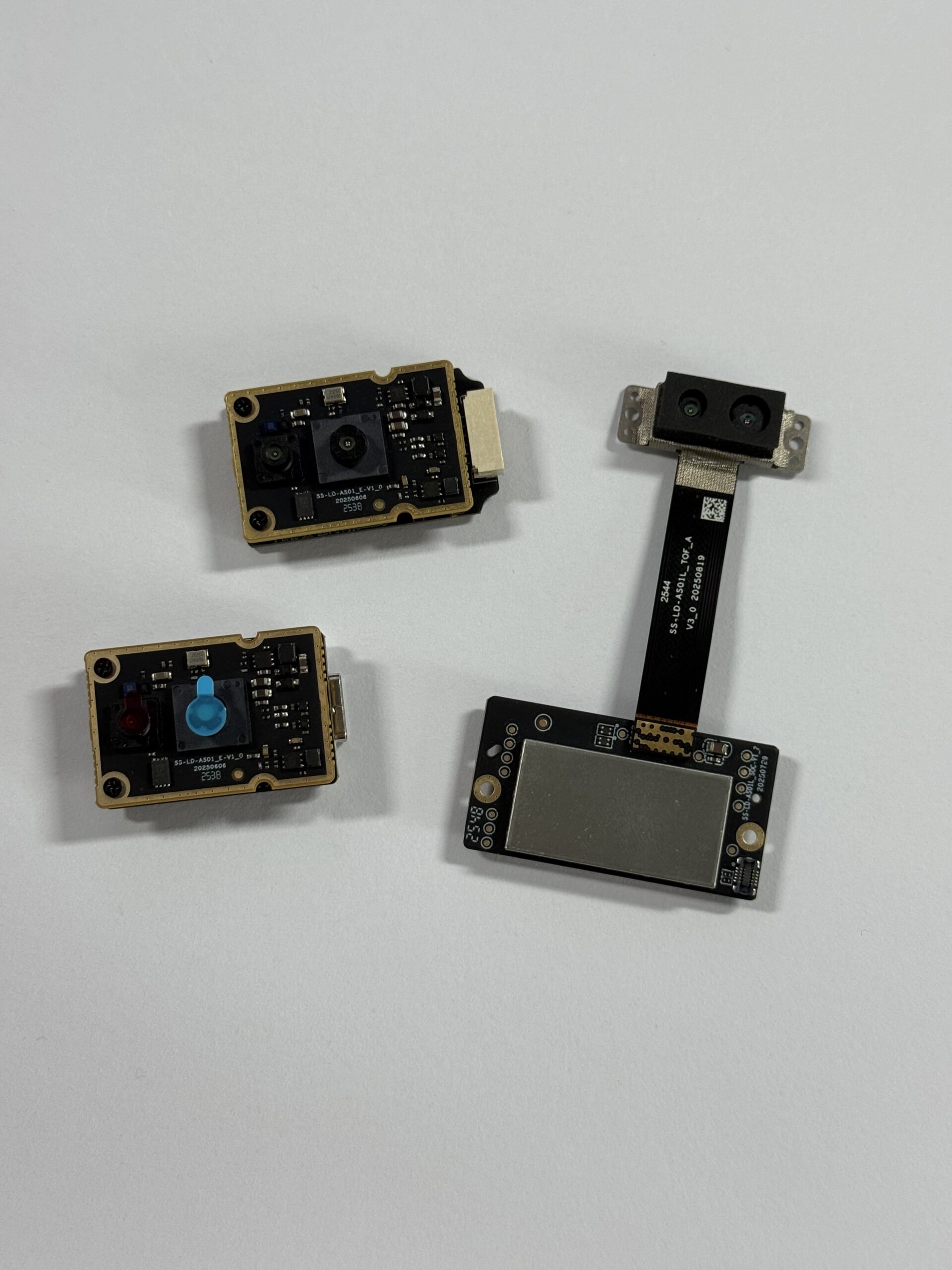
Most LiDAR drone projects fall into three broad groups. The first group is professional LiDAR mapping drones, used for topographic surveys, forestry, mining, construction, corridor mapping, and digital terrain modeling. These systems usually combine a laser scanner with GNSS, IMU, time synchronization, and post-processing software. The second group is inspection and navigation LiDAR drones, used to maintain distance from bridges, dams, tanks, silos, roofs, facades, expressways, industrial plants, and other structures. The third group is development and obstacle-avoidance LiDAR drones, used by engineers building autonomous UAVs, embedded perception systems, and robotics research platforms.
This distinction matters because selection criteria change fast by application. A mapping company may prioritize long range, georeferenced point-cloud accuracy, scan density, and a calibrated workflow. A UAV robotics engineer may care more about weight, power consumption, latency, field of view, SDK availability, and compatibility with Raspberry Pi, Jetson, x86 Linux, ARM Linux, or a flight-control companion computer. For teams watching how sensor performance and pricing are evolving, see our latest updates on LiDAR news and technology trends.
How Drone LiDAR Works
Drone LiDAR works by measuring distance from the UAV to objects, terrain, vegetation, or structures. The physics is straightforward, but a dependable airborne system takes real engineering. A LiDAR mounted on a moving drone has to deal with vibration, changing attitude, sunlight, reflectivity differences, processing latency, and sometimes synchronization with GNSS and IMU data. Industrial sensing suppliers such as domisensor also show how quickly perception hardware is moving toward compact, embedded, and application-specific designs.
The Basic Measurement Principle
A LiDAR sensor emits light toward a target surface. That light reflects from the target and returns to the receiver. The sensor measures the time delay, phase shift, or another return-signal property and converts it into a distance value. In a direct Time-of-Flight system, often called dToF LiDAR, the module directly measures the travel time of photons. Since light travels at a known speed, the measured time interval can be converted into distance.
For drone applications, this measurement repeats continuously. Instead of one distance reading, the sensor captures many distance values over its field of view. A depth module can represent those values as a depth image, where each pixel corresponds to distance. It can also convert them into a 3D point cloud, where each point has spatial coordinates.
From Distance Points to 3D Point Clouds
A single distance measurement is useful for basic proximity sensing, but it is not enough for mapping, obstacle detection, or navigation. A LiDAR system collects many distance values across its field of view and converts those measurements into X, Y, and Z coordinates. The result is a point cloud that represents the visible surfaces in the scene.
For mapping drones, this point cloud is usually combined with UAV position and orientation data from GNSS, RTK, PPK, IMU, visual odometry, or other localization systems. That data allows individual LiDAR points to be placed into a real-world coordinate system. For obstacle-avoidance drones, the point cloud may not need full georeferencing. The companion computer may simply transform points into the drone body frame, detect obstacles, and send simplified avoidance information to the flight controller.
Why UAV Motion Makes LiDAR More Complex
Drone LiDAR is more complex than stationary LiDAR because the sensor platform is always moving. The UAV may pitch, roll, yaw, accelerate, brake, climb, descend, or vibrate. Even small attitude changes can affect where the LiDAR is pointing. For survey-grade mapping, time synchronization becomes critical because the system must know exactly where the drone was and how it was oriented when each measurement was captured.
Outdoor conditions matter too. Bright sunlight can affect optical sensors. Dark, shiny, transparent, angled, or low-reflectivity surfaces may return weaker signals. Wind can introduce motion instability. Dust, rain, fog, or spray can introduce false returns. For compact UAV obstacle avoidance, engineers should test the LiDAR in the actual flight environment instead of relying only on maximum range numbers from ideal conditions.
Main Applications of Drones with LiDAR
The best LiDAR sensor for a drone depends on the mission. A forestry mapping drone, a bridge inspection drone, a warehouse navigation drone, and a research UAV for obstacle avoidance all need different hardware. The following application categories help clarify whether you need a high-end mapping payload or a compact perception module.
UAV Mapping and 3D Terrain Modeling
LiDAR mapping drones are widely used for topographic mapping, digital elevation models, digital terrain models, stockpile volume estimation, forestry canopy analysis, road corridor mapping, railway inspection, mining, quarry measurement, and civil engineering projects. Compared with camera-only photogrammetry, LiDAR can provide direct distance measurements and may perform better in areas with vegetation, repeated textures, or poor visual contrast.
Professional mapping normally requires much more than a LiDAR sensor. It requires high-density point-cloud capture, accurate GNSS/IMU integration, RTK or PPK workflows, boresight calibration, time synchronization, ground-control strategy, and post-processing software. The deliverable may need to meet engineering or regulatory requirements, so buyers should evaluate the complete payload and workflow, not just the laser scanner bolted underneath the drone.
Surveying and Engineering Measurement
Surveying applications demand accuracy, repeatability, traceability, and reliable georeferencing. A survey-grade UAV LiDAR system often includes a laser scanner, GNSS receiver, inertial measurement unit, timing synchronization electronics, onboard storage, calibration parameters, and professional processing software. The accuracy of the final point cloud depends on the complete system, not only the sensor’s range accuracy.
If your project requires legal land surveying, engineering-grade deliverables, road design inputs, infrastructure acceptance data, or centimeter-level georeferenced mapping, evaluate the entire payload. Budget sensors can be valuable for research, inspection, and development, but they are not automatically survey-certified. For procurement teams, this is one of the most important distinctions when comparing drones with LiDAR.
Obstacle Avoidance and Autonomous Navigation
Obstacle avoidance is one of the strongest use cases for compact solid-state dToF LiDAR. A UAV may need to detect walls, trees, poles, racks, machinery, cables, landing-zone hazards, structural surfaces, or nearby people. For these tasks, the most important specifications are often low latency, useful field of view, reliable near-field distance output, light weight, low power consumption, and easy integration with a companion computer.
Unlike survey mapping, obstacle avoidance usually does not require a complete georeferenced point cloud. Instead, the UAV needs to understand whether an obstacle exists in front, below, above, or to the side of the aircraft. A compact LiDAR depth module can provide real-time depth images and point cloud data that software can process into simple flight decisions.
Infrastructure Inspection
Infrastructure inspection drones are used around bridges, dams, expressways, industrial plants, tanks, silos, roofs, facades, and other difficult-to-reach assets. LiDAR helps the drone estimate distance to surfaces and maintain a safer standoff distance. This is especially useful when visual texture is limited, lighting is inconsistent, or the drone must operate close to large surfaces.
For inspection, compact LiDAR often complements cameras rather than replacing them. The camera captures visual evidence such as cracks, corrosion, leakage, deformation, and coating defects. The LiDAR provides spatial awareness and helps maintain consistent distance from the structure. In close-range inspection, near-field reliability, compact mounting, and integration simplicity can be more important than long-range scanning.
Terrain Following and Altitude Hold
Downward-facing or angled LiDAR can support terrain following and altitude hold. This is valuable for agricultural drones, low-altitude inspection drones, indoor UAVs, research platforms, and robotics labs. A LiDAR sensor can estimate distance to the ground, floor, roof, shelf, or nearby surface and provide more direct range information than barometric altitude alone.
The HM-LD1 is relevant here because its 28 g weight and 1.2 W power consumption make it easier to mount on smaller UAVs where payload mass and battery capacity are limited. For terrain following and altitude-related perception, developers should consider mounting angle, field-of-view clearance, expected ground reflectivity, flight speed, and how the processed data will be passed to the flight controller.
Types of LiDAR Sensors Used on Drones
Different LiDAR technologies offer different tradeoffs in range, resolution, field of view, cost, weight, reliability, and integration complexity. Before selecting a sensor, UAV integrators should understand the main categories. In practice, the best choice is rarely “the biggest spec number.” It is the sensor that matches the job, the airframe, and the processing pipeline.
Mechanical Scanning LiDAR
Mechanical scanning LiDAR uses rotating mirrors, spinning assemblies, or moving optical components to scan the environment. These sensors can provide wide coverage, sometimes including 360° horizontal scanning, and are common in robotics, mapping, autonomous vehicles, and industrial perception systems. They often provide higher point density and broad scene coverage.
The tradeoffs are size, weight, power consumption, mechanical wear, and cost. Moving components may also introduce reliability concerns in harsh environments. For larger UAVs or high-end mapping payloads, mechanical scanning LiDAR may be appropriate. For small drones, indoor UAVs, or embedded obstacle-avoidance prototypes, a compact solid-state approach may be more practical.
Solid-State LiDAR
Solid-state LiDAR does not rely on large rotating mechanical parts. That can make the sensor more compact, robust, and easier to integrate into embedded systems. Solid-state LiDAR is especially attractive for small drones because every gram affects flight time, payload capacity, center of gravity, and thermal design.
The limitations depend on the specific design. Some solid-state LiDAR modules have a narrower field of view or shorter range than larger scanning systems. Others are optimized for depth images rather than high-density survey point clouds. For UAV developers, the key is to match the solid-state module to the mission instead of assuming all LiDAR sensors are interchangeable.
dToF LiDAR
dToF means direct Time-of-Flight. A dToF LiDAR sensor measures the actual travel time of emitted light as it returns from a target. This approach is widely used for real-time depth sensing, distance detection, robotic perception, obstacle avoidance, and embedded vision systems. A dToF module can output depth maps and point clouds depending on its design and software support.
A dToF solid-state module can be a practical choice when the goal is not full geospatial survey mapping but reliable distance perception, navigation support, and UAV development. For small drones, a compact dToF module can provide useful spatial awareness while keeping mass, power consumption, and integration effort under control.
LiDAR Depth Camera Modules
LiDAR depth camera modules provide per-pixel depth data in an image-like format. They are often easier to integrate with computer vision and AI perception pipelines than traditional scanning sensors. Developers can process depth maps with image-processing methods, convert them into point clouds, or combine them with RGB cameras for richer scene understanding.
Compared with passive stereo cameras, LiDAR depth modules can be more robust in low-texture environments because they actively measure distance. However, outdoor performance depends heavily on sensor design, optical filtering, receiver sensitivity, sunlight tolerance, and target reflectivity. For a deeper comparison of depth sensing in robotic systems, see our guide to 3D depth camera applications in robotics.
How to Choose the Right LiDAR Sensor for a Drone
This is the central engineering decision. The right LiDAR sensor is the one that fits the mission, airframe, compute platform, power budget, software workflow, and environmental conditions. The following criteria should be evaluated before purchasing or integrating drones with LiDAR.
Weight and Payload Capacity
Drone payload capacity directly limits sensor choice. Heavier LiDAR systems reduce flight time and may require larger motors, propellers, batteries, arms, landing gear, and airframes. Added mass can also affect maneuverability, vibration, braking distance, and safety margin. For small UAVs, even tens of grams can matter.
Lightweight LiDAR modules are especially useful for indoor drones, small inspection UAVs, prototypes, and robotic perception systems. At only 28 g, the HM-LD1 is designed for applications where weight directly affects endurance and maneuverability. In the shop, that is the kind of number that makes integration easier instead of forcing a full airframe redesign.
Power Consumption
UAV power is limited. LiDAR, companion computers, cameras, radio links, telemetry units, flight controllers, and payload electronics all compete for the same battery capacity. High-power sensors reduce flight time and may create thermal-management issues. Low-power modules simplify wiring, voltage regulation, and integration.
HM-LD1 consumes approximately 1.2 W, making it easier to integrate into compact embedded UAV systems. For engineers, this low power draw can reduce the burden on the aircraft power distribution system and leave more budget for processing and communication electronics.
Ranging Capability
Range requirements must be interpreted by mission. Indoor range and outdoor range may differ significantly because sunlight can reduce effective range. Target reflectivity, surface angle, dust, rain, fog, and required confidence level also affect performance. A sensor that works well in a lab may produce different results outdoors at noon.
The HM-LD1 provides indoor ranging of 0.5–25 m and outdoor ranging of 0.2–8 m. Product information also notes accurate ranging at up to 8 meters outdoors on a clear summer day under approximately 80,000 lux conditions. For high-altitude mapping, 8 m outdoor range is not enough. For near-field obstacle avoidance, terrain following, inspection, distance detection, and UAV development, it can be very useful.
Accuracy and Repeatability
Accuracy describes how close the measurement is to the true distance. Repeatability describes how consistent measurements are over time under similar conditions. Surveying needs system-level georeferenced accuracy, which depends on GNSS, IMU, calibration, synchronization, and processing. Obstacle avoidance needs reliable relative distance measurement so the UAV can react to nearby hazards.
The HM-LD1 has a ranging accuracy of ±3 cm. That is valuable for near-field perception, distance detection, altitude-related tasks, and navigation support. However, survey-grade mapping still depends on complete system integration, calibrated positioning, and professional workflow.
Field of View
Field of view determines how much of the scene the sensor can observe. Forward obstacle avoidance needs enough horizontal and vertical coverage to detect hazards before the aircraft reaches them. Downward-looking terrain following needs a useful view of the ground. A narrow FOV may require multiple sensors, a gimbal, or a scanning mechanism.
The HM-LD1 offers a 60° horizontal × 45° vertical field of view. This FOV is suitable for compact forward-looking, downward-looking, or near-field perception tasks. Engineers should ensure that propellers, landing gear, housings, and cables do not block the sensor’s view.
Resolution and Frame Rate
Resolution affects point density and object detail. Frame rate affects latency and motion response. Faster UAVs need faster perception loops, while higher resolution increases processing requirements. The best balance depends on flight speed, obstacle size, compute capability, and how the data is used.
The HM-LD1 provides 40 × 30 resolution at 10 fps. This is appropriate for compact obstacle detection, depth perception, and development use cases. It is not comparable to high-density survey-grade LiDAR scanners, and it should not be evaluated as if it were a complete aerial mapping payload.
Interface Compatibility
Interfaces determine how easily the LiDAR connects to the rest of the drone system. UART is common for embedded control and simpler communication. UDP is useful for networked systems and data streaming. UVC is convenient for PC-style video or depth workflows. Interface choice affects latency, driver complexity, bandwidth, and platform compatibility.
HM-LD1 supports UART, UDP, and UVC. This gives developers flexibility when connecting to PCs, Raspberry Pi, Jetson-style computers, embedded Linux systems, or flight controllers through companion computers.
SDK and Software Ecosystem
SDK availability reduces development time. Drivers, demos, sample code, documentation, and platform support can be as important as hardware specifications. ROS adaptation, point-cloud visualization, and depth-image examples can accelerate robotics development. Windows, Linux, and ARM support are especially valuable when a project moves from lab testing to field deployment.
MRP offers SDKs for x86 Windows, x86 Linux, and ARM Linux, enabling development across diverse operating systems and architectures. To keep up with evolving LiDAR software and embedded perception trends, follow our latest LiDAR news.
Environmental Adaptability
Environmental adaptability includes sunlight tolerance, temperature range, vibration resistance, mounting stability, and performance on different materials. Outdoor light affects many optical sensors. Temperature affects electronics and calibration. Dust, rain, fog, and vibration can reduce measurement reliability. Indoor or nighttime performance may be stronger than bright outdoor performance.
The HM-LD1 operates from -20 °C to 60 °C. Its indoor or nighttime range can reach up to 25 m, while outdoor daytime range is specified up to 8 m. This makes it suitable for many near-field UAV and robotics perception tasks, but field validation is still essential before production deployment.
Mapping LiDAR vs Obstacle-Avoidance LiDAR
Not every LiDAR sensor for drones is built for the same mission. A LiDAR payload for professional mapping is usually evaluated by point density, scan rate, range, GNSS/IMU synchronization, boresight calibration, absolute accuracy, and post-processing workflow. A LiDAR sensor for obstacle avoidance is evaluated by weight, power consumption, latency, field of view, near-field range, embedded interface support, and real-time depth output.
| Factor | Mapping / Surveying LiDAR | Obstacle-Avoidance / Development LiDAR |
|---|---|---|
| Main Goal | Create georeferenced 3D maps and survey deliverables | Detect nearby objects and support navigation decisions |
| Typical Range Need | Longer range, often tens to hundreds of meters | Near-field to mid-range detection |
| Accuracy Requirement | System-level survey accuracy | Reliable relative distance measurement |
| Required Hardware | LiDAR scanner, GNSS, IMU, timing sync, storage | Compact depth sensor, embedded computer, flight controller link |
| Cost Level | High | Lower for prototyping and embedded perception |
| Best For | Surveying, mining, forestry, civil engineering | Obstacle avoidance, terrain following, robotics research, inspection |
Drone LiDAR Integration: Interfaces, SDKs, and Compute Platforms
Successful drones with LiDAR are not only about sensor specifications. Integration determines whether the data can be used reliably in flight. Engineers must decide where the LiDAR connects, where data is processed, how obstacles are interpreted, and how results are passed to the flight-control system.
Flight Controller vs Companion Computer
Flight controllers handle low-level stabilization, motor control, attitude estimation, and flight modes. Companion computers handle higher-level perception, planning, AI inference, logging, and custom algorithms. In many LiDAR drone systems, the sensor connects to a companion computer such as Raspberry Pi, Jetson, x86 Linux, or an embedded ARM platform. The companion computer processes depth maps or point clouds and sends simplified information to the flight controller.
UART, UDP, and UVC Integration
UART is useful for simple serial communication and embedded distance data. UDP is suitable for network-based data streaming where the system architecture uses Ethernet or IP networking. UVC is convenient when the LiDAR behaves like a video-class device, which can simplify depth-image workflows on PCs and Linux-based systems. Because HM-LD1 supports UART, UDP, and UVC, developers can select the integration route that best matches their hardware architecture.
ROS, OpenCV, and AI Perception Pipelines
Robotics developers often use ROS to publish depth images, point clouds, transforms, and obstacle data. OpenCV can process depth maps for filtering, segmentation, thresholding, and region detection. AI models may combine LiDAR depth data with RGB images for object recognition, scene understanding, or safety monitoring. SLAM systems may use LiDAR or depth data depending on range, resolution, calibration, and accuracy requirements.
Mechanical Mounting and Calibration
Mechanical integration affects measurement quality. Engineers should check mounting angle, vibration isolation, field-of-view clearance, cable strain relief, enclosure design, center-of-gravity impact, and coordinate-frame alignment. The sensor should be mounted rigidly enough for stable data but protected from excessive vibration. Calibration should define the relationship between the sensor coordinate frame and the drone body frame.
Data Processing Workflow
A typical UAV LiDAR perception workflow begins with capturing a raw depth frame. The software then converts depth pixels into distance points, filters invalid or noisy points, transforms the data into the drone coordinate frame, segments obstacles or ground plane, and sends avoidance commands or map updates. Logging is important because real flight data helps engineers diagnose latency, false positives, outdoor performance, and mounting issues.
Recommended Compact dToF LiDAR Module for UAV Development
The DTOF Solid State LiDAR HM-LD1 is a compact solid-state LiDAR module based on SPAD dToF technology. It delivers real-time depth images and 3D point cloud data for environmental perception, obstacle avoidance, distance detection, autonomous navigation, smart inspection, and robotic vision development. With a 28 g lightweight design, 1.2 W power consumption, 60° × 45° FOV, and UART/UDP/UVC interfaces, it is well suited for small UAVs, embedded platforms, Raspberry Pi, Jetson-style systems, PCs, and robotics prototypes.
For drones with LiDAR focused on near-field perception, HM-LD1 offers a practical balance of size, power, interface flexibility, and sensing capability. It should be positioned accurately: it is not a complete survey-grade aerial mapping payload by itself. Instead, it is a lightweight dToF depth LiDAR module for UAV obstacle avoidance, altitude support, terrain following, distance detection, smart inspection, robotic navigation, SLAM development, zone monitoring, and embedded perception projects.
Download the DTOF SSL HM-LD1 Product Brochure
| DTOF Solid State LiDAR HM-LD1 Specifications | |
|---|---|
| Product Name | DTOF Solid State LiDAR HM-LD1 |
| Technology | SPAD dToF solid-state LiDAR |
| Dimensions | 43.5 mm × 30 mm × 26.5 mm |
| Weight | 28 g |
| Ranging Capability | Indoor: 0.5–25 m; Outdoor: 0.2–8 m |
| Ranging Accuracy | ±3 cm |
| Field of View | 60° horizontal × 45° vertical |
| Resolution | 40 × 30 |
| Frame Rate | 10 fps |
| Interfaces | UART / UDP / UVC |
| Operating Temperature | -20 °C to 60 °C |
| Power Consumption | 1.2 W |
| Supported Development Platforms | x86 Windows, x86 Linux, ARM Linux SDKs |
| Typical Applications | UAV obstacle avoidance, altitude hold, terrain following, robot navigation, SLAM development, smart inspection, distance detection, zone monitoring |
View Product Details & Pricing ➔
Drone LiDAR Selection Comparison Table
| Sensor Type | Best Use Case | Strengths | Limitations | Typical Buyer |
|---|---|---|---|---|
| Survey-Grade UAV LiDAR Payload | Professional mapping and engineering surveys | High accuracy, georeferenced point clouds, long-range scanning | High cost, heavier payload, complex workflow | Survey companies, mining teams, civil engineers |
| Mechanical Scanning LiDAR | Wide-area scanning and robotics perception | High point density, broad coverage | Moving parts, weight, power, cost | Robotics labs, mapping integrators |
| Solid-State dToF LiDAR | Obstacle avoidance, terrain following, compact UAV perception | Lightweight, low power, compact, easier embedded integration | Shorter range and lower point density than survey payloads | UAV developers, robotics engineers, embedded system teams |
| Stereo Camera | Visual navigation and AI perception | Rich visual data, low hardware cost | Depends on texture and lighting | Computer vision teams, research developers |
| Ultrasonic / Single-Point Rangefinder | Simple altitude or proximity detection | Low cost, simple output | Limited spatial awareness | Basic drone builders, hobby prototypes |
Common Mistakes When Buying LiDAR for Drones
Choosing Range Without Considering Application
Longer range is not always better. A small drone used for indoor obstacle avoidance may benefit more from low latency, compact size, wide FOV, low power consumption, and simple software integration than from long-range scanning. Match range to the mission rather than buying the largest number on a datasheet.
Ignoring Weight and Power Budget
Every gram affects flight endurance, and every watt affects battery life and thermal stability. A sensor that looks excellent on paper may be unsuitable if it forces a larger battery, shifts the center of gravity, or overloads the power distribution system. Always evaluate LiDAR weight and power together with the companion computer and other payload devices.
Confusing Mapping LiDAR with Obstacle-Avoidance LiDAR
A compact depth LiDAR is not automatically a survey payload, and a survey payload is not always practical for real-time obstacle avoidance on a small UAV. Mapping systems are optimized for georeferenced point clouds and deliverables. Obstacle-avoidance systems are optimized for real-time perception and navigation decisions.
Overlooking SDK and Driver Support
Integration cost can exceed hardware cost if there are no SDKs, drivers, sample applications, or technical support. Before buying a LiDAR sensor, confirm which operating systems are supported, whether ARM Linux is available, how data is streamed, and whether the supplier can support your development workflow.
Not Testing Outdoor Performance
Outdoor performance depends on sunlight, reflectivity, weather, target material, and mounting geometry. A LiDAR module should be tested under real flight conditions, including bright light, dark objects, angled surfaces, and expected operating temperatures. Field testing is essential before production deployment.
Buyer Checklist for Drones with LiDAR
Use this procurement-ready checklist before selecting a drone LiDAR sensor or payload:
- ✅ What is the mission: mapping, surveying, inspection, obstacle avoidance, or research?
- ✅ What is the maximum payload weight the drone can safely carry?
- ✅ What is the available power budget?
- ✅ What indoor and outdoor range is required?
- ✅ Is the required accuracy relative or georeferenced?
- ✅ What field of view is needed?
- ✅ What resolution and frame rate are required?
- ✅ Does the LiDAR output depth maps, point clouds, or single-point distance?
- ⚙️ Does it support UART, USB, Ethernet, UDP, UVC, or other required interfaces?
- ⚙️ Are SDKs available for Windows, Linux, ARM, or embedded platforms?
- ⚙️ Will the system run on Raspberry Pi, Jetson, x86 PC, or a custom controller?
- ✅ Does the supplier provide technical support?
- ✅ Can the sensor operate in the expected temperature range?
- ✅ Has outdoor performance been validated under sunlight?
- ✅ Is the sensor suitable for production supply, not only lab testing?
FAQ: Drones with LiDAR
Is there any LiDAR suitable for small drones?
Can I build a LiDAR drone for mapping or surveying on a budget?
What should beginners check before buying drones with LiDAR?
Are drones with LiDAR better than camera-based drones?
What is the difference between drone LiDAR mapping and drone LiDAR obstacle avoidance?
How far can a drone LiDAR sensor detect objects?
Can LiDAR help drones fly indoors?
What interfaces are best for integrating LiDAR with a drone?
Is solid-state LiDAR better for UAVs than mechanical LiDAR?
Can a LiDAR module output both point cloud and depth map data?
Discuss Your UAV LiDAR Integration Project
Tell us your drone platform, payload limits, range requirement, interface needs, and application scenario. Our team can help evaluate whether HM-LD1 fits your development or deployment workflow.
📚 References & Further Reading
- Industry Standard: domisensor
- Related Guide: LiDAR news and technology trends
- Related Guide: 3D depth camera applications in robotics
- Related Guide: latest LiDAR news
- Product Reference: DTOF Solid State LiDAR HM-LD1






