


RTK Drone Buying Guide: Build, Upgrade, or Choose the Right Centimeter-Level GNSS Module
For industrial drone teams, positioning accuracy is no longer a luxury feature. It is the difference between data you can trust and data you have to explain away later. Whether the job is aerial mapping, precision agriculture, construction progress tracking, UAV inspection, robotics navigation, or autonomous vehicle testing, a properly configured RTK drone can make the workflow cleaner, more repeatable, and a lot less painful in the field. Standard GPS can wander by meters. A good RTK setup, handled correctly, can bring that down to centimeter-level positioning under the right conditions.
Here’s the deal: RTK is not magic, and it is not just a sticker on the side of a drone. The receiver, antenna, correction link, flight controller, mounting location, satellite visibility, and integration quality all matter. If one piece is weak, the whole system can underperform. That is why some buyers are better off purchasing a ready-made RTK drone, while others should upgrade an existing UAV or build a custom platform around a dedicated GNSS module.
Table of Contents
- 👉 What Is an RTK Drone?
- 👉 RTK vs Standard GPS vs PPK
- 👉 How RTK Drone Positioning Works
- 👉 Core RTK Drone Hardware
- 👉 Build, Upgrade, or Buy an RTK Drone?
- 👉 How to Choose an RTK GNSS Module for a Drone
- 👉 RTK Drone Module Comparison and Product Specs
- 👉 RTK Drone Integration Guide for UAVs, Rovers, and Robots
- 👉 What Affects RTK Drone Accuracy in the Real World?
- 👉 Industrial Applications for RTK Drones
- 👉 RTK Drone Buyer Checklist
- 👉 RTK Drone FAQ
What Is an RTK Drone?
An RTK drone is an unmanned aerial vehicle equipped with a real-time kinematic GNSS receiver that uses correction data to reduce normal GNSS errors from meter-level drift to centimeter-level precision. Instead of trusting satellite positioning by itself, the drone compares its own satellite measurements with correction data from a known reference source. That source may be a local base station, an NTRIP correction network, or another compatible reference receiver transmitting RTCM correction data.
In a professional RTK drone system, the GNSS receiver tracks signals from multiple satellite constellations such as GPS, BeiDou, Galileo, GLONASS, QZSS, and IRNSS. Multi-constellation reception gives the receiver more usable satellites, while multi-band reception helps compensate for atmospheric delay and improves positioning reliability. In the shop, that means fewer mystery offsets, cleaner geotags, and better repeatability from one mission to the next.
Why Standard GPS Is Not Enough
Standard GNSS or GPS is fine for basic navigation, but it is often not accurate enough for professional drone mapping or industrial automation. A consumer GPS receiver can drift because of satellite clock errors, ionospheric and tropospheric delay, multipath interference, weak satellite geometry, and signal blockage from trees, buildings, or industrial structures. For casual navigation, that may be acceptable. For survey-grade work, automated inspection, or repeatable autonomous routes, it can turn into a real data quality problem.
Look at a construction site, a farm boundary, or a utility corridor. If your drone’s geotagged images shift several feet between flights, the team on the ground may not know whether the site changed or the positioning changed. Agricultural prescription maps may miss field boundaries. Inspection routes may not repeat the same pass. Construction progress maps may not align cleanly week over week. RTK corrects many of those errors in real time, giving operators a stronger positioning foundation before the data ever reaches the processing software.
What Centimeter-Level Really Means
Centimeter-level accuracy should be understood as a system-level result, not a blanket promise in every environment. The HM-D20 and HM-D13 both list RTK position accuracy of H: 1 cm + 1 ppm, V: 1.5 cm + 1 ppm. The ppm term means parts per million, which is roughly one additional millimeter of error per kilometer of baseline distance from the reference source. If the rover is far from the base station, especially under different atmospheric conditions, accuracy can degrade.
To get real RTK performance, the drone needs a stable correction stream, clear satellite visibility, smart antenna placement, low multipath exposure, and properly configured serial communication. Operators should also monitor RTK fixed, float, and single states during mission planning and flight. For teams building their own autonomous positioning stack, a wireless UART bridge can simplify field wiring; see this guide on making UART/pose odometry sensors wireless: wireless UART/pose odometry sensor bridge guide.
RTK vs Standard GPS vs PPK
Buyers usually compare RTK, standard GPS, and PPK when selecting a drone positioning workflow. Each option has its own tradeoff between cost, complexity, real-time capability, and output accuracy. The best choice depends on whether the drone needs centimeter-level feedback while flying, whether post-processing is acceptable, and whether the team has access to a dependable correction source.
Standard GNSS or GPS
Standard GNSS is the simplest approach. It requires no correction data and is widely supported by autopilots, tracking systems, and consumer drones. It is suitable for basic navigation, approximate route following, non-critical tracking, and general positioning tasks. The problem is that typical errors are measured in meters rather than centimeters. For survey-grade mapping, that is not good enough. It also has poor repeatability between flights, especially near trees, metal structures, buildings, or equipment yards.
RTK Positioning
RTK positioning uses real-time corrections. The rover receiver on the drone receives satellite signals and correction data, then calculates a more precise position solution. This makes RTK valuable for live navigation, flight control, surveying, mapping, robotics, and autonomous vehicles. RTK requires an RTCM correction input, a communication path from a base station or NTRIP network, and a receiver capable of outputting usable position data such as NMEA 0183.
PPK Positioning
PPK, or post-processed kinematic positioning, does not require a live correction link during flight. Instead, the drone records GNSS observations, and the data is corrected after the mission using base station data. PPK is popular in photogrammetry when real-time correction links are unreliable. The downside is simple: PPK does not provide real-time centimeter-level feedback to the flight controller. If the drone must navigate precisely while flying, RTK is usually the more practical workflow.
| Positioning Method | Typical Accuracy | Correction Timing | Best For | Main Limitation |
|---|---|---|---|---|
| Standard GNSS | Meter-level | None | Basic navigation and non-critical tracking | Insufficient for survey-grade mapping |
| RTK | Centimeter-level under proper conditions | Real time | RTK drone mapping, UAV navigation, robotics, surveying | Requires stable correction data |
| PPK | Centimeter-level after processing | After flight | Photogrammetry and offline mapping | No real-time centimeter feedback |
How RTK Drone Positioning Works
RTK drone positioning combines precise satellite signal measurement, correction data, and real-time computation. The drone acts as a rover receiver, while the reference source provides correction information. By comparing the rover’s measurements with a known reference, the system can resolve carrier-phase information and reduce common GNSS errors.
Satellite Signal Reception
Modern RTK drone modules benefit from multi-band, multi-constellation tracking. The HM-D20 supports GPS L1/L5, BeiDou B1/B2A/B2I, GLONASS G1, Galileo E1/E5, QZSS L1/L5, and IRNSS L5. The HM-D13 supports GPS L1/L5, BeiDou B1/B2A/B2I, Galileo E1/E5, QZSS L1/L5, GLONASS G1, and IRNSS. These bands improve availability and reliability across regions because the receiver can use signals from more satellites.
Dual-frequency or multi-frequency GNSS is especially useful because different frequencies respond differently to atmospheric delay. By comparing measurements across bands, the receiver can estimate and compensate for those errors more effectively. In the real world, that can mean faster convergence, a more stable solution, and fewer RTK dropouts when the drone moves through mixed signal environments.
Base Station, Rover, and Correction Data
The base station is a GNSS receiver at a known or calculated reference point. The rover is the moving receiver installed on the drone, robot, unmanned vehicle, or survey device. The base station generates correction data, commonly in RTCM format, and the rover uses that data to refine its position solution. The rover may then output navigation data to a flight controller, companion computer, or software system using NMEA 0183.
The HM-D20 supports NMEA 0183 output and RTCM input at the rover side. That makes it a strong fit for drone-side positioning where the module receives corrections and outputs position data. The HM-D13 supports NMEA 0183 output and RTCM input at the rover side, and it also supports RTCM output at the base side. That distinction matters for teams designing workflows where one device may contribute to a base-side correction architecture.
Fixed, Float, and Single GNSS States
An RTK drone may operate in several positioning states. Single means the receiver is using standalone GNSS without an RTK solution. Float means correction data is being used, but the receiver has not fully resolved the carrier-phase ambiguities required for the strongest solution. Fixed means the receiver has resolved those ambiguities and is operating in the highest-confidence RTK state.
Industrial teams should monitor RTK state before takeoff and throughout the mission. A drone that starts in fixed mode can degrade to float or single if correction data is interrupted, satellite visibility drops, multipath increases, or baseline conditions become unfavorable. For broader context on GNSS hardware, sensor fusion, and industrial positioning ecosystems, readers can also review positioning-related technology suppliers such as domisensor.
Core RTK Drone Hardware
An RTK drone is not defined by a receiver alone. It is a complete positioning system made from a GNSS RTK module, antenna, correction data link, flight controller or companion computer, power supply, mounting structure, and software configuration. A strong module can underperform if the antenna is buried under carbon fiber or if correction data cannot reach the rover reliably.
GNSS RTK Receiver Module
The GNSS RTK receiver module processes satellite signals and correction data. When evaluating a module, buyers should check frequency bands, satellite constellation support, RTK position accuracy, UART compatibility, RTCM input, NMEA output, operating temperature, dimensions, weight, antenna integration, and environmental durability. For drones, size and payload matter. For survey rovers or larger unmanned systems, antenna form factor and base-side support may be more important.
RTK Antenna
The antenna is critical because it receives the signals that make precision positioning possible. Important antenna factors include phase center stability, ground plane behavior, multipath rejection, installation height, cable loss, and separation from electronics. Carbon fiber, batteries, ESCs, motors, telemetry radios, and video transmitters can all influence GNSS performance if the antenna is placed poorly.
The HM-D20 integrates the GNSS module and helical antenna in one compact IP67 package, reducing the need for external antenna routing. Integrated antenna-module designs can reduce connector problems, cable losses, and installation complexity. They are especially useful when a drone or autonomous platform needs a rugged, compact positioning unit.
Correction Data Link
RTK requires correction data. The correction link can be a local base station radio, a 4G or NTRIP connection, a telemetry bridge, a flight controller pass-through, or a companion computer forwarding data to the receiver. The correction path must be reliable enough to prevent excessive correction age and solution degradation. The HM-D13 supports an optional 4G radio module, making it suitable for survey workflows where network corrections are available.
Flight Controller or Companion Computer
RTK modules must communicate with the rest of the drone system. Both HM-D20 and HM-D13 use a TTL-level UART interface and a baud rate of 115200 bps. Engineers should confirm voltage compatibility, message rates, NMEA sentence support, RTCM routing, and firmware support for RTK status display. Developers prototyping custom navigation or edge-processing systems may also evaluate embedded development platforms such as the HM-RV3 RISC-V development board.
Build, Upgrade, or Buy an RTK Drone?
The right buying path depends on the team’s mission, engineering capacity, schedule, and support expectations. A survey company may prioritize fast deployment and vendor-supported workflows. A UAV OEM may want control over size, interface, and supply chain. A robotics lab may value open data access and flexible integration over turnkey convenience.
Option 1: Buy a Ready-Made RTK Drone
A ready-made RTK drone is often best for survey teams, agriculture service providers, construction companies, and operators who need fast deployment. The airframe, GNSS receiver, camera, correction workflow, and software are already integrated. This reduces engineering burden and shortens the path to field productivity. The tradeoff is higher cost, less hardware flexibility, possible vendor lock-in, and limited ability to adapt the platform for custom robotics or OEM projects.
Option 2: Upgrade an Existing Drone
Upgrading an existing drone can be practical when the airframe has available UART ports, clean power, mounting space, firmware support, and a correction data path. The team must confirm that the controller can parse NMEA data and inject or forward RTCM corrections. Antenna placement is one of the most important success factors. A technically strong module can still deliver weak field results if mounted under carbon fiber, too close to high-current wiring, or in a location with poor sky visibility.
Option 3: Build a DIY RTK Drone
A DIY RTK drone is attractive for robotics engineers, FPV developers, research labs, OEM UAV manufacturers, and autonomous vehicle teams. This approach gives the most control over airframe design, software architecture, sensor fusion, and payload layout. However, it also introduces risks including EMI from motors and ESCs, vibration, power noise, poor antenna placement, incorrect coordinate frames, RTCM communication loss, and software parsing errors. DIY teams should plan bench testing, open-sky testing, and repeatability validation before relying on the system for industrial deliverables.
| Buyer Type | Recommended Path | Why | Suggested Module Direction |
|---|---|---|---|
| Survey company | Ready-made or professional upgrade | Needs reliable field productivity and repeatable data | HM-D13 for survey-style integrated GNSS workflows |
| UAV OEM | Custom integration | Needs control over size, interface, and supply | HM-D20 for compact integrated RTK positioning |
| Robotics lab | DIY build or modular upgrade | Needs flexible data access and software integration | HM-D20 or HM-D13 depending on size and use case |
| Agriculture operator | Ready-made or rugged upgrade | Needs outdoor durability and stable corrections | HM-D13 where larger survey antenna form factor is acceptable |
How to Choose an RTK GNSS Module for a Drone
Choosing an RTK GNSS module for a drone requires more than comparing headline accuracy. Buyers should evaluate frequency support, protocol compatibility, electrical interface, mechanical design, environmental durability, correction workflow, supplier support, and long-term availability. A module that is excellent for a ground survey rover may be too large for a small UAV. A compact module may be ideal for drone integration but may not support the base-side workflow a survey team requires.
Check Frequency Band Support
Multi-band support improves positioning reliability. Signals such as GPS L1/L5, Galileo E1/E5, BeiDou B1/B2A/B2I, QZSS L1/L5, and GLONASS G1 increase the receiver’s ability to maintain a strong solution. In regions where one constellation has limited visibility, multi-constellation support gives the receiver more choices. For RTK drone mapping, this is especially valuable because missions often require stable positioning across the entire flight area.
Verify Protocol Compatibility
Protocol support determines whether the module can communicate with your controller or software. NMEA 0183 is widely used for position output. RTCM is commonly used for RTK correction data. RTCM output is important if the module or system participates in a base-side correction workflow. HM-D20 supports NMEA 0183 output and RTCM input at the rover side. HM-D13 supports NMEA 0183 output and RTCM input at the rover side, plus RTCM output at the base side.
Confirm Electrical Interface
Both modules use a TTL-level UART interface and 115200 bps baud rate. This is common in drones, embedded computers, and robotics systems, but teams should still confirm voltage levels and wiring requirements. If the controller uses a different logic voltage, level shifting may be required. Bench testing serial output before flight reduces integration risk.
Evaluate Mechanical Design
The HM-D20 is compact at Φ44 × 37 mm, making it suitable for payload-sensitive drones, embedded robotics, unmanned vehicles, ships, and small positioning systems. The HM-D13 is larger at Φ152 × 67.9 mm and weighs less than 550 g, making it more appropriate for professional survey workflows, larger UAVs, ground rovers, and outdoor positioning systems where a mushroom-shaped integrated antenna form factor is acceptable.
Check Environmental Durability
Industrial drones operate in heat, cold, vibration, rain, dust, UV exposure, and electrical noise. Both HM-D20 and HM-D13 list an operating temperature range of -40 ℃ to 85 ℃. HM-D20 specifies IP67 waterproof protection and a rugged housing. HM-D13 uses UV-resistant PC material and is described as windproof and rainproof for outdoor use. These details matter because field reliability is often determined by enclosure quality, mounting stability, and connector protection.
Consider Supply, Customization, and Support
For OEM and industrial buyers, module selection also involves supplier capability. Important factors include an independent R&D team, technical support services, source factory manufacturing, OEM/ODM customization, stable supply, and integration guidance. When ready to configure a project order or request compatible accessories, buyers can proceed through the checkout workflow: checkout.
RTK Drone Module Comparison and Product Specs
Choosing an RTK drone module is not only about headline accuracy. The right product depends on airframe size, available payload capacity, required antenna type, correction workflow, environmental exposure, and whether the module needs to operate only as a rover or also support base-side correction output. The two modules below are designed for UAVs, unmanned vehicles, ships, survey devices, robotics systems, and industrial positioning applications.
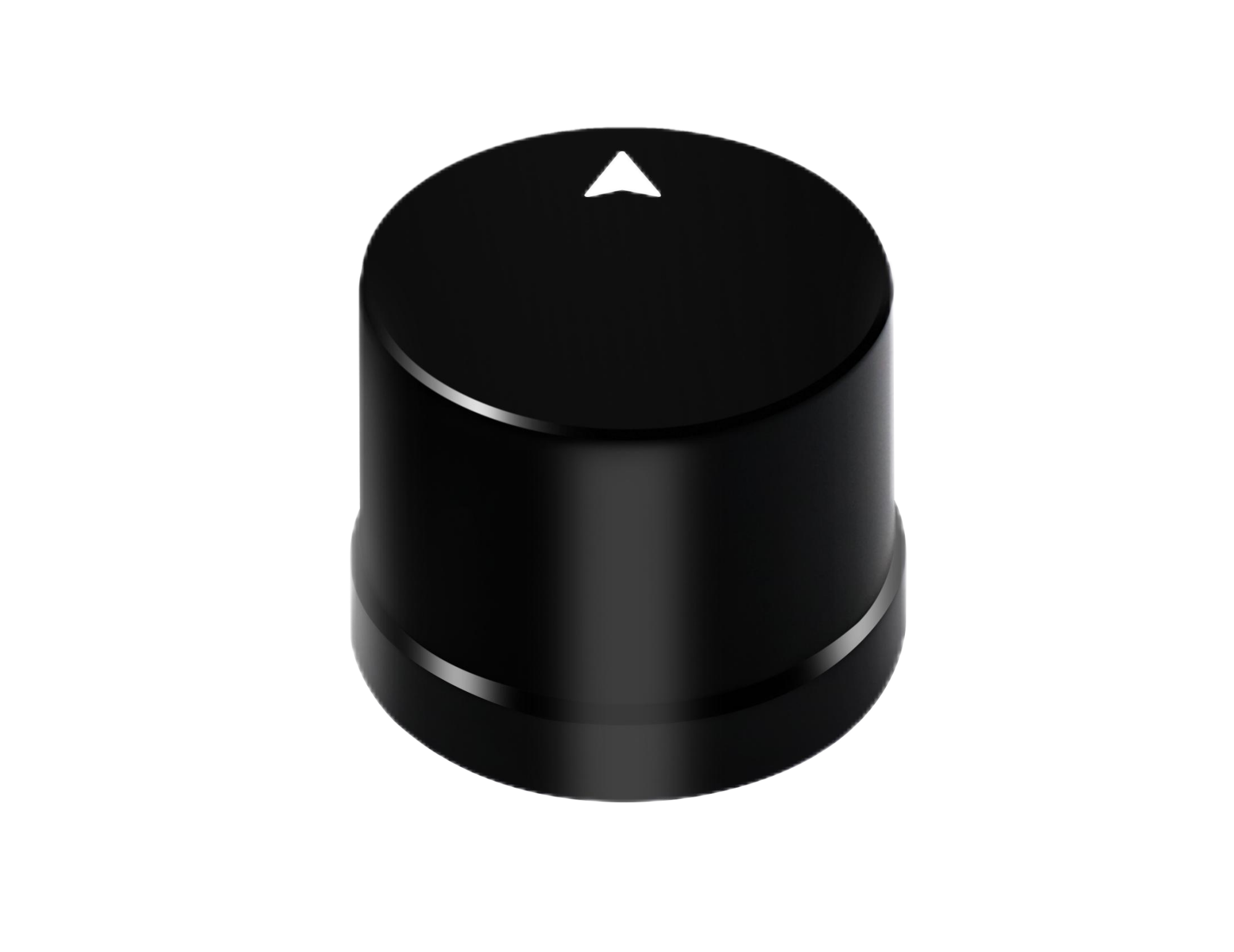
Helical Antenna RTK Module HM-D20
The HM-D20 is a compact integrated GNSS module and helical antenna for UAVs, unmanned vehicles, ships, and positioning systems. Its integrated design reduces external antenna routing and supports rover-side RTK positioning through NMEA 0183 output and RTCM input.
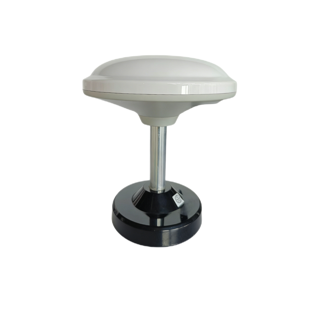
Multiband RTK Survey Module HM-D13
The HM-D13 is an integrated mushroom-shaped multiband RTK survey module for professional outdoor positioning and mapping applications. It supports rover-side NMEA output and RTCM input, plus RTCM output at the base side for more complete RTK workflows.
| Specification | Helical Antenna RTK Module HM-D20 | Multiband RTK Survey Module HM-D13 |
|---|---|---|
| Product URL | HM-D20 Product Page | HM-D13 Product Page |
| Frequency Band | GPS L1/L5, BeiDou B1/B2A/B2I, GLONASS G1, Galileo E1/E5, QZSS L1/L5, IRNSS L5 | GPS L1/L5, BeiDou B1/B2A/B2I, Galileo E1/E5, QZSS L1/L5, GLONASS G1, IRNSS |
| RTK Position Accuracy | H: 1 cm + 1 ppm, V: 1.5 cm + 1 ppm | H: 1 cm + 1 ppm, V: 1.5 cm + 1 ppm |
| Protocol | NMEA 0183 output and RTCM input at rover side | NMEA 0183 output and RTCM input at rover side; RTCM output at base side |
| Baud Rate | 115200 bps | 115200 bps |
| Interface | TTL level UART interface | TTL level UART interface |
| Dimensions | Φ44 × 37 mm | Φ152 × 67.9 mm |
| Weight | Not specified | <550 g |
| Timing Synchronization Accuracy | 20 ns | 20 ns |
| Antenna / RF Design | L1 and L5 GNSS antenna system with at least 40 dB high gain | Integrated mushroom-shaped GNSS antenna |
| Operating Temperature | -40 ℃ to 85 ℃ | -40 ℃ to 85 ℃ |
| Waterproof / Outdoor Design | IP67 waterproof rugged housing | Outdoor UV-resistant PC material; windproof and rainproof design |
| Optional Communication | Not specified | Supports optional 4G radio module |
| Best Fit | Compact RTK drone upgrades, UAV OEM integration, autonomous vehicles, robotics, ships | Survey drones, mapping systems, outdoor rover/base workflows, professional positioning projects |
When to Choose HM-D20
Choose HM-D20 when the project needs a compact, rugged, integrated RTK positioning module. Its Φ44 × 37 mm size makes it suitable for compact UAVs, payload-sensitive drones, embedded robotics, autonomous vehicles, ships, and installations where IP67 protection is valuable. Its integrated helical antenna design helps reduce antenna cable complexity, and its rover-side NMEA output with RTCM input makes it appropriate for drone-side RTK correction workflows.
When to Choose HM-D13
Choose HM-D13 when the project is closer to a professional survey workflow or when a larger integrated antenna form factor is acceptable. The module is suitable for larger UAVs, ground rovers, outdoor mapping systems, survey devices, and applications that may benefit from base-side RTCM output. Its optional 4G radio module support is also relevant for workflows using network corrections over cellular connectivity.
RTK Drone Integration Guide for UAVs, Rovers, and Robots
RTK integration should be treated as an engineering process, not just a hardware installation. The module must communicate correctly, receive stable corrections, maintain a clear sky view, and provide data that the flight controller or companion computer can use. The same principles apply to UAVs, rovers, autonomous ships, and robotics platforms.
Step 1: Confirm Flight Controller Compatibility
⚙️ Start by checking whether the controller has an available UART port, supports 115200 bps, can parse NMEA data, can display RTK status, and has a path for RTCM correction injection. Also confirm power budget and voltage requirements. A module may output correct data, but if the controller cannot parse the necessary messages or display RTK fixed status, operators may not be able to confirm whether the system is mission-ready.
Step 2: Mount the RTK Module Correctly
⚙️ Mount the RTK module high on the drone with a clear view of the sky. Avoid placing it under carbon fiber, next to ESCs, near high-current power wiring, close to telemetry radios, or near video transmitters. Keep the phase center consistent and documented if precision mapping requires camera-to-antenna offsets. Mechanical stability matters because vibration and movement can reduce consistency.
Step 3: Provide Correction Data
⚙️ Correction data can come from a local base station, NTRIP caster, 4G module, telemetry radio, or companion computer bridge. The system should monitor correction age and maintain a stable data path. HM-D13 supports RTCM output at the base side, which can be useful when designing a more complete RTK workflow. HM-D20 is well suited for rover-side use where the drone receives RTCM input and outputs NMEA data.
Step 4: Validate Data Output
⚙️ Before flight, validate the NMEA position stream, RTK fixed status, correction age, satellite count, horizontal accuracy estimate, vertical accuracy estimate, and logging consistency. Engineers should test the serial link on the bench, then repeat validation outdoors under open-sky conditions. If the module works on the bench but performs poorly in flight, investigate antenna placement, EMI, correction link stability, and power quality.
Step 5: Test Before Industrial Deployment
⚙️ Professional deployment should include a static open-sky test, short hover test, waypoint mission test, repeatability test, mapping dataset validation, and comparison against known control points. RTK improves positioning, but industrial deliverables still require quality assurance. Testing helps identify configuration mistakes before they affect survey results, inspection records, or autonomous navigation performance.
Need a compact rover-side RTK module or a survey-style base/rover workflow? Review the product specifications above, then select the module that matches your payload, correction link, and mechanical design.
What Affects RTK Drone Accuracy in the Real World?
RTK accuracy is influenced by the entire operating environment. Even a high-quality receiver can lose performance if satellite signals are blocked, correction data is delayed, or the antenna is exposed to multipath. Understanding these factors helps buyers interpret specifications realistically and design better systems.
Satellite Visibility
Open sky improves satellite availability and geometry. Urban canyons, dense trees, bridges, buildings, and industrial structures can reduce the number and quality of visible satellites. For mapping or autonomous navigation, plan missions when satellite geometry is favorable and avoid routes that force the drone into prolonged signal obstruction.
Multipath Interference
Multipath occurs when GNSS signals reflect from surfaces before reaching the antenna. Metal roofs, vehicles, water, glass, walls, and nearby structures can create reflected signals that degrade solution quality. Antenna design and placement are major defenses against multipath. Integrated modules can simplify installation, but they still require thoughtful placement.
Baseline Length
The accuracy specification of 1 cm + 1 ppm includes a baseline-related term. One ppm equals approximately one millimeter per kilometer. As the distance from the base station increases, error can increase because atmospheric conditions differ between rover and base. Network RTK quality, reference station spacing, and correction modeling also affect performance.
Correction Link Stability
RTK requires continuous or near-continuous correction data. If the correction link drops, the solution may degrade from fixed to float or single. Operators should monitor correction age, data link strength, and RTK state. A robust correction path is especially important for long missions, large sites, remote areas, or drones operating near the edge of radio coverage.
Drone Vibration and EMI
Motors, ESCs, power wiring, radio transmitters, and vibration can affect sensitive GNSS electronics. Use clean power, physical separation, shielding where appropriate, and stable mechanical mounting. Keep GNSS wiring away from high-current conductors and verify performance with the full drone powered, not only with the receiver connected on a bench.
Camera and Mapping Workflow
RTK GNSS accuracy does not automatically guarantee final map accuracy. Photogrammetry also depends on camera calibration, shutter timing, rolling shutter effects, flight altitude, image overlap, ground control points, coordinate reference systems, and processing settings. RTK gives the drone highly accurate positioning and image geotagging, but professional map deliverables still need validation.
Industrial Applications for RTK Drones
RTK drones are used wherever repeatable, georeferenced, high-accuracy data matters. They are especially valuable when teams need consistent positioning across multiple flights, precise image geotags, accurate navigation, or integration with other industrial systems.
Surveying and Mapping
Surveying and mapping are among the most common RTK drone applications. Drones can capture topographic maps, road surveys, quarry measurements, site plans, stockpile volumes, corridor maps, and terrain models. RTK improves image geotag accuracy and can reduce the number of ground control points required, although checkpoints remain important for validation.
Precision Agriculture
In agriculture, RTK drones support crop monitoring, field boundary mapping, prescription maps, repeatable flight paths, and integration with spraying or seeding workflows. Repeatability is especially important when comparing crop health data over time or aligning drone outputs with farm machinery guidance systems.
Construction and Infrastructure
Construction teams use RTK drones for earthwork volume tracking, progress documentation, BIM comparison, site logistics, and asset inspection. Accurate and repeatable georeferencing helps stakeholders compare datasets from different dates and make decisions based on consistent spatial information.
Robotics and Autonomous Vehicles
Robotics teams use RTK GNSS for outdoor robot localization, sensor fusion, autonomous test vehicles, unmanned ships, and industrial mobile platforms. RTK is often combined with IMU, LiDAR, camera, and wheel odometry data. GNSS gives global positioning, while other sensors help during temporary signal degradation.
Logistics, Security, and Industrial Inspection
RTK drones can support perimeter inspection, facility mapping, port automation, energy infrastructure inspection, and repeatable georeferenced data capture. Industrial sites often contain metal, glass, vehicles, and structures that create multipath, so module selection and antenna placement should be considered early in the design process.
RTK Drone Buyer Checklist
Use this checklist before selecting an RTK drone module, upgrading an existing UAV, or specifying a custom positioning system. The goal is to match the module to the mission, not simply choose the highest-looking accuracy number.
- ✅ Does the module support the satellite constellations required in your region?
- ✅ Does it support multi-band GNSS such as L1/L5 or E1/E5?
- ✅ Is the stated RTK accuracy suitable for the mission?
- ✅ Does your flight controller accept NMEA data over UART?
- ✅ Can your system deliver RTCM correction data to the rover?
- ✅ Is the baud rate compatible with your controller or companion computer?
- ✅ Can the drone carry the module size and weight?
- ✅ Is the antenna integrated or external?
- ✅ Is the enclosure suitable for outdoor, wet, dusty, or industrial environments?
- ✅ Do you need base-side RTCM output?
- ✅ Do you need optional 4G correction data support?
- ✅ Does the supplier provide integration support, demos, or customization?
If you are designing an RTK drone, unmanned vehicle, survey rover, or autonomous positioning system, compare HM-D20 and HM-D13 based on payload, antenna form factor, correction workflow, and integration interface before selecting the final module.






