


GPS RTK Precision Agriculture: How to Achieve Centimeter-Level Field Accuracy Without Costly Downtime
Here’s the deal: modern precision agriculture does not run on “close enough.” It runs on repeatable accuracy. A tractor, sprayer, UAV, or field robot needs to come back to the same line today, tomorrow, and again after the next rain. A few centimeters of drift may not sound like much in an office, but in the field it can mean skipped rows, double-applied fertilizer, chemical overlap, wasted seed, damaged crop, extra fuel burn, and tired operators fighting the steering wheel during long days.
Standard GNSS can be fine for basic mapping or rough location work. But when you are talking about tractor guidance, autonomous spraying, controlled traffic farming, robotic weeding, orchard navigation, strip-till, repeatable seeding passes, or UAV crop mapping, the bar is higher. That is where GPS RTK precision agriculture earns its keep. It uses real-time correction data to help farm machines hold centimeter-level accuracy across uneven terrain, long operating windows, and real production pressure.
Look, the hard part is not just getting a good accuracy number once. The hard part is keeping that accuracy without expensive downtime, messy integration, or recurring correction costs that eat into the business case. A good RTK system needs more than a receiver chip. It needs multi-band GNSS reception, a stable antenna, clean RTCM correction handling, rugged outdoor hardware, predictable serial output, and a controller that knows what to do when fix quality changes.
In this guide, we’ll walk through how RTK behaves in agricultural environments, when a local base station makes more sense than network RTK, what hardware specifications actually matter, and how modules such as the Helical Antenna RTK Module HM-D20 and Multiband RTK Survey Module HM-D13 can support OEM farm robots, tractor guidance systems, UAV crop mapping platforms, and autonomous agricultural machinery.
Table of Contents
- 👉 What Is GPS RTK Precision Agriculture?
- 👉 Why Centimeter-Level Accuracy Matters in the Field
- 👉 How RTK Works: Base, Rover, Corrections, and Fix Status
- 👉 GNSS Bands and Constellations for Farm Reliability
- 👉 Local RTK Base Station vs Network RTK for Agriculture
- 👉 How to Select RTK Hardware for Agricultural Machines
- 👉 Recommended RTK Modules and Real Specifications
- 👉 RTK Integration Workflow for Tractors, UAVs, and Robots
- 👉 How to Prevent Downtime During RTK Field Operations
- 👉 ROI and Use Cases for GPS RTK Precision Agriculture
- 👉 GPS RTK Precision Agriculture FAQ
What Is GPS RTK Precision Agriculture?
GPS RTK precision agriculture is the use of Real-Time Kinematic correction technology to guide farm machines, UAVs, field robots, and agricultural implements with centimeter-level positioning accuracy under the right conditions. In plain field language, it helps the machine know exactly where it is relative to planted rows, headlands, boundaries, spray zones, tramlines, orchard lanes, and planned routes. That is the difference between approximate navigation and serious agricultural automation.
Most people still say “GPS,” and that is fine in everyday conversation. But technically, modern agricultural positioning usually relies on the broader GNSS ecosystem. GPS is one satellite constellation. GNSS includes GPS plus BeiDou, Galileo, GLONASS, QZSS, IRNSS, and other regional or global systems. A modern GPS RTK precision agriculture system may receive signals from several constellations and multiple frequency bands, then combine those observations with real-time correction data to generate a more stable position solution.
GPS vs GNSS vs RTK
GPS refers to the United States satellite navigation constellation. GNSS is the broader family name for satellite navigation systems around the world. RTK is different. It is not a satellite constellation at all. RTK is a correction method that compares satellite observations from a known reference point with observations from a rover receiver mounted on a moving machine.
In the shop, the simple way to explain it is this: the base station knows where it is supposed to be, so it can estimate what the satellites are “getting wrong” at that moment. It sends that correction information to the rover. The rover applies those corrections in real time and can reduce errors caused by atmospheric delay, satellite orbit uncertainty, clock error, and other measurement effects.
In modern agricultural buying language, “GPS RTK” usually means multi-band GNSS RTK. That distinction matters because more satellite availability and more frequency options can help maintain performance in tough farm environments. For related autonomous navigation and perception applications, see our positioning and perception product range.
Why RTK Is Different from Standard Farm GPS
Standard GNSS can drift. The reasons include ionospheric delay, satellite geometry, multipath reflections, receiver limitations, antenna placement, and local obstructions. For a quick field map, that may be acceptable. For seeding, spraying, robotic weeding, or controlled traffic farming, that kind of movement can cost real money.
RTK fixed solutions can support centimeter-level horizontal accuracy when the system has clean satellite visibility, reliable corrections, proper configuration, and a well-mounted antenna. RTK float or standalone modes are less precise, so agricultural automation systems should monitor fix quality and define safe operating thresholds. If the receiver drops out of fixed status, the machine should not keep behaving as if nothing changed.
Why Centimeter-Level Accuracy Matters in the Field
Centimeter-level positioning matters because precision agriculture is built on repeatability. A one-time map is helpful, but the real value shows up when machines can return to the same line, row, boundary, or crop zone over and over. Seeding accuracy affects later spraying and cultivation. Spray accuracy affects input cost. Traffic lane repeatability affects compaction. Autonomous machines depend on position stability to complete missions without constant operator correction.
Seeding and Row Repeatability
Seeding is one of the most accuracy-sensitive field operations. If the planter drifts, later passes may not align with the crop. That can cause problems for spraying, cultivation, side-dressing, robotic weeding, mechanical harvesting, and controlled traffic systems. GPS RTK precision agriculture supports consistent row spacing, repeatable tramlines, and cleaner headland behavior.
This is especially important for high-value crops, orchards, vineyards, vegetables, seed production, strip-till systems, and research plots. In those environments, a small position error can turn into a bigger operational problem later in the season. Good RTK guidance does not just help on planting day. It helps every machine that follows the same pass afterward.
Spraying, Fertilizer, and Input Reduction
Spraying and fertilizer work are directly tied to input cost. Overlap wastes chemical, fertilizer, fuel, water, labor, and machine hours. Skips leave untreated zones that may reduce crop performance or create pest and weed pressure. RTK guidance helps application systems follow accurate paths, especially near boundaries, waterways, headlands, and previously treated areas.
When RTK is paired with rate controllers, section control, or variable-rate application, the savings can add up across many hectares and repeated seasonal passes. Contractors also benefit because accuracy supports consistent quality across customer fields. In a tight weather window, that reliability matters.
Autonomous Agriculture and Safety
Agricultural robots, autonomous tractors, UAVs, and unmanned sprayers need stable position awareness. RTK supports path following, geofencing, boundary control, row repeatability, and mission planning. But look, RTK is not a complete safety system by itself. It tells the machine where it is. It does not tell the machine whether a person, animal, irrigation pipe, fallen branch, or parked vehicle is in the way.
Robust autonomy usually combines RTK with LiDAR, cameras, IMUs, wheel odometry, radar, ultrasonic sensing, safety controllers, and emergency stop logic. For sensor-selection guidance in robotic perception stacks, read our guide on how to choose the best LiDAR scanner.
How RTK Works: Base, Rover, Corrections, and Fix Status
An RTK system uses a correction architecture. A base station sits at a known or stable reference point, observes satellite signals, estimates measurement errors, and sends correction data to a rover. The rover is the receiver installed on the moving platform, such as a tractor, UAV, sprayer, agricultural robot, field mapper, or autonomous vehicle. The rover receives satellite signals and correction messages, then calculates a more accurate position than standalone GNSS. For background on signal timing concepts used in ranging systems, see this overview of time of flight.
Base Station Role
The base station must be mounted where it has strong sky visibility and minimal multipath. A fixed mounting point is critical because base movement corrupts correction quality. For best repeatability, the base should use known coordinates or a properly surveyed reference position. In agricultural settings, the base may be installed at a farm office, grain facility, equipment yard, research field, high point, or dedicated mast with good correction coverage.
For OEM deployments, the base station can also be part of private correction infrastructure serving multiple machines. This is common in agricultural robotics testing, autonomous machinery fleets, and controlled test farms where repeatability matters more than convenience. Base-side RTCM output is important when the module is expected to act as the local correction source.
RTCM messages carry real-time correction data to rovers. The correction link may use radio, 4G, Wi-Fi, serial telemetry, or another communication method depending on distance, terrain, interference, available infrastructure, and machine requirements. In real farm work, the correction link is often the weak link, so it deserves careful design.
Rover Role
The rover is the moving receiver on the agricultural machine. It receives GNSS satellite signals, receives RTCM correction data, and outputs corrected position information to the machine controller. In a tractor guidance system, that data may drive steering calculations. In a UAV, it may improve georeferencing and repeatable flight paths. In a robot, it may feed a navigation stack that also uses IMU, odometry, LiDAR, camera data, and safety logic.
Antenna phase center matters. The position coming out of the RTK module corresponds to the antenna phase center, not automatically to the vehicle center, implement center, boom center, camera center, or tool point. Integrators need to measure offsets carefully and configure the controller so guidance and mapping calculations use the correct reference point. In the shop, this is one of those small details that can create big field errors if it gets ignored.
Correction Data: RTCM Input and Output
RTCM is commonly used for real-time correction messages. For rover-side integration, RTCM input is critical because the rover needs correction data to calculate an RTK solution. For base station usage, RTCM output is important because the base must transmit corrections to rovers.
The Multiband RTK Survey Module HM-D13 specifies NMEA 0183 output and RTCM input at the rover side, plus RTCM output at the base side. That makes it relevant for both base and rover workflows. The Helical Antenna RTK Module HM-D20 is especially useful as a compact rover module where installation space, ruggedness, and clean integration matter.
Position Output: NMEA 0183 and Controller Integration
NMEA 0183 is a widely used output format for GNSS position data. It allows controllers and software systems to parse latitude, longitude, altitude, fix quality, speed, and related navigation information. UART output is common in embedded agricultural equipment, but baud rate configuration must match on both sides. A mismatch can make a perfectly good receiver look broken.
Both the Helical Antenna RTK Module HM-D20 and the Multiband RTK Survey Module HM-D13 specify a 115200 bps baud rate and TTL level UART interface. That supports integration with embedded controllers, flight controllers, rovers, agricultural robots, and custom field machines. The practical job is to confirm voltage levels, grounding, message rates, RTCM injection, and NMEA parsing before the machine goes into production work.
GNSS Bands and Constellations for Farm Reliability
RTK reliability depends heavily on satellite availability and signal quality. Agricultural machines do not operate in perfect test conditions all day. They work near tree lines, barns, grain bins, irrigation systems, metal tanks, overhead structures, and rolling terrain. They also face dust, vibration, rain, chemical residue, and long power cycles. These conditions can reduce signal quality or create multipath reflections.
Multi-Constellation Support
Support for GPS, BeiDou, Galileo, GLONASS, QZSS, and IRNSS improves satellite availability. More satellites can improve geometry, reduce downtime, and help the receiver maintain a usable fix in areas where one constellation alone would not provide ideal coverage. For farms with partial obstruction, rolling ground, orchards, or uneven sky visibility, multi-constellation support is a practical reliability feature.
This is not just a spec-sheet brag. Better satellite availability can mean less waiting for convergence, fewer interrupted passes, and more stable operation near field edges. That matters when the operator is trying to finish before rain or when an autonomous machine needs to complete a mission without babysitting.
L1, L2, and L5 Considerations
L1 remains widely supported and important. L5 can provide improved signal robustness and quality where available. Multi-frequency systems help correct atmospheric effects more effectively than single-band receivers because they can compare measurements across different frequencies. In GPS RTK precision agriculture, faster convergence and more stable fix maintenance can translate into fewer delays and fewer abandoned passes.
For a farm operator, the benefit is not abstract. If the receiver gets to a reliable fixed solution faster after startup, after a temporary obstruction, or after a correction interruption, the machine spends more time working and less time waiting. That is where hardware quality starts showing up as productivity.
Antenna Gain and Signal Stability
Strong antenna reception matters because RTK depends on precise carrier-phase measurements. Weak reception, reflections, cable losses, poor mounting, loose connectors, or water-damaged cabling can cause fix instability. The HM-D20 lists an L1 and L5 GNSS antenna system with at least 40 dB high gain. Its integrated antenna-module design reduces external cable complexity and can lower installation risk for UAVs, compact farm robots, and embedded agricultural positioning systems.
Integrated designs also reduce connector count, which is valuable in wet, dusty, vibrating field environments. Every connector is a possible failure point. Every external cable is another thing to route, seal, strain-relieve, and protect from machinery, weather, and operators in a hurry.
Local RTK Base Station vs Network RTK for Agriculture
Farm operators and OEM integrators usually choose between a local RTK base station, network RTK, or a hybrid strategy. Each option has tradeoffs in cost, coverage, reliability, control, and maintenance. The best answer depends on farm size, machine fleet, cellular coverage, correction service availability, repeatability requirements, and tolerance for recurring fees.
When a Local Base Station Makes Sense
A local base station makes sense when the same fields are worked repeatedly and the operator wants farm-controlled correction coverage. Large farms, private test fields, OEM agricultural robotics deployments, research farms, and rural operations with weak network RTK availability can benefit from a local base. The advantage is control. Once installed correctly, a local base can support repeatable operations without depending entirely on a third-party correction subscription.
The limitations are setup and maintenance. The base antenna must be placed correctly, mounted rigidly, protected from the environment, and configured with accurate reference coordinates. The correction link must reach machines reliably across fields and around terrain. If the base is moved, poorly mounted, or incorrectly surveyed, repeatability can suffer. In the shop, that means base installation deserves the same seriousness as any other production fixture.
When Network RTK Makes Sense
Network RTK can be attractive for contractors, farms with strong cellular coverage, and users who want less responsibility for base station setup. It may provide broad coverage across multiple sites, which is useful when machines move frequently between farms. For some operators, paying for a correction service is simpler than installing, surveying, and maintaining a private base station.
The downside is dependency. Network RTK can introduce recurring fees, cellular coverage problems, provider outages, account issues, and coverage gaps. For critical seeding, autonomous operation, or high-value crop workflows, operators should verify performance before relying entirely on a network service. Do not assume a phone showing bars means correction data will be stable everywhere in the field.
Correction Link Design
Correction delivery may use radio, 4G, Wi-Fi, or other telemetry. The correction link is a major downtime factor because a rover cannot maintain a high-quality RTK fixed solution without timely correction data. A hybrid strategy can be effective: use a local base station for critical operations and network RTK as a backup where available.
The HM-D13 includes optional 4G radio module support, which can be useful for correction-enabled deployments where communication flexibility matters. For OEM systems, the correction path should be tested like any other production communication system: startup behavior, reconnect behavior, timeout handling, field range, terrain effects, interference, and operator alerts all matter.
How to Select RTK Hardware for Agricultural Machines
Selecting RTK hardware for agriculture requires more than comparing the best advertised accuracy number. A field-ready system must match the machine, environment, controller, correction strategy, mounting constraints, and service expectations. OEMs and integrators should evaluate accuracy, frequency bands, constellations, protocols, interface type, enclosure durability, size, weight, software resources, and supplier technical support.
Accuracy Specification
Look for clearly stated horizontal and vertical RTK accuracy. Both HM-D20 and HM-D13 list RTK position accuracy of H: 1 cm + 1 ppm and V: 1.5 cm + 1 ppm. The ppm component matters because it relates to baseline distance between base and rover. Longer base-to-rover distances can introduce proportional error.
For many agricultural applications, the goal is not just hitting a good number in a lab. The real goal is maintaining stable, repeatable accuracy during long field operation. A receiver that performs well for five minutes on a bench but loses fix under vibration, rain, or marginal corrections will not earn trust in production.
Protocol and Interface Compatibility
NMEA output is useful for navigation software, guidance controllers, data loggers, UAV autopilots, and embedded systems. RTCM input is essential for rover correction. RTCM output is important when the device will operate as a base station. UART communication is common in embedded agricultural platforms, and the baud rate must match the controller configuration.
Both HM-D20 and HM-D13 specify TTL level UART interface and 115200 bps baud rate, which helps simplify controller-side configuration. Still, integrators should confirm voltage compatibility, connector pinout, grounding, message rate, sentence selection, and correction injection before field deployment. Most RTK “mystery problems” eventually come down to a practical integration detail.
Environmental Durability
Farm machinery faces vibration, dust, rain, mud, fertilizer, chemical spray, washdown, heat, freezing temperatures, UV exposure, and long operating days. A module that works on a clean bench may fail quickly if its enclosure, connectors, and mounting are not suited for agricultural use.
Both HM-D20 and HM-D13 specify an operating temperature range of -40 ℃ to 85 ℃. HM-D20 also specifies IP67 waterproofing, which is valuable for outdoor agricultural robotics, UAV ground operations, unmanned vehicles, and compact machinery exposed to weather. Ruggedness is not a luxury in this market. It is what keeps a machine working when the schedule is tight.
Integrated Antenna vs External Antenna
Integrated RTK modules simplify installation because the antenna and receiver are packaged together. Fewer cables and connectors can reduce failure points, speed up assembly, and improve repeatability across OEM production runs. External antenna designs may offer flexible mounting, but they require careful cable routing, connector sealing, antenna placement, and mechanical protection.
Integrated modules are attractive for UAVs, agricultural robots, compact autonomous vehicles, and custom field machines where installation simplicity and ruggedness are priorities. They also reduce variation between units, which helps when an OEM needs to build more than one machine and have them behave the same way.
Size, Weight, and Mounting
HM-D20 measures Φ44 × 37 mm, making it suitable for compact platforms such as UAVs, small robots, autonomous carts, and embedded positioning systems. HM-D13 measures Φ152 × 67.9 mm and weighs less than 550 g, making it better suited for survey-style mounting, larger agricultural platforms, base/rover setups, and field stations.
Regardless of module size, the antenna should be mounted rigidly with a clear sky view and a known offset from the machine control point. A good receiver mounted in a bad location will still give poor results. Avoid low mounting near metal structures, tanks, booms, high-current wiring, motors, radios, and large reflective surfaces.
Technical Support and SDK Resources
Integration support matters for OEM projects. The product information for HM-D20 indicates serial output and support resources such as ROS, Python, and C++ demos. These resources can help software teams parse data, validate message formats, and integrate positioning into custom control systems.
For agriculture, support should also include guidance on correction handling, antenna mounting, communication configuration, fix quality monitoring, and fail-safe behavior when RTK quality degrades. Good documentation saves field time. Good supplier support saves engineering time.
Recommended RTK Modules and Real Specifications
For agricultural RTK systems, the right module depends on machine type, mounting space, correction strategy, and integration requirements. Compact UAVs and agricultural robots often need a lightweight integrated design, while survey-style base stations, larger rovers, and field equipment may benefit from a larger multiband antenna module with optional communication expansion. The following specifications are based on real product details for the Helical Antenna RTK Module HM-D20 and the Multiband RTK Survey Module HM-D13.
| Specification | Helical Antenna RTK Module HM-D20 |
Multiband RTK Survey Module HM-D13 |
|---|---|---|
| Product Image | 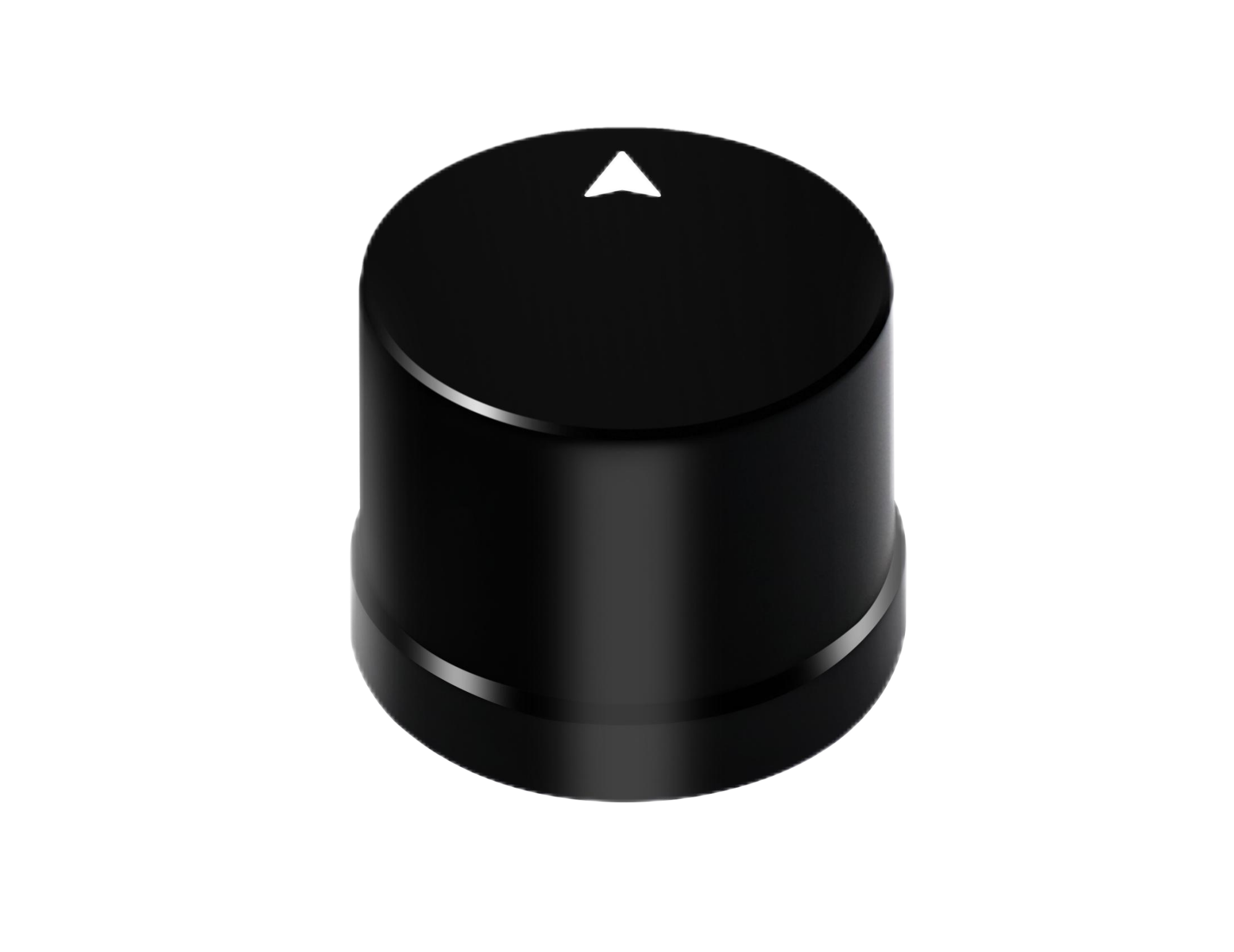 |
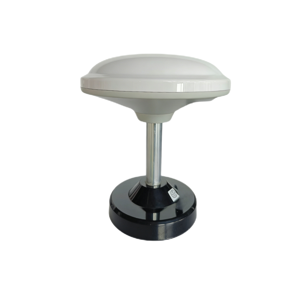 |
| Frequency Band | GPS L1/L5, BeiDou B1/B2A/B2I, GLONASS G1, Galileo E1/E5, QZSS L1/L5, IRNSS L5 | GPS L1/L5, BeiDou B1/B2A/B2I, Galileo E1/E5, QZSS L1/L5, GLONASS G1, IRNSS |
| RTK Position Accuracy | H: 1 cm + 1 ppm, V: 1.5 cm + 1 ppm | H: 1 cm + 1 ppm, V: 1.5 cm + 1 ppm |
| Protocol | NMEA 0183 output and RTCM input at rover side | NMEA 0183 output and RTCM input at rover side; RTCM output at base side |
| Baud Rate | 115200 bps | 115200 bps |
| Interface | TTL level UART interface | TTL level UART interface |
| Timing Synchronization Accuracy | 20 ns | 20 ns |
| Antenna / Signal Reception | L1 and L5 GNSS antenna system with at least 40 dB high gain | Integrated mushroom-shaped multiband GNSS antenna module |
| Dimensions | Φ44 × 37 mm | Φ152 × 67.9 mm |
| Weight | Not specified | <550 g |
| Operating Temperature | -40 ℃ to 85 ℃ | -40 ℃ to 85 ℃ |
| Waterproof / Outdoor Protection | IP67 | Outdoor UV-resistant PC material; windproof and rainproof design described |
| Communication Expansion | Serial integration with support resources such as ROS, Python, and C++ demos | Optional 4G radio module support |
| Best-Fit Agricultural Applications | UAVs, compact agricultural robots, autonomous vehicles, embedded positioning systems | RTK base/rover setups, survey-grade field positioning, larger agricultural machines, correction-enabled deployments |
Helical Antenna RTK Module HM-D20 Product Showcase
The Helical Antenna RTK Module HM-D20 is a compact integrated GNSS module and antenna designed for applications where space, durability, and installation simplicity matter. Its frequency support includes GPS L1/L5, BeiDou B1/B2A/B2I, GLONASS G1, Galileo E1/E5, QZSS L1/L5, and IRNSS L5. It provides RTK position accuracy of H: 1 cm + 1 ppm and V: 1.5 cm + 1 ppm, making it suitable for centimeter-level positioning workflows in UAVs, agricultural robots, unmanned vehicles, compact field platforms, and embedded positioning systems.
The HM-D20 supports NMEA 0183 output and RTCM input at the rover side, with a TTL level UART interface and 115200 bps baud rate. Its timing synchronization accuracy is listed as 20 ns. For signal reception, it includes an L1 and L5 GNSS antenna system with at least 40 dB high gain. Its Φ44 × 37 mm dimensions make it particularly useful where an external antenna would complicate installation, increase cabling risk, or consume valuable mounting space. The IP67 waterproof rating and -40 ℃ to 85 ℃ operating temperature range support outdoor agricultural use where rain, dust, washdown, vibration, and temperature extremes are common.
For agricultural integrators, HM-D20 is especially attractive when the goal is a compact rover mounted on a UAV, weeding robot, autonomous vehicle, field inspection platform, or custom machine controller. The integrated design means there is no separate external antenna installation, which can reduce assembly time and potential field failure points. Product information also indicates support resources such as ROS, Python, and C++ demos, which can help engineering teams parse serial data and integrate positioning into custom software systems.
View Product Details & Pricing ➔
Multiband RTK Survey Module HM-D13 Product Showcase
The Multiband RTK Survey Module HM-D13 is a larger integrated mushroom-style GNSS antenna module suited for survey-style field positioning, base/rover workflows, larger agricultural machines, and correction-enabled deployments. It supports GPS L1/L5, BeiDou B1/B2A/B2I, Galileo E1/E5, QZSS L1/L5, GLONASS G1, and IRNSS. Like HM-D20, it specifies RTK position accuracy of H: 1 cm + 1 ppm and V: 1.5 cm + 1 ppm.
The HM-D13 provides NMEA 0183 output and RTCM input at the rover side, and it also supports RTCM output at the base side. That base-side RTCM output is a key specification for local RTK base station workflows, where the module must provide correction data to tractors, rovers, UAVs, or autonomous agricultural machines. It uses a TTL level UART interface, operates at 115200 bps, and provides 20 ns timing synchronization accuracy. Its dimensions are Φ152 × 67.9 mm, and its weight is listed as less than 550 g.
For field durability, HM-D13 is described with outdoor UV-resistant PC material and a windproof and rainproof design. It also operates across -40 ℃ to 85 ℃. The product details indicate optional 4G radio module support, which may be useful when correction delivery requires cellular or radio communication flexibility. In agriculture, HM-D13 is well suited for local base station systems, survey-grade mapping, larger machine mounting, field reference stations, and RTK infrastructure where base-side correction output is required.
View Product Details & Pricing ➔
RTK Integration Workflow for Tractors, UAVs, and Robots
A successful RTK deployment starts with the agricultural task, not the receiver. Tractor guidance, precision seeding, spraying, UAV crop mapping, robotic weeding, autonomous logistics, and boundary mapping each place different demands on accuracy, update rate, mounting, correction reliability, and system safety. Before choosing hardware, define the operational requirement: how accurate the machine must be, how long it must operate, what happens if corrections are lost, and which controller or software stack will consume the position data.
Step 1 — Define the Agricultural Task
For tractor auto-steering, pass-to-pass repeatability and operator interface integration may be the priority. For seeding, row alignment and repeatable tramlines are critical. For spraying, guidance must support overlap reduction and boundary accuracy. UAV crop mapping may emphasize georeferencing and repeatable flight paths. Robotic weeding and autonomous field logistics require RTK as part of a larger autonomy stack that includes local perception, obstacle detection, and safety control.
In the shop, this is where teams should write down the operating envelope before buying hardware. Define speed, accuracy, route type, correction source, acceptable downtime, operator override behavior, and safety requirements. A compact UAV and a heavy autonomous sprayer may both use RTK, but their integration details are not the same.
Step 2 — Choose Correction Source
Choose between a local base station, network RTK, or a hybrid correction strategy. A local base station can reduce recurring subscription costs and provide farm-controlled coverage. Network RTK may be easier for contractors or users with strong cellular coverage. Correction delivery may use radio, 4G, Wi-Fi, or serial telemetry.
Define fallback behavior before field use. If corrections are lost, the system should alert the operator, slow down, pause automation, or switch to a safe mode depending on task risk. For seeding or robotic weeding, continuing with poor accuracy can create damage that shows up later. For low-risk repositioning, degraded mode may be acceptable for a short period if the controller is designed for it.
Step 3 — Mount the Antenna Correctly
The antenna should have clear sky visibility, rigid mounting, and minimal exposure to multipath. On tractors, cab-roof mounting is often effective. On robots, the antenna should be placed above the chassis and away from metal structures, high-current wiring, motors, radios, and large reflectors. On UAVs, keep the antenna away from electromagnetic interference and make sure the mount does not flex.
Record antenna height, phase center, and offsets from the navigation reference point. This is not busywork. If the controller thinks the antenna is at the machine center but it is actually offset, path following and implement control can be wrong even when the RTK solution itself is accurate.
Step 4 — Configure Serial Communication
Both HM-D20 and HM-D13 use TTL level UART interfaces and 115200 bps baud rate. The controller must be configured to match the module output. NMEA messages should be parsed correctly, and the RTCM injection path must be validated. Wiring, voltage levels, grounding, connectors, and cable strain relief should be checked before field deployment.
Communication errors are a common source of preventable RTK downtime. A loose ground, wrong voltage level, swapped UART line, overloaded message stream, or mismatched baud rate can make the system unreliable. Validate the setup on the bench, then validate it again on the machine under vibration and real operating power conditions.
Step 5 — Validate RTK Fix Before Field Operation
Before production work, confirm satellite count, correction age, RTK fixed status, position stability, and controller interpretation of the GNSS data. A repeatable path test is valuable: drive or fly a known route, return to the same path, and compare observed alignment. This practical field validation is more useful than relying only on specifications.
For additional insight into robotics and positioning trends, read our recap from SLAM at CHINASI 2025. The key idea is simple: specifications matter, but field validation decides whether the system is ready for real work.
Step 6 — Integrate with Autonomy Stack
For autonomous systems, RTK provides global positioning but should be fused with IMU data, odometry, LiDAR, cameras, or other sensors. The mission planner and controller should understand fix status and uncertainty. Safety behavior should be explicit: if RTK degrades from fixed to float, the machine may slow down, pause, request operator confirmation, or rely on local perception for short-term stability.
This is especially important around people, animals, vehicles, irrigation equipment, crop rows, field edges, slopes, and obstacles. RTK is a powerful tool, but autonomy needs layered sensing and conservative fail-safe behavior.
How to Prevent Downtime During RTK Field Operations
Downtime prevention is the difference between an RTK system that looks good on paper and one that earns trust during long field days. Agricultural equipment often operates during narrow weather windows. If an RTK receiver loses corrections during seeding, spraying, or autonomous work, the cost is not just technical inconvenience. It can affect timing, input efficiency, labor planning, machine utilization, and crop performance.
Monitor RTK Fix Quality Continuously
Operators and controllers should monitor RTK fixed status, float status, standalone mode, correction age, satellite count, HDOP or PDOP, baseline length, and signal quality indicators. A machine should not blindly continue high-precision tasks if the position solution degrades. For critical passes, fixed status should be required before work begins.
For lower-risk movement, float may be acceptable only with caution and clearly defined limits. The operator interface should make fix quality obvious. The autonomy controller should also treat fix quality as an operating condition, not just a diagnostic value buried in a log file.
Design for Correction Link Redundancy
Correction link failure is one of the most common causes of RTK downtime. A local base with radio may work well in some fields, while 4G or network RTK may be stronger in others. A robust design may include reconnect behavior, timeout thresholds, backup correction routes, and operator alerts.
HM-D13 optional 4G radio module support can be relevant where correction delivery flexibility is needed. For higher-value operations, a hybrid correction strategy may be worth the extra planning. If one correction path drops out, the system has a better chance of recovering without stopping the whole operation.
Reduce Multipath and Signal Blockage
Mount antennas above the cab or robot chassis where possible. Avoid low mounting near tanks, booms, metal frames, water surfaces, or large reflectors. Consider crop canopy, tree lines, barns, grain silos, irrigation infrastructure, overhead structures, and nearby machinery. Multipath can create measurement errors even when the receiver appears to have enough satellites.
Good antenna placement is one of the lowest-cost ways to improve field reliability. It also reduces the temptation to blame the receiver when the real issue is mechanical mounting or signal reflection. In many cases, moving the antenna a short distance can make a noticeable difference.
Use Rugged Hardware for Outdoor Farming
Rugged hardware reduces unexpected failures. Waterproofing, temperature tolerance, UV resistance, connector sealing, and vibration-resistant mounting all matter. HM-D20 specifies IP67 waterproofing and -40 ℃ to 85 ℃ operating temperature. HM-D13 specifies -40 ℃ to 85 ℃ operating temperature and an outdoor enclosure design described as UV-resistant, windproof, and rainproof.
These environmental details are important for machines exposed to rain, dust, chemical spray, washdown, and long outdoor storage. The receiver is part of the machine. It has to survive the same working conditions as the rest of the equipment.
Prepare Operational Fallbacks
Operational fallback planning should be part of the integration, not an afterthought. If RTK accuracy degrades, the machine may slow down, pause autonomous execution, allow manual override, or log the event for diagnostics. Operators should check the base station, correction link, antenna mount, connectors, and controller configuration before critical field work.
Logging RTK events helps engineering teams identify whether failures are caused by satellite conditions, correction interruptions, wiring, software, or environmental damage. Without logs, teams end up guessing. With logs, they can fix the root cause and keep machines working.
ROI and Use Cases for GPS RTK Precision Agriculture
The return on GPS RTK precision agriculture depends on farm size, crop value, labor availability, input cost, machine type, and how frequently precision operations are performed. The strongest ROI usually appears when the same fields are worked repeatedly and accuracy affects input efficiency, yield consistency, labor productivity, or autonomous machine reliability.
Tractor Auto-Steering and Guidance
RTK auto-steering reduces operator fatigue and improves pass-to-pass consistency. It is valuable in long fields, dusty conditions, low visibility, and night operations. More consistent guidance helps reduce overlap and makes work less dependent on operator endurance. For large operations, this can improve daily productivity and reduce mistakes during long seasonal windows.
There is also a human factor. An operator who is less tired at the end of the day makes better decisions. That matters when machines are large, inputs are expensive, and field windows are short.
Precision Seeding and Strip-Till
RTK supports accurate row placement, repeatable traffic lanes, and better alignment between planting and later operations. In strip-till systems, accurate guidance helps align planted rows with prepared strips. In controlled traffic systems, repeatable lanes reduce compaction in crop zones.
For high-value crops, accurate spacing and repeatable access can improve management throughout the season. The advantage is not only straighter rows. It is a more predictable production system from planting through harvest.
Spraying and Fertilizer Application
Input costs make spraying and fertilizer operations a natural fit for RTK. Accurate guidance reduces overlap and skipped areas, supports targeted application, and improves boundary control. When paired with section control or variable-rate systems, RTK can help reduce waste and improve application consistency.
For farms covering large acreage or contractors billing by job quality, this can be one of the clearest economic benefits. Less overlap means less wasted material. Fewer skips mean fewer problem zones later.
UAV Mapping and Crop Scouting
UAVs benefit from RTK by improving georeferencing, repeatable flight paths, and alignment of imagery across multiple flights. This is useful for crop health monitoring, field mapping, drainage observation, stand assessment, and scouting workflows. Compact modules such as HM-D20 can be attractive when UAV payload space is limited.
Repeatable UAV data is especially useful when comparing field conditions over time. If flight paths and image positions are more consistent, crop changes become easier to interpret.
Agricultural Robots and Autonomous Vehicles
RTK provides a global position reference for robots used in weeding, mowing, orchard work, monitoring, logistics, and field inspection. It helps machines follow planned routes and return to mapped locations. However, robot autonomy still requires perception and safety layers.
Industrial autonomy increasingly combines positioning, perception, and mapping technologies from suppliers across the ecosystem, including companies such as Ouster. The practical direction is clear: RTK gives the machine a reliable global reference, while perception sensors help it understand the local world around it.
GPS RTK Precision Agriculture FAQ
Is GPS RTK accurate enough for tractor guidance, seeding, spraying, and repeatable field passes?
Can farmers build a subscription-free RTK base station instead of paying for expensive correction services?
What happens if satellite signals or RTK corrections fail during field operations?
What is the difference between RTK fixed and RTK float?
Why does multi-band GNSS matter for agricultural RTK?
How should an RTK antenna be mounted on agricultural equipment?
Is RTK enough for fully autonomous farm robots?
What specifications should buyers check before choosing an RTK module for agriculture?
Which module is better for compact farm robots or UAVs: HM-D20 or HM-D13?
Which module is better for a local RTK base station or survey-style field setup?
How does RTK help reduce agricultural operating costs?
What causes RTK downtime in precision agriculture?
Can RTK be integrated into custom farm software or OEM controllers?
📚 References & Further Reading
- Industry Standard: Time of flight measurement concepts and Ouster autonomy perception technologies
- Related Guide: How to choose the best LiDAR scanner, SLAM at CHINASI 2025, and positioning and perception product range






