

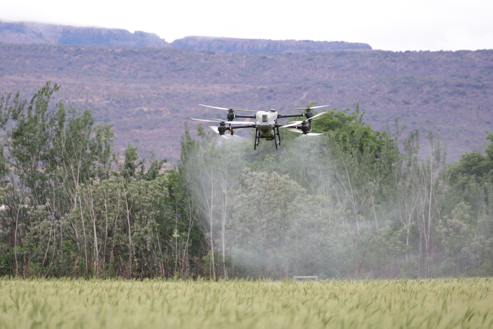
Here’s the deal: drone LiDAR has moved out of the “premium survey payload only” category and into the toolbox for UAV mapping, inspection, robotics, and autonomous navigation. The newer drone lidar news is not just about who has the longest range or the biggest point cloud. Buyers are asking more practical questions now. How heavy is the payload? Will it survive vibration? Does it work outdoors in sunlight? Can the development team actually use the SDK? Does it support UART, UDP, or UVC? How much power does it pull from the aircraft? And most important, can the sensor help the drone make decisions in real time, or is it only useful after the flight is over?
For UAV engineers, drone integrators, procurement teams, and industrial buyers, the wrong LiDAR choice can get expensive fast. I have seen teams buy a sensor that looked great on a spec sheet, then discover it shortened flight time, struggled outdoors, produced data the software team could not use, or did not match the actual mission. This guide walks through the main drone LiDAR technologies, buying specifications, mapping workflows, integration risks, and real-world tradeoffs between photogrammetry, mechanical LiDAR, MEMS LiDAR, and compact dToF solid-state LiDAR modules. It also uses the DTOF Solid State LiDAR HM-LD1 as a real product example, so buyers can see how numbers like 28g weight, 60° × 45° field of view, 10fps depth output, UART/UDP/UVC interfaces, and indoor/outdoor ranging should be interpreted in a UAV buying decision.
Table of Contents
- 👉 Why Drone LiDAR News Matters for UAV Mapping Buyers
- 👉 What Is Drone LiDAR?
- 👉 Drone LiDAR vs Photogrammetry: Which Is Better for Mapping?
- 👉 Main Drone LiDAR Sensor Technologies Buyers Should Know
- 👉 Key Specifications to Compare Before Buying a Drone LiDAR Sensor
- 👉 How Drone LiDAR Mapping Works from Flight to Point Cloud
- 👉 Drone LiDAR for Obstacle Avoidance, Altitude Hold, and Autonomous Navigation
- 👉 DTOF Solid State LiDAR HM-LD1: Real Specs for UAV and Robotics Buyers
- 👉 UAV LiDAR Integration Checklist Before Purchase
- 👉 Industrial Use Cases for Drone LiDAR Sensors
- 👉 Common Mistakes When Choosing a Drone LiDAR Sensor
- 👉 Drone LiDAR FAQ
Why Drone LiDAR News Matters for UAV Mapping Buyers
Drone LiDAR is no longer limited to high-budget surveying teams with specialized aircraft and long post-processing schedules. It is becoming part of a broader UAV perception stack used in infrastructure inspection, terrain awareness, obstacle avoidance, autonomous navigation, robotics development, and smart monitoring systems. Current drone lidar news reflects that shift. Buyers are paying closer attention to compact solid-state designs, embedded computing compatibility, real-time depth output, and sensor fusion with RTK, IMU, camera, and flight-control systems.
Look, this matters because the term “drone LiDAR” gets used too loosely. At a technical level, LiDAR technology measures distance by emitting light and analyzing the returned signal. In UAV applications, that distance data can become a point cloud, depth map, terrain model, obstacle alert, or navigation input. But a survey-grade UAV LiDAR payload and a compact dToF LiDAR module are not the same animal. One may include a scanning sensor, GNSS/INS, calibration workflow, and mapping software. The other may provide short-range depth images and point cloud data for obstacle detection, altitude support, or robotics development.
Sharing a compact dToF sensor we’ve been working with for drone obstacle av…
That distinction affects the whole buying process. A team looking for topographic survey deliverables should not evaluate sensors the same way as a team building a lightweight drone for indoor navigation, warehouse inspection, or bridge stand-off control. Surveying emphasizes georeferenced accuracy, point density, range, calibration, timestamping, and post-processing. Real-time UAV perception emphasizes weight, power, field of view, latency, frame rate, interface type, SDK quality, and platform compatibility.
Another important market trend is the overlap between drone sensing and robotic navigation. In the shop, teams rarely look at LiDAR by itself anymore. They evaluate it beside cameras, RTK positioning, embedded Linux computers, visual navigation modules, and flight controllers. If your roadmap includes autonomous flight or sensor fusion, reviewing a visual RTK navigation module selection guide can help you think past the LiDAR sensor alone and evaluate the full navigation architecture.
The practical lesson is simple: drone LiDAR news is useful only when you translate it into mission requirements. A new sensor announcement may sound impressive, but buyers still need to ask whether the product fits the aircraft, the operating environment, the software stack, the flight speed, and the final deliverable. A long-range mapping payload may be overkill for near-field obstacle sensing. A compact solid-state module may be excellent for perception but not suitable for survey-grade mapping deliverables. The winning choice is the one that fits the job, not the one with the flashiest headline.
What Is Drone LiDAR?
Drone LiDAR is a UAV-mounted sensing system that uses light-based distance measurement to capture three-dimensional information about the surrounding environment. Depending on the technology, the sensor may emit laser pulses, modulated light, or structured optical signals, then calculate distance from time delay, phase shift, or return signal characteristics. In direct time-of-flight systems, often called dToF, the sensor measures how long it takes light to travel to an object and return to the receiver.
On drones, LiDAR can serve several roles. For mapping, it can generate point clouds, digital elevation models, digital surface models, contours, and volumetric measurements. For navigation, it can support obstacle detection, altitude hold, landing assistance, terrain following, and indoor flight. For inspection, it can help detect surfaces, measure stand-off distance to structures, and provide depth information when a camera alone is not enough.
The data produced by LiDAR depends heavily on the sensor design. A survey-grade scanning system may produce dense point clouds that are later processed into mapping deliverables. A compact solid-state dToF module may output a depth map and a lower-resolution point cloud for real-time perception. A short-range obstacle sensor may output distance zones or simplified object information. That is why buyers should avoid treating LiDAR as one single product category.
Several technical concepts are especially important for UAV buyers. Field of view determines how wide and tall the sensor’s detection window is. Resolution defines how many depth samples are produced. Frame rate affects how often new measurements are available. Accuracy describes how close the measurement is to the true distance. Outdoor performance depends on sunlight, target reflectivity, atmospheric conditions, and surface angle. Ambient light deserves extra attention because strong sunlight can reduce the effective range of some optical sensors.
LiDAR also belongs to the broader field of photonics and optical measurement. Buyers who want deeper technical context can explore optical sensing and photonics research to understand why receiver sensitivity, wavelength, signal processing, and detector technology matter in real-world sensing systems. For practical purchasing, though, the main question is more direct: does the sensor produce the right data, at the right speed, in the right environment, within the weight and power limits of the UAV?
A good way to separate sensor classes is to ask what the drone must do with the data. If the mission is creating a georeferenced terrain model, the LiDAR data must be tied to accurate position, attitude, timing, and calibration. If the mission is keeping a drone from hitting a wall, the system needs reliable near-field distance data with low latency and a field of view that covers the hazard zone. If the mission is inspecting a bridge or dam, the sensor may need to help maintain a safe distance while the camera captures visual detail. Same word, very different engineering problem.
Drone LiDAR vs Photogrammetry: Which Is Better for Mapping?
Drone LiDAR and photogrammetry are both important UAV mapping technologies, but they solve different problems. Photogrammetry uses overlapping images to reconstruct 3D geometry and generate orthomosaics, textured models, and surface measurements. It performs well when lighting is good, surfaces have visible texture, and the goal includes visual documentation. It is often more affordable to start with because camera payloads are widely available and processing workflows are mature.
Photogrammetry is especially useful for construction documentation, roof inspection, facade imagery, stockpile visualization, and high-resolution visual records. If a project requires color, texture, and visual interpretation, cameras are hard to beat. However, photogrammetry depends heavily on image quality, overlap, lighting, surface texture, and software reconstruction. Featureless surfaces, reflective objects, low-light environments, dense vegetation, and repetitive patterns can reduce reliability.
LiDAR performs better when direct distance measurement is more important than visual texture. It is useful for vegetation-covered terrain, utility corridors, forest structure, low-light mapping, terrain modeling, and situations where surfaces lack enough visual features for image matching. In many workflows, LiDAR can capture usable 3D structure faster than photogrammetry because it measures distance directly rather than deriving geometry from images.
| Evaluation Factor | Drone LiDAR | Photogrammetry | Buyer Takeaway |
|---|---|---|---|
| Vegetation | Can support terrain modeling under canopy depending on payload class. | Usually captures visible canopy surface. | Choose LiDAR when ground structure under vegetation matters. |
| Low light | Can operate without relying on visible texture. | Needs usable imagery and exposure. | LiDAR is stronger for low-light depth sensing. |
| Real-time navigation | Can provide direct depth or point cloud data. | Requires vision processing to infer depth. | LiDAR is often preferred for obstacle distance measurement. |
| Cost | Usually higher for survey-grade payloads. | Often lower entry cost. | Evaluate total workflow cost, not only hardware price. |
In many industrial programs, LiDAR and photogrammetry are not competitors. They are complementary. A UAV may use LiDAR for elevation, distance, and obstacle awareness while using cameras for inspection imagery, object classification, or texture. For survey and inspection teams building a complete UAV positioning stack, an RTK drone module for UAV positioning can be part of the broader system design alongside LiDAR, cameras, IMU, and mapping software.
Here’s the shop-floor version: use photogrammetry when you need rich visual detail and the scene gives your camera enough texture and light. Use LiDAR when direct distance measurement is the job, especially around vegetation, dark areas, repetitive surfaces, or real-time navigation. Use both when the project needs geometry and visual context. The best UAV mapping programs usually stop arguing about which technology is “better” and start designing the right sensor stack for the mission.
Main Drone LiDAR Sensor Technologies Buyers Should Know
Different drone LiDAR technologies involve different tradeoffs in range, field of view, weight, durability, point density, cost, and integration complexity. Understanding these categories helps buyers avoid comparing incompatible products. A compact dToF module, a mechanical spinning LiDAR, and a full survey payload may all be called LiDAR, but they are built for different operating assumptions.
Mechanical Spinning LiDAR
Mechanical spinning LiDAR uses rotating components to scan the environment. Many systems provide wide coverage, sometimes up to 360° depending on the design. These sensors are widely used in robotics, autonomous vehicles, and mobile mapping. Their advantage is broad spatial coverage and mature point cloud workflows. Their disadvantages can include larger size, higher weight, higher power consumption, and moving parts that may require more careful mechanical integration on UAVs.
For drone work, mechanical spinning LiDAR can be a strong fit when the aircraft can carry the payload and the mission needs broad coverage. Utility corridor mapping, mobile mapping, industrial site modeling, and advanced robotics research may all benefit from this class. The caution is that UAVs are unforgiving. Weight, vibration, cabling, power draw, and weather exposure all matter. A sensor that works fine on a ground robot may not be ideal under a small aircraft unless the mounting and power system are engineered properly.
MEMS LiDAR
MEMS LiDAR uses micro-electromechanical mirrors or beam steering components to direct the sensing beam. It can provide a balance between compact size and scanning capability. MEMS designs are often considered for robotics, autonomous systems, and embedded sensing where a fully mechanical spinning assembly is too large but a directed scan is still useful. Buyers should evaluate field of view, scan pattern, vibration tolerance, and whether the output format fits their flight-control or perception pipeline.
The scan pattern is worth checking carefully. Two MEMS sensors may have similar advertised range but behave differently in the field because they sample the scene differently. For UAV obstacle sensing, the question is not only how far the sensor can see. It is whether the scan covers the hazard area before the aircraft reaches it. That depends on flight speed, frame rate, field of view, and processing latency.
Flash LiDAR and Solid-State dToF LiDAR
Flash LiDAR and compact solid-state dToF modules capture depth over a field of view without a large rotating assembly. Instead of sweeping a single beam mechanically, these systems can generate a depth image across a detection window. This approach is attractive for compact UAVs, robots, smart cameras, and embedded systems because it can reduce mechanical complexity and make integration easier.
Solid-state dToF modules are especially relevant for short-range UAV perception. They can support obstacle detection, altitude hold, terrain awareness, landing assistance, object detection, zone monitoring, and development of autonomous functions. Their value is not always in replacing long-range survey payloads. Instead, their value often comes from being lightweight, low-power, and easier to integrate with embedded controllers or companion computers.
For small drones, that can be a big deal. A few grams saved on the sensor may be the difference between carrying a larger battery, adding a camera, or staying inside a payload limit. Low power also matters because every watt pulled by a sensor becomes less margin for propulsion, onboard compute, radio links, and thermal stability. In compact UAV design, there is no free lunch.
SPAD dToF Technology
SPAD stands for single-photon avalanche diode. In a dToF system, the sensor measures the direct time delay between emitted light and the reflected signal. SPAD detector technology is useful for compact 3D sensing because it can detect very small amounts of returned light. For UAV buyers, the practical benefit is the possibility of small, low-power depth modules that output usable distance data for real-time perception tasks.
The DTOF Solid State LiDAR HM-LD1 is an example of this product class. It is based on SPAD dToF technology and provides real-time depth images and 3D point cloud data. With 28g weight, 1.2W power consumption, and UART/UDP/UVC interfaces, it is designed for compact integration in drones, robots, cameras, security systems, and embedded development platforms.
✅ Mechanical LiDAR can be useful when wide coverage and mature point cloud workflows matter.
✅ MEMS LiDAR can be useful when a compact scanning approach fits the system design.
✅ Solid-state dToF LiDAR can be useful when low weight, low power, and real-time depth data matter most.
⚙️ The right choice depends on the aircraft, mission speed, software stack, field of view, range requirement, and final data product.
Key Specifications to Compare Before Buying a Drone LiDAR Sensor
The most common buying mistake is selecting a LiDAR sensor based on one attractive number. Maximum range alone is not enough. A good UAV buying decision compares range, accuracy, field of view, resolution, frame rate, weight, power, interface, SDK support, operating temperature, and environmental performance together. In procurement meetings, I would rather see a realistic mission profile than a shiny one-line spec.
Range: Indoor, Outdoor, and Real Operating Conditions
Indoor range is often longer than outdoor daytime range because sunlight creates optical noise and reduces the signal-to-noise ratio. Target reflectivity also matters. A bright flat surface may return a stronger signal than a dark angled surface. For drones, outdoor performance is especially important because UAVs often operate in bright sunlight, over mixed materials, and at changing angles. Buyers should ask whether a range specification was measured under real sunlight, ideal laboratory conditions, low-reflectivity targets, or nighttime operation.
For example, the HM-LD1 specifies indoor ranging from 0.5m to 25m and outdoor ranging from 0.2m to 8m. That makes it suitable for short-range perception, obstacle awareness, and distance detection, rather than high-altitude topographic mapping. If a UAV is expected to fly 60m above ground and produce survey deliverables, this is not the right class of sensor. If the UAV needs near-field distance awareness around structures, landing zones, or indoor obstacles, the conversation is different.
Accuracy and Repeatability
Accuracy describes how close a measured distance is to the true distance. Repeatability describes how consistently the sensor produces similar measurements under similar conditions. The HM-LD1 has a ranging accuracy of ±3cm, which can be meaningful for near-field UAV perception, altitude support, object detection, and robotics applications. However, operational accuracy also depends on mounting rigidity, vibration, calibration, target properties, temperature, and sensor fusion.
Look closely at how accuracy is specified. Is it measured at one distance or across the full range? Is the target bright and flat, or dark and angled? Is the sensor moving, vibrating, or exposed to sunlight? In real UAV work, these details matter. A sensor mounted on a test bench and a sensor flying under a vibrating quadrotor are not operating in the same conditions.
Field of View
Field of view defines the sensor’s detection window. A wider field of view can improve obstacle awareness because the UAV sees more of the environment at once. A narrower field may be useful when focused range is more important than wide coverage. The HM-LD1 provides a 60° horizontal × 45° vertical field of view, which is practical for forward-looking, downward-looking, or angled short-range UAV perception.
For obstacle avoidance, field of view must be matched to aircraft behavior. A fast drone needs enough forward coverage to react before impact. A drone inspecting a wall may need a sensor aimed slightly off-axis to maintain stand-off distance. A landing-assist system may need downward coverage that avoids the landing gear and still sees the ground properly. The sensor is only useful if it is pointed at the right problem.
Resolution and Point Cloud Density
Resolution defines how many depth samples are produced in each frame. A 40 × 30 resolution depth output is not the same as a dense survey-grade mapping payload, but it can be useful for object detection, zone monitoring, altitude support, embedded development, and obstacle awareness. Buyers should match resolution to mission requirements. If the drone needs centimeter-level survey deliverables across a wide area, it needs a different payload class. If the drone needs a lightweight depth window for near-field sensing, compact resolution may be sufficient.
Do not confuse “point cloud output” with “survey-grade point cloud output.” A compact depth sensor may provide a usable 3D representation for perception, but that does not mean it will generate a georeferenced, dense, calibrated mapping product. In engineering reviews, it helps to define whether the point cloud is for navigation logic, operator awareness, testing, or professional deliverables.
Frame Rate and Latency
Frame rate determines how often new data arrives. HM-LD1 provides 10fps. For slow or moderate UAV perception, this may be suitable depending on obstacle distance, flight speed, control-loop timing, and processing latency. However, frame rate alone is not the full story. Data transport, SDK processing, companion computer load, and control logic all affect how quickly the UAV can respond.
Here’s the practical check: calculate how far the drone travels between sensor updates, then add processing delay and stopping distance. A sensor that looks fine on paper may be too slow for a fast aircraft in a tight environment. On the other hand, for slow inspection, landing support, or zone monitoring, 10fps may be entirely workable if the rest of the system is designed sensibly.
Weight and Power Consumption
Small UAVs are extremely sensitive to weight and power. A heavy payload can reduce flight endurance, affect center of gravity, require a larger aircraft, or limit other sensors. Power consumption affects battery life and thermal design. With 28g weight and 1.2W power consumption, HM-LD1 is relevant for compact drones, mobile robots, embedded cameras, and systems where a larger scanning payload would be impractical.
In the shop, payload creep is real. First comes the LiDAR, then the camera, then the RTK module, then the companion computer, then a larger battery, then a stronger frame. Before long, the aircraft is heavier, more expensive, and harder to certify or operate. Starting with a realistic payload budget keeps the system from growing out of control.
Interface and SDK Support
Interfaces determine how easily the LiDAR can be connected to the rest of the system. UART is useful for embedded controllers. UDP supports network data streaming. UVC can simplify camera-like depth data workflows. HM-LD1 supports UART, UDP, and UVC, and MRP offers SDKs for x86 Windows, x86 Linux, and ARM Linux. That matters for teams working with PCs, Raspberry Pi, Jetson-style embedded computers, Linux robotics systems, and prototyping platforms. For broader robotics ecosystem planning, the RoboBaton robotics platform is also relevant when evaluating how LiDAR data can fit into development and deployment workflows.
⚙️ Before purchase, confirm the data format, timestamp behavior, operating system support, sample code, SDK maturity, and whether the sensor outputs depth maps, point clouds, raw frames, or processed obstacle information.
✅ A sensor with clear documentation can save weeks of integration time.
✅ A sensor with the right interface can reduce custom hardware work.
✅ A sensor with realistic outdoor specs can prevent painful field-test surprises.
How Drone LiDAR Mapping Works from Flight to Point Cloud
A drone LiDAR workflow begins before takeoff. Mission planning defines flight altitude, speed, coverage area, route, overlap strategy, GNSS availability, obstacle risk, and safety constraints. For survey mapping, the flight plan must support the required point density and accuracy. For perception testing, the plan should include representative obstacles, surfaces, lighting conditions, and approach speeds.
Sensor mounting and calibration are critical. The LiDAR must be rigidly mounted so vibration and movement do not corrupt the data. The field of view must be clear of landing gear, propellers, cables, and brackets. The payload’s center of gravity should not destabilize the aircraft. Power cables should be secure, and data cables should be protected against strain. For survey-grade mapping, boresight calibration and timestamp synchronization with GNSS/INS data are essential. For compact perception modules, alignment, mounting angle, and latency characterization are still important.
During data capture, the UAV may record LiDAR point clouds, depth maps, IMU data, GNSS or RTK information, camera imagery, and flight controller logs. The exact data package depends on the mission. A mapping drone may collect georeferenced LiDAR returns for post-processing. A navigation drone may stream depth data to a companion computer for real-time obstacle decisions. Hybrid systems may use cameras and LiDAR together.
After capture, survey workflows involve registration, filtering, ground classification, noise removal, and generation of deliverables such as point clouds, digital elevation models, digital surface models, contours, volumetric measurements, inspection reports, and asset models. Quality assurance checks may compare control points, overlap consistency, and expected accuracy.
Compact dToF modules such as HM-LD1 should be understood in the correct workflow context. They are not direct replacements for long-range survey-grade payloads with GNSS/INS integration and mapping software. Their strongest value is in embedded depth sensing, short-range mapping, obstacle awareness, smart inspection, robotics development, and UAV perception features where low weight and simple integration are major advantages.
⚙️ A practical UAV LiDAR workflow usually moves through mission planning, mechanical mounting, electrical validation, data capture, synchronization, processing, and field verification.
⚙️ For mapping, the workflow must prove accuracy and repeatability.
⚙️ For navigation, the workflow must prove response time and reliability.
⚙️ For inspection, the workflow must prove safe stand-off distance and usable sensor coverage.
One thing buyers often underestimate is the difference between a successful bench demo and a reliable field workflow. A LiDAR may stream clean data on a desk, but the aircraft adds vibration, changing sunlight, motion blur in companion cameras, radio interference, power fluctuations, and temperature swings. Field testing should include the real surfaces, speeds, lighting, and mounting angles expected in operation. Otherwise, the first true system test happens after purchase, which is the wrong time to discover limitations.
Drone LiDAR for Obstacle Avoidance, Altitude Hold, and Autonomous Navigation
Mapping LiDAR and navigation LiDAR are not the same thing. Mapping LiDAR prioritizes data quality, georeferencing, calibration, range, and post-processing deliverables. Navigation LiDAR prioritizes real-time usability, field of view, latency, size, weight, power, and compatibility with onboard computing. A buyer who only needs near-field obstacle awareness should not automatically purchase a heavy survey payload. A buyer who needs certified terrain deliverables should not assume a compact obstacle sensor is enough.
Compact dToF LiDAR can support several UAV perception functions. A downward-facing sensor can assist altitude hold, terrain following, and landing zone evaluation. A forward-facing sensor can detect obstacles, walls, structures, or intrusions within its field of view. An angled sensor can help inspect bridges, dams, expressways, and industrial assets where keeping a safe distance from the surface is important. In indoor or GPS-denied environments, depth sensing can support navigation and localization when combined with other sensors.
Depth maps and point clouds are useful in different ways. A depth map can be easier for embedded vision pipelines because it resembles an image where each pixel represents distance. A point cloud is useful for 3D obstacle localization and spatial reasoning. Interfaces such as UART, UDP, and UVC give engineering teams multiple integration paths, from embedded controllers to networked perception systems and camera-style depth workflows.
For autonomous drones, LiDAR should usually be part of a sensor fusion strategy rather than the only input. RTK and GNSS support global positioning, IMU supports motion estimation, cameras provide visual context, and LiDAR provides direct distance measurement. When designing this type of system, a visual RTK navigation module may be relevant alongside the LiDAR sensor because robust autonomy depends on multiple complementary data sources.
Look at obstacle avoidance like a braking problem, not just a sensing problem. The UAV must detect the obstacle, process the data, decide what to do, and physically change motion before impact. That means the useful detection range depends on flight speed, system latency, controller behavior, payload inertia, and available escape paths. A compact LiDAR module can be excellent for slow inspection and controlled navigation, but the same sensor may not be enough for a fast drone flying in cluttered environments.
✅ Downward LiDAR can help with altitude hold, landing support, and terrain following.
✅ Forward LiDAR can help with wall, structure, and obstacle detection.
✅ Angled LiDAR can help maintain inspection distance from bridges, dams, and industrial assets.
✅ Depth maps can be useful for embedded vision pipelines, while point clouds can support spatial reasoning.
DTOF Solid State LiDAR HM-LD1: Real Specs for UAV and Robotics Buyers
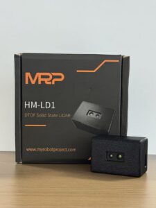
The DTOF Solid State LiDAR HM-LD1 is a compact SPAD dToF solid-state LiDAR module designed for real-time depth imaging and 3D point cloud output. It is built for accurate environmental perception in UAVs, autonomous mobile robots, embedded vision systems, security monitoring, cameras, and development platforms. For drone applications, its strongest fit is short-range perception: altitude hold, terrain following, obstacle detection, landing assistance, outdoor daytime distance sensing up to 8m, and indoor or nighttime ranging up to 25m.
Its compact size, low weight, and low power draw are important because UAVs have strict payload limits. HM-LD1 weighs 28g and consumes 1.2W, making it easier to integrate into small drones or robots where a heavier mechanical LiDAR payload would reduce endurance or complicate mounting. It supports UART, UDP, and UVC interfaces, which gives developers flexibility when connecting to embedded controllers, PCs, Raspberry Pi-class devices, flight-control systems, and Linux-based robotics platforms. MRP also offers SDKs for x86 Windows, x86 Linux, and ARM Linux.
View Product Details & Pricing ➔
| Specification | DTOF Solid State LiDAR HM-LD1 | Buyer Interpretation for UAV Mapping and Perception |
|---|---|---|
| Technology | SPAD dToF solid-state LiDAR | Suitable for compact 3D depth sensing without a large mechanical scanning assembly. |
| Dimensions | 43.5mm × 30mm × 26.5mm | Small enough for embedded integration in UAVs, robots, cameras, and inspection devices. |
| Ranging Capability | Indoor: 0.5–25m; Outdoor: 0.2–8m | Best suited for short-range perception, obstacle awareness, terrain following, and object distance measurement. |
| Ranging Accuracy | ±3cm | Useful for near-field depth sensing, altitude support, and navigation assistance when properly mounted and calibrated. |
| Field of View | 60° horizontal × 45° vertical | Provides a practical detection window for forward, downward, or angled UAV perception. |
| Weight | 28g | Low payload impact for small drones where every gram affects endurance and maneuverability. |
| Resolution | 40 × 30 | Provides depth image and point cloud data for object detection, zone monitoring, and embedded development. |
| Frame Rate | 10fps | Appropriate for many short-range perception and monitoring tasks, depending on UAV speed and control-loop design. |
| Interfaces | UART / UDP / UVC | Supports embedded controllers, network streaming, and camera-style depth data integration. |
| Operating Temperature | -20℃ to 60℃ | Supports outdoor and industrial environments within specified thermal limits. |
| Power Consumption | 1.2W | Low power draw helps protect UAV battery life and embedded system thermal budgets. |
| Development Support | SDKs for x86 Windows, x86 Linux, and ARM Linux | Helps teams integrate with PCs, Raspberry Pi, Jetson-style embedded platforms, and Linux-based robotics systems. |
Best-fit applications for HM-LD1 include UAV altitude hold, terrain following, obstacle avoidance, short-range distance detection, smart inspection, robotic navigation, SLAM development, autofocus, user presence detection, object recognition, volume measurement, and zone intrusion monitoring. Its outdoor daytime ranging capability is useful for objects that are difficult for people to approach, including bridges, expressways, and dams, when the mission fits the sensor’s range and resolution class.
Buyers should also understand when to use a different payload. For large-area, high-altitude, survey-grade mapping, a complete UAV LiDAR system with GNSS/INS integration, calibrated scanning, higher point density, and mapping software may be required. HM-LD1 is best positioned for compact real-time perception, embedded development, robotic sensing, and short-range UAV depth awareness.
In plain terms, HM-LD1 is not trying to be a heavy survey payload. Its value is in being small, low-power, interface-friendly, and useful for real-time depth sensing. That makes it interesting for UAV teams that care about near-field perception, payload limits, and embedded development speed. If your aircraft needs a lightweight sensor to help understand nearby space, it deserves a close look. If your job requires certified survey deliverables across large terrain, you should evaluate a full mapping payload instead.
UAV LiDAR Integration Checklist Before Purchase
A UAV LiDAR purchase is not just a sensor purchase. It is a system integration decision. Before ordering hardware, teams should review mechanical, electrical, data, software, and support requirements. The cheapest sensor is not cheap if it burns engineering time, forces a redesign, or fails under field conditions.
Mechanical Integration
Confirm that the LiDAR weight fits the payload budget and does not reduce flight endurance below mission requirements. Check whether the mounting bracket can hold the sensor rigidly and whether vibration isolation is needed. Verify that the sensor angle provides the correct field-of-view coverage and that nothing blocks the sensing window. Consider weather exposure, dust, cable strain relief, center of gravity, and maintenance access.
⚙️ Check payload weight, center of gravity, bracket stiffness, vibration exposure, sensor angle, field-of-view blockage, cable routing, and service access before flight testing.
Electrical Integration
Review voltage requirements, power consumption, startup current, connector type, grounding, EMI risk, and thermal dissipation. A low-power sensor such as a 1.2W module can simplify integration, but the full system still includes flight controller, companion computer, communications equipment, camera payloads, RTK modules, and batteries. Power instability can cause data interruptions, so the sensor should be powered through a reliable supply.
⚙️ Verify the power rail under real motor load, not just on the bench. UAV electrical noise can show up when motors, radios, cameras, and computers are all running together.
Data Integration
Check whether the sensor supports the interface your system needs: UART, UDP, UVC, USB, Ethernet, or another protocol. Confirm whether it provides depth maps, point clouds, raw measurements, or processed obstacle information. Review data format, timestamping, SDK documentation, sample code, operating system compatibility, and whether ROS or OpenCV examples are available. A sensor with strong documentation can reduce engineering time more than a cheaper sensor with unclear output formats.
✅ UART can be helpful for embedded controllers.
✅ UDP can be helpful for companion computers and network streaming.
✅ UVC can be helpful when the sensor behaves like a camera-style depth device.
✅ SDK support can make the difference between a fast prototype and a stalled integration project.
Flight Control and Software Integration
Decide whether LiDAR data is needed for real-time control or post-processing. If it is used for obstacle avoidance, determine whether the flight controller can accept obstacle inputs directly or whether a companion computer is required. Validate that the perception pipeline can run at the required frame rate and latency. For UAV positioning modules and companion sensors, a helical antenna RTK drone module may be part of the broader integration plan.
Software integration is where many good hardware projects bog down. The team needs to know how timestamps are handled, how data is buffered, what happens when frames drop, how the sensor recovers after power interruption, and whether the control system fails safely when data quality drops. For autonomous drones, the sensor is only one link in the chain.
Procurement and Support
Evaluate supplier technical support, SDK updates, documentation quality, sample code, lead time, customization options, warranty, and long-term availability. Drone programs often fail because integration takes longer than expected, not because the sensor cannot measure distance. Reliable support can be a major factor in reducing development risk.
Here’s the deal for procurement teams: do not buy LiDAR like a commodity part unless the integration is already proven. Ask for documentation, interface details, development support, expected lead times, and application notes. A slightly more expensive sensor with better support may be the lower-cost decision once engineering labor is included.
Industrial Use Cases for Drone LiDAR Sensors
Drone LiDAR is used across several industrial categories, but the correct sensor class depends on the use case. Surveying, inspection, obstacle avoidance, and robotics development may all use LiDAR, yet they require different performance profiles. The mission should drive the sensor choice, not the other way around.
Surveying and Terrain Modeling
Survey-grade drone LiDAR is valuable for digital elevation models, digital surface models, construction earthwork, mine volume measurement, road and railway corridor modeling, and vegetation-covered terrain. These applications often require accurate georeferencing, dense point clouds, calibrated workflows, and robust post-processing. In this category, LiDAR can outperform photogrammetry when ground elevation under vegetation is needed.
✅ Strong use cases include forested terrain, utility corridors, slopes, mines, road projects, and sites where reliable elevation data matters more than visual texture.
Infrastructure Inspection
LiDAR can help drones inspect bridges, dams, expressways, powerline corridors, industrial plants, and hard-to-access assets. Distance measurement is important because the UAV may need to maintain a safe offset from structures while collecting visual or depth data. Compact modules can be useful for short-range distance awareness, while survey-grade payloads may be used when the inspection requires precise 3D modeling.
For inspection work, safety and repeatability matter. A drone flying near a bridge girder or dam face needs to know how close it is to the surface. Cameras provide visual detail, but LiDAR can help maintain distance. That combination can reduce operator workload and improve consistency, especially when inspections are repeated over time.
Agriculture and Forestry
In agriculture and forestry, LiDAR can support canopy structure measurement, tree height estimation, biomass analysis, terrain modeling, and irrigation planning. The ability to measure depth directly makes LiDAR useful where visual imagery alone cannot describe vertical structure. Payload selection depends on area size, flight altitude, required density, and whether the mission is research, operational monitoring, or commercial survey delivery.
✅ Forestry teams may care about canopy structure and ground elevation.
✅ Agriculture teams may care about plant height, field structure, drainage, and terrain conditions.
✅ Research teams may need repeatable measurements over time rather than one-off visual maps.
Autonomous UAV Navigation
For autonomous drones, LiDAR supports obstacle avoidance, indoor navigation, GPS-denied flight, landing assistance, and terrain following. Compact solid-state modules are especially relevant when the aircraft is small and cannot carry a heavy scanning payload. In these systems, LiDAR data is often fused with IMU, camera, RTK, and flight controller information.
Autonomy is rarely solved by one sensor. LiDAR helps answer “how far away is that surface?” Cameras help answer “what is that object?” IMU data helps estimate motion. RTK or GNSS helps with global positioning when available. A good system combines these inputs and handles cases where one sensor becomes unreliable.
Robotics, Security, and Smart Devices
Beyond drones, compact LiDAR modules support AMR navigation, SLAM, user presence detection, zone intrusion monitoring, object recognition, volume measurement, and camera autofocus. This overlap between UAV and robotics perception makes development platforms important. Teams building embedded perception systems may benefit from evaluating the RoboBaton robotics development platform when planning sensor integration and application development.
That crossover is useful because a sensor proven in robotics may also be attractive for UAV prototyping, and a UAV perception workflow may carry over into ground robots, smart cameras, or security devices. The key is to validate the operating environment. A factory robot and an outdoor drone see very different lighting, vibration, motion, and power conditions.
Common Mistakes When Choosing a Drone LiDAR Sensor
Mistake 1: Buying by Maximum Range Only
Maximum range is useful, but it is incomplete without accuracy, field of view, target reflectivity, outdoor test conditions, sunlight tolerance, and data quality. A sensor with a long indoor range may have a much shorter outdoor daytime range. UAV buyers should evaluate the range that applies to their actual mission environment.
✅ Ask for indoor range, outdoor range, minimum range, target conditions, sunlight conditions, and measurement assumptions.
Mistake 2: Ignoring Payload Weight and Power
A technically impressive sensor can still be the wrong choice if it reduces flight time, shifts center of gravity, overheats, or requires a larger aircraft. Weight and power are not minor details for drones. They directly affect endurance, safety, and system cost.
✅ Check weight, power, thermal behavior, battery impact, mounting location, and aircraft balance before committing to a payload.
Mistake 3: Confusing Mapping Payloads with Obstacle Avoidance Sensors
Survey mapping and real-time obstacle avoidance are different workflows. Mapping payloads are designed for georeferenced deliverables and post-processing. Obstacle sensors are designed for near-field perception and real-time response. A buyer should define the primary mission before comparing products.
✅ If the deliverable is a certified map, evaluate mapping payloads. If the goal is near-field awareness, evaluate perception sensors. If both are required, plan for a multi-sensor system.
Mistake 4: Underestimating Integration Complexity
Interfaces, SDKs, data formats, calibration, operating system support, and timestamping can determine whether a project moves quickly or stalls. A lower-cost sensor may become more expensive if developers spend months reverse-engineering data formats or building missing drivers.
✅ Ask for SDKs, sample applications, data format documentation, operating system compatibility, and real integration examples.
Mistake 5: Forgetting Total System Cost
The total cost of a drone LiDAR system may include the LiDAR module, UAV platform, GNSS/RTK, IMU, companion computer, mounting hardware, calibration tools, processing software, batteries, training, support, and spare parts. Buyers should compare complete system cost, not only sensor price.
✅ Build a complete bill of materials and include labor, software, test time, training, and spare parts.
Mistake 6: Not Matching Sensor Specs to Flight Speed
Frame rate, field of view, processing latency, obstacle distance, and stopping distance must be evaluated together. A 10fps sensor may be suitable for slow or moderate short-range perception, but it must be validated against UAV speed, braking capability, and safety requirements.
✅ Test the sensor at real flight speeds with real obstacles, real lighting, and the actual control pipeline.
Look, most LiDAR buying mistakes come from skipping the mission definition. Before comparing brands or models, write down the aircraft class, flight speed, altitude, operating environment, required data output, software platform, payload budget, and final deliverable. That one exercise prevents a lot of expensive confusion.
Drone LiDAR FAQ
Is drone LiDAR actually worth it for surveying now?
What should beginners consider before buying a LiDAR drone on a budget?
How do I choose a LiDAR sensor for drone obstacle avoidance or autonomous navigation?
What is the difference between dToF LiDAR and traditional scanning LiDAR?
Can a compact LiDAR module replace a full UAV mapping payload?
How important are weight and power consumption for drone LiDAR?
What LiDAR range is enough for drone applications?
Why do LiDAR sensors often have different indoor and outdoor ranges?
What interfaces should I look for in a UAV LiDAR sensor?
Is LiDAR better than cameras for autonomous drones?
📚 References & Further Reading
- Industry Standard: LiDAR technology overview and SPIE optical sensing and photonics resources
- Related Guide: How to choose a visual RTK navigation module, HM-D20 helical antenna RTK drone module, and RoboBaton robotics platform






