

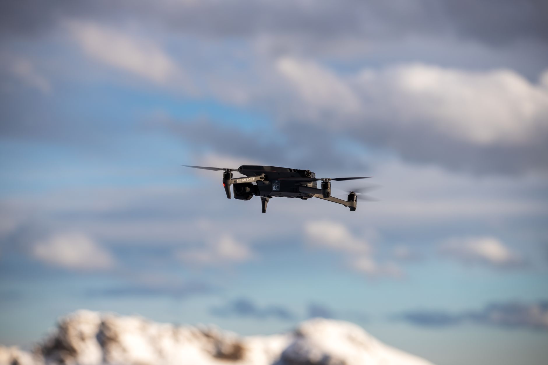
Drone Avoid Obstacles: How to Improve Collision Avoidance with dToF LiDAR and Smart Depth Sensing
Here’s the deal: a drone usually does not crash because it forgot how to fly. It crashes because it did not understand what was around it quickly enough. In inspection, mapping, warehouse automation, construction monitoring, agriculture, public safety, and indoor navigation, obstacles are rarely clean, flat, bright, or easy to read. They can be dark, shiny, transparent, moving, narrow, partly hidden, or sitting outside a camera’s reliable contrast range. For industrial UAVs, obstacle avoidance is not a nice-to-have feature. It affects mission safety, asset protection, pilot workload, insurance risk, uptime, and whether autonomous operation can be repeated without drama.
This guide explains how drone avoid obstacles systems work from the sensor layer to the flight-control layer, with a practical focus on dToF LiDAR and smart depth sensing. You will see what makes drone obstacle avoidance reliable, where common systems break down, how LiDAR compares with cameras, ultrasonic sensors, and radar, and how a compact solid-state LiDAR module such as the DTOF Solid state LiDAR HM-LD1 can support UAV altitude hold, terrain following, obstacle detection, autonomous navigation, smart inspection, and robotic vision development.
Table of Contents
- 👉 What Does It Mean When a Drone Avoids Obstacles?
- 👉 Why Obstacle Avoidance Matters for Industrial Drones
- 👉 How Drone Obstacle Avoidance Works
- 👉 Main Sensor Technologies for Drone Collision Avoidance
- 👉 Why dToF LiDAR Improves Drone Obstacle Detection
- 👉 How to Design a Better Drone Avoidance System
- 👉 Why Drone Obstacle Avoidance Fails
- 👉 Recommended dToF LiDAR Module: DTOF Solid State LiDAR HM-LD1
- 👉 Industrial Applications for Obstacle-Aware Drones
- 👉 Integration Checklist for UAV Developers
- 👉 FAQ: Drone Obstacle Avoidance
- 👉 Conclusion
What Does It Mean When a Drone Avoids Obstacles?
When people ask how a drone avoid obstacles system works, they usually mean several functions working together. First, the drone has to detect that an object exists. Then it has to estimate distance, direction, size, and risk level. After that, it must decide what to do: slow down, hover, climb, descend, reroute, warn the pilot, or trigger a safety mode. In a simple consumer drone, that may be handled by a limited forward or downward sensing system. In an industrial drone, obstacle avoidance is normally part of a larger perception and navigation architecture.
Look, this is where many projects get into trouble. Detecting an object is not the same thing as avoiding it. A drone can “see” a wall and still hit it if the aircraft is moving too fast, the sensor field of view is too narrow, or the flight controller receives the data too late. The useful question is not just, “Can the drone detect an obstacle?” The better question is, “Can the drone detect the obstacle early enough, trust the data enough, and respond in a controlled way before contact happens?”
We’ve recently been testing the HM-LD1 compact dToF LiDAR in a variety of r…
Obstacle Detection vs Obstacle Avoidance vs Collision Avoidance
Obstacle detection means the drone identifies that an object is present in its environment. Depth sensing means the drone estimates how far away that object is. Obstacle avoidance means the drone changes its path or behavior to prevent contact. Collision avoidance is a broader safety function that may include emergency braking, speed limiting, route planning, geofencing, operator alerts, and fail-safe behavior. These terms are related, but they are not identical. A drone may detect a wall but still fail to avoid it if the flight controller does not receive the data quickly enough or if the aircraft is moving too fast to stop.
Industrial drones need tougher perception because they often operate near bridges, expressways, dams, tanks, racks, cranes, tunnels, walls, cables, glass, trees, and machinery. In the shop, these are the exact kinds of environments where a neat lab demo stops being enough. Real-world surfaces are uneven, dirty, reflective, angled, or partly hidden. A safe UAV obstacle detection system must do more than identify large objects in ideal daylight. It must produce useful distance data under real mission conditions and deliver that data to the navigation stack in time for a safe response.
Why “Drone Avoid Obstacles” Is a Full-System Problem
A drone cannot avoid obstacles with hardware alone. It needs sensors to perceive the environment, algorithms to interpret the data, flight-control logic to decide the response, and integration that does not compromise weight, power, latency, or reliability. A sensor may provide accurate range measurements, but if the mounting angle is wrong, the timestamping is inconsistent, or the coordinate transform is incorrect, the drone may react in the wrong direction. That is why experienced UAV teams treat obstacle avoidance as a system design problem, not a simple shopping-list item.
For teams comparing LiDAR-based perception with automotive-grade sensing concepts, see our related guide on LiDAR car technology explained. Many of the same sensing principles apply, but UAVs add extra headaches: payload weight, vibration, flight endurance, propeller interference, rapid attitude changes, and limited onboard power.
Why Obstacle Avoidance Matters for Industrial Drones
Obstacle avoidance matters because industrial drones fly close to real assets, real people, and real deadlines. A drone used for bridge inspection, warehouse monitoring, tunnel mapping, construction progress tracking, agriculture, or emergency response cannot always maintain a large safety buffer. It may need to fly near a wall, under a structure, along a rack aisle, above uneven terrain, or around active equipment. In those jobs, the value of drone collision avoidance is measured not only in crash prevention but also in operator confidence and repeatable mission quality.
Reducing Crash Risk and Repair Costs
A crash can damage propellers, motors, arms, landing gear, batteries, gimbals, cameras, thermal payloads, LiDAR scanners, communication modules, or custom inspection equipment. For B2B users, the cost is not limited to replacement parts. It includes mission delay, rescheduling, labor cost, customer dissatisfaction, lost data, possible safety incidents, and reduced trust in automation. A reliable drone obstacle avoidance system gives the aircraft more awareness of its surroundings before a collision becomes unavoidable.
Supporting Autonomous and Semi-Autonomous Flight
Autonomous drone navigation depends on environmental perception. A route plan is only useful if the drone can react to objects that were not included in the original map. Obstacle avoidance supports repeatable inspection routes, indoor navigation, low-altitude terrain following, warehouse and factory UAV operation, and safer semi-autonomous flight. It also lowers pilot workload. Instead of constantly correcting for every nearby object, the operator can focus on mission goals while the perception system adds a protective layer around the aircraft.
Improving Safety Around People, Assets, and Infrastructure
Industrial UAVs often operate near high-value infrastructure and human workers. Power-line inspection, bridge inspection, construction monitoring, tunnel inspection, warehouse patrols, and emergency response all require careful control around obstacles. Better obstacle sensing can help the drone maintain safer standoff distances, slow down near structures, and avoid unexpected contact. If you are evaluating a sensor configuration for a UAV or robotics project, visit the Help Center for integration support and technical resources.
How Drone Obstacle Avoidance Works
A drone obstacle avoidance system can be understood as a loop: sense, estimate, assess, respond, and verify. The drone collects environmental data, converts it into useful spatial information, determines whether the current trajectory is safe, commands a flight response, and keeps updating that decision as new data arrives. The quality of this loop determines whether the drone merely notices obstacles or actually avoids them in time.
Step 1 — Environmental Sensing
The drone uses cameras, LiDAR, ultrasonic sensors, radar, infrared sensors, or depth modules to collect environmental data. For a drone to avoid obstacles, it must continuously estimate where objects are relative to the drone body frame. Useful sensor outputs may include distance readings, depth maps, point clouds, object boundaries, occupancy grids, optical flow, and semantic object labels. Each output type has a different role. A single distance value may be enough for landing assistance, while a depth map or point cloud is more useful for understanding a three-dimensional scene.
Step 2 — Depth Estimation and Spatial Mapping
Distance alone is not enough. The drone needs a spatial representation of the environment. A depth map helps show distance across a field of view, while a point cloud provides three-dimensional data that can support mapping, navigation, and obstacle boundary estimation. Field of view is especially important. A narrow sensor may detect a wall directly ahead but miss a diagonal branch, a side obstacle during turning, or a structure below the drone during descent. Engineers must match sensor coverage to the drone’s actual flight behavior, not just the cleanest use case on paper.
Step 3 — Risk Assessment
After sensing the environment, the drone evaluates distance to the obstacle, closing speed, relative direction, available braking distance, flight mode, payload weight, wind drift, and sensor confidence. A slow indoor drone may need a different safety threshold than a fast outdoor inspection drone. For example, a drone moving slowly through a warehouse aisle may prioritize wide local awareness, while a drone flying outdoors toward a bridge structure may require longer detection range and conservative braking margins.
Step 4 — Flight Response
Common responses include braking and hovering, slowing down, climbing, descending, following terrain, rerouting around the object, returning to home, triggering a pilot warning, or entering an emergency stop mode. The correct response depends on mission context. A drone inspecting a wall may not be allowed to climb suddenly if overhead obstacles exist. A terrain-following drone may need to rise smoothly rather than stop abruptly. Safe behavior must be defined in software before the drone enters the mission environment.
Step 5 — Sensor Fusion and Control Feedback
Robust systems combine multiple data sources, including IMU, GNSS, visual odometry, LiDAR, barometer, and flight controller state. The drone should not only see an obstacle; it must also understand its own motion, attitude, speed, and stability. Sensor fusion helps the system decide whether an object is stationary, whether the drone is drifting toward it, and whether the current avoidance command is working. This feedback loop is essential for reliable autonomous drone navigation.
Main Sensor Technologies for Drone Collision Avoidance
No single sensor is perfect for every mission. The best drone collision avoidance architecture depends on environment, speed, budget, payload limits, power availability, compute capacity, and safety requirements. Cameras, ultrasonic sensors, radar, and LiDAR all have useful roles, but they also have limitations that must be understood during system design.
Vision Cameras
Vision cameras are widely used for drone obstacle avoidance because they provide rich visual information. Monocular cameras can support visual navigation and object recognition. Stereo cameras can estimate depth by comparing two viewpoints. RGB-D cameras can combine image and depth information. Camera systems are often affordable and useful for recognizing objects such as people, signs, structures, and terrain features. They can also support visual odometry and mapping.
The main limitation is environmental sensitivity. Camera-based systems can struggle in darkness, glare, fog, shadows, low-texture scenes, high-contrast transitions, repetitive patterns, and reflective or transparent surfaces. Depth estimation may require significant computing power, especially when the drone needs real-time decisions. Cameras remain highly useful, but for industrial obstacle avoidance they are often stronger when paired with active depth sensing.
Ultrasonic Sensors
Ultrasonic sensors measure distance using sound waves and are common in short-range altitude hold, landing assistance, or simple proximity detection. They are low cost, easy to use, and effective in some near-field applications. A downward ultrasonic sensor can help a small drone estimate height above a flat surface during landing or low-speed flight.
However, ultrasonic sensing has limitations. Range is typically short, acoustic beams can be wide and ambiguous, and performance can be affected by soft, angled, absorbent, or irregular surfaces. Ultrasonic sensors are not ideal for fast-moving drones, complex 3D perception, or applications that require detailed spatial awareness. They may be useful as one layer in a larger system, but they are rarely sufficient for advanced industrial UAV obstacle detection.
Radar
Radar is valuable in poor visibility, rain, fog, dust, and challenging lighting conditions. It can also measure velocity, which is useful for detecting moving objects or estimating relative motion. Radar can be attractive for outdoor drones that need robust sensing in weather or dusty environments where optical systems may be degraded.
The tradeoff is spatial resolution. Radar often provides lower detail than LiDAR or cameras, and small obstacles may be difficult to classify precisely. Signal processing can also be complex. For UAVs operating near thin objects, narrow structures, or detailed geometry, radar may need to be combined with other sensors to provide enough spatial understanding for safe navigation.
LiDAR
LiDAR directly measures distance using light. Depending on design, it may use mechanical scanning, solid-state sensing, time-of-flight, or direct time-of-flight techniques. For drone depth sensing, LiDAR is valuable because it provides geometric information even when visual texture is limited. It can support point cloud generation, depth imaging, terrain following, mapping, obstacle avoidance, and distance detection.
LiDAR performance still depends on reflectivity, sunlight, range, sensor design, optical configuration, and integration quality. Engineers must evaluate weight, power consumption, field of view, interface, frame rate, mounting, and processing latency. For broader industry context on LiDAR perception development, companies such as RoboSense publish useful information about LiDAR technology trends and application areas.
Why dToF LiDAR Improves Drone Obstacle Detection
dToF LiDAR is especially relevant for drones because it gives the system direct distance information in a compact package. Instead of relying only on visual appearance, texture, or stereo matching, direct time-of-flight sensing measures how long light takes to travel to an object and return. For UAV obstacle detection, this can improve spatial awareness in low-texture, indoor, nighttime, and structured industrial environments.
What Is dToF LiDAR?
Direct Time-of-Flight LiDAR emits light pulses and measures the time it takes for reflected light to return to the sensor. Because the speed of light is known, the system calculates object distance from the travel time. Solid-state dToF LiDAR can provide compact and reliable depth sensing because it avoids bulky mechanical scanning structures. That makes it suitable for drones, mobile robots, embedded perception systems, cameras, and development platforms where size and weight matter.
Why Depth Images Matter for Drones
A depth image gives the drone a structured view of distances across a scene. Instead of receiving a single range value, the drone receives a matrix of depth measurements. This helps estimate where obstacles are located in the field of view and whether they occupy a risky zone. Depth images can support proximity zones, obstacle shape estimation, wall following, terrain awareness, and safe corridor detection. For a drone avoid obstacles system, structured depth is more actionable than a single warning signal.
Why Point Clouds Matter for Avoidance and Navigation
Point cloud data can support obstacle boundary detection, 3D environmental reconstruction, SLAM, terrain modeling, gap detection, safe corridor planning, and object proximity alerts. A point cloud helps the drone understand the geometry of nearby objects. In industrial inspection, this can be useful when flying near beams, walls, racks, machinery, bridges, or uneven ground. Point cloud data can also be fused with other sensor inputs to create a more robust navigation model.
Environmental Adaptability
dToF LiDAR can help where camera-only systems struggle, especially in low-texture scenes, indoor navigation, nighttime operation, and environments where accurate distance measurement is more important than object appearance. The HM-LD1 positioning is aligned with these needs: it supports indoor or nighttime ranging up to 25 m and outdoor daytime ranging up to 8 m. It is designed for obstacle avoidance, distance detection, autonomous navigation, smart inspection, and robotic vision development.
How to Design a Better Drone Avoidance System
A better drone avoidance system starts with mission risk, not sensor marketing. Developers should ask how the drone moves, where collisions are most likely, how fast it flies, what obstacles are expected, and what response is acceptable. The same sensor may perform well in one layout and poorly in another if it is mounted in the wrong direction or used outside its operating assumptions.
Choose Sensor Placement Based on Risk Direction
Obstacle risk depends on flight behavior. A forward-facing sensor supports forward flight. A downward-facing sensor supports altitude hold, landing, and terrain following. Side-facing sensors can help indoor navigation or inspection close to walls. Multi-directional layouts are useful for autonomous drones operating in unknown spaces. A single forward sensor may not protect the drone during lateral motion, yaw rotation, or backward flight. Mounting should align the field of view with the most likely collision direction.
Balance Range, FOV, and Speed
Fast drones need longer detection range because braking distance increases with velocity. A low-speed indoor drone may prioritize wide field of view and short-range accuracy, while an outdoor inspection drone may need longer detection distance and stronger sunlight tolerance. Field of view also affects practical safety. A wider field of view improves situational awareness, but range and resolution must still be sufficient for the mission. Engineers should define maximum speed based on sensor range, frame rate, latency, and stopping distance.
Match Frame Rate to Control Requirements
Frame rate affects reaction time. A 10 fps depth sensor provides updates every 100 milliseconds. That can be very useful for obstacle awareness, but the drone’s speed and control logic must be tuned accordingly. If the drone moves too quickly, it may cover significant distance between updates. The avoidance loop also includes data transfer, processing, decision-making, and flight response. For this reason, real-world testing is essential before relying on autonomous obstacle avoidance in constrained environments.
Use Sensor Fusion Instead of One Sensor Alone
Strong UAV perception systems combine dToF LiDAR with IMU data for motion state, barometer data for altitude support, GNSS or RTK for outdoor position, visual cameras for object recognition, flight controller telemetry for speed and attitude, and SLAM or mapping algorithms for autonomous planning. Sensor fusion reduces dependence on one data source and improves confidence. For example, LiDAR may provide reliable distance data while a camera adds semantic context and an IMU clarifies whether the drone is accelerating toward an obstacle.
Account for Latency and Processing Pipeline
The obstacle avoidance loop includes sensor exposure, data transfer, processing, decision-making, and actuator response. Low-latency integration matters as much as raw sensor range. A long-range sensor with slow processing may not outperform a shorter-range sensor with a fast and reliable control pipeline. Developers should measure end-to-end delay, not just sensor output rate. They should also timestamp data, synchronize it with flight controller state, and verify coordinate transformations.
Build Conservative Fail-Safe Rules
When sensor confidence is low, the drone should behave conservatively. Possible responses include slowing down, hovering, increasing clearance, alerting the operator, switching to manual mode, returning to home when appropriate, or avoiding autonomous entry into unknown confined spaces. Fail-safe behavior should be predictable and tested. A drone that responds aggressively to uncertain data can be almost as risky as a drone that ignores obstacles entirely.
Why Drone Obstacle Avoidance Fails
Obstacle avoidance fails when the drone cannot detect an object early enough, cannot interpret the data correctly, or cannot respond quickly enough. Many failures are not caused by one defective sensor. They happen because sensor coverage, environment, flight speed, software integration, and control logic are not aligned with mission reality.
Narrow Sensor Coverage
A drone may detect obstacles only in front, below, or in selected directions. If it turns, drifts sideways, or flies backward, it may hit an object outside the active sensing zone. This is common when a drone is designed for forward flight but used in close inspection, indoor navigation, or tight maneuvering. Sensor placement and field of view must match actual flight behavior.
Lighting Problems
Camera-based systems can fail in darkness, glare, overexposure, shadows, or low-contrast environments. This is especially relevant in warehouses, tunnels, night inspection, reflective industrial sites, and outdoor transitions between bright and dark areas. Active depth sensing such as dToF LiDAR can help by providing direct distance measurement where visual contrast is unreliable.
Thin, Transparent, or Reflective Objects
Common problem objects include wires, small branches, glass, glossy panels, metal rails, mesh fences, cables, and transparent plastic. Different sensors struggle with different materials. A camera may miss glass because it sees through it. A LiDAR system may receive weak or confusing returns from some reflective or transparent surfaces. This is why multi-sensor redundancy and real mission testing are valuable.
Fast Motion and Insufficient Braking Distance
Even a good sensor cannot prevent impact if the drone flies too fast for its detection range, processing delay, and braking capability. A drone carrying a heavier payload may require more stopping distance than a lightly loaded drone. Wind and drift also affect braking. Engineers should set speed limits based on measured stopping distance, not just theoretical sensor range.
Poor Hardware-Software Integration
Sensor data must be correctly calibrated, timestamped, filtered, and transformed into the flight controller’s coordinate system. Many failures happen because obstacle data is accurate but not used correctly by the navigation stack. A reversed axis, wrong mounting angle, delayed timestamp, or noisy data filter can create unsafe behavior. Proper integration testing is essential before autonomous operation.
Recommended dToF LiDAR Module: DTOF Solid State LiDAR HM-LD1
The DTOF Solid state LiDAR HM-LD1 is a compact solid-state LiDAR module based on SPAD dToF technology. It is designed to deliver real-time depth images and 3D point cloud data for accurate environmental perception. For drones and robotic platforms, it can support obstacle avoidance, distance detection, autonomous navigation, altitude hold, terrain following, smart inspection, and robotic vision development.
Because drones are sensitive to size, weight, and power, HM-LD1 is especially relevant for UAV developers who need a compact perception module rather than a large scanning LiDAR. It offers indoor ranging of 0.5–25 m, outdoor ranging of 0.2–8 m, ±3 cm ranging accuracy, a 60° horizontal by 45° vertical field of view, 40 × 30 resolution, 10 fps frame rate, UART / UDP / UVC interfaces, -20 ℃ to 60 ℃ operating temperature, and 1.2 W power consumption.
Learn more about the
DTOF Solid state LiDAR HM-LD1
View Product Details & Pricing ➔
| Specification | DTOF Solid State LiDAR HM-LD1 | Why It Matters for Drone Obstacle Avoidance |
|---|---|---|
| Dimension | 43.5 mm × 30 mm × 26.5 mm | Compact size helps integration into drones, mobile robots, and embedded perception systems with limited mounting space. |
| Ranging Capability | Indoor: 0.5–25 m; Outdoor: 0.2–8 m | Supports indoor navigation, nighttime perception, and outdoor daytime obstacle detection within practical UAV safety envelopes. |
| Ranging Accuracy | ±3 cm | Accurate distance measurement helps improve clearance estimation, braking decisions, and near-obstacle maneuvering. |
| Field of View | 60° horizontal × 45° vertical | A structured FOV supports forward obstacle perception, depth imaging, and scene awareness for UAV navigation. |
| Weight | 28 g | Low weight is important for drones because every gram affects endurance, payload capacity, and flight efficiency. |
| Resolution | 40 × 30 | Provides depth-image data that can support obstacle shape estimation, proximity zones, and perception algorithms. |
| Frame Rate | 10 fps | Provides regular depth updates for obstacle awareness; flight speed and avoidance logic should be tuned to update rate. |
| Interface | UART / UDP / UVC | Flexible interfaces support integration with PCs, Raspberry Pi, flight controllers, and embedded platforms. |
| Operating Temperature | -20 ℃ to 60 ℃ | Supports use in a broad range of indoor and outdoor industrial environments. |
| Power Consumption | 1.2 W | Low power draw helps reduce the impact on UAV battery life and onboard power budgets. |
Key Product Advantages for UAV Developers
HM-LD1 combines compact mechanical design with depth map and point cloud output. Its 28 g weight supports drone integration where payload mass affects endurance and flight efficiency. The module’s 0.5–25 m indoor ranging and 0.2–8 m outdoor ranging make it useful for indoor navigation, nighttime perception, outdoor daytime obstacle detection, distance measurement, and smart inspection. With UART, UDP, and UVC interfaces, it can be integrated with PCs, Raspberry Pi, flight controllers, and embedded platforms depending on the architecture.
MRP offers SDK support for x86 Windows, x86 Linux, and ARM Linux, enabling development across common operating systems and processor architectures. This is valuable for teams moving from prototype to system deployment. Practical use cases include UAV altitude hold, terrain following, robot navigation, obstacle avoidance, SLAM, smart inspection, autofocus, user presence detection, object recognition, volume measurement, and zone intrusion monitoring.
Download the
DTOF SSL HM-LD1 Product Brochure
for detailed technical information.
Industrial Applications for Obstacle-Aware Drones
Obstacle-aware drones are valuable wherever UAVs must fly near structures, terrain, people, equipment, or changing environments. dToF LiDAR for drones can support multiple applications by improving distance awareness and helping the aircraft maintain safer clearances.
Infrastructure Inspection
Infrastructure inspection includes bridges, expressways, dams, towers, tunnels, construction sites, and industrial facilities. These environments often include beams, cables, uneven surfaces, shadows, and hard-to-reach areas. Depth sensing helps the drone estimate distance from structures and maintain a safer standoff. Accurate ranging is especially valuable when operators need close visual data but still want to reduce collision risk.
Warehouse and Factory UAVs
Indoor drone operation is challenging because GPS may be unavailable and layouts can change. Warehouses and factories include shelves, racks, machinery, people, forklifts, hanging objects, narrow aisles, and reflective surfaces. dToF LiDAR can support proximity detection, controlled navigation, and depth-aware movement in defined flight zones. Conservative speed limits and good integration remain essential, but direct distance sensing gives the drone more useful data than visual estimation alone.
Terrain Following and Low-Altitude Flight
Downward or angled LiDAR can help drones maintain height over uneven surfaces. This is relevant in agriculture, mining, construction, surveying, and inspection. Terrain following requires the drone to understand changes in ground distance quickly enough to adjust altitude smoothly. A drone altitude hold sensor can help reduce the risk of flying too low over slopes, piles, vegetation, or structural features.
Security and Monitoring
Obstacle-aware drones can support zone intrusion monitoring, perimeter inspection, automated patrols, and object presence detection. In these missions, the drone may fly repeatedly along defined routes, sometimes in low-light or complex environments. Depth sensing can help the drone recognize nearby structures, maintain clearance, and reduce the chance of contacting walls, fences, or equipment during patrol operations.
Robotics and Multi-Platform Perception
The same dToF LiDAR module can also support mobile robots, cameras, embedded vision systems, and development platforms. For teams building multi-platform perception, using a compact module across drones and ground robots can simplify testing and software development. For more robotics and UAV perception articles, visit the MRP Blogs.
Integration Checklist for UAV Developers
Successful drone obstacle avoidance depends on careful integration. A sensor that performs well on a bench may behave differently in flight because of vibration, power noise, propeller wash, sunlight, mounting angle, and software latency. Use the following checklist to guide development.
Mechanical Integration
- ⚙️ Confirm mounting location and vibration isolation.
- ⚙️ Avoid propeller obstruction and airframe blockage in the sensor field of view.
- ⚙️ Protect the sensor window from dust, impact, and water exposure.
- ⚙️ Align the field of view with the drone’s primary risk direction.
- ⚙️ Consider aerodynamic impact and cable routing.
Electrical Integration
- ⚙️ Confirm power supply stability during flight and payload operation.
- ⚙️ Validate the 1.2 W power budget within the UAV electrical system.
- ⚙️ Check connector reliability under vibration.
- ⚙️ Separate noisy power lines where possible.
- ⚙️ Validate operation across the -20 ℃ to 60 ℃ temperature range when mission conditions require it.
Data Interface Integration
- ⚙️ Choose UART, UDP, or UVC depending on processing architecture.
- ⚙️ Confirm bandwidth, latency, and data reliability.
- ⚙️ Timestamp incoming data for accurate synchronization.
- ⚙️ Convert depth map or point cloud data into the navigation frame.
- ⚙️ Validate SDK compatibility with x86 Windows, x86 Linux, or ARM Linux.
Software and Flight Control Integration
- ✅ Define detection zones and obstacle confidence thresholds.
- ✅ Set minimum clearance rules for each flight mode.
- ✅ Tune speed limits based on range, frame rate, and stopping distance.
- ✅ Integrate obstacle data with flight controller fail-safe logic.
- ✅ Test in controlled indoor and outdoor environments before mission deployment.
- ✅ Record logs for debugging and post-flight analysis.
Validation Testing
Progressive testing should begin with a static bench test, followed by indoor slow movement, controlled obstacle approach, multi-angle obstacle detection, outdoor daylight testing, real mission simulation, and fail-safe behavior testing. Validation should include the actual obstacle types expected in the mission environment. If the drone will fly near glass, cables, branches, racks, or metal structures, those objects should be included in controlled tests before autonomous deployment. In the shop, this is where good engineering saves expensive field failures.
Full LiDAR setups are powerful — but often too heavy, too complex, or just …
FAQ: Drone Obstacle Avoidance
How effective is drone obstacle avoidance in real-world flights?
Is obstacle avoidance worth the extra cost on a drone?
Why does obstacle avoidance fail on some drones?
What sensor is best for helping a drone avoid obstacles?
Can a drone avoid obstacles indoors?
How does LiDAR help drones avoid obstacles compared with cameras?
What field of view does a drone obstacle avoidance sensor need?
How far should a drone detect obstacles before avoiding them?
Can obstacle avoidance detect wires, branches, and glass?
Is dToF LiDAR suitable for small drones?
Conclusion
Here’s the bottom line: a drone can avoid obstacles reliably only when it has accurate environmental perception, enough reaction time, and a control system designed around real mission risks. Cameras, ultrasonic sensors, radar, and LiDAR each have strengths, but dToF LiDAR is especially useful when compact depth sensing, distance accuracy, point cloud data, and integration flexibility matter. For industrial UAVs, the right obstacle avoidance design can reduce crash risk, improve autonomous navigation, support indoor flight, assist terrain following, and protect valuable payloads.
To improve drone depth sensing and obstacle avoidance development, explore the
DTOF Solid state LiDAR HM-LD1
or download the
product brochure
.
📚 References & Further Reading
- Industry Standard: RoboSense LiDAR technology and application information
- Related Guide: LiDAR car technology explained






