

RTK Receptor vs. Receiver: Centimeter-Precision GNSS Modules for Robotics & UAV Navigation

RTK Receptor vs. Receiver: Centimeter-Precision GNSS Modules for Robotics & UAV Navigation
The demand for high-reliability spatial...
What is RTK? The Ultimate Guide to Centimeter-Level GPS Navigation for Robots & UAVs
body {
font-family: 'Helvetica Neue', Helvetica, Arial, sans-serif;
line-height: 1.8;
...
What is LiDAR Technology? The Ultimate B2B Guide to Robotics Perception & dToF Sensors
What is LiDAR Technology? The Ultimate B2B Guide to Robotics Perception & dToF Sensors
Look, if you’ve ever spent a long weekend in...
What is LiDAR? Working Principles, Applications, and Choosing the Right Sensor for Robotics
body {
font-family: -apple-system, BlinkMacSystemFont, "Segoe UI", Roboto, Helvetica, Arial, sans-serif;
...
How to Choose the Best LiDAR Scanner for Robotics, UAVs, and 3D Sensing: A Complete Developer’s Guide
How to Choose the Best LiDAR Scanner for Robotics, UAVs, and 3D Sensing: A Complete Developer's Guide
Choosing the right lidar scanner ...
Latest LiDAR News: How Cost Drops & Solid-State Tech Are Democratizing Robotics Perception
Latest LiDAR News: How Cost Drops & Solid-State Tech Are Democratizing Robotics Perception
If you've spent any time on a factory fl...

How Does LiDAR Work? The Ultimate Guide for Next-Gen Robotics & Drone Navigation
How Does LiDAR Work? The Ultimate Guide for Next-Gen Robotics & Drone Navigation
If you are trying to build a robot or a drone tha...
Ultimate Clarity: What Is DTOF Solid State LiDAR & How It Powers Autonomous Systems

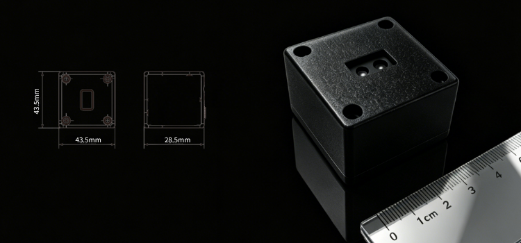
In the era of autonomous navigation, 3D perception is the foundation of intelligent machines. Traditional mechanical LiDAR, ultrasonic ...

Game-Changing Precision: Unlock Ultra-Stable Flight with RTK Module HM-D20
In the fast-evolving world of drones, autonomous robots, and precision geospatial applications, positioning performance defines success...

Visual-Based Navigation (VBN) : The Complete Guide to UAV Navigation
Learn how UAV Visual-Based Navigation (VBN) solves drone localization issues in GNSS-denied environments—explore its principles, uses, challenges, and breakthroughs for safer, precise flights.

VIO With Global Shutter And Odometer: Practical Application Tips
Struggling with outdoor VIO accuracy? Learn practical, low-cost tips for global shutter camera photometric adaptation and a efficient loose-coupling method to use odometer data for error checking without high computational cost.

The Ultimate Guide to Robot State Estimation (15):VIO/VSLAM/Depth Camera
Move beyond academic metrics. Learn how hardware selection, fusion algorithms (VIO, GNSS), and depth camera traits (iTOF, Stereo) impact real-world VIO/VSLAM accuracy and robustness for robotics applications.