


UAV DToF LiDAR Guide: Choosing a Lightweight Depth Sensor for Drone Mapping, Obstacle Avoidance, and ROS Integration
Choosing a uav dtof lidar module is not a catalog exercise. It is an engineering tradeoff, plain and simple. UAVs need reliable depth perception, but every sensor you bolt onto the airframe changes the payload weight, flight endurance, power draw, mounting design, processing load, wiring complexity, and maintenance picture. Professional airborne LiDAR payloads can produce excellent geospatial mapping data, but they may be too expensive, too heavy, or frankly overbuilt for small drones, research aircraft, indoor inspection platforms, autonomous navigation tests, and short-range obstacle avoidance. Camera-only systems have their place, but they can struggle in low-texture spaces, narrow industrial aisles, changing lighting, glare, or any situation where the control system needs a direct distance measurement instead of a best-guess depth estimate.
UAV DToF LiDAR gives many drone and robotics teams a practical middle ground. Direct Time-of-Flight LiDAR can output depth images or point cloud data from a compact solid-state module, helping drones handle altitude hold, terrain following, close-range obstacle detection, landing assistance, robotic vision, and ROS-based perception without the size and cost of a survey-grade LiDAR payload. Here’s the deal: a lightweight DToF module will not magically turn a small drone into a certified mapping aircraft, but it can give the vehicle a much better sense of what is immediately around it. This guide walks through how DToF works, how to judge range, field of view, resolution, frame rate, interfaces, power, and environmental limits, and where a lightweight module such as the DTOF Solid state LiDAR HM-LD1 fits into UAV and embedded robotics projects.
Table of Contents
- 👉 What Is UAV DToF LiDAR?
- 👉 How DToF LiDAR Works on a Drone
- 👉 DToF LiDAR vs Stereo, iToF, Radar, and Scanning LiDAR
- 👉 Key UAV Applications: Mapping, Obstacle Avoidance, and Terrain Following
- 👉 Specifications That Matter When Choosing UAV DToF LiDAR
- 👉 Lightweight UAV DToF LiDAR Product Example: HM-LD1
- 👉 ROS, Raspberry Pi, Jetson, and Flight Controller Integration
- 👉 Mounting, Calibration, and Environmental Design
- 👉 Engineering Selection Checklist
- 👉 Final Recommendations for Choosing UAV DToF LiDAR
- 👉 FAQ: UAV DToF LiDAR
What Is UAV DToF LiDAR?
DToF means Direct Time-of-Flight. A DToF LiDAR module measures distance by emitting light pulses and calculating how long it takes for reflected photons to return to the receiver. Because the measurement is based on the travel time of light, DToF provides direct distance information rather than estimating depth only from visual texture, image disparity, or learned scene features.
In UAV systems, DToF LiDAR is typically used as a compact perception layer. It can support depth imaging, short-range 3D awareness, UAV obstacle avoidance, altitude reference, indoor navigation, inspection assistance, terrain following, landing support, and robotic vision development. Look, it is important to separate compact DToF modules from high-end spinning or scanning survey LiDAR payloads. A compact drone depth sensor may be excellent for local perception, but it is not automatically a complete geospatial mapping system.
a short-flex design and a long-flex design for different robotics and UAV d…
For a broader overview of how LiDAR is used in mobility and autonomous systems, see our related guide on LiDAR car technology explained.
DToF LiDAR in the UAV Sensor Stack
A UAV normally depends on several sensors working together. The IMU measures acceleration and angular rate; the barometer estimates altitude; GNSS or RTK GNSS provides global positioning outdoors; optical flow can support low-altitude drift control; cameras help with visual navigation, object recognition, and SLAM; and range sensors provide local distance measurements. A UAV DToF LiDAR module complements these sensors by adding direct depth data inside a defined field of view.
For example, a downward-facing DToF module can improve low-altitude height estimation where barometer readings drift. A forward-facing module can create obstacle zones for slow-to-medium-speed flight. A side-facing module can support wall following during warehouse inspection or industrial asset monitoring. In more advanced systems, depth maps and point clouds can be fused with visual odometry, IMU data, SLAM, or GNSS/RTK pose estimates. In the shop, this kind of sensor fusion is where a simple-looking range module starts becoming a real perception system.
Why Lightweight Depth Sensors Matter for Drones
Every gram on a drone affects flight endurance, handling, payload margin, and mechanical design. A heavy sensor can reduce flight time, shift the center of gravity, increase vibration sensitivity, or require a larger airframe. Power consumption matters for the same reason: a sensor that draws too much power reduces battery life and may require additional regulators, wiring, cooling, and EMI management.
Compact LiDAR modules are especially valuable when teams are developing small UAVs, indoor drones, inspection systems, experimental autonomous platforms, or multi-sensor research payloads. A lightweight UAV LiDAR can be mounted on a frame, nose cone, underside plate, side bracket, or custom gimbal with less mechanical burden than a full survey payload. The best choice is not simply the sensor with the longest advertised range; it is the module that fits the vehicle’s payload budget, flight envelope, software architecture, and operating environment.
How DToF LiDAR Works on a Drone
A DToF LiDAR sends short optical pulses toward the environment. When those pulses hit an object, a portion of the light reflects back to the receiver. The sensor measures the time delay between emission and return, then calculates distance. In a solid-state DToF LiDAR module, this process can be performed across an array to generate a depth map and, with calibration, 3D point cloud data.
SPAD-based DToF sensors use single-photon avalanche diode technology to detect very small amounts of returned light. This supports compact 3D sensing in a small package. For UAVs, solid-state operation is valuable because there are no rotating mirrors or spinning assemblies, which can reduce mechanical wear and simplify integration into small airframes.
Direct Time-of-Flight Formula
The basic distance calculation is: Distance = Speed of Light × Round-Trip Time ÷ 2. The division by two is required because the light pulse travels from the sensor to the object and then back to the receiver. Although the formula is simple, practical sensor performance depends on optical power, receiver sensitivity, signal processing, target reflectivity, ambient light, incidence angle, calibration, and noise filtering.
From Depth Map to Point Cloud
A depth map is a two-dimensional grid where each pixel stores distance information. For UAV obstacle avoidance, this can be enough: the flight computer may only need to know whether a region of the sensor view contains an object within a defined safety distance. A point cloud is created when valid depth pixels are projected into 3D coordinates using camera or sensor intrinsics.
For mapping and reconstruction, point clouds are useful, but they are only one part of the workflow. A drone must also know where it was when each measurement was taken. That means pose estimation from IMU, SLAM, visual odometry, or GNSS/RTK is required. Without accurate pose, a point cloud may describe local geometry but will not produce reliable georeferenced mapping output.
Solid-State DToF vs Mechanical Scanning
Solid-state DToF LiDAR has no spinning turret or mechanical scanning assembly. This can reduce size, power draw, mechanical complexity, and wear. It also makes the module easier to place on compact UAVs where airflow, vibration, and packaging space are limited. The tradeoff is that compact solid-state modules often have lower range, resolution, or field of view than professional survey-grade LiDAR systems. For many UAVs, however, the objective is not dense geospatial mapping; it is reliable local awareness.
DToF LiDAR vs Stereo, iToF, Radar, and Scanning LiDAR
Drone engineers rarely choose sensors in isolation. A robust UAV perception system may use several technologies together, because each sensor type has strengths and weaknesses. DToF LiDAR is attractive when a project needs direct distance measurement in a compact package, but stereo cameras, iToF depth cameras, radar, and survey-grade LiDAR may be better for specific requirements.
| Sensor Type | Strengths | Limitations | Best UAV Use Cases |
|---|---|---|---|
| DToF LiDAR | Direct distance measurement, compact modules, useful for depth maps and short-range 3D perception. | Range and resolution depend on module design, reflectivity, target angle, and ambient light. | Obstacle avoidance, altitude hold, indoor navigation, inspection assistance. |
| Stereo Vision | Rich visual data, passive sensing, useful for visual SLAM and object recognition. | Can struggle with low texture, low light, glare, repetitive patterns, and scale uncertainty. | Visual navigation, SLAM, semantic perception, object classification. |
| iToF Camera | Depth imaging, compact format, common in robotics and HMI systems. | May be affected by multipath, modulation interference, and outdoor lighting depending on design. | Indoor depth sensing, user interaction, short-range robotics. |
| Radar | Works in dust, fog, rain, and poor visibility; useful for velocity measurement. | Lower spatial resolution than optical depth sensors. | All-weather detection, velocity sensing, safety redundancy. |
| Survey-Grade UAV LiDAR | Long range, high point density, calibrated mapping workflow, geospatial capability. | Higher cost, weight, power draw, and integration complexity. | Topographic mapping, forestry, corridor survey, digital elevation models. |
For readers comparing compact solid-state depth sensing with higher-end LiDAR architectures, companies such as Blickfeld provide useful context on LiDAR technology categories. When UAV mapping requires georeferenced output, GNSS/RTK modules from suppliers such as Unicore Communications are often used alongside LiDAR and IMU systems.
When DToF Is Better Than Camera-Only Perception
DToF can be better than camera-only perception when the system needs direct distance measurement, low-latency range estimates, or texture-independent sensing. Cameras infer depth from image features, stereo disparity, motion, or AI models. That can work extremely well, but it can fail when walls are blank, floors are repetitive, lighting changes quickly, surfaces are reflective, or the scene lacks visual features. A DToF LiDAR module gives the drone a more direct measurement of distance inside its field of view.
When Survey-Grade UAV LiDAR Is Still Required
Survey-grade UAV LiDAR is still required when the deliverable is a high-accuracy geospatial map, digital elevation model, forestry point cloud, corridor survey, or engineering-grade terrain model. These applications require long range, high point density, precise timing, GNSS/INS integration, boresight calibration, and professional post-processing. A compact DToF module can assist mapping and local reconstruction, but it should not be marketed as a direct replacement for a certified mapping payload.
Key UAV Applications: Mapping, Obstacle Avoidance, and Terrain Following
Obstacle Avoidance for Small UAVs
Obstacle avoidance is one of the most common uses for a compact DToF LiDAR module. A forward-facing drone depth sensor can detect walls, shelves, structural beams, vehicles, machinery, or other objects in the flight path. A downward-facing module can support landing assistance, while side-facing modules can help maintain distance from walls or infrastructure.
Reaction distance is critical. Engineers must consider drone speed, sensor frame rate, processing latency, control loop delay, braking distance, and maneuverability. A sensor with a 10 fps frame rate updates every 100 milliseconds, and the drone continues moving during that time. For slow inspection, indoor operation, or controlled autonomy, this may be acceptable. For high-speed outdoor flight, additional long-range sensors or multi-sensor fusion may be required.
UAV Altitude Hold and Terrain Following
A downward DToF LiDAR can act as a UAV altitude hold LiDAR by measuring distance to the ground or nearby surface. This helps compensate for barometer drift, especially in low-altitude flight. It can also support terrain-relative flight, where the UAV maintains a set height above the surface rather than a fixed altitude above sea level.
Surface conditions matter. Water, glass, dark materials, shiny surfaces, steep slopes, tall vegetation, and direct sunlight can reduce measurement reliability. For robust altitude hold, LiDAR data is often fused with IMU, barometer, optical flow, visual odometry, or other sensors. The system should define what happens when the distance reading becomes invalid or inconsistent.
Drone Mapping and Short-Range 3D Reconstruction
Lightweight DToF LiDAR can assist drone mapping by providing local 3D structure. It may help with indoor mapping, small-scale reconstruction, inspection documentation, and robotics research. However, mapping quality depends on more than the depth sensor. Field of view, resolution, time synchronization, motion compensation, calibration, SLAM quality, and pose estimation all affect the final point cloud.
For short-range 3D reconstruction, a compact solid-state LiDAR for drones can provide useful depth map and point cloud data. For professional topographic deliverables, the UAV needs survey-grade LiDAR, GNSS/INS integration, calibrated processing, and appropriate flight planning.
UAV Inspection of Bridges, Dams, Warehouses, and Industrial Assets
Industrial inspection is a strong fit for compact DToF modules. Drones often need to fly near bridges, expressways, dams, storage racks, tanks, machines, and other structures that are difficult or unsafe for people to approach. A lightweight sensor can help the UAV maintain standoff distance, measure clearance, detect nearby surfaces, and improve situational awareness during close inspection.
In warehouses or industrial facilities, DToF depth sensing may support aisle navigation, rack distance measurement, landing checks, or safety monitoring. In outdoor infrastructure inspection, the shorter outdoor range of compact modules must be considered, especially under bright sunlight or on dark surfaces.
Specifications That Matter When Choosing UAV DToF LiDAR
Weight and Dimensions
Weight and dimensions are among the first specifications to review. Every gram affects endurance, battery sizing, payload margin, and center of gravity. A small module is easier to integrate into a drone nose, underside mount, side bracket, protective shell, or custom robotic platform. Compact dimensions also reduce aerodynamic drag and simplify cable routing.
Indoor and Outdoor Ranging Capability
Indoor and outdoor ranges should be evaluated separately. Indoor or nighttime performance is often stronger because ambient light interference is lower. Outdoor sunlight can reduce effective range, especially under high illumination or on low-reflectivity targets. Always test the module in the actual use environment rather than assuming the best-case range applies everywhere.
Ranging Accuracy
Accuracy, precision, repeatability, and resolution are related but different. Accuracy describes closeness to the true distance. Precision describes measurement spread. Repeatability describes consistency under similar conditions. Resolution describes the smallest measurable change or the density of the depth grid. For obstacle avoidance or altitude reference, centimeter-level accuracy may be useful. For survey mapping, additional geospatial calibration and higher-grade systems are normally required.
Field of View
Field of view defines the angular coverage of the sensor. A wider horizontal FOV helps detect objects across the drone’s path, while vertical FOV affects coverage of ground, ceiling, slopes, or elevated obstacles. Mounting angle and vehicle speed determine whether the field of view gives enough warning distance. If a single sensor does not cover the required area, multiple modules or complementary sensors may be needed.
Resolution and Frame Rate
Depth resolution affects object detail. A lower-resolution grid may be sufficient for obstacle zones, landing checks, and coarse terrain awareness, but it may not detect thin wires, small branches, or detailed geometry. Frame rate affects reaction time. A 10 fps depth feed can support many slow-to-medium robotic perception tasks, but high-speed flight requires careful latency analysis.
Interface Options: UART, UDP, and UVC
Interfaces shape the whole software architecture. UART is simple and common for embedded systems and flight controllers. UDP is useful for streaming data to Linux computers or robotics middleware over a network interface. UVC makes the module behave more like a camera, which can simplify PC, Raspberry Pi, Jetson, and vision pipeline integration. The best interface depends on bandwidth, latency, cable design, connector reliability, and driver support.
Power Consumption and Thermal Design
Low power consumption is essential for UAV endurance. Even a few watts matter on small drones. Power rail stability, electrical noise, grounding, and connector quality should be considered early in the design. Thermal behavior also matters if the module is installed in a sealed housing, exposed to direct sun, or mounted near other heat-generating electronics.
Operating Temperature
UAVs may operate in cold outdoor environments, hot industrial spaces, or changing weather. Temperature can affect electronics, optics, calibration, and measurement stability. A wide operating temperature range gives integrators more deployment flexibility, but field testing remains essential.
Lightweight UAV DToF LiDAR Product Example: HM-LD1
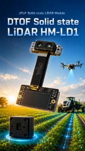
The DTOF Solid state LiDAR HM-LD1 is a compact SPAD DToF solid-state LiDAR module designed for real-time depth imaging and 3D point cloud output. Its small size, 28 g weight, low 1.2 W power consumption, and UART/UDP/UVC interfaces make it suitable for drones, mobile robots, embedded vision systems, and ROS-based development platforms. For UAV teams evaluating a compact LiDAR module, the HM-LD1 is a practical example of how a lightweight DToF LiDAR module can support obstacle avoidance, distance detection, altitude reference, terrain following, inspection assistance, and robotic vision development.
The module is designed for multi-scenario applications across drones, robots, cameras, and security systems. It supports UAV altitude hold and terrain following, robot navigation, obstacle avoidance, SLAM-related perception workflows, autofocus, user presence detection, object recognition, volume measurement, and zone intrusion monitoring. Its SDK support for x86 Windows, x86 Linux, and ARM Linux helps development teams integrate it across PCs, Raspberry Pi, Jetson-class systems, and embedded Linux platforms.
| Specification | HM-LD1 Details | Why It Matters for UAV DToF LiDAR |
|---|---|---|
| Product Name | DTOF Solid state LiDAR HM-LD1 | Compact DToF LiDAR module for UAVs, robots, and embedded perception systems. |
| Technology | SPAD DToF solid-state LiDAR | Supports real-time depth image and 3D point cloud generation without mechanical scanning parts. |
| Dimensions | 43.5 mm × 30 mm × 26.5 mm | Small form factor helps integration on compact UAV frames and embedded robotic platforms. |
| Weight | 28 g | Low payload weight helps preserve flight endurance and simplifies mounting. |
| Ranging Capability | Indoor: 0.5–25 m; Outdoor: 0.2–8 m | Suitable for short-range UAV perception, obstacle detection, terrain following, and inspection assistance. |
| Ranging Accuracy | ±3 cm | Useful for robotic perception, distance detection, altitude reference, and close-range navigation tasks. |
| Field of View | 60° horizontal × 45° vertical | Provides a practical depth-sensing window for forward, downward, or side-facing UAV mounting. |
| Resolution | 40 × 30 | Outputs a low-resolution depth image suitable for compact perception and obstacle-zone analysis. |
| Frame Rate | 10 fps | Supports real-time depth updates for slow-to-medium-speed robotic and UAV sensing applications. |
| Interfaces | UART / UDP / UVC | Enables integration with embedded boards, PCs, Raspberry Pi, Jetson, flight controllers, and ROS pipelines. |
| Operating Temperature | -20 ℃ to 60 ℃ | Supports deployment in a range of indoor, outdoor, and industrial environments. |
| Power Consumption | 1.2 W | Low power draw is valuable for UAV endurance and embedded power budgets. |
| SDK Support | x86 Windows, x86 Linux, ARM Linux | Supports development across PCs, embedded Linux systems, and robotics platforms. |
View Product Details & Pricing ➔
Download the DTOF SSL HM-LD1 Product Brochure for detailed product documentation.
ROS, Raspberry Pi, Jetson, and Flight Controller Integration
Choosing the Right Interface for Your Architecture
For UAV integration, the interface determines how sensor data enters the vehicle’s software stack. UART is useful when the system needs simple distance data or embedded communication with a flight controller or microcontroller. UDP is well suited to networked data streaming on Linux systems. UVC can simplify integration by presenting depth data through camera-style workflows. A module with UART, UDP, and UVC gives engineers flexibility during prototyping and deployment.
ROS and ROS2 Data Pipeline
In ROS or ROS2, a UAV DToF LiDAR can publish depth images, point clouds, or range messages. Depth data may be represented as an image topic; point clouds can be published as sensor_msgs/PointCloud2; and simplified distance information can be published as sensor_msgs/Range. Correct TF frames are essential. Common frames include base_link, lidar_link, and camera_depth_frame. Timestamping also matters because UAVs move quickly, and delayed data can create inaccurate obstacle positions.
Raspberry Pi and ARM Linux Integration
Raspberry Pi and similar ARM Linux boards are popular for lightweight UAV perception. HM-LD1 support for ARM Linux helps teams build compact systems without relying only on desktop computers. Developers should still check CPU load, USB or UART reliability, power rail design, thermal behavior, and whether the application needs real-time control or only perception assistance.
Jetson Integration for AI + Depth Perception
Jetson-class platforms are useful when teams want to combine AI vision and depth perception. Object detection can identify a person, vehicle, shelf, or structure, while DToF depth data estimates distance. This enables depth-aware obstacle segmentation, inspection automation, and ROS2 perception pipelines. The key is to synchronize depth and image data carefully enough for the drone’s speed and control requirements.
Flight Controller Integration Considerations
Flight controller integration often focuses on downward range data for altitude control or forward obstacle zones for safety logic. Some systems use MAVLink distance sensor messages, while others process data on a companion computer and send high-level commands. Latency, failsafe behavior, invalid-data handling, and controlled flight testing are essential before autonomous deployment.
For teams building custom embedded perception systems, the RISC-V Dev Board HM-RV3 may be relevant for development and prototyping workflows.
Mounting, Calibration, and Environmental Design
Mounting Direction: Forward, Downward, or Side-Facing
Mounting direction depends on the mission. A forward-facing module supports obstacle detection. A downward-facing module supports altitude hold, landing assistance, and terrain following. A side-facing module helps with wall following and inspection standoff distance. Angled mounting can help detect slopes or upcoming ground changes, but it complicates calibration and interpretation.
Vibration Isolation and Mechanical Stability
Propellers and motors generate vibration that can affect sensor readings, connectors, and mechanical alignment. A mount should be stable enough to preserve extrinsic calibration while avoiding excessive vibration transfer. Very soft mounts may reduce vibration but allow the sensor orientation to change during acceleration, which can degrade point cloud fusion.
Extrinsic Calibration
Extrinsic calibration defines the translation and rotation between the LiDAR coordinate frame and the drone body frame. It is important when point clouds are transformed into the UAV frame, fused with IMU data, or used in ROS TF trees. Calibration should be validated using known targets, controlled movements, and repeatable test procedures.
Ambient Light, Reflectivity, and Outdoor Performance
Outdoor performance depends on sunlight, surface reflectivity, target angle, distance, and optical filtering. Dark, shiny, transparent, or sharply angled surfaces can reduce valid returns. Because compact modules often specify shorter outdoor range than indoor range, UAV teams should test in direct sunlight, shadows, high-contrast scenes, and the actual surfaces expected during operation.
Safety and Redundancy
A compact DToF module should be treated as one layer in the perception stack, especially in safety-critical UAVs. Combine it with IMU, barometer, cameras, optical flow, radar, ultrasonic sensors, or GNSS/RTK where appropriate. Define failsafe behavior for invalid readings, blocked optics, communication loss, or unexpected obstacles. Test first in controlled environments before enabling autonomous flight around people, vehicles, or valuable infrastructure.
Engineering Selection Checklist
- ✅ Payload budget: Confirm that the LiDAR weight fits flight endurance, mounting, and center-of-gravity requirements.
- ✅ Range: Verify indoor and outdoor range against drone speed, stopping distance, and mission profile.
- ✅ Accuracy: Decide whether the ranging accuracy is sufficient for obstacle avoidance, altitude hold, or mapping assistance.
- ✅ FOV: Check whether the horizontal and vertical field of view cover the required detection zone.
- ✅ Resolution: Confirm that the depth grid can detect the object sizes that matter for your mission.
- ⚙️ Frame rate: Ensure the update rate is fast enough for the control loop and vehicle speed.
- ⚙️ Interface: Choose UART, UDP, UVC, or another interface based on bandwidth, latency, and host platform.
- ⚙️ SDK support: Confirm support for Windows, Linux, or ARM Linux development workflows.
- ⚙️ Power: Make sure the UAV power system can supply the module reliably without excessive noise or heat.
- ✅ Environment: Test sunlight, dust, vibration, temperature variation, and target reflectivity.
- ⚙️ Software: Plan how to publish data into ROS or ROS2 as depth images, point clouds, or range messages.
- ✅ Mapping requirement: Decide whether you need local 3D perception or survey-grade geospatial mapping.
Explore more robotics and UAV perception resources in our technical blog library.
Final Recommendations for Choosing UAV DToF LiDAR
The best UAV DToF LiDAR is not automatically the longest-range, highest-resolution, or most expensive module. It is the sensor that best matches the drone’s size, payload budget, flight speed, perception goal, interface requirements, software stack, and operating environment. A compact module is often ideal for obstacle avoidance, altitude hold, terrain following, short-range inspection, robotic vision, and ROS development. A survey-grade payload is still required for professional geospatial mapping deliverables.
The DTOF Solid state LiDAR HM-LD1 is a practical option for teams needing a compact, 28 g, low-power DToF module with depth map and point cloud support, UART/UDP/UVC interfaces, and SDK support for Windows, Linux, and ARM Linux. Its indoor 0.5–25 m and outdoor 0.2–8 m ranging capability make it relevant for short-range UAV perception, robotic development, and embedded sensing applications.
Learn more about the DTOF Solid state LiDAR HM-LD1 or browse additional robotics and UAV perception resources in our blog library.
HM-LD1 dToF Solid-State LiDAR: Compact Depth Sensing for UAVs & Robotics
FAQ: UAV DToF LiDAR
Are all ToF sensors considered LiDAR, and is DToF suitable for UAV applications?
Can a lightweight DToF LiDAR replace expensive UAV LiDAR for 3D mapping?
How difficult is it to integrate UAV DToF LiDAR with ROS2, Raspberry Pi, Jetson, or flight controllers?
What range is enough for UAV obstacle avoidance?
Is a 40 × 30 depth resolution useful on a drone?
What is the difference between a depth map and a point cloud?
Does sunlight affect UAV DToF LiDAR performance?
Can UAV DToF LiDAR be used for altitude hold?
What interface is best for UAV DToF LiDAR: UART, UDP, or UVC?
What are the main limitations of compact UAV DToF LiDAR?
📚 References & Further Reading
- Industry Standard: Blickfeld LiDAR technology resources and Unicore Communications GNSS/RTK positioning solutions
- Related Guide: LiDAR car technology explained, DTOF Solid state LiDAR HM-LD1, and MyRobotProject technical blog library






