

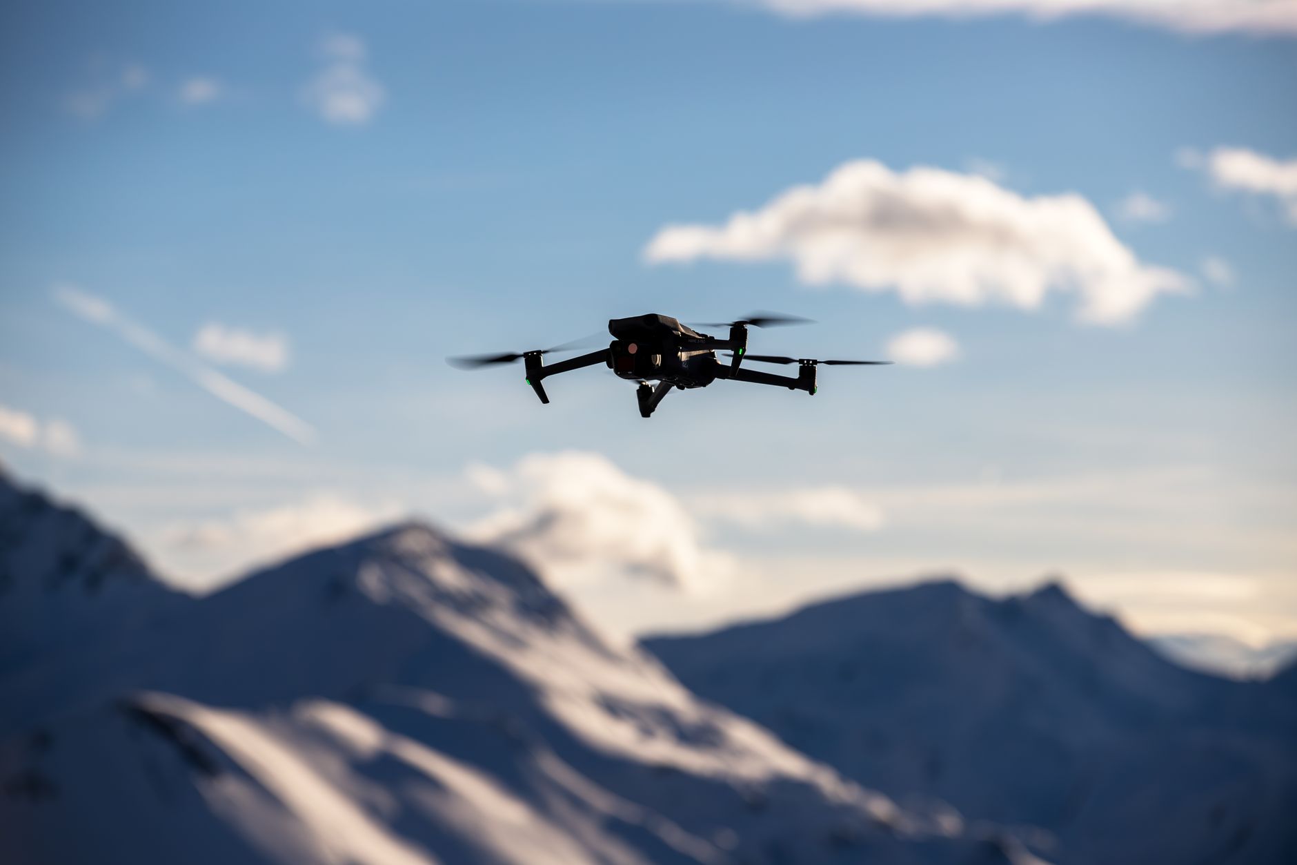
LiDAR and Drones: Beginner-Friendly Guide to UAV Mapping, Obstacle Avoidance, and Sensor Selection
For a lot of beginners, the phrase lidar and drones sounds like something that belongs in a defense lab, a survey truck, or a high-budget autonomous vehicle program. Here’s the deal: the core idea is not that mysterious. LiDAR, short for Light Detection and Ranging, measures distance by sending out light and timing how long it takes the reflected signal to come back. Put that sensing technology on a drone, and now the aircraft can collect depth, shape, elevation, and spatial information from the air. A regular camera captures color and texture. A LiDAR sensor measures 3D distance. That difference is why LiDAR matters for UAV mapping, inspection, altitude hold, terrain following, obstacle avoidance, robotics, and autonomous navigation.
Look, the practical challenge is not understanding what LiDAR does. The hard part is choosing the right LiDAR for the job. A high-end aerial survey LiDAR system can create dense georeferenced point clouds, but it may also need a large UAV, GNSS/INS integration, vibration control, calibration, and professional post-processing software. A compact solid-state dToF LiDAR module, on the other hand, may be exactly what you want for a small UAV that needs near-field obstacle detection, landing assistance, indoor navigation, terrain following, or embedded robotics development. This guide walks through how drone LiDAR works, how it compares with photogrammetry, where it is used, and how to evaluate range, accuracy, field of view, weight, power consumption, frame rate, interface, and SDK support before selecting a LiDAR drone sensor.
Table of Contents
- 👉 What Does “LiDAR and Drones” Mean?
- 👉 How Drone LiDAR Works
- 👉 Drone LiDAR vs Drone Photogrammetry
- 👉 Main Applications of LiDAR on Drones
- 👉 Beginner UAV LiDAR Mapping Workflow
- 👉 LiDAR for Drone Obstacle Avoidance
- 👉 Types of LiDAR Sensors Used on Drones
- 👉 How to Choose a LiDAR Sensor for a Drone
- 👉 Product Example: DTOF Solid State LiDAR HM-LD1
- 👉 Integration Tips for UAV Developers
- 👉 Common Beginner Mistakes When Using LiDAR and Drones
- 👉 FAQ About LiDAR and Drones
What Does “LiDAR and Drones” Mean?
LiDAR stands for Light Detection and Ranging. A LiDAR sensor emits light pulses and measures the time required for those pulses to return after reflecting from nearby surfaces. By converting time into distance, the sensor can determine how far objects, ground, walls, trees, structures, or terrain are from the sensor. When LiDAR is mounted on a drone, the UAV can collect distance and 3D spatial information while flying over, around, or inside a target environment.
In practical shop-floor terms, lidar and drones work together in two broad ways. First, LiDAR can be used for aerial mapping, where the goal is to create a 3D point cloud, terrain model, or elevation dataset. Second, LiDAR can be used for real-time perception, where the goal is to help the drone sense obstacles, maintain altitude, follow terrain, or provide distance data to an onboard controller. These two use cases overlap, but they are not the same job. Mapping is usually focused on accuracy, density, georeferencing, and deliverables. Perception is usually focused on reaction time, local awareness, low weight, low power, and reliable short-range sensing.
a short-flex design and a long-flex design for different robotics and UAV d…
LiDAR as a 3D Sensing Technology
LiDAR is an active sensing technology. That means it sends out its own signal instead of relying only on sunlight or room lighting. A camera captures what something looks like. LiDAR measures how far away that thing is. In the shop, that difference matters. A white wall, a gray warehouse floor, a repetitive rack system, or a dark inspection area may not give a camera enough visual texture to work with. A LiDAR sensor can still provide useful range measurements if the target reflects enough signal back to the receiver.
The output can be a distance reading, a depth image, or a point cloud. A depth image is similar to a 2D grid where each point contains distance information. A point cloud is a collection of 3D points that represents the geometry of the environment. For drone mapping, that geometry can describe roofs, terrain, stockpiles, roads, bridges, vegetation, and utility corridors. For drone obstacle avoidance, the same basic principle can identify nearby obstacles that the aircraft should avoid.
Why Put LiDAR on a Drone?
Drones put LiDAR into places where people either should not go or do not want to spend all day trying to access. A UAV can fly near bridges, dams, rooftops, towers, cliffs, mines, storage yards, warehouses, construction sites, agricultural fields, and industrial plants. Instead of asking workers to climb, manually measure, or install scaffolding, a drone can carry a LiDAR sensor to capture distance data from safer positions.
For small UAV perception and development, compact modules matter because payload weight directly affects flight time and stability. A module such as the DTOF Solid State LiDAR HM-LD1 is designed around compact solid-state dToF sensing, making it relevant for drone altitude hold, short-range obstacle detection, terrain following, smart inspection, and robotics vision development.
How Drone LiDAR Works
A drone LiDAR system works by emitting light, receiving reflections, calculating distance, and converting many measurements into useful spatial data. In a simple distance sensor, the output might be one range value. In a depth LiDAR module, the output may be a grid of distance measurements. In a mapping LiDAR, the output can become a dense point cloud that is combined with drone position and orientation data.
The core measurement method is time-of-flight. Light travels extremely fast, so the sensor must use precise timing and signal processing to measure very small time differences. The shorter the time between emission and return, the closer the object is. The longer the time, the farther away it is. Performance depends on emitter design, receiver sensitivity, optics, signal processing, sunlight resistance, and target reflectivity. Photonics and optical sensing suppliers such as AMS Osram are part of the broader ecosystem supporting advanced light-based sensing technologies.
Time-of-Flight Measurement
Direct time-of-flight, often abbreviated as dToF, measures the actual travel time of emitted light. A dToF LiDAR module emits a short light signal and detects the returned photons after reflection from an object. Since the speed of light is known, distance can be calculated from the measured round-trip time. In compact sensing modules, this requires precise timing electronics and sensitive detectors. SPAD-based dToF modules use single-photon avalanche diode technology to detect extremely small amounts of returned light, enabling compact depth sensing for robotics and embedded systems.
From Distance Readings to Point Clouds
A single distance value is useful, but most UAV applications need more than one measurement. When a LiDAR sensor collects many distance readings across an area, those measurements can be converted into spatial points. A collection of these points is called a point cloud. In aerial mapping, point clouds can show terrain, buildings, tree canopies, power line corridors, stockpiles, roads, and industrial assets. In robotics, point clouds help a system understand the location and shape of nearby objects.
For drones, point cloud quality depends on the LiDAR sensor and on how the aircraft moves. Flight speed, vibration, altitude, scan angle, time synchronization, positioning accuracy, and calibration all influence the final data. A survey-grade drone LiDAR workflow often combines sensor data with GNSS, IMU, and post-processing software. A compact perception LiDAR workflow may focus instead on local obstacle zones, depth thresholds, and real-time control decisions.
Depth Maps vs Point Clouds
A depth map is usually a 2D grid where each pixel or cell contains a distance value. This format is convenient for embedded vision, object detection, obstacle zones, and quick software interpretation. A point cloud is a 3D coordinate dataset that represents surfaces in space. Depth maps can often be transformed into point clouds if the camera model, field of view, and calibration parameters are known. For a drone developer, the difference matters because a flight controller may only need a simplified distance or obstacle warning, while mapping software may need full 3D point data.
Why Frame Rate Matters on a Moving Drone
Drones move. That sounds obvious, but it is where a lot of beginner designs get into trouble. A LiDAR sensor that works fine on a slow ground robot may not be enough for a UAV if detection range and control response are not matched to flight speed. Frame rate, latency, braking distance, and software processing time must be evaluated together. A sensor with a 10fps frame rate can support real-time depth updates for many controlled sensing tasks, but the aircraft must fly at a speed that gives the system enough time to detect, decide, and react. Build in margin. Do not design the aircraft like every sensor reading will be perfect every time.
Drone LiDAR vs Drone Photogrammetry
One of the most common beginner questions is whether LiDAR is better than photogrammetry. The honest answer is: better for what? Drone photogrammetry uses overlapping images to reconstruct 3D shape. It is excellent for visual maps, textured 3D models, construction documentation, agriculture imaging, and orthomosaics. Drone LiDAR directly measures distance, which makes it strong for geometry, elevation, low-light operation, vegetation analysis, and surfaces with limited visual texture.
| Factor | Drone LiDAR | Drone Photogrammetry |
|---|---|---|
| Measurement Method | Direct distance measurement using light pulses | 3D reconstruction from overlapping images |
| Lighting Dependence | Lower dependence on ambient light | Requires good lighting and image quality |
| Vegetation | Can better capture ground points through gaps in vegetation | Often reconstructs the top of vegetation canopy |
| Low-Texture Surfaces | Works better for direct range sensing | Can struggle with uniform, reflective, or low-texture surfaces |
| Output | Point clouds, distance data, depth maps | Orthomosaics, 3D meshes, textured models |
| Typical Use | Surveying, inspection, terrain modeling, obstacle avoidance | Visual mapping, construction progress, agriculture imaging |
When LiDAR Is the Better Choice
LiDAR is often the better choice when the deliverable depends on accurate 3D geometry rather than visual texture. Forest mapping, terrain modeling, night inspection, height measurement, low-texture surfaces, and obstacle detection are common examples. If the drone needs to know how far away an obstacle is right now, direct distance measurement is usually more appropriate than waiting for image reconstruction.
✅ Good LiDAR use cases include: terrain models, clearance checks, bridge and dam inspection support, indoor navigation, low-light sensing, vegetation structure, stockpile geometry, altitude hold, and near-field collision awareness. In the field, these are the jobs where “pretty pictures” are not enough. You need distance, shape, and repeatable measurements.
When Photogrammetry Is Still Useful
Photogrammetry remains highly useful for many UAV projects. It can be cost-effective, visually rich, and excellent for applications where color, texture, and appearance matter. Construction progress reports, roof documentation, crop scouting, facade inspection, and orthomosaic creation often benefit from high-resolution camera imagery. If a project requires a visual map that stakeholders can easily interpret, photogrammetry may be the right tool.
✅ Good photogrammetry use cases include: orthomosaics, marketing-grade site visuals, roof reports, construction progress documentation, crop color analysis, facade photographs, and textured 3D models. In many commercial jobs, the customer still wants a map or model that looks like the site, not just a cloud of geometry.
Why Many UAV Systems Use Both
Advanced drone systems often combine LiDAR and cameras. This is called sensor fusion. LiDAR provides geometry and distance, while cameras provide texture, color, and object classification. A drone inspecting a utility corridor may use LiDAR to measure clearance and a camera to visually document components. A robotics system may use LiDAR to detect the position of an obstacle and a camera to classify whether it is a person, wall, pallet, or vehicle.
Main Applications of LiDAR on Drones
LiDAR on drones is used across surveying, construction, infrastructure, energy, forestry, warehousing, security, robotics, and industrial inspection. The exact configuration depends on whether the UAV is being used as a mapping platform or as an autonomous sensing platform. That distinction matters because a mapping payload and an obstacle-avoidance payload are built around different priorities.
UAV Mapping and Surveying
For mapping and surveying, drone LiDAR can generate point clouds that support digital elevation models, digital terrain models, surface models, corridor surveys, mine surveys, stockpile measurement, and construction site analysis. When paired with accurate positioning, LiDAR can capture detailed terrain information from the air. This is especially useful where ground access is difficult or vegetation makes visual surface reconstruction less reliable.
In a professional survey workflow, the drone is only one part of the system. You also have GNSS, IMU data, flight planning, control points, calibration, and processing software. Beginners sometimes buy the sensor first and define the deliverable later. That is backward. Start with the deliverable, then choose the aircraft, payload, software, and validation method.
Bridge, Dam, and Infrastructure Inspection
Infrastructure inspection is a natural fit for lidar and drones because many structures are difficult or unsafe to inspect manually. Bridges, dams, overpasses, retaining walls, and industrial structures often require distance measurements, surface awareness, and controlled flight near obstacles. A UAV with LiDAR can help measure distance to the structure, assist in maintaining clearance, and collect 3D geometry for analysis. This can reduce the need for scaffolding, rope access, or traffic closures in certain inspection workflows.
Power Line and Utility Corridor Inspection
Power line corridors require careful spatial analysis. LiDAR can help measure relationships between conductors, poles, vegetation, terrain, and nearby structures. In professional utility mapping, dense LiDAR point clouds can support clearance analysis and vegetation management. In smaller UAV development projects, LiDAR may also help the drone sense obstacles and maintain safer standoff distances.
Forestry and Vegetation Analysis
LiDAR can be valuable in forestry because it captures 3D vegetation structure. Depending on sensor capability and flight conditions, LiDAR can measure canopy height, vegetation density, tree structure, and ground surfaces visible through gaps in vegetation. This makes it useful for biomass estimation, forest inventory, habitat assessment, and terrain modeling below canopy.
Warehouse, Security, and Indoor UAV Applications
Indoor drones face different challenges from outdoor mapping drones. GPS may be unavailable, lighting may be inconsistent, and obstacles may be close. LiDAR can support indoor navigation, obstacle sensing, zone monitoring, presence detection, and smart inspection. Compact depth LiDAR modules are especially useful in these applications because indoor UAVs often have limited payload capacity and require lightweight sensors with low power draw.
Drone Altitude Hold and Terrain Following
Altitude hold and terrain following are two important perception tasks. A downward-facing LiDAR can provide distance-to-ground information, helping the drone maintain a stable height above floors, crops, roofs, slopes, or uneven terrain. A compact solid-state dToF LiDAR module such as the HM-LD1 is especially relevant for short-range UAV altitude hold, terrain following, obstacle detection, and embedded robotic vision projects where weight and power are critical.
Beginner UAV LiDAR Mapping Workflow
A successful UAV LiDAR project starts before the drone leaves the ground. Beginners often focus only on the sensor, but the workflow includes objective definition, platform selection, mounting, flight planning, data capture, processing, validation, and deliverable creation. Each step affects final results. In the shop, we call this system thinking. The sensor is important, but it does not carry the whole job by itself.
Step 1 — Define the Mapping Objective
⚙️ Define the job first. A topographic survey, construction measurement, vegetation analysis, infrastructure inspection, indoor navigation test, and obstacle detection prototype all require different sensor characteristics. If the project needs survey-grade terrain data, the drone may require a professional mapping LiDAR with positioning and calibration. If the project needs short-range distance sensing for an experimental UAV, a compact dToF module may be enough.
Step 2 — Select Drone, Payload, and Sensor
⚙️ Match the payload to the aircraft. Drone selection depends on payload capacity, flight time, vibration characteristics, mounting options, communication interfaces, and onboard processing requirements. The sensor must fit within the aircraft’s power budget and mechanical envelope. Engineers should account for the LiDAR, cables, mounting brackets, companion computer, power converter, and any protective enclosure. A sensor that looks light on paper can become a heavier system once real mounting hardware is included.
Step 3 — Plan the Flight Path
⚙️ Plan the path like the data depends on it, because it does. For mapping, flight path planning includes altitude, speed, line spacing, scan direction, coverage, safety margins, and regulatory restrictions. For obstacle avoidance testing, the flight plan should include controlled environments, known test obstacles, safe speeds, and emergency stop procedures. For terrain following, the test environment should include gradual changes before more complex surfaces are attempted.
Step 4 — Capture LiDAR Data
⚙️ Capture clean, synchronized data. During data capture, the LiDAR sensor outputs depth maps, distance readings, or point clouds. Timestamps, synchronization, and positioning data become important if the data will be mapped into a common coordinate system. For simple real-time sensing, the priority may be reliable data streaming, low latency, and stable detection zones.
Step 5 — Process and Validate Data
⚙️ Validate before you trust it. Processing may include filtering, coordinate transformation, point cloud cleaning, ground classification, alignment, and quality checking. Survey workflows may compare point clouds with control points or known measurements. Robotics workflows may validate whether the obstacle map correctly identifies free space and blocked zones. Raw sensor output is not the same thing as a reliable system result.
Step 6 — Export Deliverables
⚙️ Deliver what the job actually needs. Final deliverables may include a point cloud, digital elevation model, digital terrain model, surface model, inspection report, obstacle map, or navigation dataset. The deliverable should match the original objective. A common beginner mistake is collecting impressive-looking data without knowing how it will be used. Good engineering starts with the end use in mind.
LiDAR for Drone Obstacle Avoidance
Obstacle avoidance is different from mapping. Mapping focuses on building accurate spatial models, often after the flight. Obstacle avoidance focuses on fast, reliable detection and control response during flight. A drone must detect an obstacle early enough to slow, stop, climb, descend, reroute, or trigger a failsafe. For this reason, range, field of view, frame rate, latency, reflectivity, sunlight tolerance, and software integration are all critical.
Forward Obstacle Detection
A front-facing LiDAR can detect walls, trees, people, poles, equipment, doors, shelves, and structural elements in the flight path. The usefulness of the sensor depends on whether its field of view covers the relevant area and whether the control software interprets the data correctly. For example, a forward sensor may need to define warning, braking, and emergency stop zones. It may also need to ignore floor returns, propeller interference, or irrelevant background measurements depending on mounting geometry.
Downward Altitude Sensing
A downward-facing LiDAR can measure distance to the ground or floor. This is useful for indoor flight, low-altitude flight, landing assistance, and operations where barometers or GPS altitude may be unreliable. Barometers can drift due to pressure changes, and GPS altitude can be inaccurate or unavailable indoors. LiDAR provides direct local distance, which can improve height awareness when used correctly.
Terrain Following
Terrain following allows a UAV to maintain a consistent distance from changing surfaces such as crops, slopes, roofs, conveyor areas, warehouse floors, or industrial equipment. The drone uses distance data to adjust altitude or trajectory. This is useful for agricultural spraying, inspection, low-altitude mapping, and research platforms. Engineers must tune the control loop carefully because aggressive corrections can create unstable flight.
Field of View and Blind Zones
Field of view determines how much of the environment the LiDAR can see at one time. A wider field of view gives more context, while a narrow sensor may only detect objects in a small region. The HM-LD1 provides a 60° horizontal × 45° vertical FOV, which can be useful for short-range depth perception in forward or downward sensing configurations. Designers must still consider blind zones outside the sensor’s view and may use multiple sensors or complementary sensing methods for broader coverage.
Why Outdoor Range Matters
Outdoor optical sensing can be affected by sunlight, surface reflectivity, and environmental conditions. A sensor that reaches long distances indoors may have a shorter effective range in bright sunlight. The HM-LD1 specification lists indoor ranging of 0.5–25m and outdoor ranging of 0.2–8m. This makes it suitable for near-field UAV sensing, short-range obstacle detection, altitude assistance, and development projects, but it should not be confused with long-range aerial survey LiDAR designed for large-area mapping.
Types of LiDAR Sensors Used on Drones
Drone LiDAR sensors vary widely in design, size, price, performance, and intended use. Some are built for professional mapping, while others are designed for short-range perception. Understanding the category is essential before comparing specifications. Sensor ecosystem companies and suppliers such as domisensor are part of a broader market that includes LiDAR, depth sensing, optical modules, and perception technologies.
Mechanical Scanning LiDAR
Mechanical scanning LiDAR uses moving components to scan the environment. These systems can provide wide coverage and dense point clouds, making them common in mapping, autonomous vehicle research, and robotics. However, they may be heavier, more expensive, and mechanically complex compared with compact solid-state modules. For drones, mechanical scanning units are often used when the aircraft has enough payload capacity and the project requires high-density 3D mapping.
Solid-State LiDAR
Solid-state LiDAR avoids large rotating mechanisms, which can improve compactness, durability, and integration flexibility. For small UAVs, solid-state designs are attractive because weight, power consumption, and mechanical robustness are critical. A compact solid-state LiDAR can be mounted forward, downward, or at an angle for local perception tasks.
dToF LiDAR
dToF LiDAR uses direct time-of-flight measurement. In SPAD-based dToF modules, sensitive detectors capture returned photons and calculate distance from the measured travel time. This approach can support compact depth sensing, real-time distance measurement, and point cloud output for embedded systems. dToF LiDAR modules are commonly considered for robots, drones, smart devices, industrial sensing, and development platforms.
Single-Point LiDAR vs 3D Depth LiDAR
A single-point LiDAR measures one distance along one line or spot. It can be useful for simple altitude measurement or distance triggering. A 3D depth LiDAR module provides a grid of distance measurements, giving the system more environmental context. A richer 3D LiDAR system may generate more detailed point clouds for mapping and navigation. The right choice depends on whether the drone only needs one distance value or a spatial understanding of the surrounding area.
Mapping LiDAR vs Perception LiDAR
Not every LiDAR drone setup is designed for survey-grade mapping. Mapping LiDAR prioritizes point density, georeferencing, scanning coverage, calibration, and post-processing. Perception LiDAR prioritizes local depth awareness, low latency, power efficiency, compact size, and integration with control systems. Confusing these categories leads to poor product selection. A compact perception module can be excellent for short-range sensing, but a survey deliverable may require a professional aerial LiDAR payload.
How to Choose a LiDAR Sensor for a Drone
Choosing a LiDAR sensor for a drone requires engineering tradeoffs. The best sensor is not simply the one with the longest range or the highest resolution. It is the one that matches the drone, mission, environment, software stack, and deliverable. A small indoor UAV may need a lightweight module with low power consumption and simple interface support. A professional survey drone may need a mapping LiDAR with accurate positioning and processing software.
Range
Range should be evaluated in context. For large-area mapping, longer range may be necessary because the drone flies higher above the target. For obstacle avoidance, landing assistance, and altitude hold, shorter near-field range may be enough if the drone flies slowly and the control loop reacts quickly. Always compare indoor and outdoor range separately because sunlight can reduce optical sensing performance.
Accuracy
Accuracy describes how close the measured distance is to the true distance. The HM-LD1 offers ±3cm ranging accuracy, which is useful for short-range perception, proximity detection, landing support, and robotics development. For survey-grade mapping, final accuracy depends on more than sensor ranging accuracy. GNSS, IMU, calibration, vibration, flight planning, and data processing all contribute to the final map.
Field of View
Field of view determines the sensor’s coverage. A wide FOV can detect more of the environment, while a narrow FOV may miss obstacles outside the sensing cone. For forward obstacle detection, the field of view should cover the drone’s likely flight path. For downward altitude sensing, it should capture the surface below without excessive interference from drone landing gear or payload structure.
Resolution
Resolution determines how many measurement points are captured per frame. A 40 × 30 depth resolution means 1,200 measurement points per frame. This is not the same as a high-density survey scanner, but it can be very useful for embedded depth sensing, obstacle zones, proximity awareness, and short-range environmental perception.
Frame Rate
Frame rate affects how frequently the sensor updates its data. The faster the drone moves, the more important update rate and latency become. A 10fps frame rate can support many real-time sensing tasks when matched with appropriate flight speed, control logic, and safety margins. For high-speed autonomous flight, engineers may need faster updates, longer detection range, or multiple sensing layers.
Weight and Size
Weight is one of the most important drone constraints. Every gram added to a UAV affects flight time, payload capacity, stability, and thermal design. The HM-LD1’s 28g weight is a major advantage for small drone integration. Its compact dimensions also make it easier to fit into constrained UAV frames, gimbals, robot bodies, and embedded systems.
Power Consumption
Power consumption affects battery life and heat. A sensor with low power draw is easier to integrate into small drones and mobile robots. The HM-LD1’s 1.2W power consumption is practical for battery-powered UAV and embedded platforms, especially when combined with a compact onboard computer.
Interface
Interface selection determines how easily the LiDAR connects to the drone’s electronics. UART is useful for embedded controllers and lightweight data links. UDP is useful for network-based data streaming to a companion computer. UVC can support camera-like USB video or depth integration. The HM-LD1 supports UART / UDP / UVC, giving developers several options for integrating with PCs, Raspberry Pi, flight controllers, and embedded platforms.
SDK and Platform Support
SDK support can save significant development time. Hardware without software support can delay a project, especially when raw data must be parsed, visualized, filtered, or converted into obstacle logic. The HM-LD1 supports SDKs for x86 Windows, x86 Linux, and arm Linux, which helps development across PCs, Raspberry Pi, Jetson-class embedded computers, and Linux-based robotics systems.
Environmental Conditions
Real-world drone operation includes sunlight, reflectivity changes, dust, fog, rain, vibration, temperature shifts, and electromagnetic noise. A sensor must be selected and tested for the intended environment. Operating temperature is also important. The HM-LD1 is specified for -20℃ to 60℃, supporting a broad range of field, indoor, and industrial environments.
Need a compact LiDAR module for UAV sensing?
The DTOF Solid State LiDAR HM-LD1 provides real-time depth data, 3D point cloud output, 28g lightweight design, 1.2W low power consumption, and UART/UDP/UVC interfaces for embedded development.
Product Example: DTOF Solid State LiDAR HM-LD1
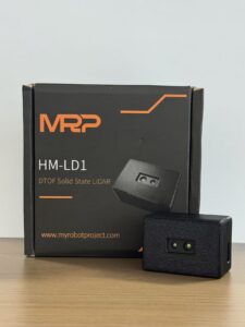
The DTOF Solid State LiDAR HM-LD1 is a compact SPAD dToF LiDAR module designed to deliver real-time depth images and 3D point cloud data for accurate environmental perception. For drone developers, its key advantages are low weight, compact size, low power consumption, and multiple integration interfaces. It is especially relevant for small UAV altitude hold, terrain following, short-range obstacle detection, autonomous navigation research, smart inspection, distance detection, and robotic vision development.
Unlike large aerial survey LiDAR systems, the HM-LD1 is best understood as a compact depth-sensing and perception module. It supports indoor or nighttime ranging up to 25m and outdoor daytime ranging up to 8m, making it useful for near-field sensing where drones need immediate distance awareness. Its 40 × 30 resolution provides a depth grid, while its output can be used for depth maps and point cloud visualization. The module supports UVC, UDP, and UART interfaces, helping developers connect it to PCs, Raspberry Pi, flight controllers, embedded Linux systems, and other development platforms.
Learn more:
DTOF Solid State LiDAR HM-LD1
| Specification | DTOF Solid State LiDAR HM-LD1 | Why It Matters for Drones |
|---|---|---|
| Dimension | 43.5mm × 30mm × 26.5mm | Compact size helps integration into small UAV frames, gimbals, robot bodies, and embedded sensing modules. |
| Ranging Capability | Indoor: 0.5–25m; Outdoor: 0.2–8m | Suitable for indoor/nighttime ranging and short-range outdoor sensing such as obstacle detection and altitude assistance. |
| Ranging Accuracy | ±3cm | Useful for near-field distance measurement, proximity detection, landing support, and robotics perception. |
| Field of View | 60° horizontal × 45° vertical | Provides a depth-sensing window for detecting nearby objects, terrain changes, and forward/downward obstacles. |
| Weight | 28g | Low mass helps preserve drone flight time and payload capacity. |
| Resolution | 40 × 30 | Provides a depth grid suitable for embedded perception, obstacle zones, and distance mapping. |
| Frame Rate | 10fps | Supports real-time depth updates for controlled UAV sensing and robotics development. |
| Interface | UART / UDP / UVC | Enables integration with embedded controllers, networked systems, PCs, Raspberry Pi, and development platforms. |
| Operating Temperature | -20℃ to 60℃ | Supports use in a broad range of field, indoor, and industrial environments. |
| Power Consumption | 1.2W | Low power draw is valuable for battery-powered UAV and robotic systems. |
| SDK Support | x86 Windows, x86 Linux, arm Linux | Reduces development time for PC, Raspberry Pi, embedded Linux, and robotics projects. |
View Product Details & Pricing ➔
Point Cloud and Depth Map Output
The HM-LD1 can provide ranging measurement data that may be displayed as point cloud and depth data. For drone and robotics developers, this matters because raw distance measurements become more useful when visualized or processed as spatial information. A depth map can be used for obstacle zones and distance thresholds, while point cloud output can support local 3D perception and environment understanding.
Long Measurement Range for a Compact Module
The module is designed for accurate ranging measurement, including outdoor measurement at up to 8 meters under stated clear daytime conditions. This capability can support distance measurement to objects that may be difficult for people to approach, such as bridges, expressways, dams, industrial structures, and inspection targets. For UAV use, the outdoor 0.2–8m range should be viewed as a near-field sensing capability rather than a replacement for long-range aerial survey LiDAR.
Compact and Lightweight Design
With a 28g weight and compact housing, the HM-LD1 is practical for devices where space and payload are limited. Drones are highly sensitive to payload mass because extra weight reduces endurance and may affect flight dynamics. A lightweight LiDAR module can be integrated into small UAVs, autonomous mobile robots, embedded test rigs, and compact inspection systems with less impact on power budget and mechanical design.
Advanced 3D Sensing with Environmental Adaptability
The HM-LD1 is a solid-state LiDAR module based on SPAD dToF technology. It delivers real-time depth images and 3D point cloud data for environmental perception. Its specified ranging is 0.5–25m indoors or in nighttime conditions and 0.2–8m outdoors during daytime. This makes it suitable for obstacle avoidance, distance detection, autonomous navigation, smart inspection, and robotic vision development. With UVC, UDP, and UART interfaces, it can be integrated with PCs, Raspberry Pi, flight controllers, and embedded platforms for both prototyping and deployment.
Multi-Scenario dToF LiDAR Applications
This dToF LiDAR module supports applications for drones, robots, cameras, and security systems. For UAVs, it can help with altitude hold, terrain following, and short-range obstacle detection. For robots, it can assist navigation, obstacle avoidance, and SLAM research. The same depth sensing principle can also support autofocus, user presence detection, object recognition, volume measurement, and zone intrusion monitoring in other embedded systems.
Development Platform Support
MRP offers SDKs for x86 Windows, x86 Linux, and arm Linux. This support helps engineering teams integrate the LiDAR into diverse operating systems and architectures. For UAV developers, arm Linux support is especially valuable because many companion computers and embedded robotics platforms run Linux on ARM-based processors.
Best-Fit Drone Use Cases for HM-LD1
The HM-LD1 is a strong candidate for small UAV obstacle detection, altitude hold, terrain following, indoor navigation, low-altitude inspection, embedded LiDAR development, robotics vision prototyping, and smart perception testing. Its low weight and low power consumption make it particularly attractive for drones where a full survey payload would be too heavy or unnecessary.
✅ Best-fit HM-LD1 drone applications include: short-range forward obstacle sensing, downward altitude measurement, indoor UAV testing, close-range inspection standoff, terrain following experiments, embedded Linux perception projects, and robotics development platforms that need depth data without a heavy payload.
What HM-LD1 Is Not Intended to Replace
A compact 40 × 30 dToF module should not be positioned as a replacement for high-end survey-grade aerial LiDAR systems used for large-area topographic mapping. Professional mapping systems may include high-density scanning, precision positioning, calibrated IMU integration, and specialized processing workflows. The HM-LD1 is better framed as a compact depth-sensing and perception module for UAV sensing, robot vision, obstacle detection, terrain following, and embedded development.
Download the product brochure:
DTOF SSL HM-LD1 Product Brochure
Integration Tips for UAV Developers
Successful LiDAR integration requires more than connecting wires. A drone developer must consider mounting position, vibration, power stability, EMI, data bandwidth, software processing, and safety logic. The sensor is only one part of the perception system. In the shop, the difference between a good prototype and a frustrating prototype is usually not the sensor spec sheet. It is the integration work around it.
Mounting Direction
Mounting direction should match the sensing goal. A forward-facing LiDAR helps detect obstacles in the flight path. A downward-facing LiDAR supports altitude hold, landing assistance, and terrain following. An angled LiDAR may be useful for inspection where the drone must maintain distance from a wall, roof, bridge, or industrial surface. Multiple sensors may be required if the drone needs broad coverage.
Vibration and Mechanical Isolation
Drone motors and propellers generate vibration. Vibration can affect measurement stability, connector reliability, and mechanical alignment. Developers should use secure mounting, strain relief, appropriate fasteners, and vibration isolation where needed. The sensor should be protected from propeller wash, debris, and accidental impact while maintaining a clear field of view.
Power Supply Design
Power design should provide stable voltage and adequate current. UAV electrical systems can be noisy due to motors, ESCs, radios, and power converters. Poor cable routing or unstable supply can create communication errors or measurement instability. Low-power modules such as the HM-LD1 are easier to integrate, but engineers should still consider filtering, grounding, cable length, and EMI management.
Data Interface Selection
UART is often appropriate for lightweight embedded communication. UDP is useful when streaming data over a network to a companion computer. UVC can simplify camera-style streaming in PC or embedded vision pipelines. The best choice depends on bandwidth, latency, software architecture, processor capability, and the amount of data needed by the control system.
Software Integration
Software integration may include Linux, Windows, arm Linux, Raspberry Pi, Jetson-class computers, ROS pipelines, OpenCV depth processing, obstacle maps, and flight control loops. Developers should convert raw depth or point cloud data into actionable information. For example, the software may divide the depth map into zones, calculate minimum distance in each zone, filter unreliable returns, and generate warnings or commands.
Control Logic and Safety
LiDAR data does not automatically make a drone safe. The aircraft must have software logic that defines detection thresholds, speed limits, braking distances, failsafe behavior, and obstacle response. Testing should begin in controlled environments at low speed. Engineers should confirm that the drone reacts correctly to walls, people, thin objects, dark surfaces, reflective surfaces, and sunlight conditions before moving to more complex environments.
⚙️ A practical integration checklist should include: mount rigidity, field-of-view clearance, power filtering, connector strain relief, interface bandwidth, SDK compatibility, timestamp handling, depth filtering, obstacle thresholds, emergency stop logic, and repeated testing under real lighting conditions. Do not skip the boring checks. Those are usually the ones that save the aircraft.
Common Beginner Mistakes When Using LiDAR and Drones
Beginners often underestimate system-level engineering. A LiDAR sensor may have excellent specifications, but final drone behavior depends on mounting, power, software, environment, and control design. Avoiding common mistakes can save time and reduce risk.
Confusing Mapping LiDAR with Obstacle Avoidance LiDAR
High-density mapping and real-time obstacle avoidance are different engineering goals. A mapping LiDAR may generate excellent point clouds for post-processing but may not be optimized for lightweight drone control. A compact perception LiDAR may support real-time obstacle detection but may not create survey-grade maps. Select the sensor for the job.
Ignoring Payload Weight
Payload weight includes more than the sensor. Cables, mounts, protective cases, companion computers, antennas, and power hardware all add mass. Extra payload can reduce flight time, increase motor load, and change the aircraft’s center of gravity. Small drones require especially careful weight budgeting.
Overlooking Outdoor Sunlight Performance
Outdoor performance can differ significantly from indoor performance. Strong sunlight can reduce effective range for some optical sensors. Always check outdoor range specifications and test in the actual lighting conditions expected during operation. For example, the HM-LD1 specifies different indoor and outdoor ranging capabilities, which helps developers plan realistic use cases.
Choosing Range Without Considering FOV
Long range alone is not enough. A sensor must see the obstacle area. A narrow FOV may miss objects outside its coverage, while a wide FOV gives more context but may have tradeoffs in resolution and processing. The sensor’s field of view should match the drone’s speed, direction, and expected obstacle locations.
Forgetting Software and SDK Support
Even good hardware can slow a project if the development team lacks drivers, SDKs, sample code, or technical support. Before buying a LiDAR module, confirm operating system support, communication protocol documentation, data format, visualization tools, and integration examples. SDK support for x86 Windows, x86 Linux, and arm Linux can be a major advantage for prototyping and deployment.
Flying Too Fast for the Sensor and Control Loop
A drone must detect an obstacle early enough to react. Detection range, update rate, processing latency, braking distance, and flight speed must be considered together. A slow inspection drone may safely use a shorter-range sensor, while a fast autonomous drone may need longer range, faster updates, and more advanced control logic. Always test with safety margins.
Start your UAV LiDAR development project
Explore the HM-LD1 solid-state dToF LiDAR module for drone altitude hold, obstacle detection, terrain following, smart inspection, and robotic vision development.
Got tired of bulky LiDAR setups for simple depth tasks
FAQ About LiDAR and Drones
Is there any LiDAR for small drones?
What is the difference between drone LiDAR and drone photogrammetry?
What should beginners consider before buying a LiDAR drone setup?
Can LiDAR drones fly at night?
Can LiDAR help a drone avoid trees, walls, and power lines?
Is LiDAR better than radar for drones?
How accurate is drone LiDAR?
What data does a drone LiDAR sensor output?
Can a small LiDAR module be used for UAV mapping?
What interface is best for connecting LiDAR to a drone?
📚 References & Further Reading
- Industry Standard: AMS Osram and domisensor
- Related Guide: DTOF Solid State LiDAR HM-LD1 and DTOF SSL HM-LD1 Product Brochure






