

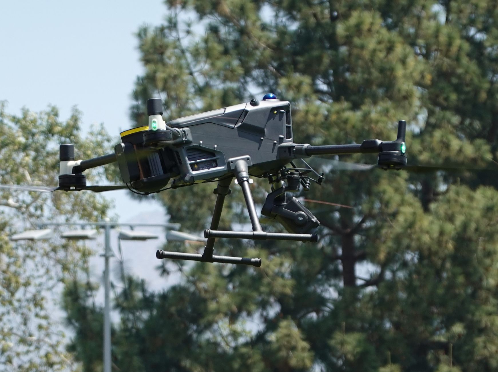
Drone LiDAR Guide: Best Use Cases, Specs, and Setup Tips for UAV Mapping
Look, drone LiDAR has become the practical bridge between aerial imaging and dependable 3D spatial data. For years, UAV mapping leaned hard on photogrammetry, and there’s no doubt it still earns its keep when the light is good, the surfaces have texture, and the image overlap is dialed in. But drone lidar adds a different kind of confidence because it measures distance directly. In the real world, that means you can capture terrain, structures, vegetation, and hard-to-reach assets with more consistent depth information when the job gets ugly, dim, repetitive, or just plain difficult for cameras.
For engineers and UAV buyers, the real question is never just “What has the longest range?” Here’s the deal: payload limits, outdoor ranging behavior, integration complexity, power draw, field of view, and data interface all decide whether a LiDAR module is actually usable in flight. A compact solid-state dToF module such as the DTOF Solid State LiDAR HM-LD1 is a good example of the kind of sensor that can make sense on smaller UAVs. It is built for lightweight 3D sensing, depth output, and flexible interfaces that can support UAV inspection, altitude awareness, terrain following, and robotic perception without turning the drone into a brick.
Table of Contents
- 👉 What Drone LiDAR Is and Why It Matters
- 👉 How Drone LiDAR Works on a UAV
- 👉 Best Drone LiDAR Use Cases for Industrial UAV Mapping
- 👉 Drone LiDAR Specs That Matter Most
- 👉 How to Choose the Right Drone LiDAR System
- 👉 Drone LiDAR Setup Tips for UAV Integration
- 👉 Drone LiDAR Mapping Workflow From Flight Plan to Output
- 👉 Real Product Example: DTOF Solid State LiDAR HM-LD1
- 👉 Drone LiDAR Applications Across Industrial Sectors
- 👉 Common Drone LiDAR Mistakes to Avoid
- 👉 Drone LiDAR Buying Checklist for Engineers and Integrators
- 👉 FAQ
What Is Drone LiDAR and Why It Matters
Drone LiDAR is a UAV-mounted sensing method that uses laser-based ranging or time-of-flight measurement to calculate distance from the aircraft to surrounding surfaces. Instead of estimating geometry only from overlapping photographs, a drone lidar system measures spatial depth directly and can turn that range data into depth maps, obstacle maps, or 3D point clouds. In industrial work, that matters because a lot of the assets people care about are hard to reach, risky to inspect, or expensive to measure by hand. A UAV carrying LiDAR can work bridges, rooftops, power corridors, dams, construction sites, stockpiles, forest canopies, and other places where a ground crew would burn a lot of time or take unnecessary risk.
From an engineering standpoint, LiDAR gives drone operators a measurement channel that depends less on visual texture than camera-only mapping. That is a big deal for concrete walls, uniform roofs, dark tunnel entrances, utility structures, repetitive crop rows, and vegetation. It also helps when the job is about fast assessment rather than pretty imagery. The output may be a survey-style point cloud, a depth image for machine perception, or a proximity signal for flight assistance. Which one matters most depends on the mission, the aircraft class, the processing hardware, and how precise the final deliverable needs to be.
Drone LiDAR vs Photogrammetry
Photogrammetry still earns a lot of respect in UAV mapping because it produces color-rich models from camera images. It can deliver orthomosaics, textured 3D meshes, and documentation that non-technical stakeholders usually understand right away. The catch is that photogrammetry needs good overlap, stable lighting, visible surface texture, and careful camera calibration. When the scene has repetitive surfaces, shadows, moving vegetation, reflective materials, or low visual detail, photogrammetry can struggle to rebuild geometry cleanly.
LiDAR fills in the gaps by measuring range more directly. Drone lidar can improve mapping confidence in low light, over repeating textures, around structural edges, and in places where geometry matters more than color. In vegetation work, LiDAR can describe canopy structure and ground elevation more effectively than images alone, depending on the sensor class and the mission setup. In a lot of industrial programs, the smartest answer is to use both methods together: LiDAR handles geometry and depth consistency, while cameras handle color, context, and visual inspection records.
The broader LiDAR ecosystem includes established industrial perception companies such as Cepton Technologies, which is a good reminder that LiDAR has moved well past the research lab stage. It now shows up in transportation, smart infrastructure, robotics, and industrial sensing. For UAV teams, that market maturity matters because it raises the bar for reliability, integration support, environmental performance, and long-term availability.
Why UAVs Changed the LiDAR Market
UAVs changed LiDAR deployment by lowering the cost and complexity of collecting aerial 3D data. Traditional airborne LiDAR often meant manned aircraft, expensive payloads, specialized pilots, and a lot of logistics. Drones let smaller teams inspect assets more often and reach places that would otherwise need scaffolding, rope access, road closures, boats, or helicopter support. That shift created demand for lighter, lower-power, easier-to-integrate LiDAR modules that fit smaller airframes.
Industrial users now expect drone lidar to support construction progress tracking, corridor mapping, infrastructure inspection, autonomous navigation research, facility monitoring, and emergency response. The UAV itself is only one part of the system. The whole package includes the sensor, mounting method, power supply, onboard computer, flight controller, data logger, software stack, calibration procedure, and post-processing workflow. In the shop, the best results come from treating LiDAR as part of an integrated airborne measurement system, not as a standalone accessory.
How Drone LiDAR Works on a UAV
A drone LiDAR system works by emitting optical signals, capturing the reflected signal from a target, and calculating distance based on how that signal returns. Different LiDAR architectures use different scanning methods and detection principles, but the industrial goal stays the same: convert the physical distance between the UAV and the environment into usable digital data. That data may come out as points, frames, depth maps, or structured measurement packets depending on the sensor design.
On a UAV, the measurement chain has to survive vibration, motion, changing sunlight, changing target reflectivity, and strict power constraints. The aircraft may be moving forward, rotating slightly, changing altitude, or correcting for wind. A reliable drone lidar setup therefore depends on stable mechanical mounting, clean power, sensible flight speed, correct sensor orientation, and synchronization with other data sources when needed. Even a strong LiDAR module can deliver weak results if the installation is sloppy.
Time-of-Flight and dToF Basics
Time-of-flight LiDAR measures distance by looking at how long light takes to travel from the sensor to an object and back again. In direct time-of-flight, usually called dToF, the system emits a light pulse and detects the returned photons. Since the speed of light is known, the travel time can be converted into distance. That approach is attractive for compact modules because it supports direct distance measurement without demanding large mechanical assemblies.
dToF modules are especially useful for UAVs and robots when the application needs compact 3D sensing, proximity awareness, or depth imaging. A drone does not always need a large long-range mapping payload. In a lot of use cases, the job is simply detecting nearby structures, following terrain, maintaining safer altitude, or feeding perception software with range information. Compact solid-state designs help reduce the integration burden, which is often the real bottleneck on small UAV platforms.
From Range Data to Point Cloud
Raw distance measurement becomes useful once software organizes it into something meaningful. A simple sensor may provide single-point distance, while a multi-pixel depth sensor can provide a grid of range measurements. Those measurements can be visualized as a depth map, where closer and farther areas show up as different depth values. With the right geometry and calibration, the data can also be reconstructed into a point cloud that represents surfaces in 3D space.
For drone lidar applications, point clouds are useful for terrain mapping, obstacle detection, volume estimation, structural inspection, and navigation algorithms. Depth maps are often better for embedded perception because they are structured and easier to process in real time. The right output depends on the job. A mapping team may care most about point cloud density and georeferencing, while a UAV autonomy developer may care more about latency, frame rate, interface simplicity, and whether the data can feed a flight or companion-computer pipeline without a lot of friction.
Why Solid-State Matters
Solid-state LiDAR matters because UAVs put real mechanical stress on sensors. Rotors create vibration, rapid maneuvers create acceleration, and outdoor deployments expose gear to temperature swings and rough handling. A solid-state module with fewer moving parts is often easier to package, easier to mount, and more tolerant of compact UAV environments than a larger mechanical scanning unit. It also helps cut weight and power, and both of those things hit flight time directly.
For small drones, every gram and every watt is a system-level decision. A LiDAR that looks great on paper can turn into a headache if it needs a heavy mount, dedicated cooling, a large power reserve, or complicated communications hardware. Solid-state drone lidar modules lower those barriers, which makes them attractive for inspection drones, robotics research platforms, and lightweight mapping prototypes where the mission does not call for a full professional airborne survey payload.
Environmental Challenges
Outdoor LiDAR performance depends on sunlight, target reflectivity, range, weather, dust, and aircraft motion. Bright sunlight can reduce effective range by raising background optical noise. Dark or low-reflectivity surfaces may return weaker signals than bright surfaces. Highly reflective or transparent materials can create measurement headaches. Rain, fog, dust, and airborne particles can scatter light and introduce noise or missing returns.
Motion matters too. If the drone flies too fast relative to the sensor frame rate and resolution, the data can get sparse, blurred, or difficult to line up with telemetry. For mapping and inspection, slower and steadier flight usually improves the output. For obstacle awareness, the sensor has to update quickly enough for the flight or companion computer to react. That is why engineers should evaluate not only maximum range but also frame rate, field of view, latency, interface, mounting angle, and actual outdoor test conditions.
Best Drone LiDAR Use Cases for Industrial UAV Mapping
The best drone lidar use cases are the ones where direct distance measurement solves a real problem. That may mean measuring terrain where cameras struggle, inspecting assets that are unsafe to approach, helping a drone fly at low altitude, or building 3D perception for autonomy. LiDAR is not always a replacement for cameras. In a lot of projects, it becomes the sensor that gives the geometry more backbone while the camera provides the visual story.
Terrain Mapping and Elevation Modeling
Terrain mapping is one of the most recognized uses of UAV LiDAR. A drone can fly planned lines over a site and collect depth data that supports digital elevation models, digital surface models, slope analysis, and cut/fill calculations. Construction teams use those outputs for site planning, progress tracking, earthwork estimation, and quality checks. Civil engineers use them for road corridors, embankments, drainage areas, and terrain change detection.
Compared with camera-only methods, LiDAR can be more reliable when terrain lacks visual texture or when vegetation makes surface interpretation harder. The actual performance depends on the sensor class and the processing workflow, but the core advantage stays the same: drone lidar measures distance instead of inferring geometry only from image matching. For teams working in changing field conditions, that direct measurement can lower uncertainty in a way that operators notice right away.
Powerline and Infrastructure Inspection
Infrastructure inspection is a natural fit for drone LiDAR because a lot of assets are tall, linear, remote, or hazardous. Powerline corridors, transmission towers, bridges, dams, rooftops, expressways, tunnel entrances, and industrial buildings can all benefit from UAV-based 3D sensing. LiDAR can help evaluate clearances, detect nearby obstacles, map structural geometry, and support repeat inspections over time.
For bridge and dam work, a drone lidar payload can help measure hard-to-reach surfaces and give 3D context to visual findings. For powerline work, range data can support corridor awareness and help operators understand the spatial relationship between conductors, towers, vegetation, and terrain. The accuracy requirement changes from one application to the next, so teams should match sensor capability to the inspection standard instead of assuming every LiDAR output is the same.
Agriculture and Forestry
In agriculture and forestry, drone lidar can support canopy profiling, vegetation structure analysis, terrain awareness, and obstacle-aware navigation. Forestry teams may use 3D data to estimate canopy height, vegetation density, and terrain variation. Agriculture teams may use LiDAR to understand crop structure, orchard geometry, or field obstacles that affect autonomous machinery and UAV flight paths.
LiDAR is especially useful when shape matters more than color. Cameras are excellent for multispectral analysis and plant health imaging, but they do not always describe 3D structure well. A combined workflow can provide both geometry and visual information, which gives agronomy, forestry planning, and environmental monitoring teams a richer dataset to work from.
Search, Rescue, and Emergency Surveying
Emergency teams need fast spatial awareness. Drone lidar can support rapid terrain assessment, obstacle localization, and low-visibility operations where camera imagery alone may not be enough. In search and rescue, a UAV may need to fly near trees, buildings, slopes, debris, or damaged infrastructure. LiDAR can improve situational awareness by giving the aircraft or operator another depth channel to work with.
Emergency surveying also benefits from repeatable data collection. After floods, landslides, fires, or structural failures, teams may need to compare the current geometry against previous conditions. Drone-based LiDAR can help document changes and prioritize response areas. The system has to be easy to deploy, tough enough for field conditions, and compatible with fast processing workflows when time matters.
UAV Altitude Hold and Terrain Following
Small solid-state LiDAR modules can support more stable flight behavior by providing range information for altitude hold, terrain following, and proximity awareness. This is different from large-scale mapping. Instead of building a dense survey deliverable, the sensor supports real-time decision-making. A drone flying over uneven ground, rooftops, industrial equipment, or vegetation can use depth measurements to preserve safer clearance.
When building advanced autonomy, LiDAR is often paired with cameras, inertial sensors, and visual-inertial pipelines. For more background on sensor fusion and navigation, see this related guide on building VIO and VSLAM systems. The best UAV autonomy stacks usually lean on multiple sensing modes because each one has strengths and weak spots under different lighting, texture, and motion conditions.
Drone LiDAR Specs That Matter Most
Buying drone lidar is not a one-number exercise. Range, accuracy, field of view, frame rate, resolution, interface, weight, power consumption, and SDK support all decide whether a sensor works in the actual aircraft. A technically impressive sensor can still be the wrong UAV choice if it is too heavy, too power-hungry, too difficult to mount, or incompatible with the processing stack.
Weight and Payload Budget
Weight is usually the first constraint in UAV integration. Every gram added to the aircraft cuts into payload margin and can shorten flight time. A LiDAR sensor also needs cables, connectors, mounting hardware, and sometimes a companion computer or data logger. Engineers should evaluate the total installed weight, not just the sensor module by itself.
Payload location matters almost as much as payload mass. A badly placed LiDAR can shift the center of gravity, affect flight stability, increase vibration, or block propeller airflow. Lightweight modules are especially valuable for small drones because they preserve endurance and simplify mechanical design. For compact UAVs, a 28 g class sensor can be much easier to justify than a heavier payload built for larger mapping aircraft.
Range and Outdoor Performance
Range has to be judged under realistic conditions. Indoor range and outdoor range are often different because sunlight affects optical sensing. A drone lidar module that performs well in a controlled indoor environment may have a shorter useful range in bright daylight. UAV users should pay attention to outdoor specifications, target reflectivity, and test reports instead of relying only on a maximum advertised number.
For low-altitude inspection, obstacle awareness, and terrain following, short-to-medium range may be enough. For high-altitude mapping or wide-area surveying, a longer-range payload may be necessary. The right choice depends on flight altitude, required ground coverage, safety margin, aircraft speed, and the size of the target features you actually care about.
Accuracy and Repeatability
Accuracy describes how close a measurement is to the true distance, while repeatability describes whether the sensor gives consistent results under similar conditions. Both matter. A nominal accuracy figure such as ±3 cm can be very useful in a lot of UAV workflows, but field performance depends on mounting, calibration, target surface, sunlight, vibration, and processing quality.
For mapping, accuracy also has to be considered alongside georeferencing. A LiDAR module may measure distance accurately relative to the drone, but the final point cloud also depends on the quality of aircraft positioning, attitude estimation, time synchronization, and calibration. For obstacle awareness, relative accuracy and low latency may matter more than survey-grade absolute positioning.
Field of View
Field of view determines how much of the scene the sensor can see at once. A wider horizontal field of view supports obstacle awareness across more of the aircraft’s forward or downward direction. A wider vertical field of view can help detect changes in terrain height, walls, slopes, or obstacles above and below the centerline. The trick is that FOV always has to be balanced against resolution. A wide FOV with very low resolution may not show enough detail for small objects.
Mounting angle also changes the useful FOV. A forward-facing LiDAR can support obstacle detection and navigation, while a downward-facing LiDAR can support altitude hold, terrain following, and ground mapping. Some jobs benefit from an angled mount to capture both forward and downward context. Engineers should pick the orientation based on the mission instead of defaulting to a generic installation.
Resolution and Frame Rate
Resolution determines how many measurement points or pixels are available in each depth frame. Higher resolution can capture more scene detail but can also require more processing bandwidth. Frame rate determines how often the sensor updates. Higher frame rate improves motion handling and responsiveness, but it can increase data load and power needs.
For steady mapping and controlled inspection, a moderate frame rate may be fine if the drone flies slowly and consistently. For high-speed obstacle avoidance, frame rate and latency become more critical. UAV integrators should test sensor output at the intended flight speed and altitude to make sure the data stays useful in real motion conditions, not just on a bench.
Interface and SDK Support
Interface compatibility often decides how fast integration moves. UART can be convenient for embedded systems and flight-controller-adjacent applications. UDP can support network-based data transfer to companion computers. UVC can make depth or video-style data access easier on PC and embedded platforms that support camera-like input. A flexible drone lidar module with multiple interfaces gives engineers more room to prototype and deploy.
SDK availability matters just as much. Support for x86 Windows, x86 Linux, and ARM Linux can cut development time because teams can work across desktop testing, Linux robotics stacks, and embedded ARM platforms. Without decent documentation and software support, even a strong sensor can turn into a delay machine when it comes time to build drivers, parse data, log output, and visualize results.
Environmental Ratings and Power
Operating temperature and power consumption affect mission reliability. A UAV may fly in cold mornings, hot rooftops, direct sun, or industrial environments where the thermal load changes fast. The sensor should stay inside its expected temperature range and remain stable for the whole flight. Power draw matters too because drones have limited battery capacity and onboard electronics compete for the same energy budget.
Low power consumption is especially valuable for small drones. A 1.2 W LiDAR module hits the battery much less than a heavier, higher-power payload. Still, engineers need to account for the full system, including the companion computer, communication links, storage devices, and any regulators required to power the sensor safely.
How to Choose the Right Drone LiDAR System
The right drone lidar system is the one that fits the mission, the aircraft, the processing stack, and the field workflow. Buyers sometimes start with the longest range or highest resolution they can find, but that approach often creates cost and integration pain that never pays off. A better move is to define the mission first, then pick the sensor that meets the actual performance need with the least practical burden on the UAV.
Match the Sensor to the Mission
Mapping, inspection, and autonomy all ask for different things. A mapping mission may prioritize point cloud quality, georeferencing, flight planning, and post-processing. An inspection mission may prioritize close-range measurement, structural detail, easy deployment, and visual context. An autonomy mission may prioritize latency, frame rate, field of view, and compatibility with navigation software.
Short-range indoor or rooftop tasks may not need a long-range survey payload. Outdoor daytime corridor work may need stronger sunlight performance and more careful validation. For terrain following and altitude hold, downward range stability may matter more than point density. Defining the mission keeps you from overbuying and helps prevent the common mistake of choosing a sensor that is powerful but a bad fit for the actual UAV job.
Match the Sensor to the Drone Class
Micro UAVs, small inspection drones, and larger mapping platforms all have different payload budgets. A micro UAV may only support a compact module and minimal wiring. A small inspection drone may carry a LiDAR, camera, and lightweight companion computer. A larger mapping platform may support heavier sensors, GNSS equipment, inertial measurement units, and more complex mounts.
Endurance tradeoffs need to be considered early. If adding a LiDAR cuts flight time too much, the aircraft may need a bigger battery, a different mounting layout, or a different mission plan. A lighter solid-state module can extend the range of practical UAV applications by trimming the total burden on the drone.
Match the Sensor to the Processing Stack
A LiDAR sensor is only useful if the data gets to the software that needs it. Engineers should confirm whether the sensor can connect to the flight controller, companion computer, or data logger using the available interfaces. They should also confirm that the output format is compatible with the intended software environment, whether that is custom C/C++ development, Python tools, ROS-based robotics, Linux data logging, or Windows visualization.
SDK support can be the deciding factor. A sensor that supports common development platforms can shorten the path from bench testing to flight testing. For teams building perception systems, the sensor should provide stable access to depth frames, point cloud data, or range measurements in a format that can be time-aligned with flight telemetry without a bunch of workaround code.
Common Buying Mistakes
One common mistake is choosing by range alone. Range matters, but it does not guarantee useful data if resolution, frame rate, sunlight performance, and mounting are wrong. Another mistake is ignoring power draw. A sensor that consumes too much power can reduce flight time or force an electrical redesign. Buyers also overlook field of view and only discover during flight tests that the sensor cannot see enough of the scene.
Validation is essential. Review available performance reports and test data before committing to a design. For more context on interpreting module behavior and test claims, see this D20 module performance test report. Every product and mission is different, but the habit of reviewing real test evidence helps engineering teams make smarter procurement decisions.
Drone LiDAR Setup Tips for UAV Integration
Successful drone lidar integration starts before the first flight. Mechanical, electrical, and software decisions all affect data quality. A clean installation makes calibration easier, cuts troubleshooting time, and improves confidence in field results. Engineers should treat installation as a system design task, not just as a matter of bolting a sensor to a drone frame.
Mechanical Mounting
The LiDAR should be mounted securely with minimal vibration. The sensor window has to stay clear of landing gear, propellers, cables, payload brackets, or protective guards. If the sensor faces downward, the mount should preserve a clear view of the ground during normal flight attitudes. If the sensor faces forward, it should be angled to cover the expected obstacle zone.
Mounting should also respect center of gravity. A sensor mounted far from the aircraft centerline may affect balance or require flight controller compensation. Lightweight mounts are preferred, but they still have to be rigid enough to resist movement during acceleration and landing. If the sensor shifts between calibration and flight, the collected data may not line up correctly with the aircraft frame.
Electrical Integration
Electrical integration starts with power budget verification. Confirm the sensor’s power requirements, the available power rail, voltage compatibility, connector quality, and startup behavior. Regulators should provide stable power without adding too much electrical noise. Cable routing should reduce electromagnetic interference and avoid contact with moving parts or high-current motor wiring.
Startup sequencing may matter if the LiDAR has to initialize before the companion computer or data logger. Engineers should test power cycling, boot timing, and reconnection behavior on the bench before field deployment. A system that only works after manual reconnection can waste mission time and make the field crew lose confidence in the setup fast.
Software and Data Pipeline Setup
The software pipeline should be built around the selected interface. UART may be appropriate for simple range or embedded data transfer. UDP may be better for networked companion-computer workflows. UVC can simplify access to depth-style data in systems that can handle camera-like streams. The interface should support the needed data rate and latency.
Driver installation, SDK configuration, visualization, logging, and playback tools should all be tested before flight. Engineers should confirm that data can be recorded reliably and reviewed after the mission. A solid bench workflow makes field testing much easier because the team can separate sensor problems from aircraft problems.
Calibration and Validation
Calibration should start with known targets. Place objects at measured distances and compare sensor output under controlled indoor conditions. Then move outdoors and test the lighting and surface types expected in the real mission. Confirm that the sensor orientation matches the aircraft coordinate frame and that data aligns with flight telemetry when needed.
Validation should include drift checks, missing-return checks, and repeatability tests. If the drone will use LiDAR for terrain following or obstacle awareness, test the response at low speed before increasing mission complexity. Calibration is not a one-time formality. It is the step that turns a sensor installation into a trusted measurement system.
Field Test Checklist
A practical field test sequence starts with a static target test on the ground. Next, perform a low-speed hover test to confirm that vibration and airflow do not hurt data quality. Then run a short mapping or inspection pass at conservative speed. Finally, test safety fallback behavior, including what happens if the LiDAR signal gets weak, the data link drops, or the onboard computer stops receiving frames.
Document every test condition, including altitude, speed, lighting, surface type, temperature, mounting angle, and software version. That makes it easier to compare flights and diagnose changes. Industrial UAV teams should build repeatable validation procedures instead of relying on informal field impressions that nobody can reproduce later.
Drone LiDAR Mapping Workflow From Flight Plan to Output
A drone lidar mapping workflow starts with mission planning and ends with a usable output such as a point cloud, depth map, obstacle map, terrain model, or inspection overlay. Each stage affects the next one. A weak flight plan can create data gaps. Unstable flight can reduce alignment quality. Weak logging can make processing messy. Good workflows are repeatable, documented, and matched to the final deliverable.
Mission Planning
Mission planning defines altitude, speed, line spacing, overlap, takeoff location, safety boundaries, and environmental constraints. For LiDAR, altitude must be chosen based on sensor range and the level of detail required. Flying too high may reduce usable returns, while flying too low may require more passes and increase obstacle risk. Speed should match frame rate and data density requirements.
Line spacing and coverage strategy depend on field of view and mission output. Terrain mapping may require consistent coverage across the whole area. Infrastructure inspection may need targeted passes around specific structures. Corridor mapping may require long, stable lines with controlled turns. A good plan reduces aggressive maneuvers because sudden movement can make data alignment harder.
Data Collection
During data collection, stable flight is a big advantage. Avoid unnecessary acceleration, sharp turns, and abrupt altitude changes. Monitor sensor output if real-time visualization is available. Pick weather windows that minimize rain, fog, dust, and excessive wind. While LiDAR is less dependent on visual texture than cameras, environmental conditions still affect range and return quality.
Operators should also watch battery reserve. LiDAR missions may take longer than standard visual flights because slower speed improves data quality. If the drone carries extra processing hardware, power consumption may rise. Plan conservative flight segments rather than pushing endurance limits, especially during early validation.
Data Processing
Processing may include filtering noisy points, cleaning depth maps, aligning frames, merging flight lines, georeferencing, and exporting final data. The complexity depends on the sensor and output requirements. For simple obstacle awareness, processing may happen in real time onboard the drone. For mapping, post-processing may be required to create clean point clouds or terrain products.
Multi-sensor workflows often combine LiDAR with cameras, IMU data, GNSS, VIO, or SLAM pipelines. When localization matters, time alignment and coordinate calibration become critical. Teams building advanced perception stacks can connect LiDAR output with broader autonomy methods described in this guide to building VIO and VSLAM systems.
Output Types
The most common outputs include point clouds, depth maps, obstacle maps, elevation models, and inspection overlays. Point clouds are useful for 3D measurement, mapping, modeling, and engineering analysis. Depth maps are useful for perception and embedded systems because they provide structured distance information. Obstacle maps help navigation systems understand nearby hazards.
Inspection overlays combine LiDAR-derived geometry with visual or operational context. For example, a bridge inspection may use camera images for defect documentation and LiDAR data for spatial reference. A construction workflow may use point clouds for volume and progress measurement while using photos for stakeholder reporting. The best output is the one that supports a decision, not the one that produces the biggest file.
Real Product Example: DTOF Solid State LiDAR HM-LD1
The DTOF Solid State LiDAR HM-LD1 is a compact dToF LiDAR module designed for real-time depth images and 3D point cloud data. It is based on SPAD dToF technology and is positioned for accurate environmental perception in drones, robots, cameras, security systems, and embedded vision development. For UAV work, its value is strongest where compact size, low power draw, flexible interfaces, and short-to-medium range sensing matter more than carrying a big survey-grade payload.
The HM-LD1 supports indoor or nighttime ranging up to 25 m and outdoor daytime ranging up to 8 m according to the provided product details. That makes it relevant for obstacle avoidance, distance detection, autonomous navigation, smart inspection, robotic vision development, altitude hold, and terrain following. It can output depth and point cloud style data, and its UART, UDP, and UVC interfaces support integration with PCs, Raspberry Pi, flight controllers, and embedded platforms. MRP also offers SDKs for x86 Windows, x86 Linux, and ARM Linux, which can lower software integration effort for engineering teams.

Why This Module Fits Drone Work
Drone platforms are constrained by payload, power, and available mounting space. HM-LD1 deals with those constraints through a compact body, 28 g weight, and 1.2 W power consumption. Its solid-state design can simplify mechanical integration because it avoids the packaging burden that comes with larger scanning assemblies. For small UAVs, industrial inspection drones, and lightweight robotics platforms, that combination can make LiDAR practical where heavier options would be hard to justify.
The module’s 60° horizontal by 45° vertical field of view supports situational awareness for short-range sensing. Its 10 fps frame rate is appropriate for steady proximity sensing, controlled mapping passes, and development scenarios where the aircraft is not moving at high speed. Engineers should not treat it as a universal long-range mapping payload. It should be matched to missions where compact dToF depth sensing is the right tool for the job.
Best-Fit Applications
HM-LD1 is suitable for small UAVs that need lightweight range perception, industrial inspection drones that need compact depth awareness, robotics platforms that require 3D sensing, embedded vision prototypes, smart monitoring systems, and development projects involving obstacle avoidance or autonomous navigation. It can also support autofocus, user presence detection, object recognition, volume measurement, and zone intrusion monitoring in non-UAV applications.
For drones, the most practical use cases include UAV altitude hold, terrain following, low-altitude obstacle awareness, close inspection of industrial assets, and lightweight mapping prototypes. It is also a good candidate for engineering teams that want to evaluate dToF LiDAR behavior before committing to a larger system architecture.
| Specification | HM-LD1 Value |
|---|---|
| Dimension | 43.5mm*30mm*26.5mm |
| Ranging Capability | Indoor: 0.5-25m; Outdoor: 0.2-8m |
| Ranging Accuracy | ±3cm |
| FOV | 60°(H) x 45°(V) |
| Weight | 28g |
| Resolution | 40*30 |
| Frame Rate | 10fps |
| Interface | UART/UDP/UVC |
| Operating Temperature | -20 ℃ – 60 ℃ |
| Power Consumption | 1.2 W |
View Product Details & Pricing ➔
Interpreting the Specs for UAV Use
The 28 g weight is one of the most important UAV-relevant figures because small drones are very sensitive to payload mass. The 1.2 W power consumption is also attractive for battery-sensitive platforms because it limits the electrical burden of adding depth sensing. The 60° by 45° field of view gives useful coverage for proximity sensing, and the 40*30 resolution provides structured depth information that works well for embedded perception and development workflows.
The outdoor range of 0.2-8 m should be read realistically. It is a solid fit for close-range inspection, obstacle awareness, and low-altitude sensing, but it is not intended to replace high-altitude, long-range survey LiDAR systems. The 10 fps frame rate suits steady flight and controlled data collection rather than high-speed racing or aggressive maneuvering. The UART, UDP, and UVC interfaces make the module flexible for different integration strategies, especially when paired with SDK support for x86 Windows, x86 Linux, and ARM Linux.
For product documentation, the DTOF SSL HM-LD1 Product Brochure provides another reference point for engineers evaluating the module for UAV, robotic, and embedded sensing projects.
Drone LiDAR Applications Across Industrial Sectors
Drone lidar is useful across industries because a lot of organizations need reliable spatial data but cannot always collect it safely or efficiently from the ground. The same sensing principle can support construction, energy, transportation, security, robotics, and research, but the implementation priorities change by sector.
Construction and Surveying
Construction teams use UAV LiDAR for stockpile volume measurement, site progress monitoring, earthwork planning, slope analysis, and documentation. A drone can collect 3D data over active sites with less disruption than ground crews. LiDAR can help detect terrain changes, measure material movement, and support coordination between design plans and field conditions.
For surveying, the requirements are stricter. Teams must consider calibration, ground control, georeferencing, accuracy class, and repeatability. Compact LiDAR modules can support useful mapping and development workflows, but formal survey deliverables may require higher-grade positioning and processing systems. The key is to align the sensor with the required standard.
Energy and Utilities
Energy and utility companies inspect transmission lines, substations, wind turbines, solar farms, pipelines, and access roads. Drone lidar can help map clearances, detect encroaching vegetation, support asset modeling, and improve operator awareness near complex structures. UAVs reduce the need for manual climbing and can collect data in areas where access is limited.
For utility corridors, repeatability is important. Operators may need to compare vegetation growth, structural movement, or clearance changes over time. A consistent LiDAR workflow allows teams to track those changes more effectively and prioritize maintenance.
Transportation and Civil Infrastructure
Transportation agencies and civil engineering teams can use drone lidar for bridges, expressways, rail corridors, dams, embankments, retaining walls, and tunnel entrances. These environments often include hard-to-reach surfaces and safety risks for ground crews. A UAV can approach inspection zones quickly and gather spatial data that supports maintenance planning.
LiDAR is especially helpful when geometry is the main concern. Measuring clearances, structural shape, slope, or deformation requires reliable spatial data. Cameras provide essential visual detail, but depth data adds measurement context that improves engineering interpretation.
Security and Smart Monitoring
Security applications use LiDAR for zone intrusion detection, perimeter awareness, object presence, and facility monitoring. A drone equipped with LiDAR can patrol areas, inspect boundaries, or provide temporary monitoring after events. In fixed or mobile security systems, depth sensing can help distinguish real objects from visual background changes.
For smart monitoring, privacy and operational rules should be considered alongside technical performance. LiDAR can provide spatial awareness without relying entirely on high-resolution imagery, which may be useful in some facility applications. However, integration with alert logic, logging, and response workflows is essential.
Robotics and Research
Robotics researchers use LiDAR for SLAM, obstacle avoidance, autonomous navigation, sensor fusion, and prototype development. Drone lidar modules can serve as practical perception components for aerial robots, ground robots, and hybrid systems. A compact module with SDK support is useful in research because teams often need to test ideas quickly across different platforms.
In research settings, flexibility may be more valuable than maximum range. Interfaces, documentation, driver access, and operating system support determine how quickly a sensor can be integrated into experiments. That is one reason compact solid-state modules are widely evaluated in robotics and embedded vision development.
Common Drone LiDAR Mistakes to Avoid
Many drone lidar failures come from mismatched expectations, not from the sensing principle itself. A sensor selected for the wrong mission, installed poorly, or tested too casually can produce disappointing results. Avoiding common mistakes improves safety, data quality, and return on investment.
Buying the Wrong Range Class
Overbuying is common when teams purchase long-range payloads for short-range missions. That can increase cost, weight, power consumption, and integration complexity without improving the actual deliverable. Underbuying is risky too. A sensor with limited outdoor range may not work for high-altitude daylight mapping or wide corridor survey tasks.
The best approach is to define the required measurement distance under real environmental conditions. Indoor range, nighttime range, and bright outdoor range should not be treated as the same thing. If the mission is close inspection or terrain following, a compact module may be perfect. If the mission is high-altitude mapping, a different payload class may be needed.
Ignoring Payload and Power
Payload and power are system-level constraints. A LiDAR that exceeds the drone’s practical payload budget can reduce flight time, hurt stability, or force the use of larger batteries. A high-power sensor can create heat, voltage drop, and electrical noise issues. Even if the aircraft can lift the sensor, it may not perform efficiently during real missions.
Engineers should calculate total installed weight and total electrical load. Include brackets, cables, companion computers, regulators, and storage devices. Then test hover time and flight behavior with the complete payload installed. That prevents surprises once the aircraft gets out into the field.
Skipping Validation Flights
Skipping validation flights creates false confidence. Bench tests are necessary, but they do not expose all flight-related issues. Vibration, sunlight, aircraft attitude, wind, and motion can affect data quality. A short validation flight can reveal missing returns, misalignment, frame drops, or mounting movement before a mission depends on the system.
Validation should move in steps. Start with static targets, move to hover tests, then perform low-speed passes, and finally test representative mission conditions. Document the results so that later changes in mounting, firmware, or software can be compared against a known baseline.
Overlooking Software Compatibility
Software problems can delay projects more than hardware installation. Without SDK access, clear documentation, usable drivers, and reliable logging, teams may spend weeks building basic data pipelines. Interface selection matters too. A sensor may support a format that is convenient on a desktop but awkward on an embedded flight platform.
Industrial LiDAR vendors and perception companies, including references such as Cepton Technologies, show how important reliability, data consistency, and integration maturity are in real deployments. UAV buyers should use the same mindset when evaluating compact modules: the sensor has to work as part of a complete system.
Drone LiDAR Buying Checklist for Engineers and Integrators
A buying checklist helps teams move from general interest to a solid procurement decision. Drone lidar selection should involve engineering, operations, software, safety, and procurement stakeholders because the sensor affects aircraft performance, mission workflow, and final data quality.
Essential Questions
Start by asking what the payload budget is, what flight time is required, and whether the mission is indoor, outdoor, nighttime, daytime, or mixed. Confirm the required range, accuracy, field of view, and update rate. Identify whether the output must be a point cloud, depth map, simple distance stream, or obstacle signal. Determine whether the sensor needs to connect to a flight controller, companion computer, PC, or embedded Linux platform.
Also ask whether SDK access is available, whether documentation is complete, and whether the team can test the sensor before full deployment. For UAV integrators who need application guidance, custom deployment advice, or purchasing support, contacting the supplier early can reduce selection risk. You can reach the team through the contact page.
Procurement Priorities
Procurement should prioritize mission-fit accuracy, usable range, weight, power, environmental resilience, documentation, and support. The lowest-cost sensor is not always the lowest-cost system if it needs a lot of custom development. On the other hand, the most expensive sensor is not always the best choice if the mission only needs short-range sensing.
Ask for real specifications and test context. Confirm operating temperature, interface details, power consumption, mounting requirements, and software platform support. If multiple teams will use the system, factor in training time and repeatability. A good drone lidar purchase should reduce operational friction, not add hidden complexity.
Deployment Priorities
Deployment priorities include mounting, calibration, integration, logging, and testing. The sensor should be easy to mount securely and align consistently. The electrical design should be stable and field-serviceable. The software pipeline should let operators confirm that data is being captured correctly before flight.
Finally, define acceptance criteria. For example, the system may need to detect obstacles within a specific range, maintain stable altitude over uneven terrain, or produce a point cloud with enough detail for inspection. Clear acceptance criteria prevent vague evaluations and help teams decide whether a drone lidar setup is ready for operational use.
We’ve recently been testing the HM-LD1 compact dToF LiDAR in a variety of r…
FAQ
I’m a beginner—what should I look for in a drone LiDAR system?
Is there LiDAR for small drones with limited payload and power?
Can drone LiDAR be used for land surveying or waterway bathymetry on a budget?
What is the difference between solid-state LiDAR and mechanical LiDAR on drones?
How accurate is drone LiDAR in bright sunlight?
Can LiDAR help with drone obstacle avoidance?
What interfaces are best for UAV LiDAR integration?
How do you combine LiDAR with cameras or VIO/VSLAM?
Combining LiDAR with cameras or VIO/VSLAM takes calibration, synchronization, and a clean data architecture. Cameras bring texture and color, while LiDAR brings direct depth measurements. VIO and VSLAM use camera and inertial data to estimate motion and build spatial understanding. LiDAR can add range constraints, improve obstacle awareness, and help in scenes where visual texture is weak. The usual workflow is to mount the sensors rigidly, define the coordinate frames, calibrate the relative position and orientation between sensors, and align timestamps so the measurements line up with the same instant in flight. The processing stack may run on a companion computer using Linux or another development environment. For UAV autonomy, the goal is not just collecting more data; it is combining sensor strengths in a way that improves navigation reliability, mapping consistency, and safety.
📚 References & Further Reading
- Industry Standard: Cepton Technologies
- Related Guide: Build VIO/VSLAM Systems






