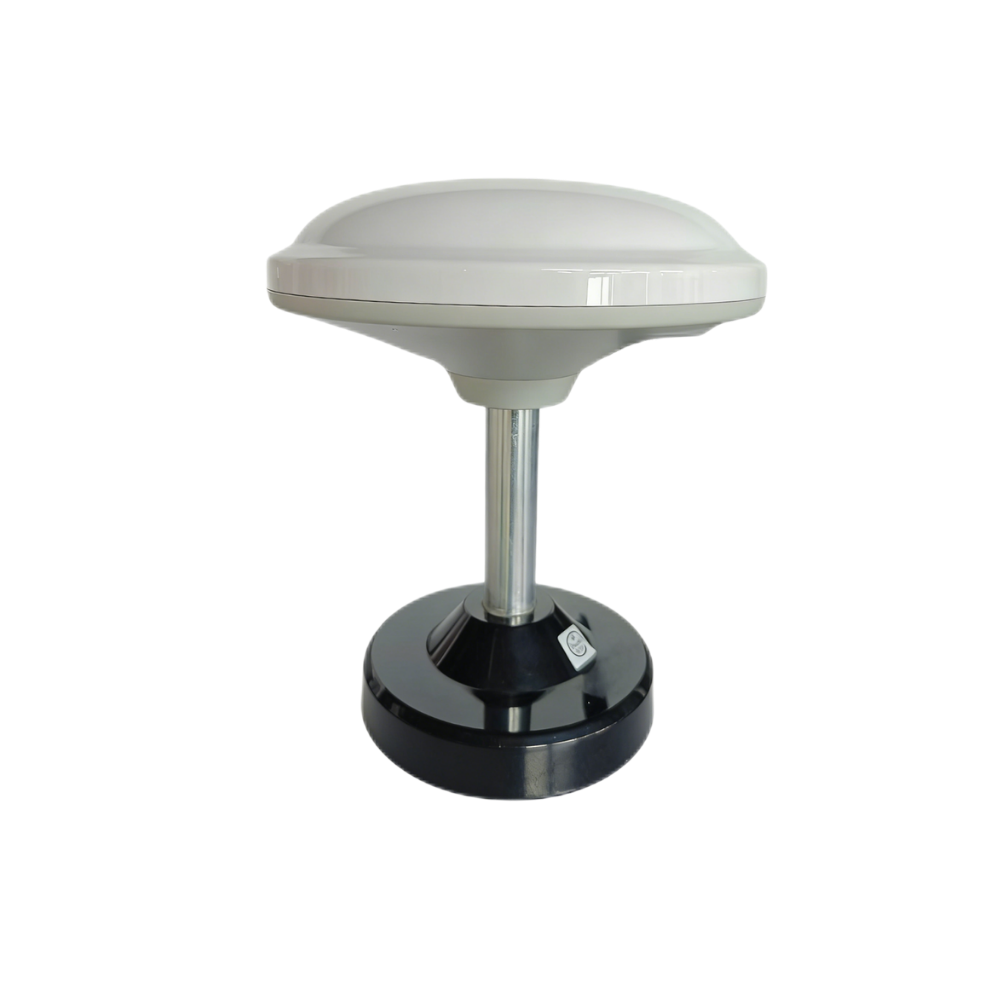
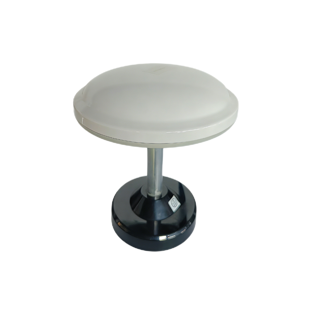
Multiband RTK Survey Module HM-D13
- Multiband RTK Survey Module centimeter-level differential positioning
- All-in-one: The receiver can be used as both a base station and a rover station.
- Integrated Design: Built-in GNSS module and GNSS antenna can receive and output data.
- Integrated LORA module, achieving 6km wireless connect performance
$200.00
DIMENSIONS
|
Frequency band |
GPS L1/L5, Beidou B1/B2A/B2I, Galileo E1/E5, QZSS L1/L5, GLONASS G1, IRNSS |
|
RTK position accuracy |
H: 1cm + 1ppm, V: 1.5cm + 1ppm |
|
Protocol |
NMEA 0183 output and RTCM input at rover side. RTCM output at base side. |
|
Baud Rate |
115200 bps |
|
Dimensions |
Φ152*67.9mm |
PRODUCT DETAILS
|
Weight |
<550 g |
|
Interface |
TTL level UART interface |
|
Timing synchronization accuracy |
20ns |
|
Operating Temperature |
-40 ℃ - 85 ℃ |
|
Others |
Supports 4G radio module and is optional |
Multi-system positioning, precise and stable
Capable of synchronously receiving BDS, GPS, GLONASS, GALILEO, QZSS and IRNSS satellite signals, perfectly fulfilling user needs.
Stable signal reception, Centimeter-accurate positioning
The product integrates modules and antennae. All-in-one design ensures more stable signal reception and precise positioning.
Excellent outdoor performance
Made of UV-resistant PC material, it resists discoloration during long-term outdoor use. With high protection level, it is windproof and rainproof, ensuring stable performance even in harsh environments.
Why choose us
We specialize in perception and positioning modules for robots and UAVs, and are a world-leading supplier of navigation devices and solutions.
Independent Research and Development Team
We have a professional independent R&D team, focusing on innovation of perception and positioning technology
technical support services
Provide professional technical support for product integration and application
Direct manufacturing from the source factory
Manufactured by the original factory, with in-house production for stable supply
Customized products on demand
We customize products on demand and provide one-stop technical support
Self-manufactured with steady supply guaranteed
In-house production for stable supply, supporting customized OEM/ODM needs
Customer Reviews
FAQ
1. Q: What is the expected positioning accuracy?
A: Under open-sky conditions with RTK corrections, the HM-D13 can achieve centimeter-level horizontal and vertical accuracy, making it suitable for professional surveying, mapping, and UAV navigation applications.
2. Q: How does the module output data?
A: The HM-D13 provides data via a TTL-level UART interface and supports standard protocols including NMEA and UBX, allowing seamless integration with survey controllers, drones, and embedded systems.
3. Q: Does the module require an external antenna?
A: No. The HM-D13 features a compact mushroom-shaped integrated GNSS antenna, eliminating the need for external antennas while ensuring optimal signal reception and system reliability.
4. Q: Can the module be connected to a flight controller or rover?
A: Yes. It can be connected directly via UART to compatible flight controllers, rovers, or survey devices. Users can then configure the module parameters according to their workflow or software requirements.
5. Q: Does the module require calibration or additional configuration before use?
A: The HM-D13 is pre-configured at the factory for standard RTK operation. Advanced configuration can be performed if users require custom settings for specialized survey workflows.
6. Q: How does the module handle signal loss or interference?
A: The HM-D13 uses multi-band and multi-constellation processing to minimize signal loss and maintain RTK fix reliability. In the event of temporary obstruction, it rapidly reacquires corrections without compromising survey accuracy.
7. Q: What environments is the HM-D13 suitable for?
A: The module is designed for outdoor surveying, UAV missions, construction site mapping, and robotics applications, where reliable centimeter-level RTK positioning is required across varying terrain and partially obstructed environments.
8. Q: Can this module integrate with existing survey software or systems?
A: Yes. The HM-D13 outputs standard GNSS/RTK data that can be parsed and integrated into existing survey software platforms, UAV navigation controllers, and robotic systems using ROS, Python, C++, or other compatible interfaces.
Applications
Robotic Dog
Education Research
Drone
Robot
| Weight | 1.075 kg |
|---|---|
| storage |
256 GB ,30GB |
Contact us
TEL: +8618926195421
Huangmei Road, Huangge Town, Nansha District, Guangzhou City, Guangdong Province, China
Email:[email protected]

Reviews
There are no reviews yet.