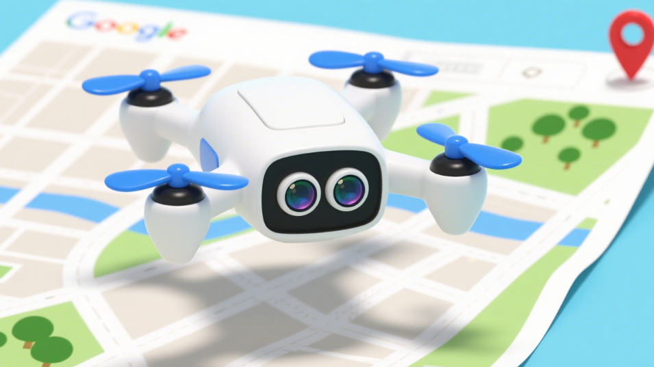
As drone technology evolves at a rapid pace and market demand continues to surge, drone visual positioning systems (VPS) have emerged as a practical and indispensable solution in the drone sector. This technology has not only transformed the landscape of the drone industry but also spawned numerous new business opportunities. How does it work? What real-world applications does it have? And how will it shape the future of aerial navigation? Let’s dive in and explore.

1. How Drone Visual Positioning Systems(VPS) Work
A drone visual positioning system is a location-tracking technology built on computer vision. It relies on cameras and image-processing algorithms to enable positioning and navigation. Its core principle involves three key steps: capturing visual data from the drone’s surroundings, identifying and tracking critical reference points, and using these visual features to calculate the drone’s position for precise navigation. A complete VPS typically consists of three core components:
• Sensors: Capturing Environmental Data
Sensors are responsible for detecting the drone’s surrounding environment. The primary device is a high-definition camera (monocular or stereo), while radar, infrared detectors, or LiDAR may be added for specific scenarios. Their role is to comprehensively capture environmental details—such as images, ground textures, and landmarks—to provide raw data for subsequent positioning.
• Image Processing Unit: Analyzing Visual Data
The image processing unit performs real-time processing and analysis of the data collected by sensors. Using algorithms like feature point extraction and image matching, it filters out key reference points from complex visuals—such as ground textures, building outlines, or road markings. Based on these points, it quickly constructs a local environmental map, laying the groundwork for accurate positioning.
• Flight Control Unit: Guiding Precise Navigation
Acting as the “brain” of the system, the flight control unit integrates the environmental map generated by the image processing unit with data from other devices (e.g., GPS, Inertial Measurement Units/IMUs). Through advanced algorithms, it calculates the drone’s exact position, flight attitude, and optimal route. Finally, it sends control commands to the drone to ensure stable and accurate navigation.
2. Real-World Applications of Drone Visual Positioning Systems(VPS)
Drone VPS has found widespread use across multiple industries. Below are its most typical applications:
• Aerial Photography & Filmmaking
In aerial photography and filmmaking, VPS empowers photographers and cinematographers to track subjects in real time. Even in complex environments—such as areas with dense trees or tall buildings—the system keeps the target (e.g., a person, vehicle, or landscape) centered in the frame. This ensures the capture of high-quality, smooth aerial photos and videos, making it a go-to tool for movie productions, wedding shoots, and scenic spot photography.
• Precision Agriculture
For farmers, drone VPS is a game-changer for precision agriculture. Drones equipped with VPS can conduct detailed crop inspections: they identify pest-infested areas, nutrient-deficient plots, or overgrown weeds by analyzing visual data. The system then guides the drone to spray pesticides, fertilizers, or herbicides with pinpoint accuracy—reducing chemical waste by up to 30% while boosting crop yield and quality.
• Logistics & Delivery
In logistics, VPS solves the “last-mile” positioning challenge. In dense urban areas or indoor spaces where GPS signals are weak or blocked, VPS uses visual cues (e.g., building windows, street signs, or delivery hub landmarks) to navigate. Logistics companies leverage this technology to ensure drones land precisely—often within 50 centimeters of the target—slashing delivery time and lowering labor costs.
• Search & Rescue (SAR)
During emergencies like earthquakes, floods, or mountain rescues, VPS turns drones into life-saving tools. Equipped with HD or infrared cameras, drones use VPS to locate trapped individuals (by detecting body heat or clothing colors) in complex terrains (e.g., rubble or forests). The system simultaneously tracks the drone’s own position and transmits the victim’s coordinates to rescue teams in real time—cutting search efforts from days to hours and improving survival rates.
3. The Future of Drone Visual Positioning Systems (VPS)
The future of drone VPS is incredibly promising. As technology advances, it will play an even more pivotal role in the following areas, redefining aerial navigation:
• Autonomous Drone Flight
VPS will integrate with multi-sensor fusion (e.g., vision + LiDAR + millimeter-wave radar) to enable Level 4 autonomous drone flight. This means drones will operate entirely independently—from takeoff and route planning to obstacle avoidance and landing—without human intervention. This will lower operational barriers and drastically reduce flight accidents, making it ideal for urban air mobility (UAM) and large-scale delivery operations.
• Smart Urban Air Traffic Management
As drone numbers grow, “air congestion” will become a critical issue. VPS will act as a real-time aerial traffic sensor: drones will collect their flight paths and positions, then share this data via 5G/6G networks to urban air traffic management platforms. These platforms will use the data to coordinate flights, optimize routes, and prevent collisions between drones and manned aircraft—building a safe, orderly “air highway” for cities.
• Environmental Monitoring
In environmental protection, VPS will enable real-time, full-area monitoring. Drones equipped with multispectral cameras and VPS will track air pollution spread, water quality changes, and vegetation coverage. The system will record precise coordinates for each monitoring point, allowing environmental agencies to analyze pollution sources, predict ecological trends, and replace outdated “spot sampling” with dynamic, data-driven decision-making.
• Security & Border Control
VPS will enhance 24/7 security and border patrol. Drones using night-vision and infrared technology will rely on VPS to detect anomalies (e.g., illegal border crossers, suspicious vehicles, or wildfires) even in harsh weather (e.g., fog, rain, or darkness). The system will lock onto targets, track their movements, and send alerts to security teams—creating a “360-degree, gap-free” security network for borders, airports, and large events.
Conclusion
Drone visual positioning systems are one of the most promising innovations in the drone industry. They solve the positioning challenges of traditional navigation in complex environments while driving efficiency gains and model innovation across sectors. From current applications to future breakthroughs, VPS will continue to propel the drone industry forward, reshape aerial navigation, and create greater commercial and social value in agriculture, logistics, rescue, and environmental protection. In the near future, VPS will become a “standard feature” for aerial navigation—integrating into more daily scenarios and bringing greater convenience to people’s lives and societal development.