Drone Without GPS: Challenges and Innovative Solutions
Drone technology is rapidly evolving, and GPS (Global Positioning System) has long been a core navigation tool. However, in scenarios such as indoor flight, urban canyons, or signal-jammed areas, GPS can be unreliable or completely unavailable. This is where a drone without GPS demonstrates its unique advantages. This article delves into how drones without GPS work, their key technologies, applications, and challenges, providing a comprehensive overview of this cutting-edge field.
What is a Drone Without GPS?
A drone without GPS refers to an unmanned aerial vehicle that does not rely on the Global Positioning System for navigation. Traditional drones use GPS to determine position, velocity, and altitude, but in GPS-denied environments, these devices depend on other sensors and algorithms to maintain stable flight and autonomous operation. Such drones are often used for specific missions, including indoor inspections, disaster response, or military operations where GPS signals may be limited.
Key Technologies for Drones Without GPS
The implementation of drones without GPS relies on various advanced technologies to ensure precise operation in signal-free environments:
1.Visual Odometry (VO) and Optical Flow Sensors: These technologies use cameras to capture environmental images, estimating the drone’s movement by analyzing changes between consecutive frames. Optical flow sensors are particularly useful for low-altitude flight, calculating speed and position by detecting ground texture variations.
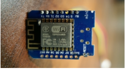
2.Inertial Measurement Unit (IMU): An IMU includes accelerometers and gyroscopes to measure the drone’s angular velocity and linear acceleration. Combined with advanced filtering algorithms like Kalman filters, the IMU provides accurate motion data over short periods, compensating for the lack of GPS.
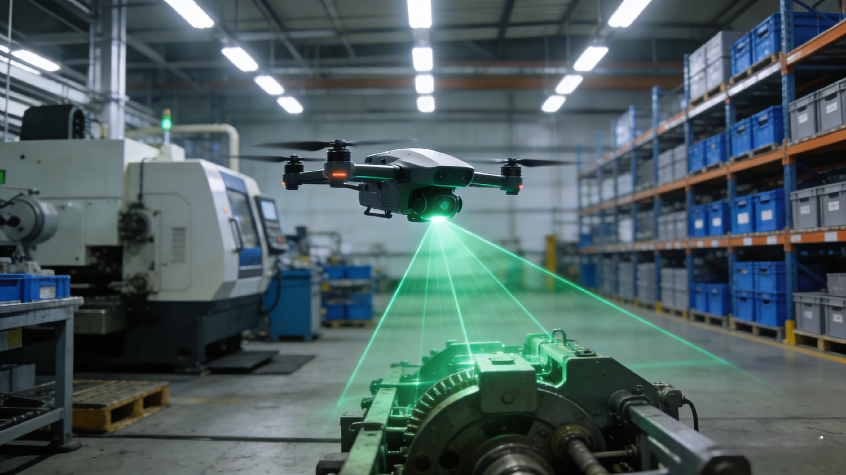
3.LiDAR and Ultrasonic Sensors: LiDAR uses laser pulses to create 3D maps of the environment, ideal for navigating complex terrains. Ultrasonic sensors are commonly used for altitude measurement and obstacle avoidance, especially in indoor settings.
4.Simultaneous Localization and Mapping (SLAM): SLAM technology enables drones to build real-time maps and determine their position in unknown environments. It integrates data from visual, LiDAR, and other sources, making it key to achieving fully autonomous GPS-free flight.
5.Wireless Communication and Sensor Fusion: Through Wi-Fi, Bluetooth, or other wireless technologies, drones can interact with external devices or beacons to enhance positioning accuracy. Sensor fusion algorithms combine multiple data sources to improve overall navigation reliability.
Applications of Drones Without GPS
Drones without GPS play a vital role in multiple fields:
1.Indoor Inspection and Mapping: In factories, warehouses, or buildings, these drones can inspect facilities, monitor inventory, or create detailed maps. They’re particularly valuable in environments where GPS signals cannot penetrate, such as underground facilities or large industrial complexes with metal structures that block satellite signals.
2.Disaster Response: After earthquakes or fires, GPS signals may be disrupted, allowing drone without GPS to enter hazardous areas for search and rescue missions. They can navigate through collapsed structures and smoke-filled environments where traditional GPS-dependent drones would be useless.
3.Agriculture and Environmental Protection: In dense forests or greenhouses, drones can use visual navigation for crop monitoring or wildlife tracking. The ability to operate under thick canopies makes them ideal for precision agriculture applications and ecological research.
4.Military and Security: Drones without GPS are suitable for covert operations, performing reconnaissance in electronically contested environments. Their ability to operate in GPS-jammed conditions makes them invaluable for modern battlefield scenarios.
5.Emerging Applications: New use cases are continually emerging, including underwater exploration, tunnel inspection, and even space exploration where GPS is unavailable. Archaeological documentation in dense jungles and mining operations are other areas seeing increased adoption.
Challenges and Limitations
Despite their potential, drones without GPS face several challenges. First, sensor errors can accumulate, leading to position drift, especially during long flights. Second, high computational demands for real-time processing of visual or LiDAR data may increase costs and power consumption. Additionally, environmental factors like poor lighting or dynamic obstacles can affect navigation accuracy. Researchers are addressing these issues by developing more efficient algorithms and hardware solutions.
Future Outlook
With advancements in AI and edge computing, drones without GPS are becoming smarter and more reliable. In the future, we may see more systems integrating multimodal sensors for seamless indoor-outdoor navigation. If you’re considering using a drone without GPS, start with specific applications, choose the right technology mix, and stay updated on industry developments.
In summary, drones without GPS represent an innovative direction in drone technology, opening new possibilities by overcoming GPS dependency. Whether you’re a hobbyist or professional, understanding their principles and applications can be highly beneficial.