How to Navigate in GPS-Free environment?In modern digital life, GPS positioning technology has become deeply integrated into daily scenarios — it guides drivers around traffic jams, enables real-time package tracking for online shopping, and provides precise direction for agricultural drone seeding and logistics unmanned vehicle deliveries. However, this seemingly “all-powerful” navigation tool is not without flaws. The development of navigation solutions for GPS failure has become a key focus in the current technology sector, and a critical direction for addressing positioning needs across various scenarios.
I. Advantages and Core Shortcomings of GPS Technology
GPS positioning has revolutionized traditional positioning methods with its high accuracy, wide coverage, and low cost. Yet, its limitations are equally notable. For accurate positioning, GPS devices must maintain an unobstructed line of sight with at least 4 satellites — a requirement that leaves it ineffective in many scenarios:
Indoor and enclosed spaces: In shopping malls, underground parking lots, and similar areas, satellite signals are blocked by buildings, causing frequent “freezes” or complete failure of phone/device navigation;
Urban and natural obstacle scenarios: In high-rise “urban canyons,” signals are easily distorted, leading to navigation errors ranging from tens to hundreds of meters. For deep-sea exploration and underwater operations, GPS signals cannot penetrate water, rendering positioning completely ineffective;
Signal interference and spoofing risks: As a radio frequency technology, GPS signals are vulnerable to external interference. In conflict zones, simple jamming devices can disable nearby GPS terminals. Worse still, technologies exist to spoof GPS signals, misleading ships and aircraft off course and posing life-threatening risks to commercial transportation and military operations.
This over-reliance on a single GPS technology creates significant risks to navigation safety. Exploring more robust Alternative Positioning and Navigation (APN) technologies has become an urgent priority.

II. GPS Limitations and Practical Impacts in Civilian Scenarios
Even in daily civilian use, the GPS-Free environment often cause inconveniences: During morning rush hour commutes, signal interruptions under overpasses may lead drivers to miss exits. Outdoor hikers frequently lose their way in dense forests due to weak GPS signals.
For critical infrastructure like airports, the consequences of GPS failure are far more severe. In 2019, Denver International Airport (USA) experienced GPS signal interference, resulting in nearly 100 flight delays or cancellations, chaotic ground operations, and large-scale passenger stranding. This incident made the industry acutely aware that relying solely on GPS in critical scenarios is unacceptable — backup navigation solutions are essential.

III. Mainstream Alternative Positioning Technologies (APN) for GPS-Free Condition
To address GPS failure, a variety of alternative positioning and navigation technologies have matured and been put into use, covering diverse scenario needs:
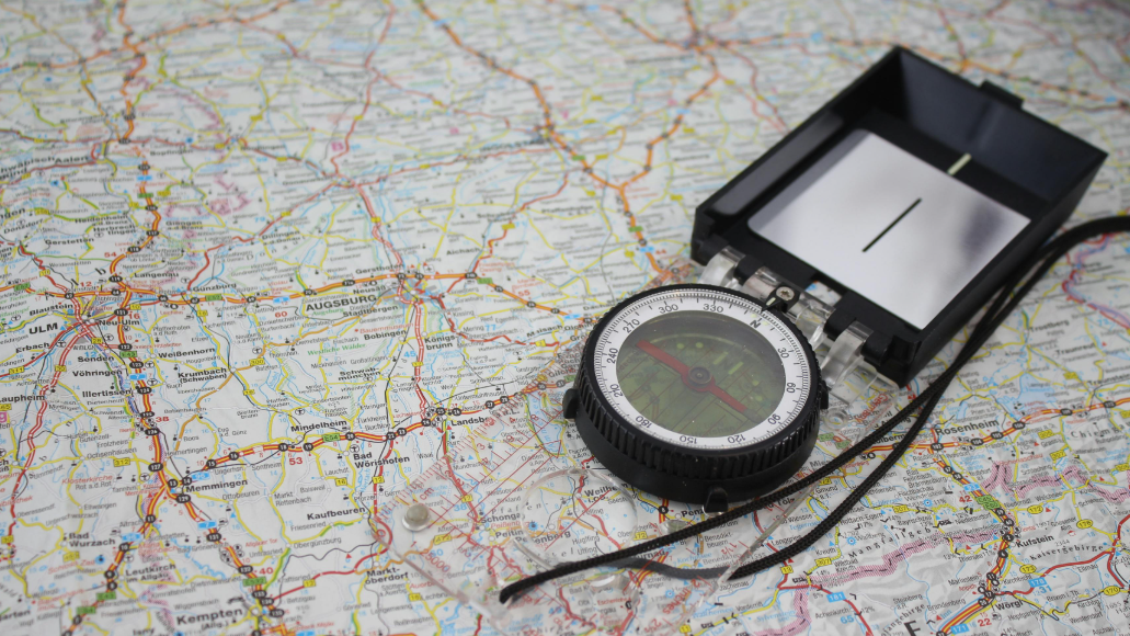
Magnetometer technology: The compass app on our phones is a typical application. It determines direction by detecting Earth’s magnetic field, requiring no satellite signals and working stably even indoors;
Acoustic navigation systems: Suitable for underwater use, underwater robots and submarines rely on sonar technology for navigation. By emitting and receiving sound waves, they accurately identify positions and obstacles in dark underwater environments;
Dead reckoning: A classic backup method in maritime navigation. Crews record a ship’s starting position, speed, heading, and travel time to roughly estimate its current location, with no need for external signals;
Inertial navigation systems: Widely used in military equipment like fighter jets and missiles. Equipped with accelerometers and gyroscopes, they detect motion in real time and achieve positioning without any external signals;
Visual navigation technology: A core technology in autonomous driving. Vehicles use roof-mounted cameras to capture road conditions, and AI algorithms analyze image sequences to determine movement paths and build environmental maps for independent navigation.
Each of these alternative navigation technologies has unique strengths. When combined (e.g., autonomous vehicles using both visual and inertial navigation), stable positioning can be maintained even when GPS fails.

IV. The Future Core of Navigation Technology: Sensor Fusion Navigation
In the future, sensor fusion navigation will become the core development direction of navigation technology. Individual navigation technologies have inherent limitations: magnetometers are susceptible to electronic interference, inertial navigation accumulates errors over time, and visual navigation performs poorly in severe weather.
By integrating data from multiple sensors (magnetometers, inertial sensors, cameras, acoustic devices, etc.) through advanced algorithms, “complementary advantages” can be achieved: visual navigation corrects inertial navigation errors, while magnetometers assist visual navigation in direction-finding — resulting in more accurate and reliable positioning. Today, with the development of artificial intelligence (AI) and the Internet of Things (IoT), the accuracy and efficiency of sensor fusion continue to improve.
It is certain that in the ongoing pursuit of efficient and resilient navigation, more innovations will emerge in the field of GPS-free navigation technology. These advancements will provide solid support for positioning needs across all scenarios and offer more comprehensive solutions for GPS failure.